Items Similar to Antique Map of Cities Nanking and Suzhou in the Jiangsu Region, China, c.1758


Want more images or videos?
Request additional images or videos from the seller
1 of 5
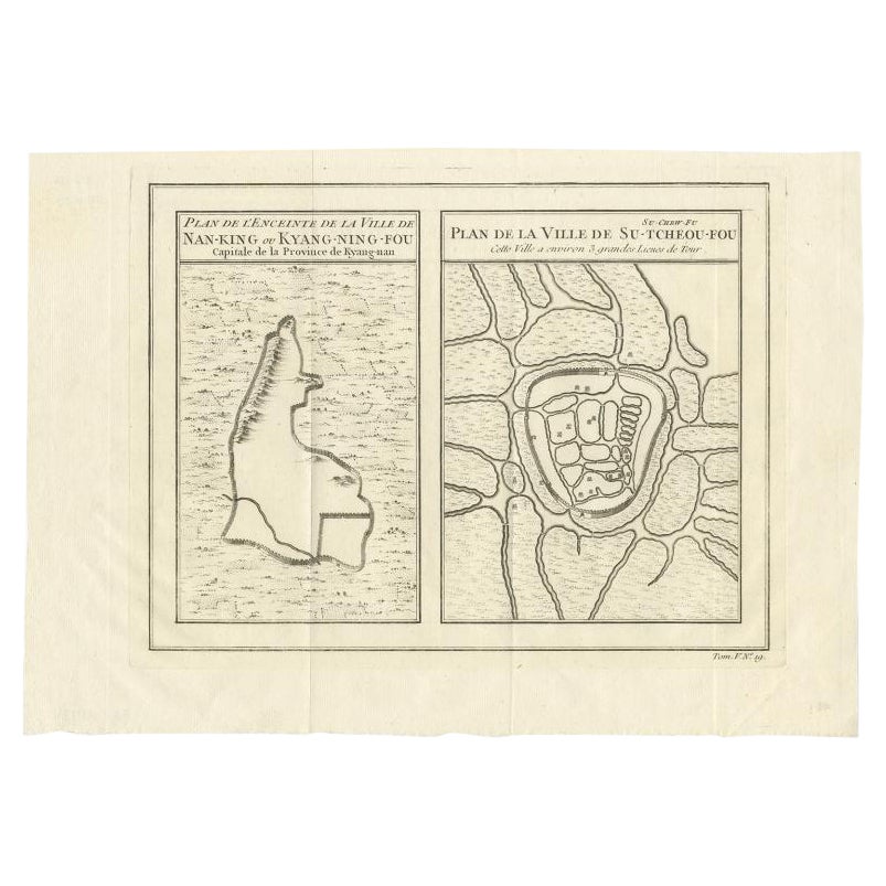
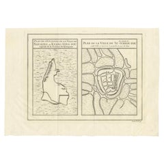
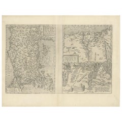
Antique Map of Cities Nanking and Suzhou in the Jiangsu Region, China, c.1758
About the Item
Antique map titled 'Plan de l' Enceinte de la Ville de Nan-King ou Kyang-Ning-Fou et plan de la ville de Su-Tcheou-Fou.' A map of the city of Nanking or Nanjing. A second map shows Suzhou (?) in the Jiangsu region. While these maps by Van Schley after Bellin were initially made for 'Histoire Generale des Voyages' (Paris 1746-1759), this is from the 1758 Dutch edition of that work published by Arkstee & Merkus.
Artists and Engravers: Made by 'Jakob van Schley' after 'Jacques Nicolas Bellin'. Jakob van der Schley (1715-1779) was a Dutch draughtsman and engraver, who studied under Bernard Picart. Jacques-Nicolas Bellin (1703-1772) was a French hydrographer, geographer and member of The Philosophes. His career, spanning over 50 years, caused an enormous outpt in maps, particular of maritime interest.
Condition: Very good, given age. Original middle fold, as issued. Three tiny holes in the print, closed using contemporary paper backed with acid free archival tape. General age-related toning and/or occasional minor defects from handling. Please study image carefully.
Date: 1758
Overall size: 32.2 x 23.8 cm.
Image size: 28.2 x 21.8 cm.
- Dimensions:Height: 9.38 in (23.8 cm)Width: 12.68 in (32.2 cm)Depth: 0 in (0.01 mm)
- Materials and Techniques:
- Period:
- Date of Manufacture:1758
- Condition:
- Seller Location:Langweer, NL
- Reference Number:
About the Seller
5.0
Platinum Seller
These expertly vetted sellers are 1stDibs' most experienced sellers and are rated highest by our customers.
Established in 2009
1stDibs seller since 2017
1,913 sales on 1stDibs
Typical response time: <1 hour
- ShippingRetrieving quote...Ships From: Langweer, Netherlands
- Return PolicyA return for this item may be initiated within 14 days of delivery.
More From This SellerView All
- Antique Map of Cities of the Jiangsu Region in China, c.1760By Jacques-Nicolas BellinLocated in Langweer, NLAntique map titled 'Plan de l' Enceinte de la Ville de Nan-King ou Kyang-Ning-Fou et plan de la ville de Su-Tcheou-Fou.' A map of the city of Nanking or Nanjing and a second map show...Category
Antique 18th Century Maps
MaterialsPaper
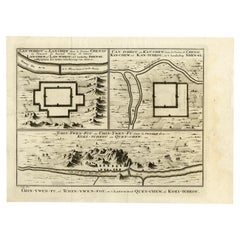
- Antique Map of Cities in the Region of Hubei in China, 1758Located in Langweer, NLAntique map titled 'Plans de Quelques villes de la province de Hou-Quang.' Three plans of cities in a region named Hou-Quang (currently Hubei). While these maps by Van Schley after B...Category
Antique 18th Century Maps
MaterialsPaper
- Antique Map of Three Chinese Cities in Chensi and Koei Tcheou, c.1758Located in Langweer, NLAntique map titled 'Lan-Tcheou ou Lan-Chew dan la province Chensi; Can Tcheou ou Kan-Chew dan la province de Chensi; Tchin-Ywe-Fou ou Chin-Ywen-Fu dans la province de Koei-Tcheou ou Quey-chew.' Three plans of old Chinese cities...Category
Antique 18th Century Maps
MaterialsPaper
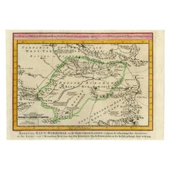
- Antique Map of the Bukhari Region by Van Schley, 1758Located in Langweer, NLAntique map titled 'Carte de la petite Bukharie et pays voisins.' Original antique map of the Bukhari (Sinkiang in north-western China) and neighboring countries. While these maps by...Category
Antique 18th Century Maps
MaterialsPaper
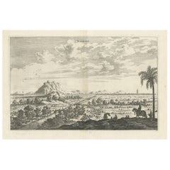
- Antique Print of the City of Nanking in China, 1668Located in Langweer, NLAntique print China titled ‘Nanking'. This plate shows a view on the Chinese city of Nanking with its ramparts. Also depicted are several pagodas and on the foreground there is a pal...Category
Antique 17th Century Prints
MaterialsPaper
- Antique Map of Asia Minor, Region of the Nile and Region of the City of CarthageLocated in Langweer, NLThree antique maps on one sheet titled 'Natoliae quae olim Asia Minor [with] Aegypti recentior descriptio [with] Carthaginis Celeberrimisinus Typus'. The first map covers Asia Minor,...Category
Antique 16th Century Maps
MaterialsPaper

You May Also Like
- Super Rare Antique French Map of Chine and the Chinese Empire, 1780Located in Amsterdam, Noord HollandSuper Rare Antique French Map of Chine and the Chinese Empire, 1780 Very nice map of Asia. 1780 Made by Bonne. Additional information: Type: Map ...Category
Antique 18th Century European Maps
MaterialsPaper
- 1594 Maurice Bouguereau Map of the Region Limoges, France, Ric0015Located in Norton, MA1594 Maurice Bouguereau map of the region Limoges, France, entitled "Totivs Lemovici et Confinium Pro Uinciarum Quantum ad Dioecefin Lemo Uicenfen Fpectant," Hand Colored Ric0015 Jean IV Le Clerc...Category
Antique 16th Century Dutch Maps
MaterialsPaper
- 17th Century Hand Colored Map of the Liege Region in Belgium by VisscherBy Nicolaes Visscher IILocated in Alamo, CAAn original 17th century map entitled "Leodiensis Episcopatus in omnes Subjacentes Provincias distincté divisusVisscher, Leodiensis Episcopatus" by Nicolaes Visscher II, published in Amsterdam in 1688. The map is centered on Liege, Belgium, includes the area between Antwerp, Turnhout, Roermond, Cologne, Trier and Dinant. This attractive map is presented in a cream-colored mat measuring 30" wide x 27.5" high. There is a central fold, as issued. There is minimal spotting in the upper margin and a tiny spot in the right lower margin, which are under the mat. The map is otherwise in excellent condition. The Visscher family were one of the great cartographic families of the 17th century. Begun by Claes Jansz Visscher...Category
Antique Late 17th Century Dutch Maps
MaterialsPaper
- Original Antique Map of China, Arrowsmith, 1820Located in St Annes, LancashireGreat map of China Drawn under the direction of Arrowsmith Copper-plate engraving Published by Longman, Hurst, Rees, Orme and Brown, 1820 Unfr...Category
Antique 1820s English Maps
MaterialsPaper
- The Normandy Region of France: A 17th C. Hand-colored Map by Sanson and JaillotBy Nicolas SansonLocated in Alamo, CAThis large hand-colored map entitled "Le Duché et Gouvernement de Normandie divisée en Haute et Basse Normandie en divers Pays; et par evêchez, avec le Gouvernement General du Havre ...Category
Antique 1690s French Maps
MaterialsPaper
- Italian Parchment Map of the City of Pisa Dated, 1640By Matthäus Merian the ElderLocated in Roma, ITAn antique map of the Tuscan city of Pisa engraved for The 'Itinerarium Italiæ Nov-antiquæ' by Matthäus Merian the Elder and printed in 1640....Category
Antique 1640s Italian Maps
MaterialsPaper


Recently Viewed
View AllMore Ways To Browse
Antique City Plans
Antique Map China
Antique China Map
Antique Chinese Maps
Antique Map Of China
Antique Maps Of China
Antique Paris Map Print
Paris City Maps
Chinese Antique Map
Antique Maritime Prints
Dutch Maritime
Maritime Map
Chinese Nanking
Nanking China
Antique Maps Of London
Antique Map Of London
Antique And Collectable Fairs
Antique Maps Amsterdam