Items Similar to Antique Map of the Dordogne ‘France’ by V. Levasseur, 1854
Want more images or videos?
Request additional images or videos from the seller
1 of 5
Antique Map of the Dordogne ‘France’ by V. Levasseur, 1854
About the Item
Antique map titled 'Dépt. de la Dordogne'. Map of the French department of Dordogne, France. This area is best known for its production of Monbazillac, a sweet white wine, and Cabécou, a soft goat cheese. The whole is surrounded by elaborate decorative engravings designed to illustrate both the natural beauty and trade richness of the land. There is a short textual history of the regions depicted on both the left and right sides of the map. This map originates from ‘Atlas National de la France Illustré’. Published by A. Combette, Paris, 1854.
- Dimensions:Height: 13.98 in (35.5 cm)Width: 20.67 in (52.5 cm)Depth: 0.02 in (0.5 mm)
- Materials and Techniques:
- Period:
- Date of Manufacture:1854
- Condition:General age-related toning. Please study image carefully.
- Seller Location:Langweer, NL
- Reference Number:
About the Seller
5.0
Platinum Seller
These expertly vetted sellers are 1stDibs' most experienced sellers and are rated highest by our customers.
Established in 2009
1stDibs seller since 2017
1,909 sales on 1stDibs
Typical response time: <1 hour
- ShippingRetrieving quote...Ships From: Langweer, Netherlands
- Return PolicyA return for this item may be initiated within 14 days of delivery.
More From This SellerView All
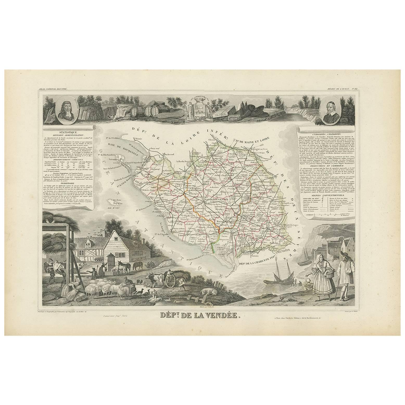
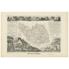
- Antique Map of Vendée ‘France’ by V. Levasseur, 1854By Victor LevasseurLocated in Langweer, NLAntique map titled 'Dépt. de la Vendée'. Map of the French department of Vendee, France. Vendee is home to a number of small vineyards around the communes of Vix, Brem, Pissotte and ...Category
Antique Mid-19th Century Maps
MaterialsPaper
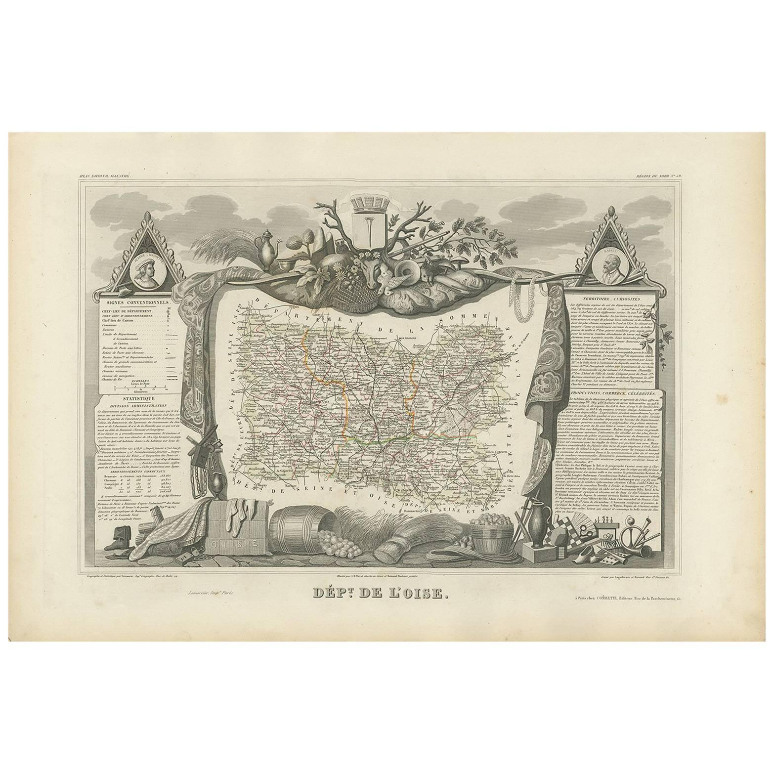
- Antique Map of Oise ‘France’ by V. Levasseur, 1854By Victor LevasseurLocated in Langweer, NLAntique map titled 'Dépt. de l'Oise'. Map of the French department of Oise, France. The map is surrounded by elaborate decorative engravings designed to illustrate both the natural b...Category
Antique Mid-19th Century Maps
MaterialsPaper
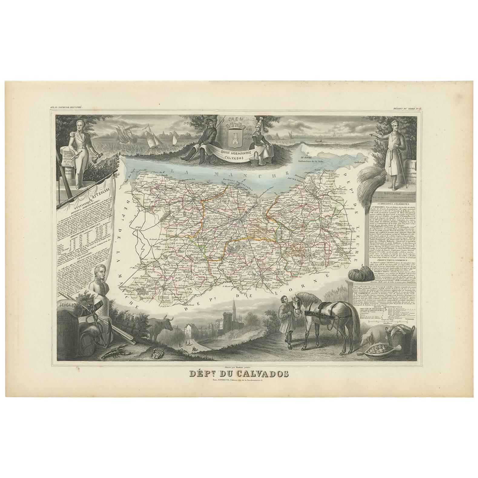
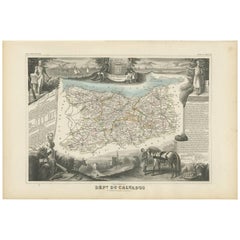
- Antique Map of Calvados ‘France’ by V. Levasseur, 1854By Victor LevasseurLocated in Langweer, NLAntique map titled 'Dépt. du Calvados'. Map of the French department of Calvados, France. This area of France is known for its production of Calvados, the world's fines apple brandy....Category
Antique Mid-19th Century Maps
MaterialsPaper
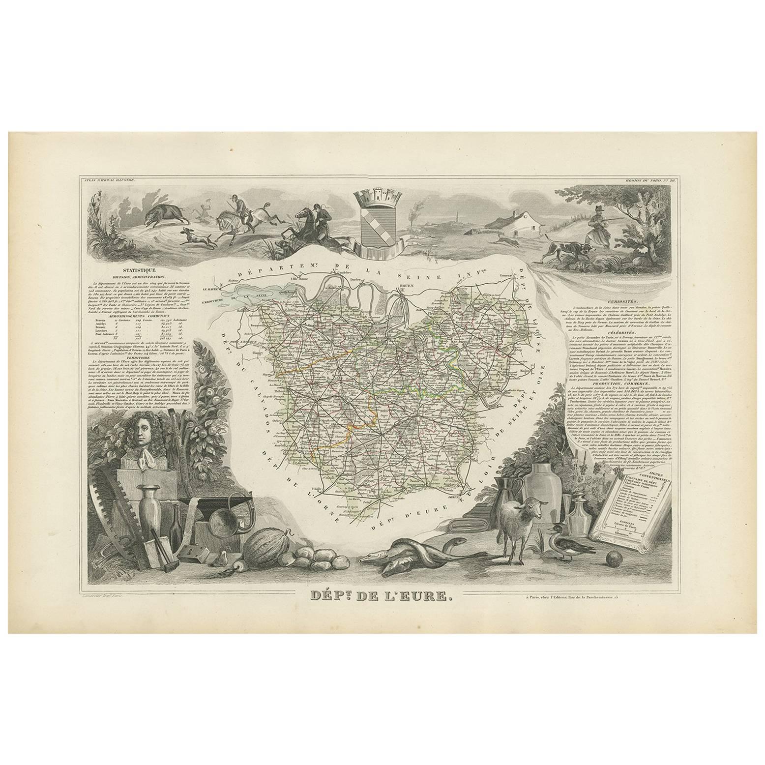
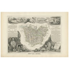
- Antique Map of Eure ‘France’ by V. Levasseur, 1854By Victor LevasseurLocated in Langweer, NLAntique map titled 'Dépt. de l'Eure'. Map of the French department of Eure, France. This region of France is home to Giverny, where impressionist Claude Monet’s home and garden can b...Category
Antique Mid-19th Century Maps
MaterialsPaper
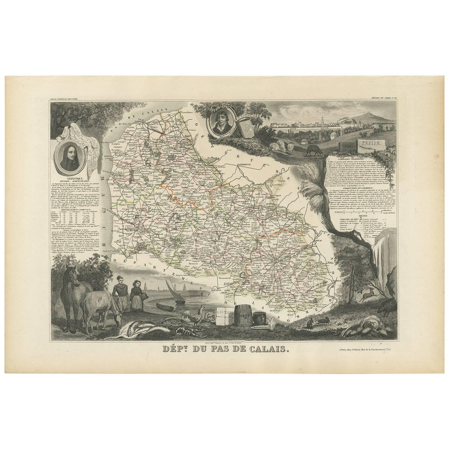
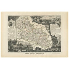
- Antique Map of Calais ‘France’ by V. Levasseur, 1854By Victor LevasseurLocated in Langweer, NLAntique map titled 'Dépt. du Pas de Calais'. Map of the French department of Calais, France. This area is known for producing Maroilles, a soft cheese made from cow’s milk and with a...Category
Antique Mid-19th Century Maps
MaterialsPaper
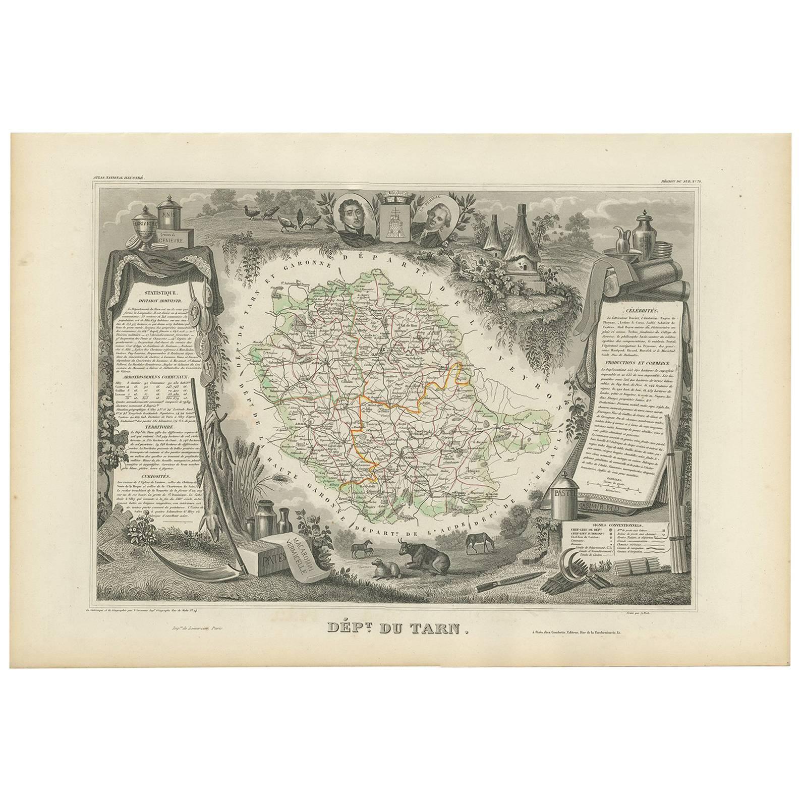
- Antique Map of Tarn 'France' by V. Levasseur, 1854By Victor LevasseurLocated in Langweer, NLAntique map titled 'Dépt. du Tarn'. Map of the French department of Tarn, France. This area produces a variety of traditional wines, including Cahors, Mauzac, Loin de l'Oeil and Onde...Category
Antique Mid-19th Century Maps
MaterialsPaper


You May Also Like
- Original Antique Map of The World by Thomas Clerk, 1817Located in St Annes, LancashireGreat map of The Eastern and Western Hemispheres On 2 sheets Copper-plate engraving Drawn and engraved by Thomas Clerk, Edinburgh. Published by Mackenzie And Dent, 1817 ...Category
Antique 1810s English Maps
MaterialsPaper
- Original Antique Map of France, Arrowsmith, 1820Located in St Annes, LancashireGreat map of France Drawn under the direction of Arrowsmith. Copper-plate engraving. Published by Longman, Hurst, Rees, Orme and Brown, 1820 Unframed.Category
Antique 1820s English Maps
MaterialsPaper
- Original Antique Map of The Netherlands, Engraved by Barlow, Dated 1807Located in St Annes, LancashireGreat map of Netherlands Copper-plate engraving by Barlow Published by Brightly & Kinnersly, Bungay, Suffolk. Dated 1807 Unframed.Category
Antique Early 1800s English Maps
MaterialsPaper
- Map of the Republic of GenoaLocated in New York, NYFramed antique hand-coloured map of the Republic of Genoa including the duchies of Mantua, Modena, and Parma. Europe, late 18th century. Dimension: 25...Category
Antique Late 18th Century European Maps
- Antique Map of Italy by Andriveau-Goujon, 1843By Andriveau-GoujonLocated in New York, NYAntique Map of Italy by Andriveau-Goujon, 1843. Map of Italy in two parts by Andriveau-Goujon for the Library of Prince Carini at Palazzo Carini i...Category
Antique 1840s French Maps
MaterialsLinen, Paper
- Antique Map of Principality of MonacoBy Antonio Vallardi EditoreLocated in Alessandria, PiemonteST/619 - "Old Geographical Atlas of Italy - Topographic map of ex-Principality of Monaco" - ediz Vallardi - Milano - A somewhat special edition ---Category
Antique Late 19th Century Italian Other Prints
MaterialsPaper


Recently Viewed
View AllMore Ways To Browse
Antique Maps Of Paris France
Antique Map Of Paris France
Wine Maps
Wine Map
Dordogne France
Map Of France Wine
Wine Map France
French Wine Map
Wine And Cheese
Antique French Cheese
Antique Wine Maps
Antique Map Dordogne
Antique Map Prints
Antique Prints Maps
Antique Prints And Maps
Antique Maps And Prints
Map 19th Century
Antique Atlas Furniture