Items Similar to Antique Map of the Expedition of Govert Knol by Van Schley, 1765

Want more images or videos?
Request additional images or videos from the seller
1 of 5
Antique Map of the Expedition of Govert Knol by Van Schley, 1765
About the Item
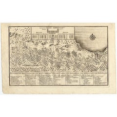
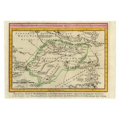
Antique map titled 'Plan de l' expédition de Mr. le Commiss. re Govert Knol, forti de Soerabaja, pour aller recévoir Pangerang Depati Anom. / Aftékening der Expeditie van de H. r Commiss. is Govert Knol , uyt Soerabaya , tot afhaalinge van Pangerang Depati Anom'. Map showing the expedition of Commissioner Govert Knol from Surabaya to Pangerang, Indonesia. This map originates from 'Historische beschryving der reizen (..)' published 1765.
Artists and Engravers: Jakob van der Schley (Amsterdam 1715-1779) was a Dutch draughtsman and engraver. He studied under Bernard Picart and became heavily influenced by his style.
Condition: Very good, please study image carefully.
Date: 1765
Overall size: 36 x 27.5 cm.
Image size: 29.2 x 20.2 cm.
We sell original antique maps to collectors, historians, educators and interior decorators all over the world. Our collection includes a wide range of authentic antique maps from the 16th to the 20th centuries. Buying and collecting antique maps is a tradition that goes back hundreds of years. Antique maps have proved a richly rewarding investment over the past decade, thanks to a growing appreciation of their unique historical appeal. Today the decorative qualities of antique maps are widely recognized by interior designers who appreciate their beauty and design flexibility. Depending on the individual map, presentation, and context, a rare or antique map can be modern, traditional, abstract, figurative, serious or whimsical. We offer a wide range of authentic antique maps for any budget.
- Creator:Jakob van der Schley (Artist)
- Dimensions:Height: 10.83 in (27.5 cm)Width: 14.18 in (36 cm)Depth: 0 in (0.01 mm)
- Materials and Techniques:
- Period:
- Date of Manufacture:1765
- Condition:
- Seller Location:Langweer, NL
- Reference Number:
About the Seller
5.0
Platinum Seller
These expertly vetted sellers are 1stDibs' most experienced sellers and are rated highest by our customers.
Established in 2009
1stDibs seller since 2017
1,914 sales on 1stDibs
Typical response time: <1 hour
- ShippingRetrieving quote...Ships From: Langweer, Netherlands
- Return PolicyA return for this item may be initiated within 14 days of delivery.
More From This SellerView All
- Antique Map of the Expedition of Govert Knol by Valentijn, 1726Located in Langweer, NLAntique map titled 'Aftekening der Expeditie van de Hr. Commissaris Govert Cnoll uyt Soerabaja, tot afhalinge van Pangerang Adepati Anom'. Map showing the expedition...Category
Antique 18th Century Maps
MaterialsPaper
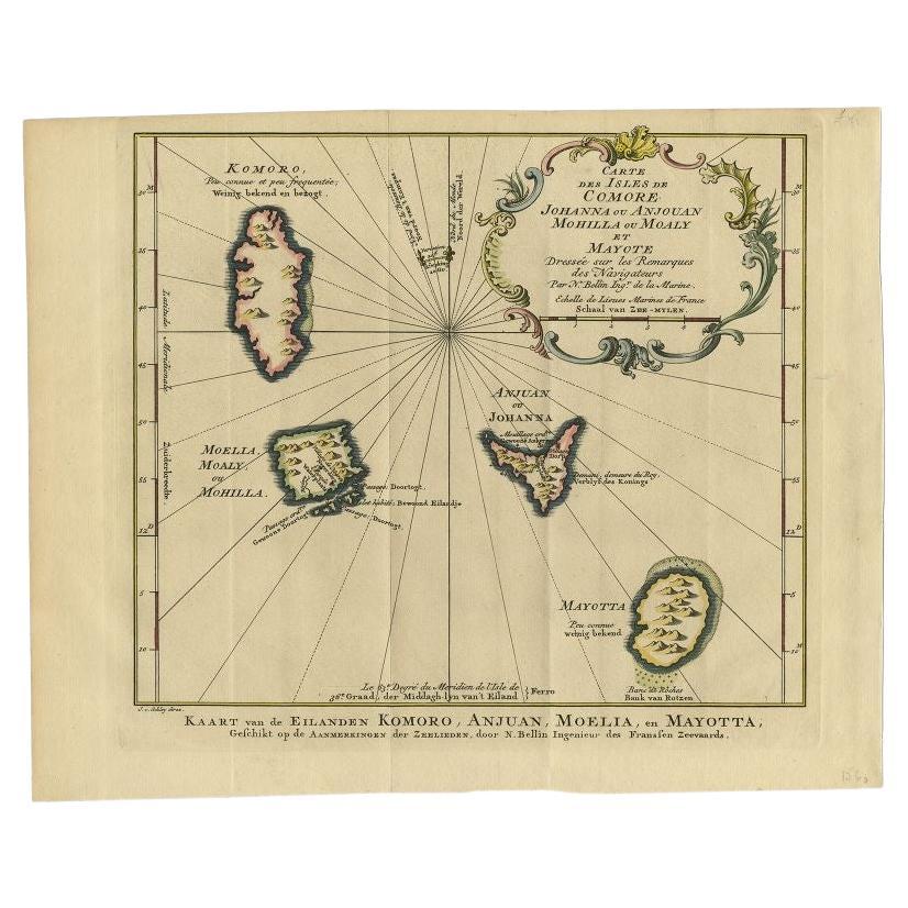
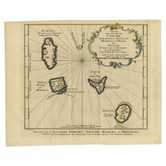
- Antique Map of the Main Comoro Islands by Van Schley, 1749By Jakob van der SchleyLocated in Langweer, NLAntique map titled ‘Carte des Isles de Comore (..) - Kaart van de Eilanden Komoro (..)’. Original antique map of the main Comoro Islands or Comoros including Comore, Mohéli, Anjouan ...Category
Antique 18th Century Maps
MaterialsPaper
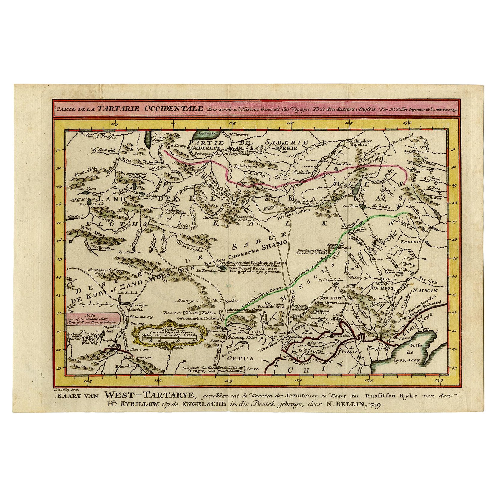
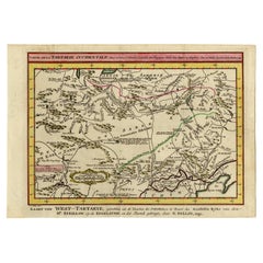
- Antique Map of Eastern Tartary and the Gobi Desert by Van Schley, 1758By Jakob van der SchleyLocated in Langweer, NLAntique map titled 'Carte de la Tartarie occidentale.' Original antique map of Eastern Tartary and the Gobi desert showing the silk road and the Great Wall of China. While these maps...Category
Antique 18th Century Maps
MaterialsPaper
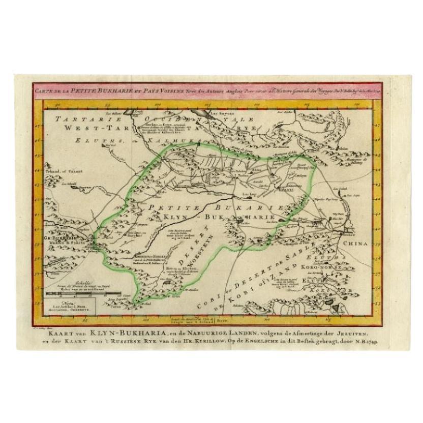
- Antique Map of the Bukhari Region by Van Schley, 1758Located in Langweer, NLAntique map titled 'Carte de la petite Bukharie et pays voisins.' Original antique map of the Bukhari (Sinkiang in north-western China) and neighboring countries. While these maps by...Category
Antique 18th Century Maps
MaterialsPaper
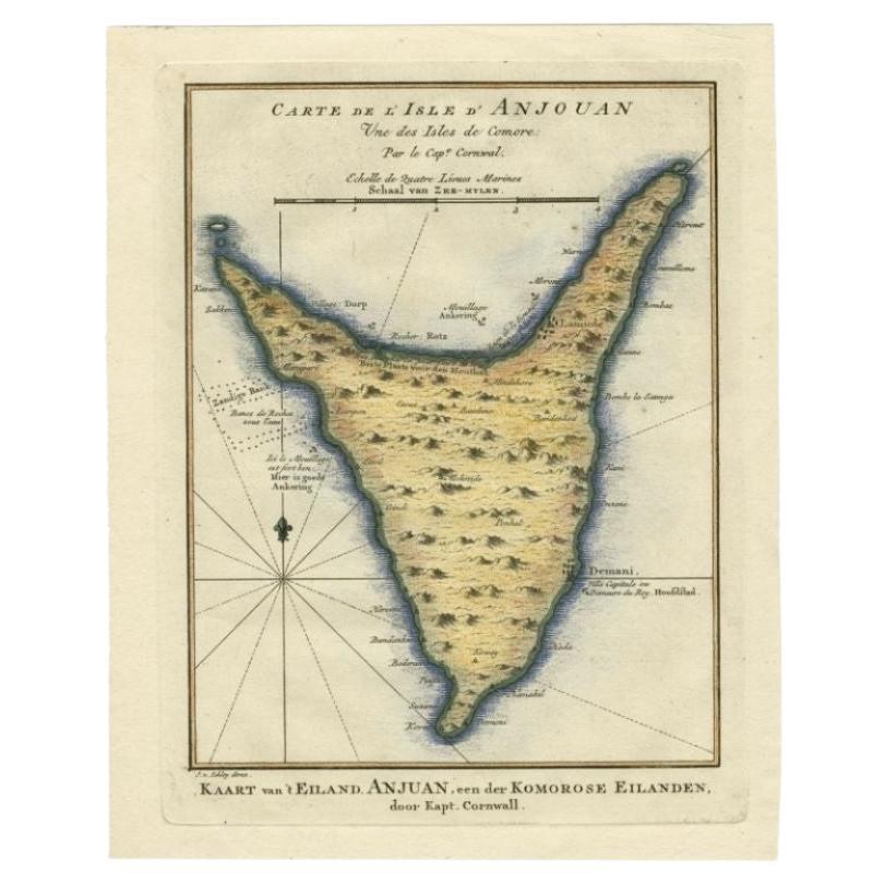
- Antique Map of the Island Anjouan by Van Schley, c.1750Located in Langweer, NLAntique map titled 'Carte de l'Isle d'Anjouan une des Isles de Comore'. Striking map of the Island Anjouan, part of the Comoros in the Indian Ocean by Nicolas Bellin. Source unknown,...Category
Antique 18th Century Maps
MaterialsPaper
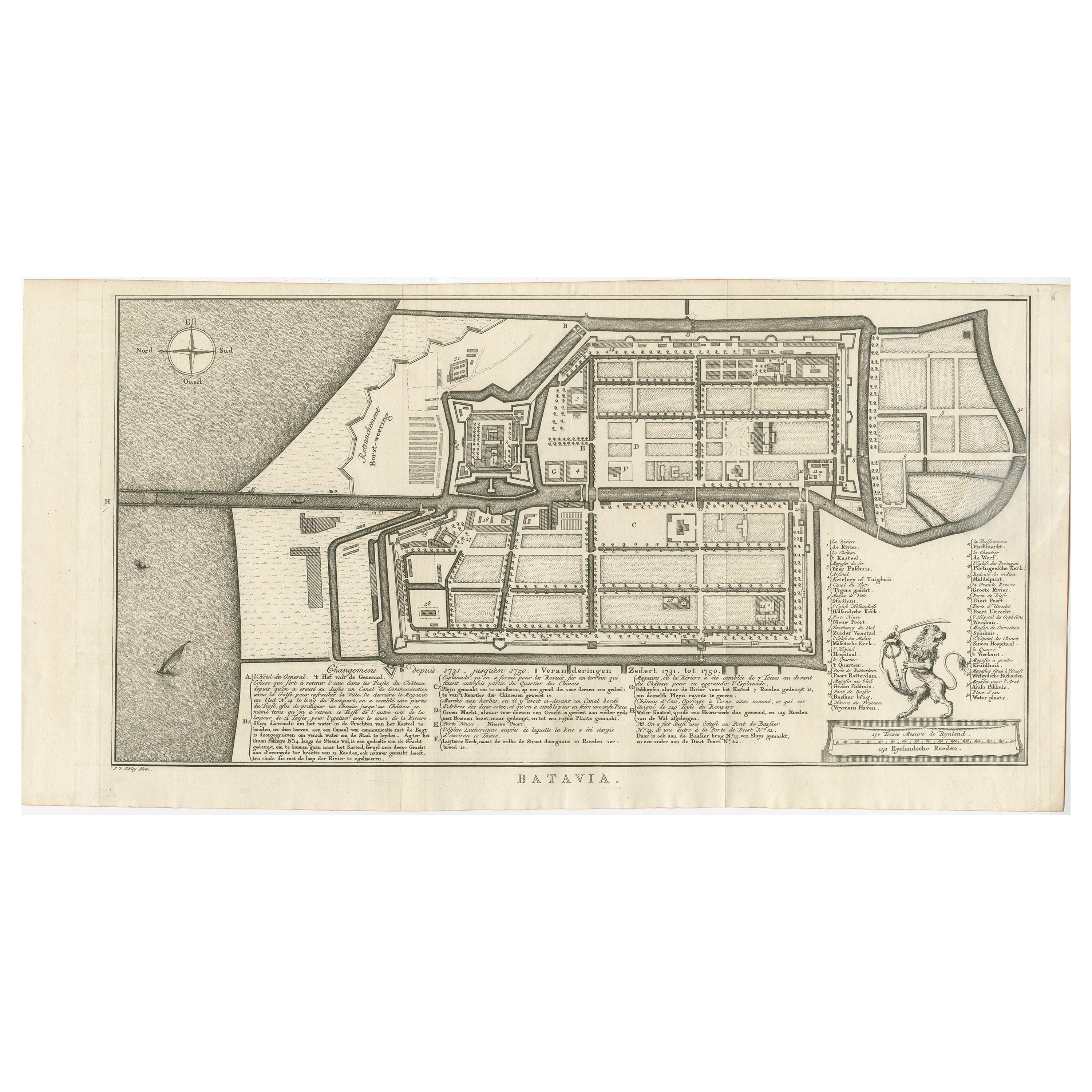
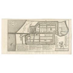
- Antique Map of Batavia by Van Schley 'c.1750'Located in Langweer, NLAntique map titled 'Batavia'. Original antique map of Batavia, Jakarta, Indonesia. This print originates from the Dutch edition of Prevost's 'Histoire Generale des Voyages' (Paris 17...Category
Antique Mid-18th Century Prints
MaterialsPaper

You May Also Like
- 1861 Topographical Map of the District of Columbia, by Boschke, Antique MapLocated in Colorado Springs, COPresented is an original map of Albert Boschke's extremely sought-after "Topographical Map of the District of Columbia Surveyed in the Years 1856 ...Category
Antique 1860s American Historical Memorabilia
MaterialsPaper
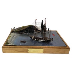
- Deep Water Diorama of the Galapagos ExpeditionLocated in Norwell, MAFabulous maritime diorama with engraved nameplate "Galapagos Expedition H.M.S. Beagle and Charles Darwin At Islands c. 1831. 3/32 Scale, A. Clark". This project was built by William Hitchcock...Category
1990s North American Models and Miniatures
MaterialsWood
- Original Antique Map of The World by Thomas Clerk, 1817Located in St Annes, LancashireGreat map of The Eastern and Western Hemispheres On 2 sheets Copper-plate engraving Drawn and engraved by Thomas Clerk, Edinburgh. Published by Mackenzie And Dent, 1817 ...Category
Antique 1810s English Maps
MaterialsPaper
- 1907 Map of Colorado, Antique Topographical Map, by Louis NellLocated in Colorado Springs, COThis highly detailed pocket map is a topographical map of the state of Colorado by Louis Nell from 1907. The map "has been complied from all availabl...Category
Antique Early 1900s American Maps
MaterialsPaper
- Original Antique Map of the American State of Pennsylvania, 1889Located in St Annes, LancashireGreat map of Pennsylvania Drawn and Engraved by W. & A.K. Johnston Published By A & C Black, Edinburgh. Original colour Unframed. Repair to a minor tear on bottom edge.Category
Antique 1880s Scottish Victorian Maps
MaterialsPaper
- Original Antique Map of the American State of Nevada, 1889Located in St Annes, LancashireGreat map of Nevada Drawn and Engraved by W. & A.K. Johnston Published By A & C Black, Edinburgh. Original colour Unframed.Category
Antique 1880s Scottish Victorian Maps
MaterialsPaper


Recently Viewed
View AllMore Ways To Browse
Expedition Furniture
Van Der Mr
Expedition Map
Antique Style Map Of The World
World Maps Antique Style
World Map Antique Style
Compass Antique Map
Antique Compass Map
Antique Russian Wood Furniture
Antique Russian Wood
Antique Map Britain
Antique Map China
Antique China Map
Antique Chinese Maps
Antique Britain Map
Large Antique Map Of The World
Antique Maps Of China
Compass 18th Century