Items Similar to Antique Map of Groningen from a 19th Century Dutch Atlas, 1864
Want more images or videos?
Request additional images or videos from the seller
1 of 5
Antique Map of Groningen from a 19th Century Dutch Atlas, 1864
About the Item
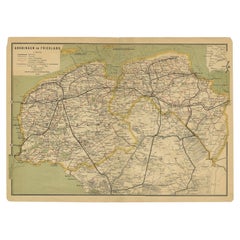
Antique map titled 'De Provincie Groningen'. Map of the province of Groningen, the Netherlands. This map originates from 'F. C. Brugsma's Atlas van het Koninkrijk der Nederlanden (..)'. Artists and Engravers: Author: Frederik Carel Brugsma. Published by J.B. Wolters.
Artist: Author: Frederik Carel Brugsma. Published by J.B. Wolters.
Condition: Good, general age-related toning. Original folding line, minor wear. Blank verso. Please study image carefully.
Date: 1864
Overall size: 25.5 x 30.5 cm.
Image size: 20.5 x 24.5 cm.
We sell original antique maps to collectors, historians, educators and interior decorators all over the world. Our collection includes a wide range of authentic antique maps from the 16th to the 20th centuries. Buying and collecting antique maps is a tradition that goes back hundreds of years. Antique maps have proved a richly rewarding investment over the past decade, thanks to a growing appreciation of their unique historical appeal. Today the decorative qualities of antique maps are widely recognized by interior designers who appreciate their beauty and design flexibility. Depending on the individual map, presentation, and context, a rare or antique map can be modern, traditional, abstract, figurative, serious or whimsical. We offer a wide range of authentic antique maps for any budget.
- Dimensions:Height: 12.01 in (30.5 cm)Width: 10.04 in (25.5 cm)Depth: 0 in (0.01 mm)
- Materials and Techniques:
- Period:
- Date of Manufacture:1864
- Condition:
- Seller Location:Langweer, NL
- Reference Number:
About the Seller
5.0
Platinum Seller
These expertly vetted sellers are 1stDibs' most experienced sellers and are rated highest by our customers.
Established in 2009
1stDibs seller since 2017
1,909 sales on 1stDibs
Typical response time: <1 hour
- ShippingRetrieving quote...Ships From: Langweer, Netherlands
- Return PolicyA return for this item may be initiated within 14 days of delivery.
More From This SellerView All
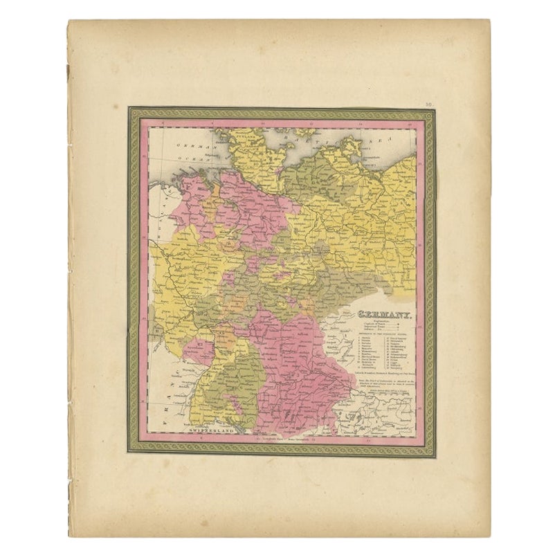
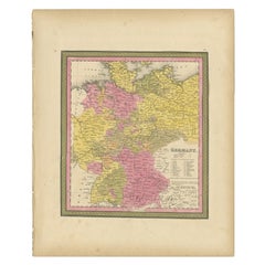
- Antique Map of Germany from an American 19th Century Atlas, 1846Located in Langweer, NLAntique map titled 'Germany'. Old map of Germany. This map originates from 'A New Universal Atlas Containing Maps of the various Empires, Kingdoms, States and Republics Of The World ...Category
Antique 19th Century Maps
MaterialsPaper
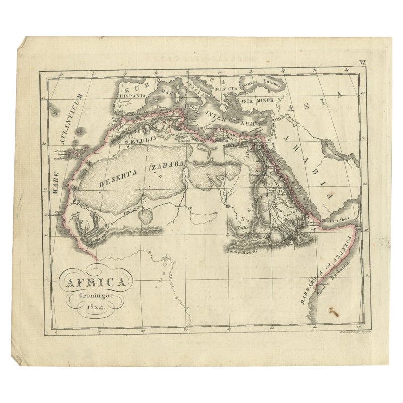
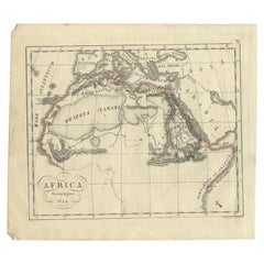
- Antique Map of Northern Africa from a Rare Dutch Atlas, 1825Located in Langweer, NLAntique map titled 'Africa'. Old map of the African continent originating from 'Atlas der Oude Wereld'. Artists and Engravers: Published by C. Ph. Funke and W. van Boekeren, Gron...Category
Antique 19th Century Maps
MaterialsPaper
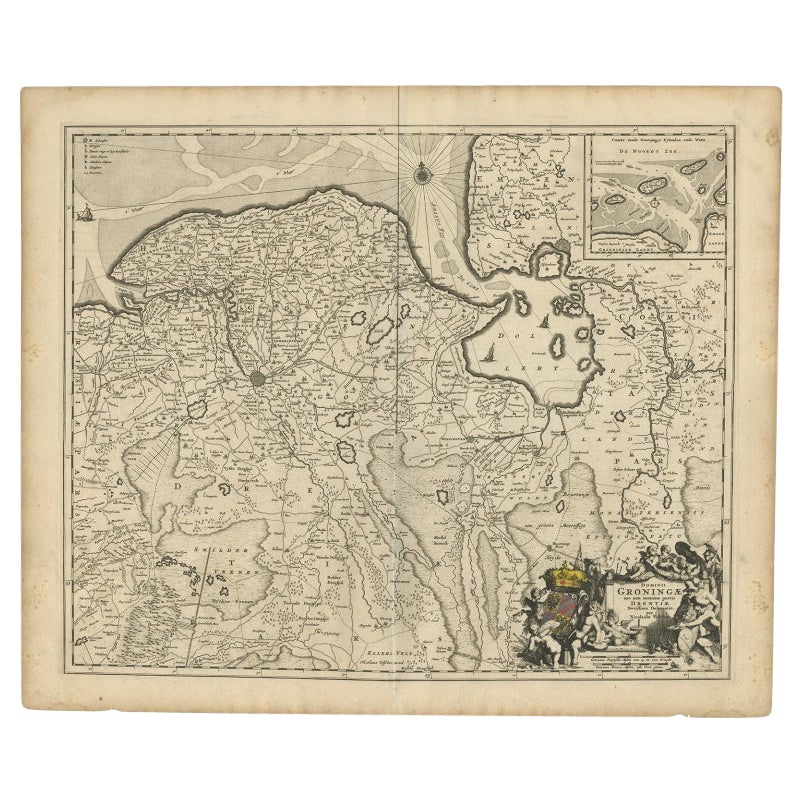
- Antique Map of the Dutch Provinces Groningen and Drenthe, C.1660Located in Langweer, NLAntique map titled 'Dominii Groningae nec non maximae partis Drentiae (..)'. Map of Groningen and Drenthe in the north-east part of the Netherlands. Inset upper right corner of the "...Category
Antique 17th Century Maps
MaterialsPaper
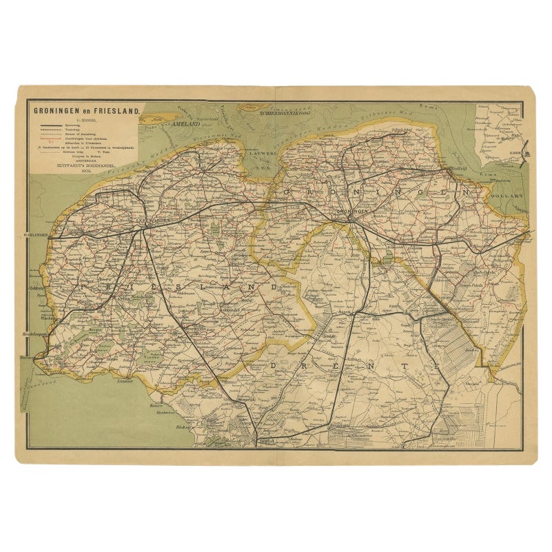
- Antique Map of the Dutch Provinces Groningen and Friesland, 1902Located in Langweer, NLAntique map titled 'Groningen en Friesland'. Lithographed map of the provinces of Groningen and Friesland, the Netherlands. This map originates from 'Atlas van Nederland'. Artists an...Category
20th Century Maps
MaterialsPaper
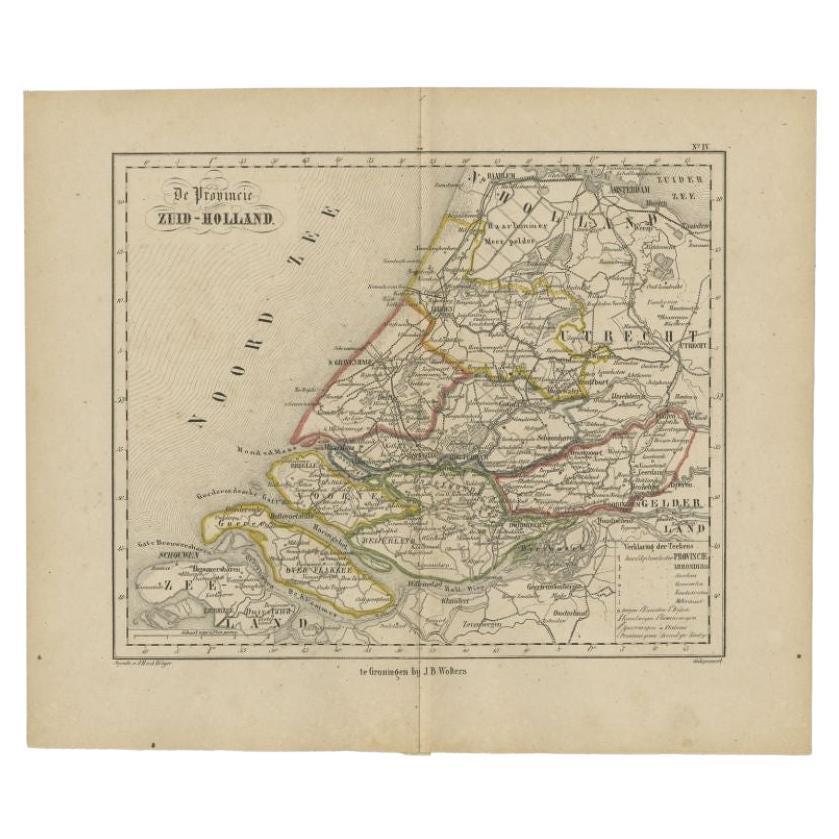
- Original Antique Map of Zuid-Holland by Brugsma, 1864Located in Langweer, NLAntique map titled 'De Provincie Zuid-Holland'. Map of the province of Zuid-Holland, the Netherlands. This map originates from 'F. C. Brugsma's Atlas van het Koninkrijk der Nederland...Category
Antique 19th Century Maps
MaterialsPaper
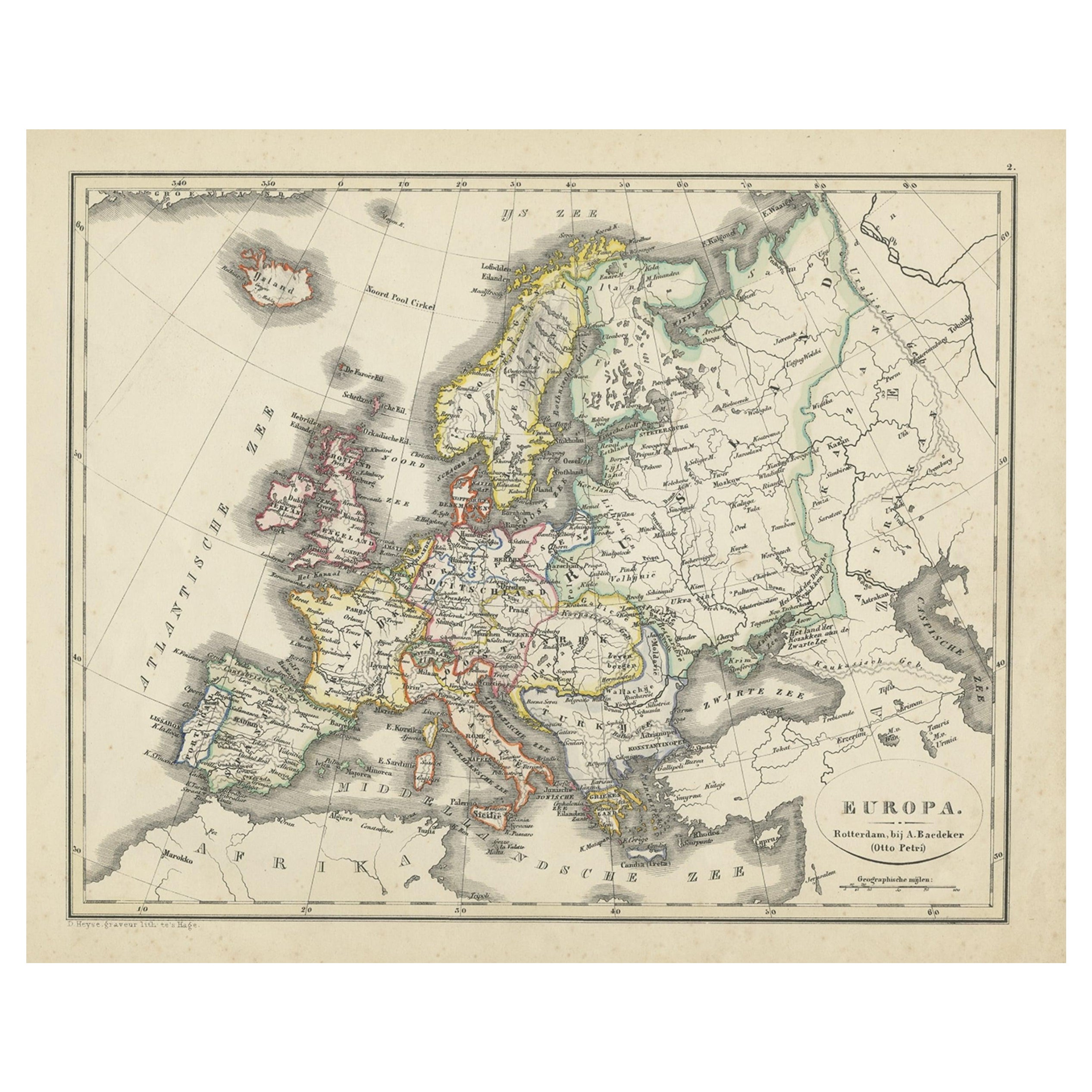
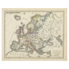
- Antique Map of Europe from an Old Dutch School-Atlas, 1852Located in Langweer, NLAntique map titled 'Europa'. Map of Europe. This map originates from 'School-Atlas van alle deelen der Aarde' by Otto Petri. Artists and Engravers: Published by A. Baedeker (Otto...Category
Antique 19th Century Maps
MaterialsPaper


You May Also Like
- Antique Framed Pen and Ink on Fabric Map of Cornwall from Early 19th CenturyLocated in Los Angeles, CAEarly 19th-century English pen-and-ink fabric map of Cornwall. With beautiful hand-drawn details and faded sepia tones, this framed piece turns history into art. England, circa 181...Category
Antique Early 19th Century English Drawings
MaterialsFabric, Walnut
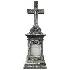
- Antique Tombstone from France, 19th CenturyLocated in Udenhout, NLBeautiful recuperated antique tombstone from France. Recuperated from a cemetery near Paris.Category
Antique 1840s French Religious Items
MaterialsSandstone
- 1864 Map of North America, Antique Hand-Colored Map, by Adolphe Hippolyte DufourLocated in Colorado Springs, COOffered is a map of North America entitled Amerique du Nord from 1864. This rare, separately published wall map was produced by Adolphe Hippolyte Dufour. This map includes vibrant an...Category
Antique 1860s French Maps
MaterialsPaper
- Set of Antique Books Dating from the 19th CenturyLocated in Beuzevillette, FRSet of antique books dating from the 19th century. From an old protestant library near Le Havre in France. These books are called "Holy Bible". Th...Category
Antique Mid-19th Century English Books
MaterialsPaper
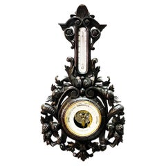
- Dutch 19th Century Carved Wooden BarometerLocated in Delft, NLA Dutch carved wooden barometer with copper and facet cut glass housing. The carved wood has a scene of fruits and scrolls A barometer is a scien...Category
Antique Late 19th Century Dutch Scientific Instruments
MaterialsWood
- 2 Dutch Silver Match Vestas, 19th CenturyLocated in Delft, NL2 Dutch Silver Match Vestas, 19th Century 2 Silver match vestas, Dutch silver, Silver Hallmarked with the "Sword" used from 1814-1906. The one with the te...Category
Antique 19th Century Dutch Tobacco Accessories
MaterialsSilver


Recently Viewed
View AllMore Ways To Browse
Dutch 16th Century Furniture
United States Map Antique
Antique United States Map
Railroad Antique
Antique Maps Of United States
Antique Collectible Bears
United States Map Vintage
United States Vintage Map
Amsterdam Map
Map Of Amsterdam
Old World Antique Maps
Antique Old World Map
Old Antique World Map
Old World Antique Map
Antique Old Map Of The World
18th Russian Furniture
Furniture Russian 18th Century
Space Map