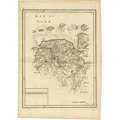
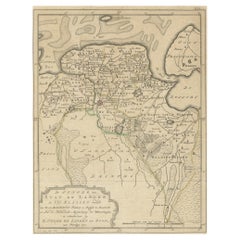
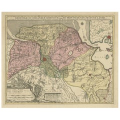
Antique Map of Groningen 'The Netherlands' by G.L. Le Rouge, 1748
View Similar Items


Want more images or videos?
Request additional images or videos from the seller
1 of 2
Antique Map of Groningen 'The Netherlands' by G.L. Le Rouge, 1748
About the Item
- Dimensions:Height: 13.12 in (33.3 cm)Width: 9.22 in (23.4 cm)Depth: 0.02 in (0.5 mm)
- Period:
- Date of Manufacture:1748
- Condition:Please study image carefully.
- Seller Location:Langweer, NL
- Reference Number:Seller: D-02901stDibs: LU305439343641
About the Seller
5.0
Platinum Seller
These expertly vetted sellers are 1stDibs' most experienced sellers and are rated highest by our customers.
Established in 2009
1stDibs seller since 2017
1,914 sales on 1stDibs
More From This SellerView All
- Antique Map of Groningen, the Netherlands, 1771Located in Langweer, NLAntique map titled 'De Synode van Stad en Landen in VII Klassen verdeeld (..)'. Map of the province of Groningen, the Netherlands. This map originates from 'Nieuwe kerkelyke geogra...Category
Antique 18th Century Maps
MaterialsPaper
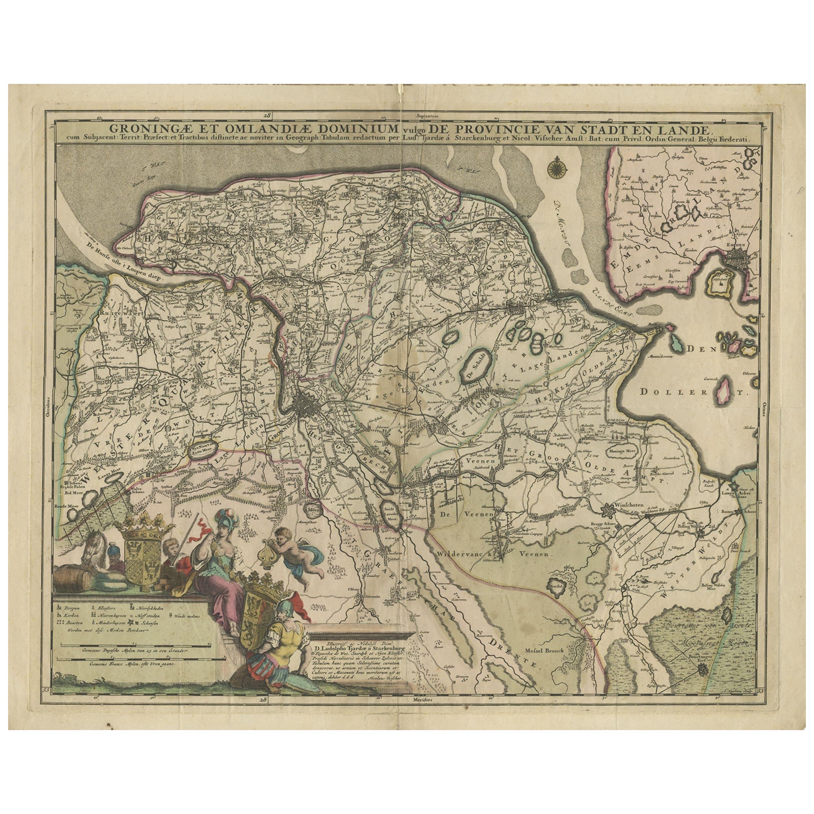
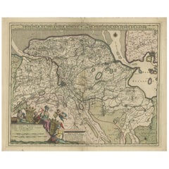
- Antique Map of the Province Groningen in The Netherlands, c.1680Located in Langweer, NLAntique map titled 'Groningae et Omlandiae Dominium vulgo de Provincie van Stadt en Lande'. Old map of the province of Groningen, the Netherlands. This map originates from 'Germani...Category
Antique 17th Century Maps
MaterialsPaper
- Antique Map of the Province of Groningen in the Netherlands, c.1700Located in Langweer, NLAntique map titled 'Groningae et Omlandiae Dominium vulgo de Provincie van Stadt en Lande'. Old map of the province of Groningen, the Netherlands. This map originates from 'Atlas C...Category
Antique 18th Century Maps
MaterialsPaper
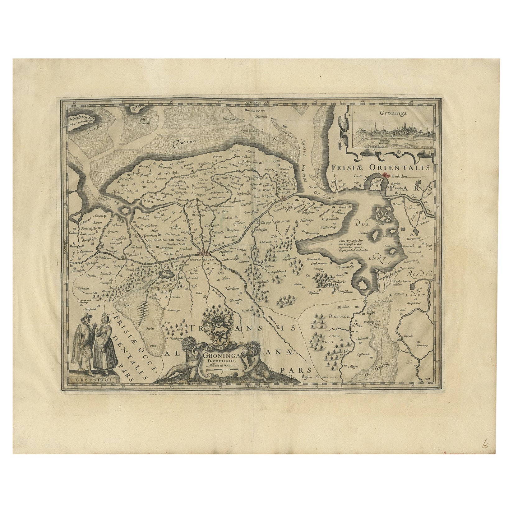
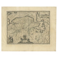
- Antique Map of the Province of Groningen in the Netherlands, 1634Located in Langweer, NLAntique map titled 'Groninga Dominium'. Old map of the province of Groningen, the Netherlands. In the upper right hand corner a general view of Groningen (taken from Guicciardini...Category
Antique 17th Century Maps
MaterialsPaper
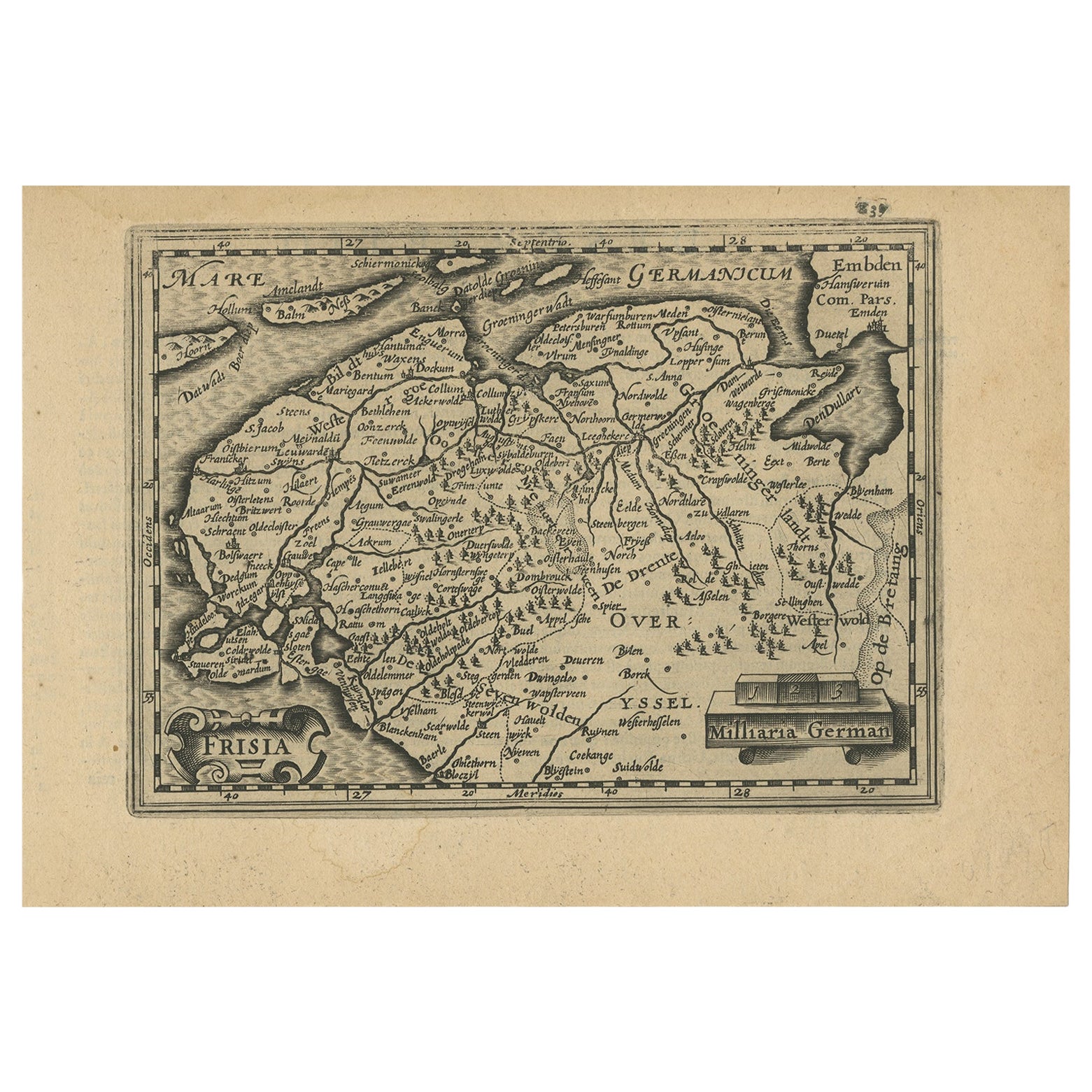
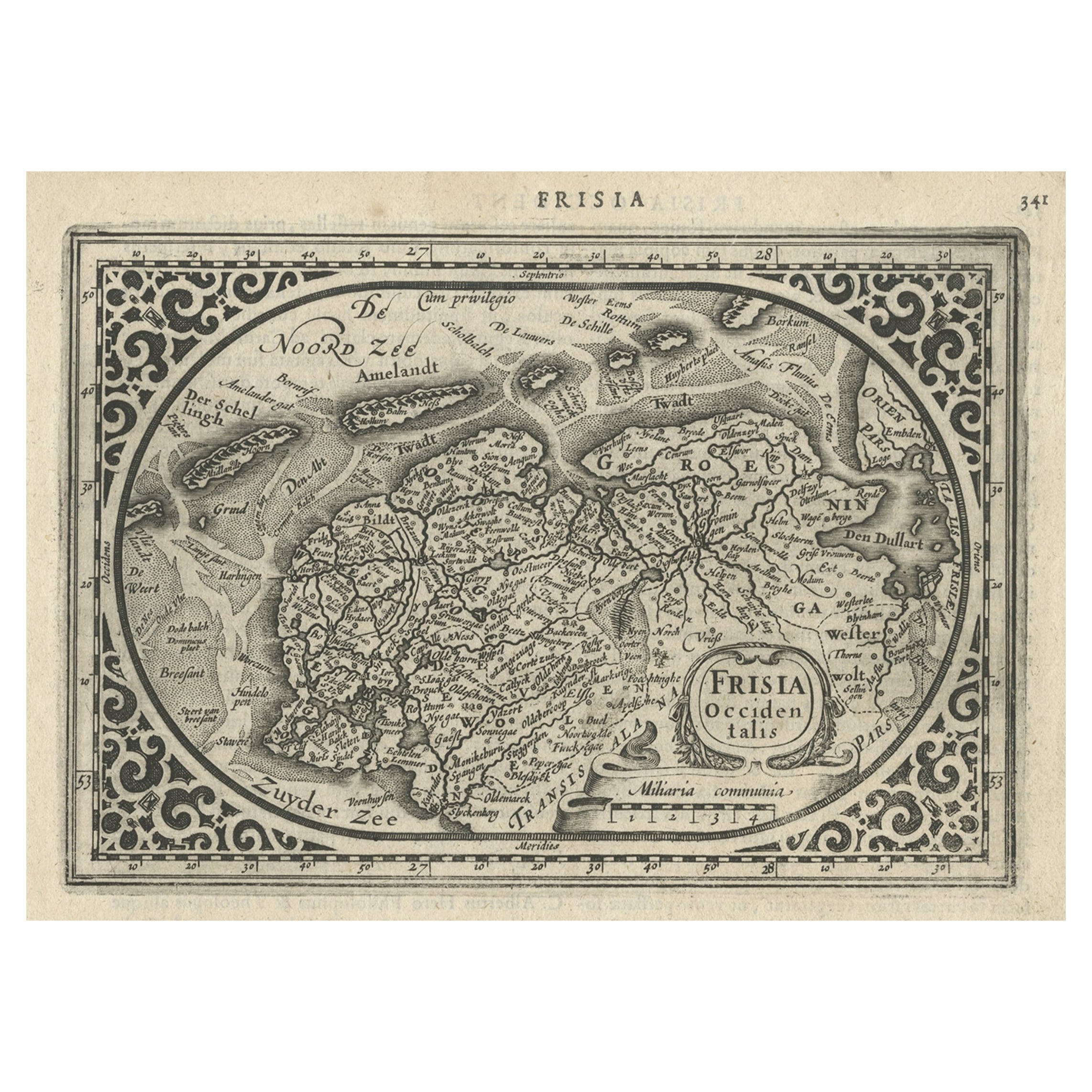
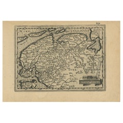
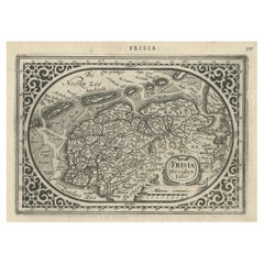
- Antique Map of Friesland and Groningen in The Netherlands, 1616Located in Langweer, NLAntique map titled 'Frisia'. Small map of the province of Friesland, the Netherlands. This map originates from 'Omnium Belgii, sive Inferioris Germaniae, regionum descriptio' by ...Category
Antique 17th Century Maps
MaterialsPaper
- Antique Map of Friesland and Groningen, Provinces of the Netherlands, 1628Located in Langweer, NLAntique map Friesland titled 'Frisia Occidentalis'. Small, decorative map of the province of Friesland, the Netherlands. Second state, out of three, originating from 'Atlas Minor' by...Category
Antique 17th Century Maps
MaterialsPaper
You May Also Like
- Original Antique Map of The Netherlands, Engraved by Barlow, Dated 1807Located in St Annes, LancashireGreat map of Netherlands Copper-plate engraving by Barlow Published by Brightly & Kinnersly, Bungay, Suffolk. Dated 1807 Unframed.Category
Antique Early 1800s English Maps
MaterialsPaper
- Original Antique Map of The Netherlands, Sherwood, Neely & Jones, Dated 1809Located in St Annes, LancashireGreat map of The Netherlands Copper-plate engraving by Cooper Published by Sherwood, Neely & Jones. Dated 1809 Unframed.Category
Antique Early 1800s English Maps
MaterialsPaper
- 1861 Topographical Map of the District of Columbia, by Boschke, Antique MapLocated in Colorado Springs, COPresented is an original map of Albert Boschke's extremely sought-after "Topographical Map of the District of Columbia Surveyed in the Years 1856 ...Category
Antique 1860s American Historical Memorabilia
MaterialsPaper
- Le Cercle RougeLocated in London, GBOriginal Japanese poster for the Le Cercle Rouge, 1970. This film was written and directed by Jean-Pierre Melville and starred Alain Delon, Bourvil an...Category
Vintage 1970s Japanese Posters
MaterialsPaper
 $2,223
 - School Chart or Pull Down Map of Geography of the Netherlands, 1950sLocated in Hemiksem, VANA beautiful old school map of the Netherlands, painted on linen. The map shows the 3 different reliefs (low, middle, high) of the Netherlands. The beau...Category
Vintage 1950s Belgian Mid-Century Modern Maps
MaterialsLinen, Paint
- 1752 Vaugoundy Map of Flanders : Belgium, France, and the Netherlands, Ric.a002Located in Norton, MALarge Vaugoundy Map of Flanders: Belgium, France, and the Netherlands Colored -1752 Ric.a002 Description: This is a 1752 Didier Robert de Vaugondy map of Flanders. The map de...Category
Antique 17th Century Unknown Maps
MaterialsPaper


