Items Similar to Antique Map of the Malabar Coast by Baldaeus, 1744

Want more images or videos?
Request additional images or videos from the seller
1 of 5
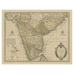
Antique Map of the Malabar Coast by Baldaeus, 1744
About the Item
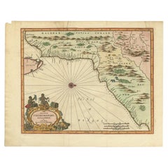
Antique map titled 'Descriptio Nova Imperii Malabar (..).' Nice map of the Malabar Coast. This map was published in 'The True and Exact Description of the Most Celebrated East - India Coast of Malabar and Choromandel as also of the Island of Ceylon' by Philip Baldaeus (first printed in 1672), part of 'A Collection of Voyages and Travels, some now first printed from original manuscripts others now first printed in English', printed in 1744 for Henry Lintot and John Osborn. This map originates from Churchill's 'A Collection of Voyages and Travels, some now first printed from original manuscripts others now first printed in English', printed in 1744 for Henry Lintot and John Osborn.
Artists and Engravers: Made by 'Philip Baldaeus' after an anonymous artist.
Condition: Good, given age. A few minor spots. Small tear top edge. Original folds as issued. General age-related toning and/or occasional minor defects from handling. Please study image carefully.
Date: 1744
Overall size: 42 x 34.3 cm.
Image size: 36 x 28.8 cm.
We sell original antique maps to collectors, historians, educators and interior decorators all over the world. Our collection includes a wide range of authentic antique maps from the 16th to the 20th centuries. Buying and collecting antique maps is a tradition that goes back hundreds of years. Antique maps have proved a richly rewarding investment over the past decade, thanks to a growing appreciation of their unique historical appeal. Today the decorative qualities of antique maps are widely recognized by interior designers who appreciate their beauty and design flexibility. Depending on the individual map, presentation, and context, a rare or antique map can be modern, traditional, abstract, figurative, serious or whimsical. We offer a wide range of authentic antique maps for any budget.
- Creator:Philip Baldaeus (Artist)
- Dimensions:Height: 13.51 in (34.3 cm)Width: 16.54 in (42 cm)Depth: 0 in (0.01 mm)
- Materials and Techniques:
- Period:
- Date of Manufacture:1744
- Condition:
- Seller Location:Langweer, NL
- Reference Number:
About the Seller
5.0
Platinum Seller
These expertly vetted sellers are 1stDibs' most experienced sellers and are rated highest by our customers.
Established in 2009
1stDibs seller since 2017
1,916 sales on 1stDibs
Typical response time: <1 hour
- ShippingRetrieving quote...Ships From: Langweer, Netherlands
- Return PolicyA return for this item may be initiated within 14 days of delivery.
More From This SellerView All
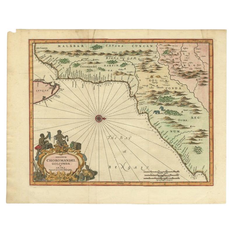
- Antique Map of Choromandel, Golconda and Orixa, Malabar, India, 1744By Philip BaldaeusLocated in Langweer, NLAntique map titled 'Regionum Choromandel, Golconda (..).' Handsome map of Choromandel, Golconda and Orixa, published in 'The True and Exact Description of the Most Celebrated East - ...Category
Antique 18th Century Maps
MaterialsPaper
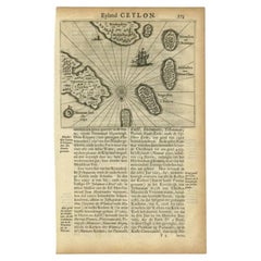
- Antique Map of the Islands Near Ceylon by Baldaeus, 1672By Philip BaldaeusLocated in Langweer, NLAntique print, untitled. This original antique print shows the islands Leyden, Middelburg, Hammenhiel, Bramines, Dona Clara and Deserta near Ceylon / Sri Lanka, with their Dutch name...Category
Antique 17th Century Maps
MaterialsPaper
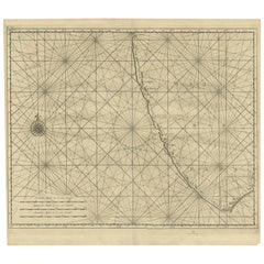
- Antique Map of Malabar Coast by Valentijn, 1726By F. ValentijnLocated in Langweer, NLUntitled sea chart of the coast of Malabar, India. This print originates from 'Oud en Nieuw Oost-Indiën' by F. Valentijn.Category
Antique Early 18th Century Dutch Maps
MaterialsPaper
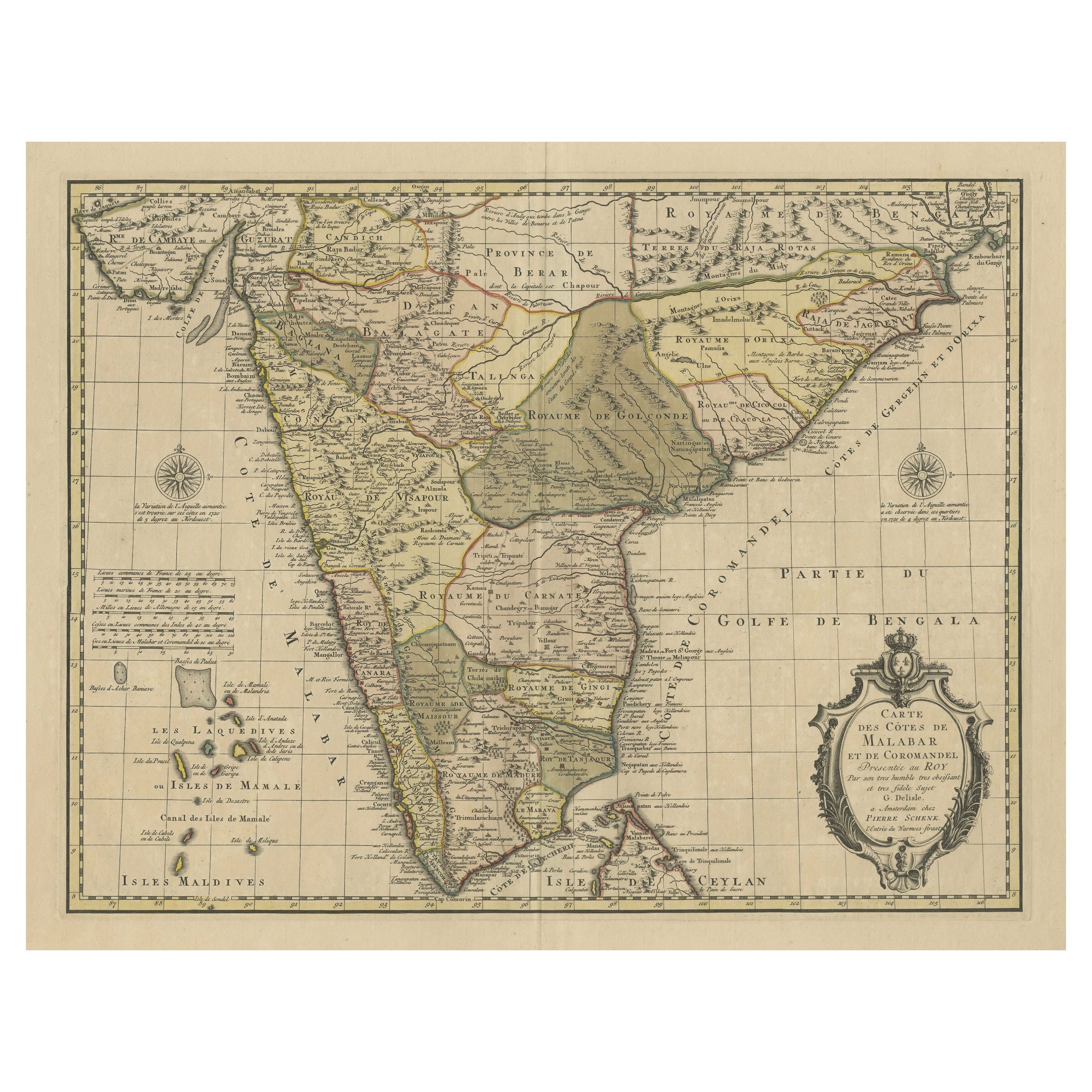
- Detailed Decorative Antique Map of the Coast of Malabar and Coromandel, IndiaLocated in Langweer, NLAntique map titled 'Carte des Côtes de Malabar et de Coromandel'. Finely engraved map of the southern part of India, first issued in 1723 by acclaimed French mapmaker Guillaume De L’...Category
Antique Mid-18th Century Maps
MaterialsPaper
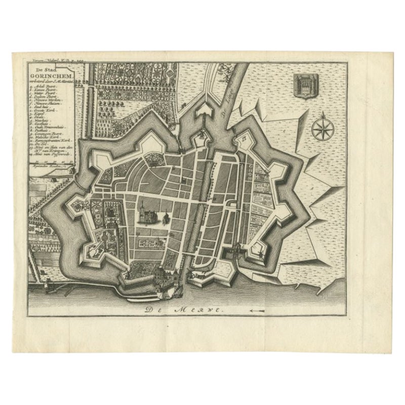
- Antique Map of the City of Gorinchem by Tirion, 1744Located in Langweer, NLAntique map titled 'De Stad Gorinchem'. Original antique map of the city of Gorinchem, the Netherlands. This map originates from 'Tegenwoordige Staat der Vereenigde Nederlanden' by J...Category
Antique 18th Century Maps
MaterialsPaper
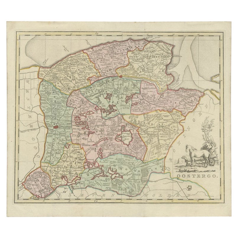
- Antique Map of Oostergo by Tirion, 1744Located in Langweer, NLAntique map titled 'Oostergo'. Original antique map of Oostergo, part of the province of Friesland, the Netherlands. Published 1744. Artists and Engravers: Isaak Tirion (1705 in Utre...Category
Antique 18th Century Maps
MaterialsPaper
You May Also Like
- London 1744 Published Watercolour Antique Map of East Africa by Eman BowenLocated in GBWe are delighted to offer for sale this New and Accurate Map of Nubia & Abissinia, together with all the Kingdoms Tributary Thereto, and bordering upon them published in 1744 by Emanuel Bowen This is a decorative antique engraved map of East Africa...Category
Antique 1740s English George III Maps
MaterialsPaper
- 1861 Topographical Map of the District of Columbia, by Boschke, Antique MapLocated in Colorado Springs, COPresented is an original map of Albert Boschke's extremely sought-after "Topographical Map of the District of Columbia Surveyed in the Years 1856 ...Category
Antique 1860s American Historical Memorabilia
MaterialsPaper
- John Alden’s Model of the Schooner “Malabar X”Located in Norwell, MAA scale model of the John Alden designed schooner “Malabar X". The planked deck carries a long cabin with oval portholes, toe-rail, skylights, and compa...Category
20th Century Models and Miniatures
- Northwest Coast and Isle of Man MapLocated in Cheshire, GBGreenville Collins Northwest Coast and Isle of Man. hand coloured chart, encased in an ebonised frame. Dimensions Height 26.5 Inches Width 30 Inches Depth 1 InchesCategory
Early 20th Century British Maps
MaterialsPaper
- Original Antique Decorative Map of South America-West Coast, Fullarton, C.1870Located in St Annes, LancashireGreat map of Chili, Peru and part of Bolivia Wonderful figural border From the celebrated Royal Illustrated Atlas Lithograph. Original color. Published by Fullarton, Edi...Category
Antique 1870s Scottish Maps
MaterialsPaper
- Original Antique Map of The World by Thomas Clerk, 1817Located in St Annes, LancashireGreat map of The Eastern and Western Hemispheres On 2 sheets Copper-plate engraving Drawn and engraved by Thomas Clerk, Edinburgh. Published by Mackenzie And Dent, 1817 ...Category
Antique 1810s English Maps
MaterialsPaper


Recently Viewed
View AllMore Ways To Browse
Antique Ceylon
16th Century English Antique
Antique Manuscript Paper
Ceylon Antique Furniture
Malabar Furniture
East Coast Antiques
East India Map
Ceylon Prints
Antique Print Ceylon
Churchill Antiques
Ceylon Map
Antique Map Ceylon
Philips Spot
Malabar X
Malabar Map
Pediment Metal
Russian Antique Book
Antique In The Philippines