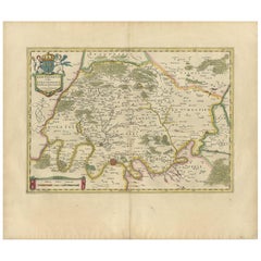
Antique Map of the Region of Paris and the Seine River, circa 1640
View Similar Items


Want more images or videos?
Request additional images or videos from the seller
1 of 5
Antique Map of the Region of Paris and the Seine River, circa 1640
About the Item
- Dimensions:Height: 19.49 in (49.5 cm)Width: 23.04 in (58.5 cm)Depth: 0.02 in (0.5 mm)
- Materials and Techniques:
- Period:Mid-17th Century
- Date of Manufacture:circa 1640
- Condition:Original/contemporary hand coloring. Latin text on verso. Minor wear and defects, please study images carefully.
- Seller Location:Langweer, NL
- Reference Number:Seller: BG-12380-201stDibs: LU3054317847891
About the Seller
5.0
Platinum Seller
These expertly vetted sellers are 1stDibs' most experienced sellers and are rated highest by our customers.
Established in 2009
1stDibs seller since 2017
1,913 sales on 1stDibs
More From This SellerView All
- Antique Map of the Region of Blois by Janssonius, 'circa 1640'By Johannes JanssoniusLocated in Langweer, NLAntique map titled 'Description du Blaisois'. Old map of the region of Blois, France. It shows the city of Blois, Amboise, the Loire River and more. Published by J. Janssonius, circa...Category
Antique Mid-17th Century Maps
MaterialsPaper
- Antique Map of the Region of Bourbonnais by Janssonius, circa 1640Located in Langweer, NLAntique map titled 'Bourbonois - Borbonium Ducatus'. Old map of the former region of Bourbonnais, France. It includes the cities of Bourbon, Moulins, Charenton, Brulles, Varennes and...Category
Antique Mid-17th Century Maps
MaterialsPaper
- Antique Map of the Hainaut and Namur Region by Janssonius, 'circa 1640'By Johannes JanssoniusLocated in Langweer, NLAntique map titled 'Comitatuum Hannoniae et Namurci Descriptio'. Old map of the region of Hainaut and Namur, France. Published by J. Janssonius, circa 1640.Category
Antique Mid-17th Century Maps
MaterialsPaper
- Antique Map of the Region of Le Mans 'France' by Blaeu, circa 1640By Willem BlaeuLocated in Langweer, NLAntique map titled 'Cenomanorum Galliae regionis typus vulgo le Mans'. This lovely map of the historical province of Maine is centered on the famous city of Le Mans. This region witn...Category
Antique Mid-17th Century Maps
MaterialsPaper

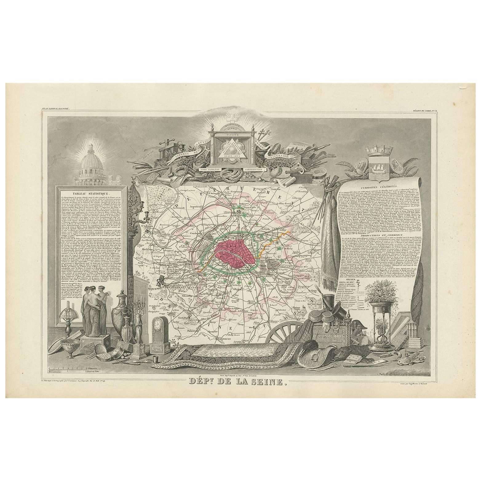
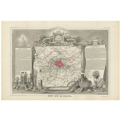
- Decorative Antique Map of the Seine River and Paris in France, ca.1854By Victor LevasseurLocated in Langweer, NLAntique map titled 'Dépt. de la Seine'. Map of the French department of Seine. Focusing on Paris, this map covers from the Foret de St. Germain to the Bois Notre Dame and from Versai...Category
Antique Mid-19th Century Maps
MaterialsPaper
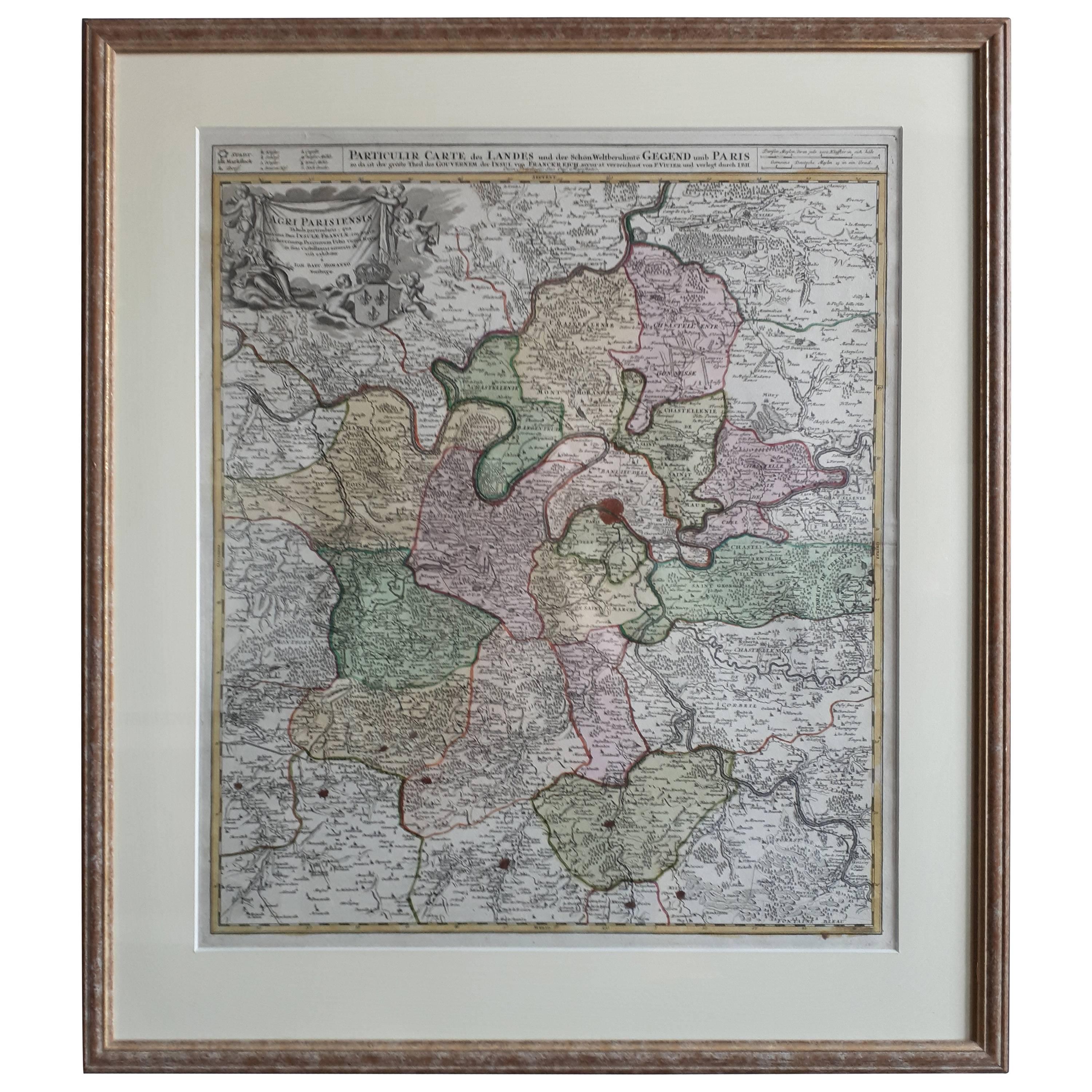
- Antique Map of the Region of Paris ‘France’ by H. Heirs, circa 1720Located in Langweer, NLAntique map titled 'Agri Parisiensis Tabula particularis, qua maxima Pars Insulae Franciae (..)'. Incredibly detailed map showing everything from tiny villages to forests, farmland, ...Category
Antique Early 18th Century Maps
MaterialsPaper
 $923 Sale Price22% Off


You May Also Like
- The Normandy Region of France: A 17th C. Hand-colored Map by Sanson and JaillotBy Nicolas SansonLocated in Alamo, CAThis large hand-colored map entitled "Le Duché et Gouvernement de Normandie divisée en Haute et Basse Normandie en divers Pays; et par evêchez, avec le Gouvernement General du Havre ...Category
Antique 1690s French Maps
MaterialsPaper
- Antique Map of Paris, "Carte Routiere des Environs de Paris" 1841Located in Colorado Springs, COThis beautiful hand-colored road map of Paris was published in 1841. The map shows Paris and the surrounding area in a folding pocket map. Organized and detailed for travelers, this ...Category
Antique 1840s French Maps
MaterialsPaper
- Original Antique Map of Spain and Portugal, circa 1790Located in St Annes, LancashireSuper map of Spain and Portugal Copper plate engraving by A. Bell Published, circa 1790. Unframed.Category
Antique 1790s English Other Maps
MaterialsPaper
- Vintage "View of the Center of Paris Taken from the Air" Lithograph MapLocated in San Diego, CAA very stylish "View of the Center of Paris Taken from the Air" lithograph map published by the Paris Ministry of Tourism, circa early 1950s. The piece measures 27" x 43" and shows...Category
20th Century French Mid-Century Modern Prints
MaterialsPaper
- 17th Century Hand Colored Map of the Liege Region in Belgium by VisscherBy Nicolaes Visscher IILocated in Alamo, CAAn original 17th century map entitled "Leodiensis Episcopatus in omnes Subjacentes Provincias distincté divisusVisscher, Leodiensis Episcopatus" by Nicolaes Visscher II, published in Amsterdam in 1688. The map is centered on Liege, Belgium, includes the area between Antwerp, Turnhout, Roermond, Cologne, Trier and Dinant. This attractive map is presented in a cream-colored mat measuring 30" wide x 27.5" high. There is a central fold, as issued. There is minimal spotting in the upper margin and a tiny spot in the right lower margin, which are under the mat. The map is otherwise in excellent condition. The Visscher family were one of the great cartographic families of the 17th century. Begun by Claes Jansz Visscher...Category
Antique Late 17th Century Dutch Maps
MaterialsPaper
- Original Antique Map of South America, circa 1830Located in St Annes, LancashireGreat map of South America Copper plate engraving Published by Butterworth, Livesey & Co., circa 1830 Unframed.Category
Antique Early 1800s English Other Maps
MaterialsPaper


Recently Viewed
View AllMore Ways To Browse
Russian Collectable
Office World Map
Sea Collectables
Antique Curiosities Prints
Antique Appreciation
United States Map
Antique Collectible Plate
Prints Of Antique Maps
Antique Over A Hundred Years Old
Antique Furniture Plans
Antique Rare Maps
Rare Antique Maps
Original Antique World Map
Map Of United States
Antique German Collectible
Authentic Antique Maps
The United States Map
Map France