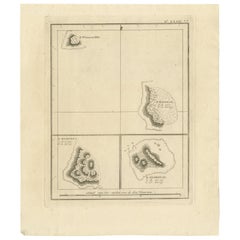
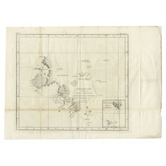
Antique Map of South Pacific Islands by J. Cook, 1803
View Similar Items


Want more images or videos?
Request additional images or videos from the seller
1 of 5
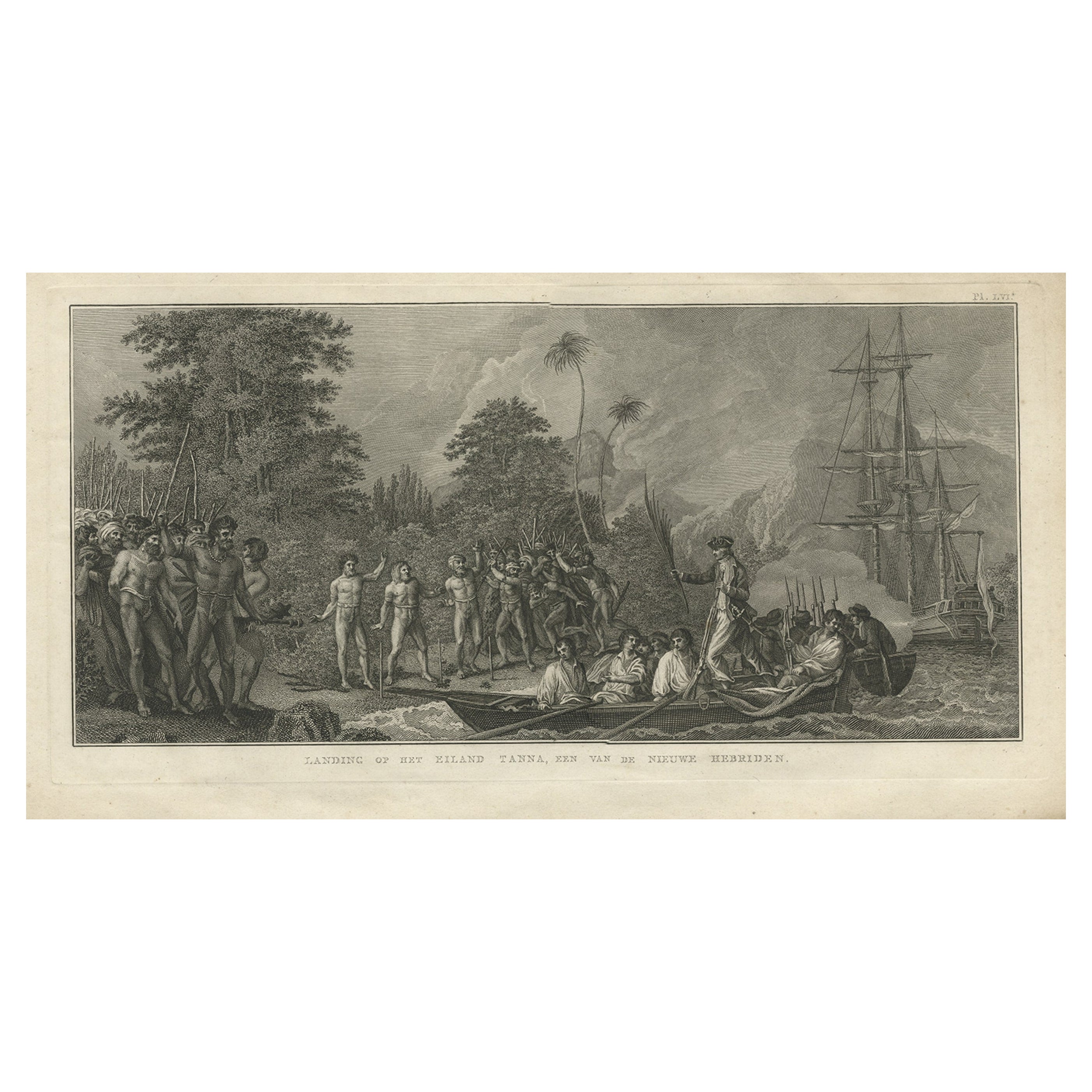
Antique Map of South Pacific Islands by J. Cook, 1803
About the Item
- Creator:James Cook (Artist)
- Dimensions:Height: 11.23 in (28.5 cm)Width: 9.65 in (24.5 cm)Depth: 0.02 in (0.5 mm)
- Materials and Techniques:
- Place of Origin:
- Period:
- Date of Manufacture:1803
- Condition:General age-related toning, please study image carefully.
- Seller Location:Langweer, NL
- Reference Number:Seller: BG-11487-391stDibs: LU3054313291192
About the Seller
5.0
Platinum Seller
These expertly vetted sellers are 1stDibs' most experienced sellers and are rated highest by our customers.
Established in 2009
1stDibs seller since 2017
1,909 sales on 1stDibs
More From This SellerView All
- Antique Map of Suffren Island by Cook, 1803Located in Langweer, NLAntique map Australia titled 'Gezigt van het Eil. Suffren'. Antique map of Suffren Island. Originates from 'Reizen Rondom de Waereld door James C...Category
Antique 19th Century Maps
MaterialsPaper
- Antique Map of the Harbour of Taloo by J. Cook, 1803By James CookLocated in Langweer, NLAntique map French Polynesia titled 'Schets van de Havenen aan de Noord Zijde van Eimeo'. Plan of the harbour of Taloo in the Island of Moorea, one of the Society Islands, French Polynesia. Originates from 'Reize rondom de Waereld door James Cook...Category
Antique Early 19th Century Dutch Maps
MaterialsPaper
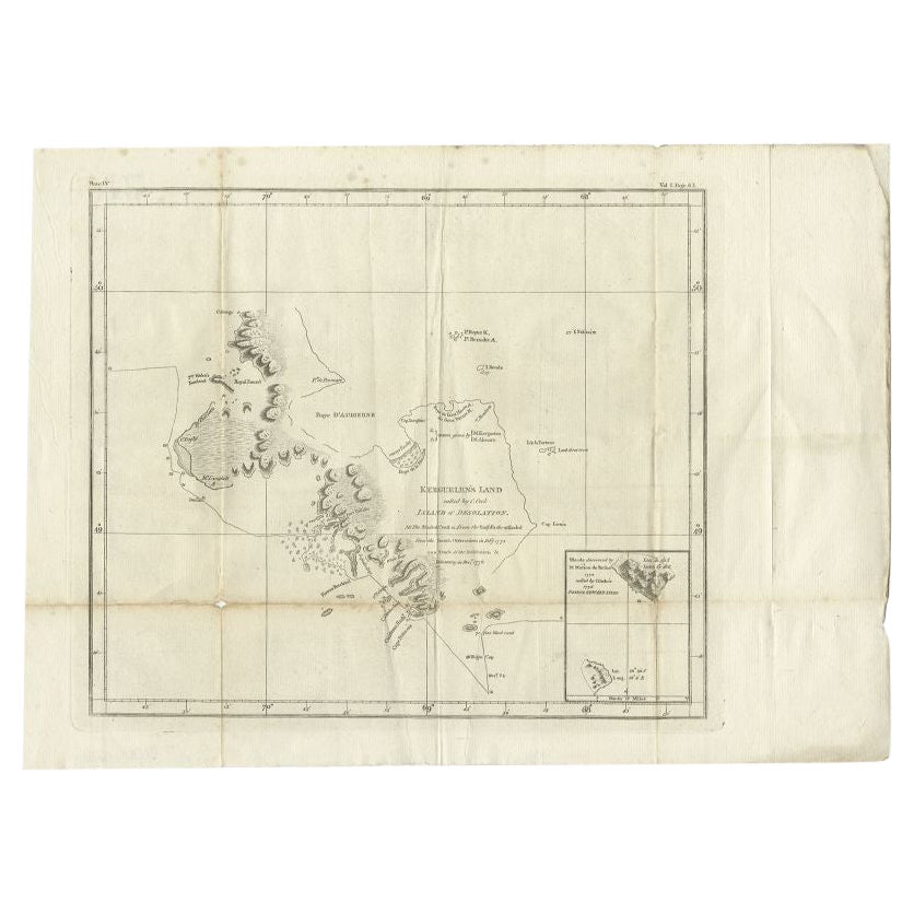
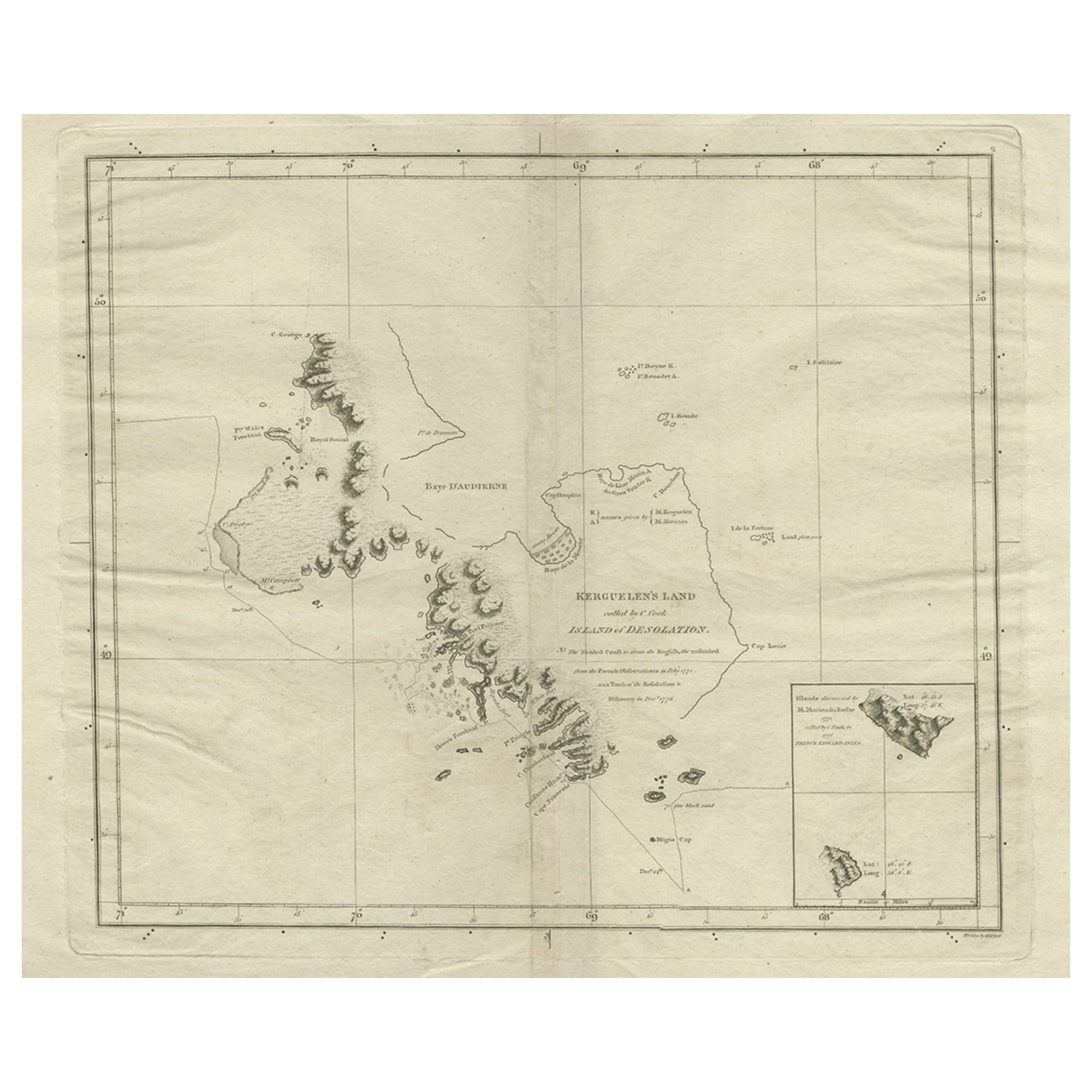
- Antique Map of Kerguelens Island Coast by Cook, 1784By James CookLocated in Langweer, NLAntique print titled 'Kerguelen's Land (..)'. Antique map of Kerguelens island coast, known today as the Desolation islands. Originates from 'A Voyage to the Pacific Ocean: Undertaken, by the Command of His Majesty, for Making Discoveries in the Northern Hemisphere (..)' published in Dublin. Artists and Engravers: James Cook...Category
Antique 18th Century Prints
MaterialsPaper
 $292 Sale Price25% Off
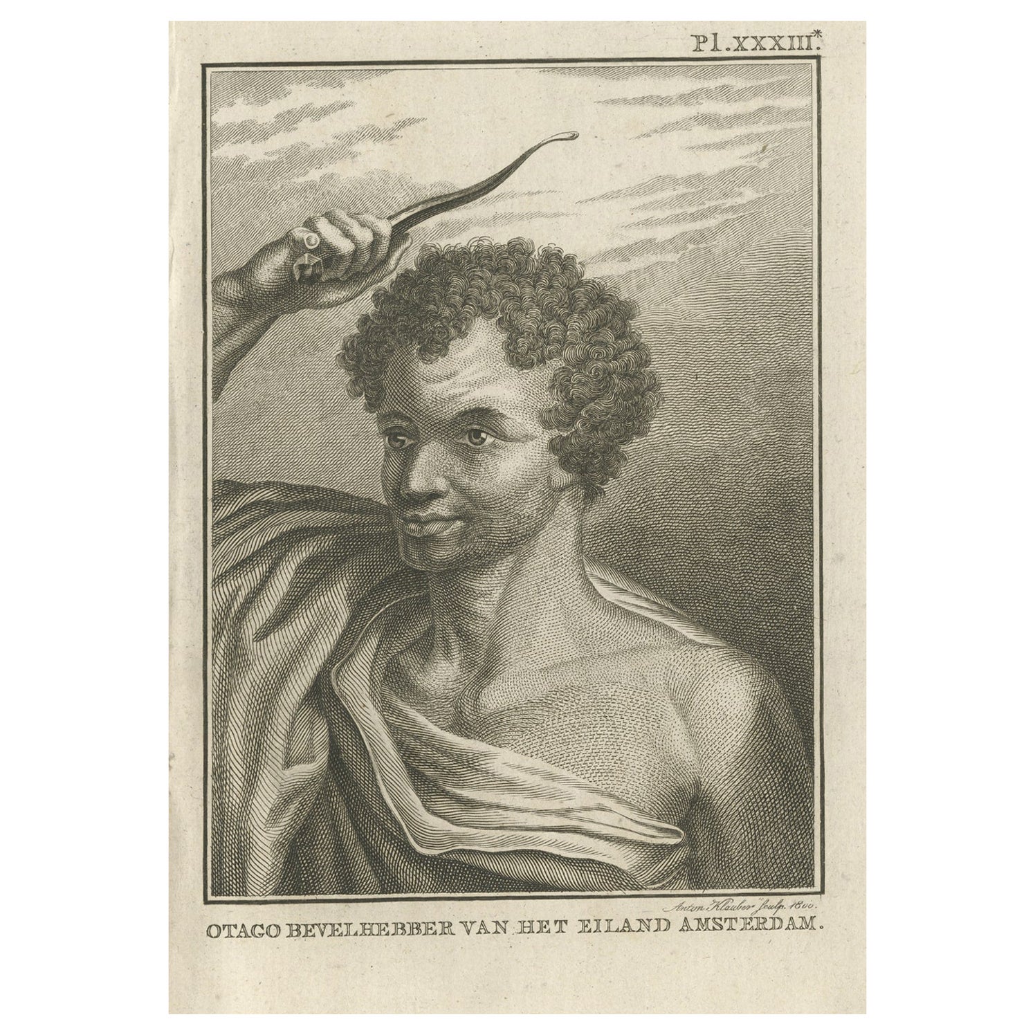
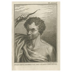
 - Original Antique Engraving of Otago by Cook, 1803By James CookLocated in Langweer, NLAntique print titled 'Otago Bevelhebber van het Eiland Amsterdam'. Antique print depicting Otago, commander of the Island Amsterdam. Originates from 'Reizen Rondom de Waereld door James Cook...Category
Antique 19th Century Prints
MaterialsPaper
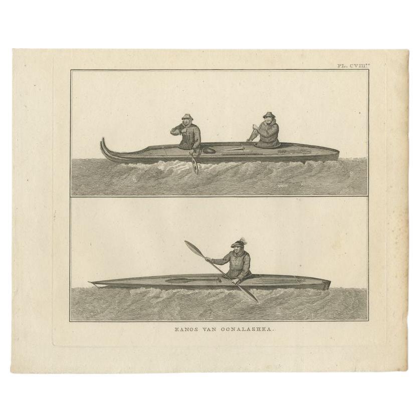
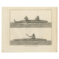
- Antique Print of Canoes of Unalaska by Cook, 1803By James CookLocated in Langweer, NLAntique print Alaska titled 'Kanos van Oonalashka'. Antique print depicting two canoes of Unalaska. Originates from 'Reizen Rondom de Waereld door James Cook (..)'. Artists and E...Category
Antique 19th Century Prints
MaterialsPaper
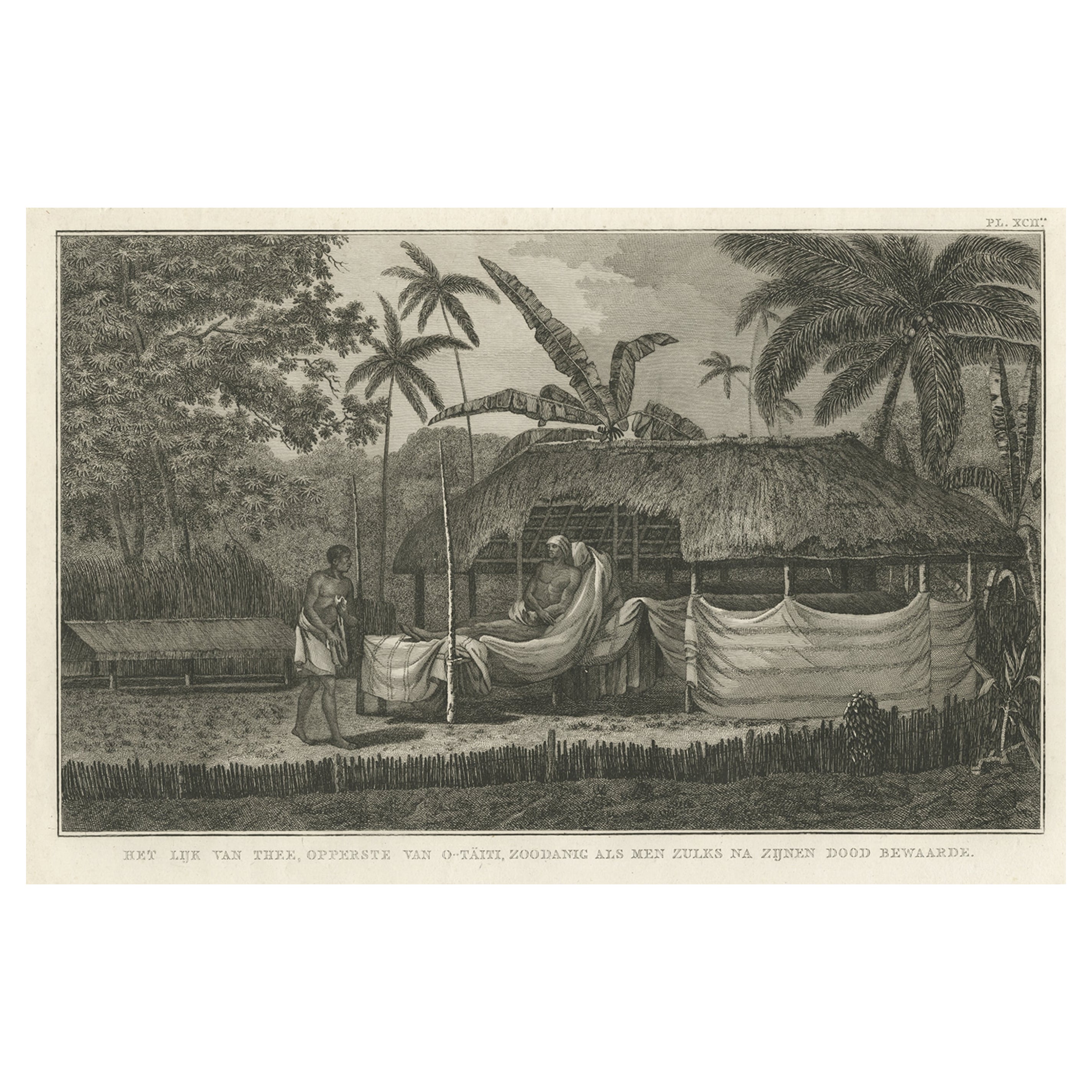
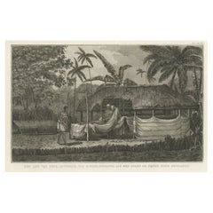
- Antique Engraving of the Dead Chief of Tahiti Island in the Pacific, 1803By James CookLocated in Langweer, NLAntique print titled 'Het Lijk van Thee, Opperste van O-Tahiti, zoodanig als men zulks na zijnen dood bewaarde'. Antique print depicting the remnents of Thee, Chief of Tahiti. Origin...Category
Antique 19th Century Prints
MaterialsPaper


You May Also Like
- Original Antique Map of South America. C.1780Located in St Annes, LancashireGreat map of South America Copper-plate engraving Published C.1780 Two small worm holes to left side of map Unframed.Category
Antique Early 1800s English Georgian Maps
MaterialsPaper

- Original Antique Map of South America by Thomas Clerk, 1817Located in St Annes, LancashireGreat map of South America Copper-plate engraving Drawn and engraved by Thomas Clerk, Edinburgh. Published by Mackenzie And Dent, 1817 Unframed.Category
Antique 1810s English Maps
MaterialsPaper
- Original Antique Map of South America, circa 1830Located in St Annes, LancashireGreat map of South America Copper plate engraving Published by Butterworth, Livesey & Co., circa 1830 Unframed.Category
Antique Early 1800s English Other Maps
MaterialsPaper

- Original Antique Map of South Africa, Arrowsmith, 1820Located in St Annes, LancashireGreat map of South Africa. Drawn under the direction of Arrowsmith. Copper-plate engraving. Published by Longman, Hurst, Rees, Orme and Br...Category
Antique 1820s English Maps
MaterialsPaper
- Original Antique Map of South East Asia by Thomas Clerk, 1817Located in St Annes, LancashireGreat map of South East Asia Copper-plate engraving Drawn and engraved by Thomas Clerk, Edinburgh. Published by Mackenzie And Dent, 1817 Unframed.Category
Antique 1810s English Maps
MaterialsPaper
- Original Antique Map of South East Asia, Arrowsmith, 1820Located in St Annes, LancashireGreat map of South East Asia Drawn under the direction of Arrowsmith Copper-plate engraving Published by Longman, Hurst, Rees, Orme and Brown, 1820 Unframed.Category
Antique 1820s English Maps
MaterialsPaper


