Items Similar to Original Antique Map of Southern Asia, Published in 1833


Want more images or videos?
Request additional images or videos from the seller
1 of 6
Original Antique Map of Southern Asia, Published in 1833
About the Item
Antique map titled 'Carte de l'Inde'. Detailed map extending from India in the west to Vietnam and the Malay Peninsula in the east. This map originates from 'Atlas universel de geographie ancienne et moderne, precede d'un abrege de geographie physique et historique' by M. Lapie. Published 1833.
- Dimensions:Height: 19.69 in (50 cm)Width: 25.99 in (66 cm)Depth: 0.02 in (0.5 mm)
- Materials and Techniques:
- Period:
- Date of Manufacture:1833
- Condition:General age-related toning. Minor wear, blank verso. Blind stamp above 'Mer des Indes'. Please study image carefully.
- Seller Location:Langweer, NL
- Reference Number:
About the Seller
5.0
Platinum Seller
These expertly vetted sellers are 1stDibs' most experienced sellers and are rated highest by our customers.
Established in 2009
1stDibs seller since 2017
1,909 sales on 1stDibs
Typical response time: <1 hour
- ShippingRetrieving quote...Ships From: Langweer, Netherlands
- Return PolicyA return for this item may be initiated within 14 days of delivery.
More From This SellerView All
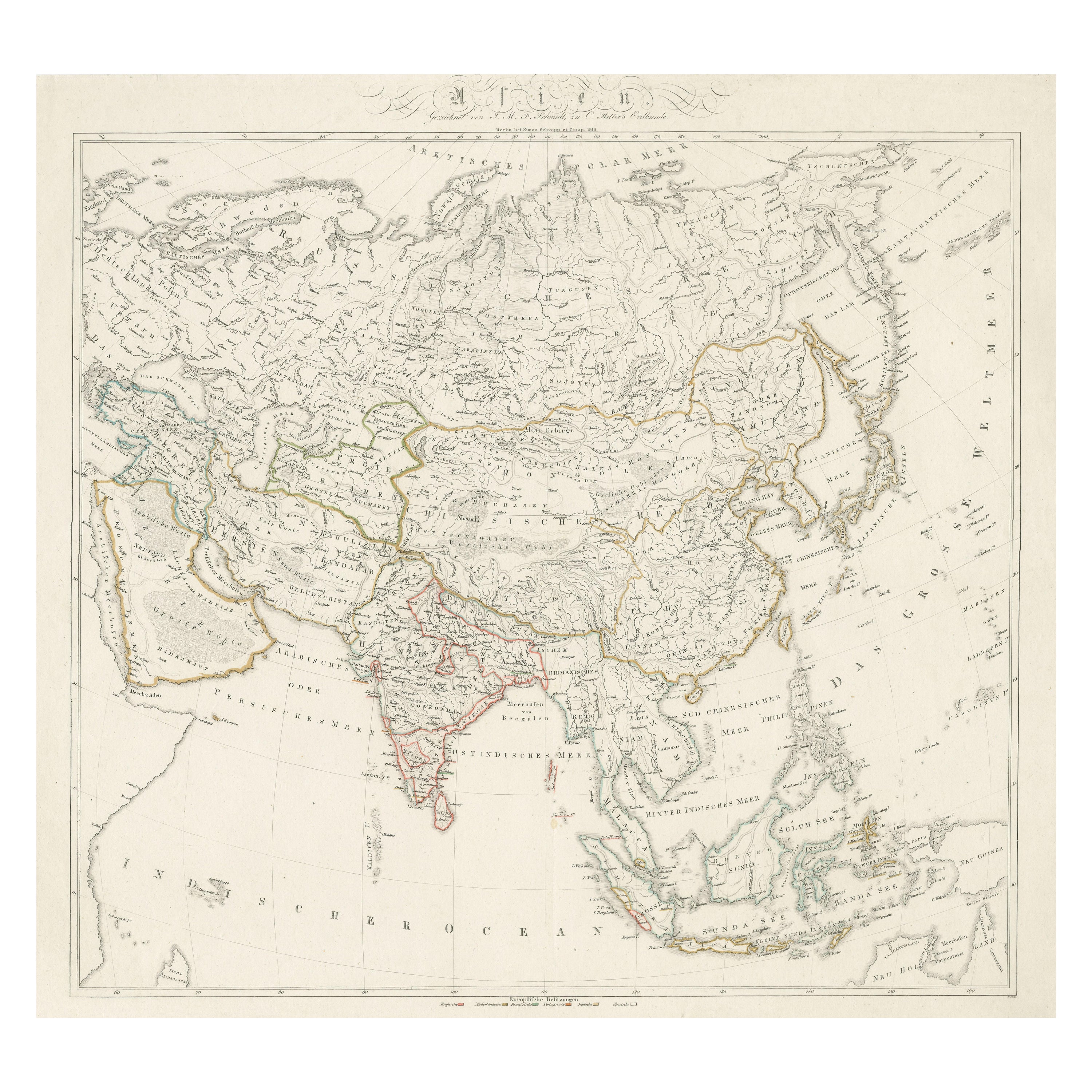
- Original Antique Map of AsiaLocated in Langweer, NLAntique map titled 'Asien'. Original old map of Asia. Published in Berlin by Simon Schropp et Comp, 1819.Category
Antique Early 19th Century Maps
MaterialsPaper
- Decorative Original Antique Map of Southern Germany, c.1730Located in Langweer, NL"Antique map titled 'The South West Part of Germany. Containing ye Dominions of the Archbishops and Electors of Mentz Y Treves, and of ye Elec. Palatine of ye Rhine; with Franconia, ...Category
Antique 18th Century Maps
MaterialsPaper
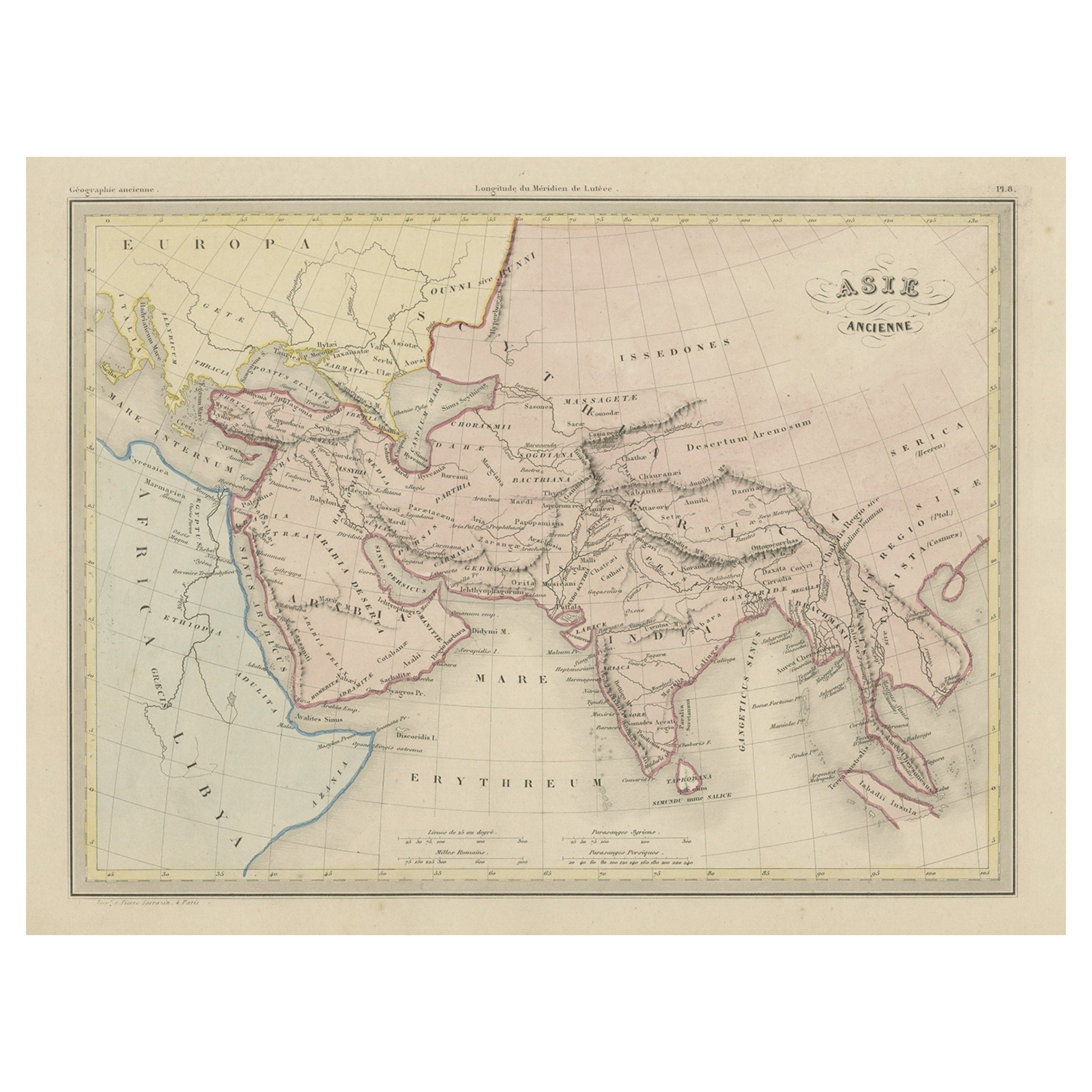
- Original Antique Map of Ancient Asia, 1847Located in Langweer, NLDescription: Antique map Asia titled 'Asie Ancienne'. This is an original antique map of Ancient Asia and originates from 'Atlas de la Geographie ...Category
Antique 1840s Maps
MaterialsPaper
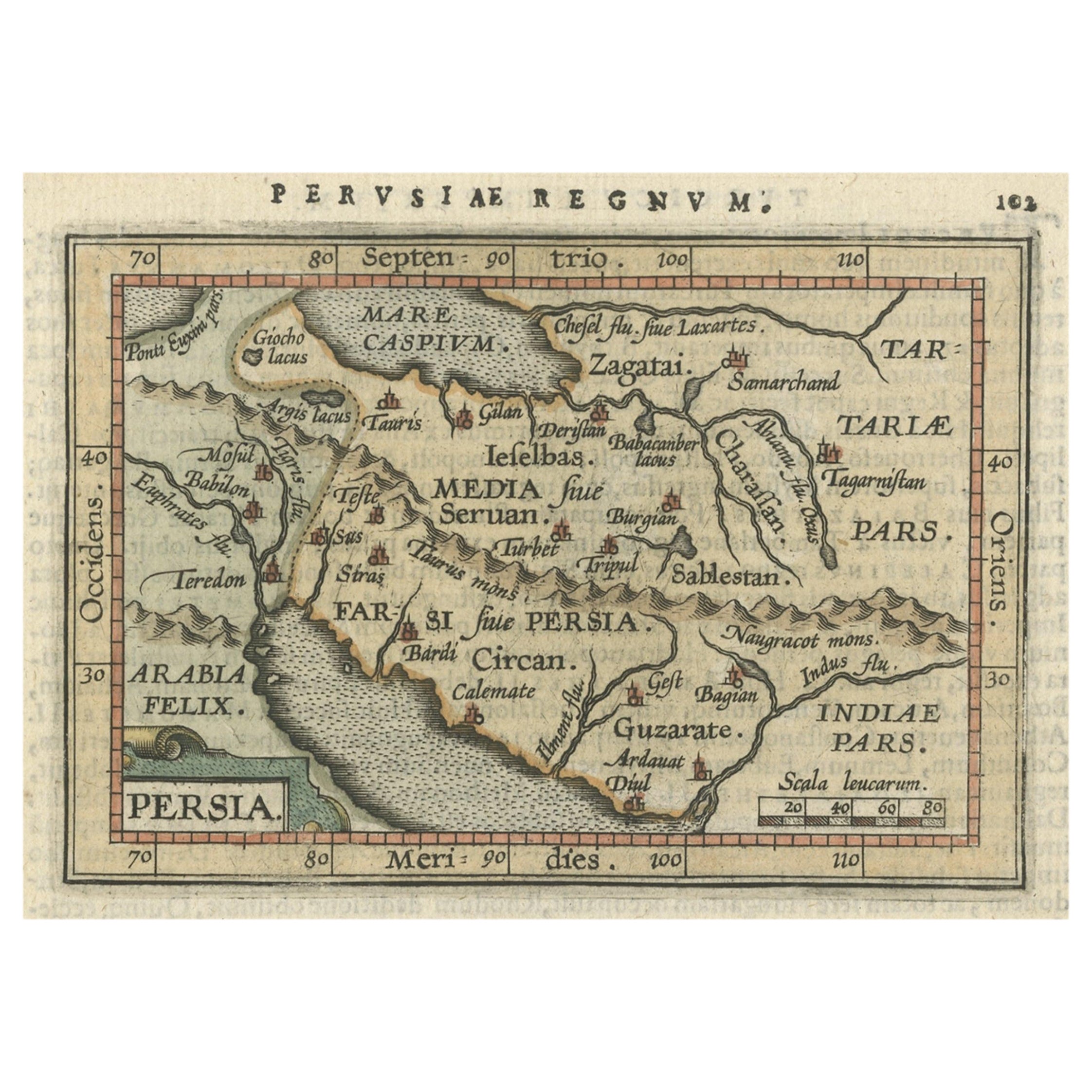
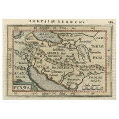
- Original Antique Miniature Map of Persia, Published, ca.1601Located in Langweer, NLAntique miniature map titled 'Persia'. Small map of Persia published in the Epitome, or pocket-edition of the "Theatrum Orbis Terrarum". Artists and e...Category
Antique Early 1600s Maps
MaterialsPaper
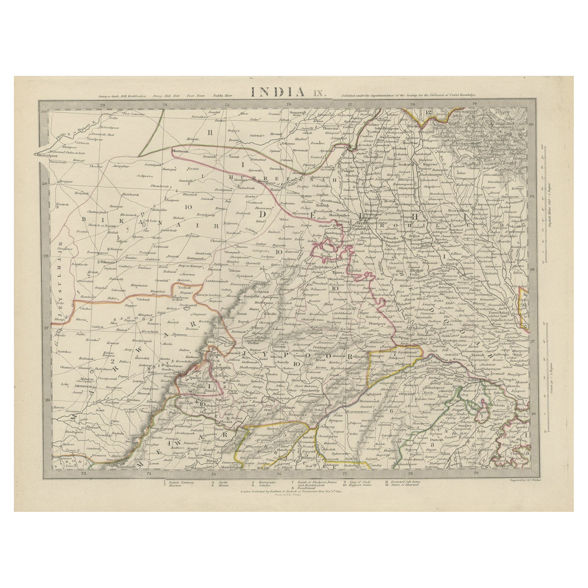
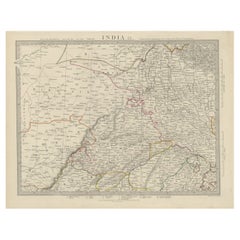
- Antique Map of the Region of Delhi in India, 1833Located in Langweer, NLAntique map titled 'India IX'. Old steel engraved map of the region of Delhi, with great detail. Artists and Engravers: Engraved by J. & C. Walker. Published under the superinten...Category
Antique 19th Century Maps
MaterialsPaper
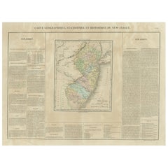
- Original Antique Map of the State of New Jersey Published in FranceLocated in Langweer, NLOriginal antique map titled 'Carte Géographique Statistique et Historique du New-Jersey'. One of the earliest obtainable maps of the State of New Jersey published outside of the Unit...Category
Antique Early 19th Century Maps
MaterialsPaper


You May Also Like
- Original Antique Map of Asia. C.1780Located in St Annes, LancashireGreat map of Asia Copper-plate engraving Published C.1780 Two small worm holes to right side of map Unframed.Category
Antique Early 1800s English Georgian Maps
MaterialsPaper

- Original Antique Map of South East Asia, Arrowsmith, 1820Located in St Annes, LancashireGreat map of South East Asia Drawn under the direction of Arrowsmith Copper-plate engraving Published by Longman, Hurst, Rees, Orme and Brown, 1820 Unframed.Category
Antique 1820s English Maps
MaterialsPaper
- Original Antique Map of South East Asia by Becker, circa 1840Located in St Annes, LancashireGreat map of South East Asia Steel engraving with original color outline Engraved by Becker Published by Virtue, circa 1840. Unframed.Category
Antique 1840s English Other Maps
MaterialsPaper
- Original Antique Map of Italy. C.1780Located in St Annes, LancashireGreat map of Italy Copper-plate engraving Published C.1780 Unframed.Category
Antique Early 1800s English Georgian Maps
MaterialsPaper

- Original Antique Map of India. C.1780Located in St Annes, LancashireGreat map of India Copper-plate engraving Published C.1780 Three small worm holes to right side of map and one bottom left corner Unframed.Category
Antique Early 1800s English Georgian Maps
MaterialsPaper

- Original Antique Map of Hungary, Arrowsmith, 1820Located in St Annes, LancashireGreat map of Hungary Drawn under the direction of Arrowsmith. Copper-plate engraving. Published by Longman, Hurst, Rees, Orme and Brown, 1820 Unframed.Category
Antique 1820s English Maps
MaterialsPaper


