Items Similar to Extremely Rare Map of The land of Eso or Hokkaido in Japan, 1725
Want more images or videos?
Request additional images or videos from the seller
1 of 5
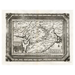
Extremely Rare Map of The land of Eso or Hokkaido in Japan, 1725
About the Item
Plate 46: 'Le Pais d' Eso.' (The land of Eso / Hokkaido in Japan.) Extremely rare in this edition.
This plate originates from the very scarse: 'La Galerie Agreable du Monde (..). Tome premier des Indes Orientales.', published by P. van der Aa, Leyden, c. 1725. This famous work was published in 66 parts and is the biggest print / map book ever published. Van der Aa incorporated plates by other publishers such as Blaeu, Visscher, de Wit, Meurs, Montanus, Dapper, Halma, Mortier, Allard in this work and often added broad decorative borders. Probably the costliest and complete universal geographic work ever produced. It is said that only 100 copies were printed. Ref: Koeman Aa9; Phillips 2780 note.
Artists and Engravers: Pieter van der Aa (Leiden 1659-1733) was a Dutch publisher best known for preparing maps and atlases. The Galerie Agreable contains plates and maps by the best Dutch engravers: Luiken, Goeree, Mulder, Stoopendaal, Aldert Meijer, Romeyn de Hooghe, ao.
Condition: Very good. General age related toning and light staining. Paper edge uncut and thus irregular and with occasional minimal tears. Original folding as issued. Please study image carefully.
Date: 1725
Overall size: 48 x 37.5 cm.
Image size: 15.5 x 16 cm.
We sell original antique maps to collectors, historians, educators and interior decorators all over the world. Our collection includes a wide range of authentic antique maps from the 16th to the 20th centuries. Buying and collecting antique maps is a tradition that goes back hundreds of years. Antique maps have proved a richly rewarding investment over the past decade, thanks to a growing appreciation of their unique historical appeal. Today the decorative qualities of antique maps are widely recognized by interior designers who appreciate their beauty and design flexibility. Depending on the individual map, presentation, and context, a rare or antique map can be modern, traditional, abstract, figurative, serious or whimsical. We offer a wide range of authentic antique maps for any budget.
- Dimensions:Height: 14.77 in (37.5 cm)Width: 18.9 in (48 cm)Depth: 0 in (0.01 mm)
- Materials and Techniques:
- Period:
- Date of Manufacture:1725
- Condition:Condition: Very good. General age related toning and light staining. Paper edge uncut and thus irregular and with occasional minimal tears. Original folding as issued. Please study image carefully.
- Seller Location:Langweer, NL
- Reference Number:
About the Seller
5.0
Platinum Seller
These expertly vetted sellers are 1stDibs' most experienced sellers and are rated highest by our customers.
Established in 2009
1stDibs seller since 2017
1,914 sales on 1stDibs
Typical response time: <1 hour
- ShippingRetrieving quote...Ships From: Langweer, Netherlands
- Return PolicyA return for this item may be initiated within 14 days of delivery.
More From This SellerView All
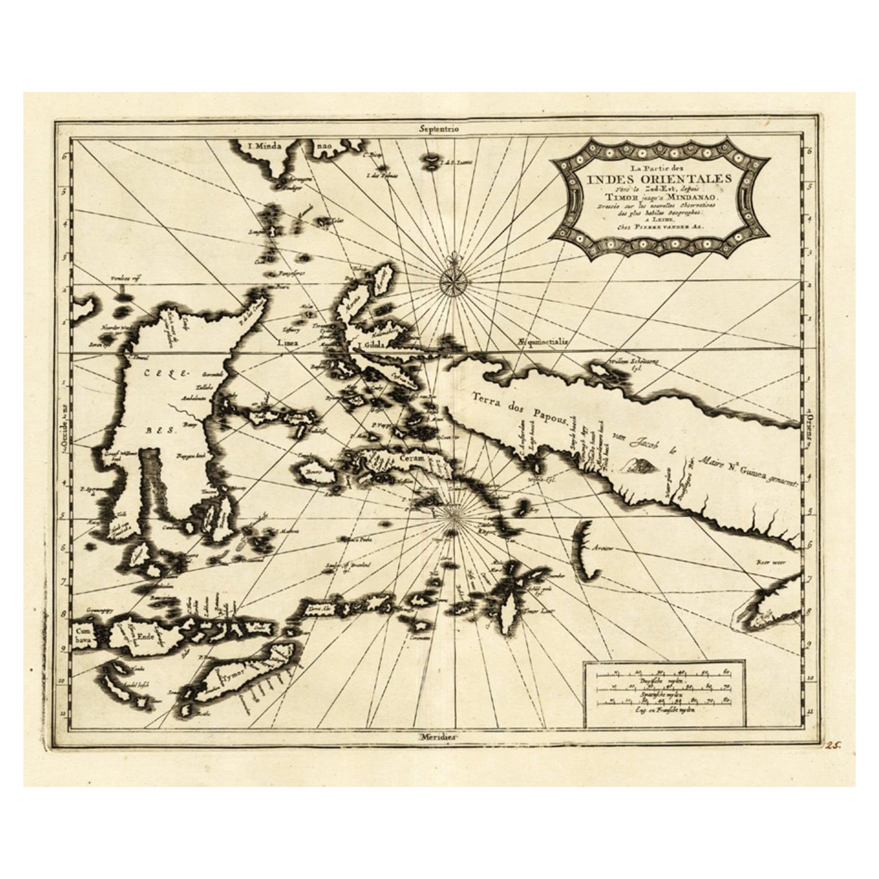
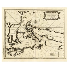
- Extremely Rare Map of the East-Indies towards the South-East 'Indonesia', 1725Located in Langweer, NLAntique map titled 'La partie des Indes Orientales vers le Zud-Est, depuis Timor jusqu'a Midanao (...).' (The part of the East-Indies towards the South-East, from Timor to Mindanao.)...Category
Antique 1720s Maps
MaterialsPaper
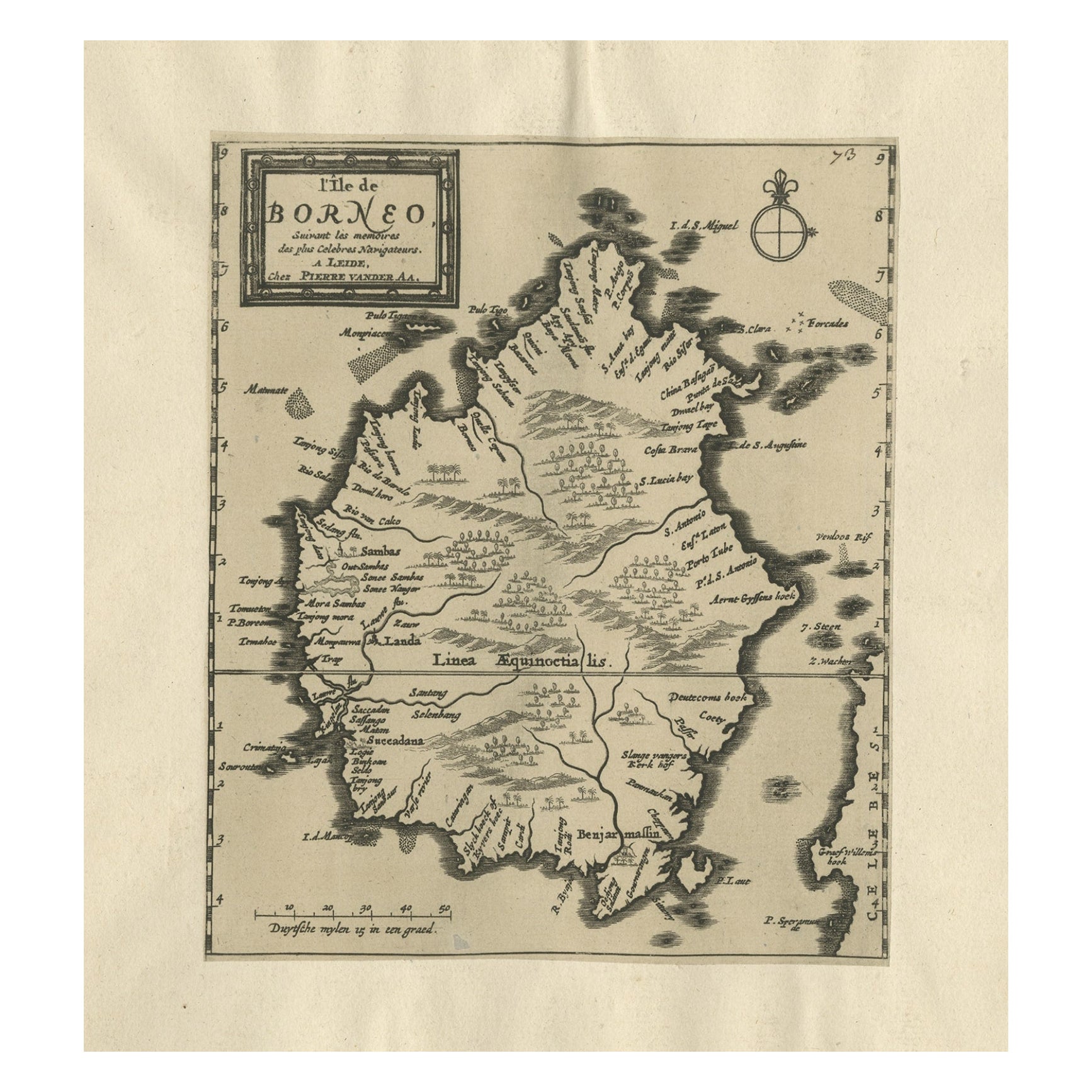
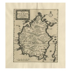
- Extremely Scarce Antique Map of The Island of Borneo, Indonesia, c. 1725Located in Langweer, NLAntique map titled 'L'Ile de Borneo Suivant les memoires des plus Celebres Navigateurs.' A detailed map of the island Borneo, with a small part of Celebes visible. This plate origi...Category
Antique 18th Century Maps
MaterialsPaper
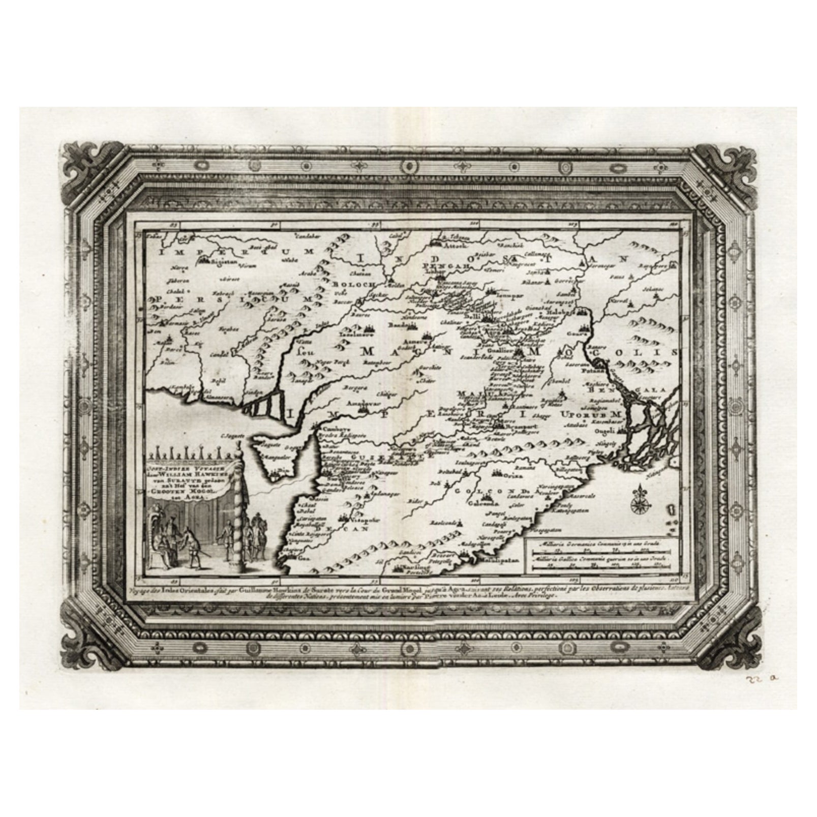
- Rare Antique Map of the Moghul Empire, ca.1725Located in Langweer, NLAntique map titled 'Oost-Indize Voyagie door William Hawkins van Suratte gedaan na 't Hof van den Grooten Mogol tot Agra. - Voyage des Indes Orientales...Category
Antique 1720s Maps
MaterialsPaper
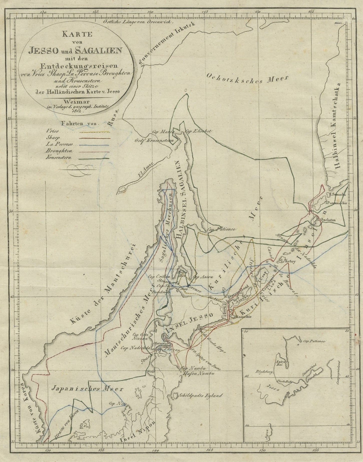
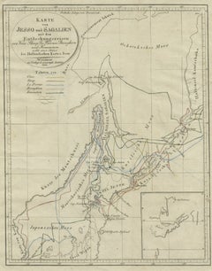
- Antique Map of the Region of Hokkaido, Island of Japan, 1812Located in Langweer, NLAntique map titled 'Karte von Jesso und Sagalien'. Old map of the region of the island of Yesso (Mororan, Hokkaido, Japan). This map originates from Volume 38 of 'Allgemeine geograph...Category
Antique 19th Century Maps
MaterialsPaper
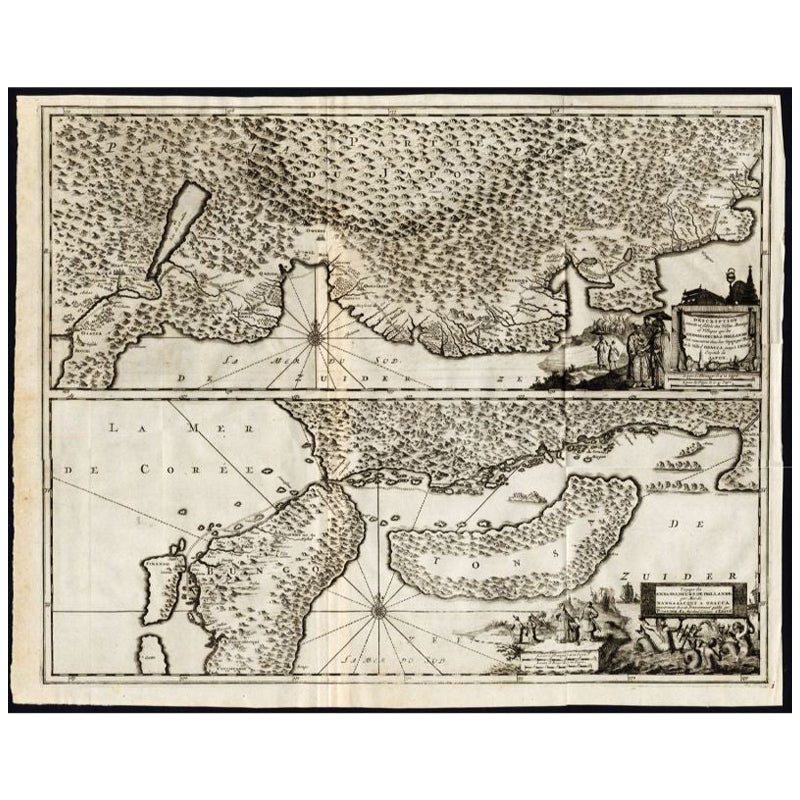
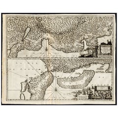
- Antique Map of the Region of Osaka and Hirado Island in Japan, 1725By Pieter Van Der AaLocated in Langweer, NLAntique map titled 'Description exacte et fidele des villes, bourgs et villages qui les Ambassadeurs de Hollande ont rencontrez dans leur voyage par terre de la ville Osacca jusqu'a ...Category
Antique 18th Century Maps
MaterialsPaper
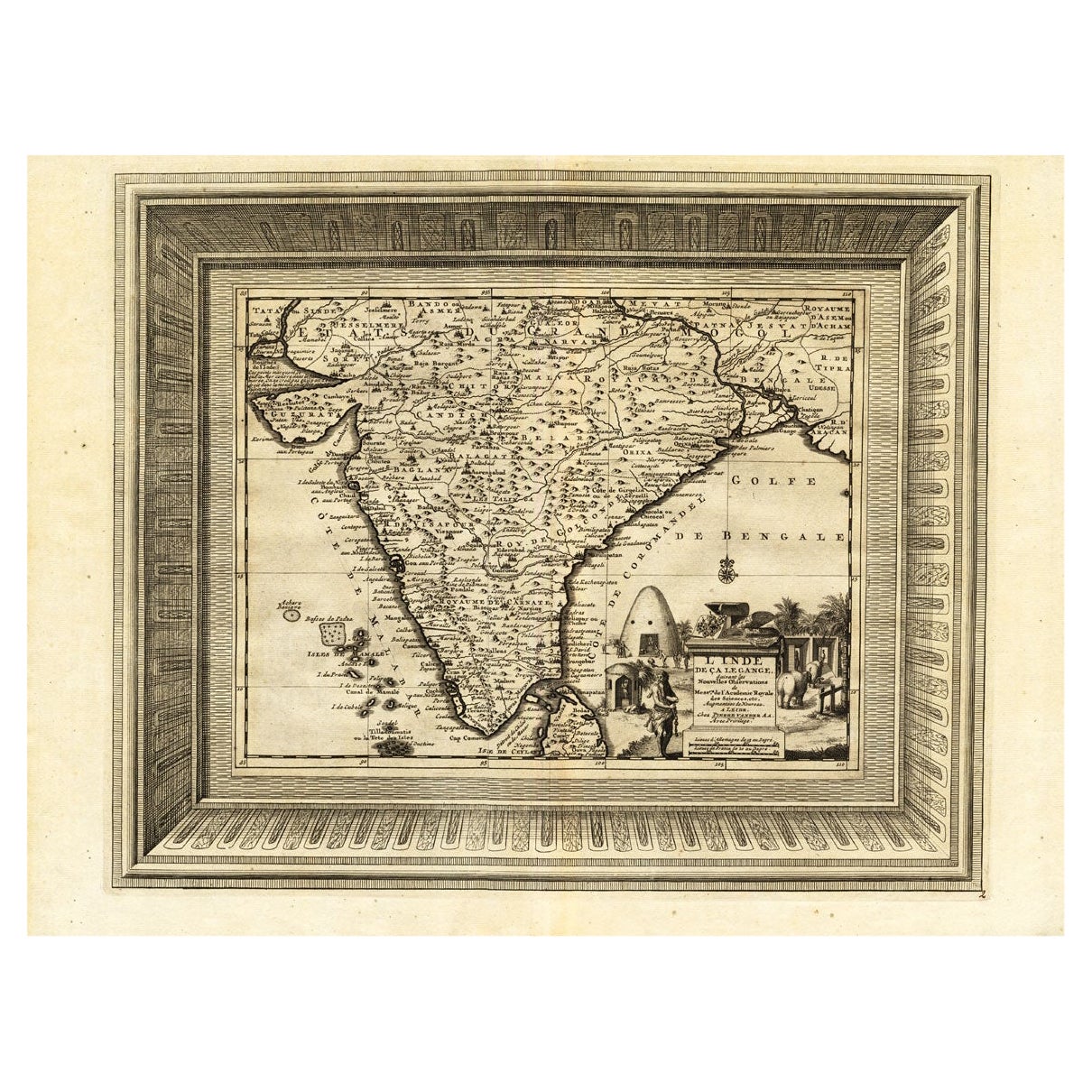
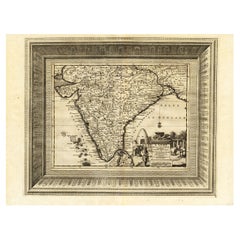
- Rare Engraved Antique Map of India with Elephants in the Cartouche, c.1725Located in Langweer, NLAntique map titled 'L'Inde de ca le Gange suivant les nouvelles observations (..)'. Detailed map of India, with part of Sri Lanka. Compass rose and decorative cartouche lower rig...Category
Antique 18th Century Maps
MaterialsPaper
You May Also Like
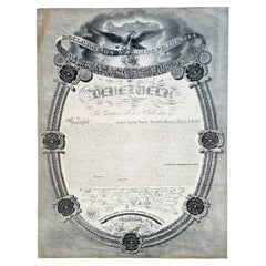
- Extremely Rare Copy of the Venezuelan Declaration of Independance, 1811Located in Amsterdam, NLExtremely rare copy of the Venezuelan Declaration of Independance 'Declaracion de Independencia de las Siete Provincias Unidas de Venezuela en Congreso de 5 de Julio de 1811' By Lorenzo Lüthy (c. 1811-1877), printed in Philadelphia, Peter S. Duval, 1841. Lithograph on laid paper, mounted in passepartout, H. 84 x W. 64.5 cm (with mount H. 96,5 x W. 77 cm.) Large and extremely rare lithographed broadside Declaration of Independence of Venezuela by American immigrant...Category
Antique Early 19th Century Venezuelan Prints
MaterialsPaper
- The Holy Land at the Time of Jesus: A 17th Century Dutch Map by VisscherBy Nicolaes Visscher IILocated in Alamo, CAThis detailed Dutch map entitled "Het Beloofe de Landt Canaan door wandelt van onsen Salichmaecker Iesu Christo, nessens syne Apostelen" by Nicolaes Visscher was published in Amsterd...Category
Antique Mid-17th Century Dutch Maps
MaterialsPaper
- Map of the Holy Land "Carte de la Syrie et de l'Egypte" by Pierre M. LapieBy Pierre M. LapieLocated in Alamo, CAAn early 19th century map of ancient Syria and Egypt entitled "Carte de la Syrie et de l'Egypte anciennes/dressée par M. Lapie, Colonel d'Etat Major, et...Category
Antique Early 19th Century French Maps
MaterialsPaper
- Map of the Republic of GenoaLocated in New York, NYFramed antique hand-coloured map of the Republic of Genoa including the duchies of Mantua, Modena, and Parma. Europe, late 18th century. Dimension: 25...Category
Antique Late 18th Century European Maps
- Map "Estuary- Mouth of the Thames"Located in Alessandria, PiemonteST/426 - Antique French Map of the estuary of the Thames, map dated 1769 - "Mape of the entrance of the Thames. Designed by filing of Navy cards fo...Category
Antique Mid-18th Century French Other Prints
MaterialsPaper
- Vintage "View of the Center of Paris Taken from the Air" Lithograph MapLocated in San Diego, CAA very stylish "View of the Center of Paris Taken from the Air" lithograph map published by the Paris Ministry of Tourism, circa early 1950s. The piece measures 27" x 43" and shows...Category
20th Century French Mid-Century Modern Prints
MaterialsPaper


Recently Viewed
View AllMore Ways To Browse
Extremely Rare
Collection Of Rare Plates
Extremely Rare Collectible
Antique White Stain Furniture
Japanese Antique Collectables
Japanese Interiors Book
Antique Map Book
Antique Maps Book
16th Century Japanese
Phillips Collection Furniture
Oriental Antiques Collectables
Japan Maps
Map Japan
Map Of Japan
18th Century Japanese Plate
Premier Antiques
Antique Japanese Map
Antique Japanese Maps