Items Similar to Genuine Antique Engraved Map of Helvetia or Switzerland, 1729
Want more images or videos?
Request additional images or videos from the seller
1 of 7
Genuine Antique Engraved Map of Helvetia or Switzerland, 1729
About the Item
Decorative early 18th century engraved map of Switzerland.
Title: Helvetia Conterminarumq terra rum antiqua.
Translated from Latin: Switzerland is an ancient land
Description: Switzerland, antique copperplate engraved map with hand coloring and a decorative title cartouche. Two figures greatly enhances visual appeal.
Author: Phillip Cluver, or Philip Cluverius, Philipp Clüver, Latinized as Philippus Cluverius studied law in Leiden and settled over there in 1615.
We only sell Guaranteed Absolutely Original authentic Maps and Prints.
A Certificate of Authenticity ( COA ) will be supplied on request.
We ship our antique maps and prints carefully packed across the world with Express Service.
Key words: Europe, Ancient World, Helvetia, Switzerland, Lake Geneva, Lake Constance.
- Dimensions:Height: 9.85 in (25 cm)Width: 14.18 in (36 cm)Depth: 0 in (0.02 mm)
- Materials and Techniques:Paper,Engraved
- Period:1720-1729
- Date of Manufacture:1729
- Condition:Wear consistent with age and use. Original fold line as issued, but hardly visible. Please study the image carefully or ask for additional photos.
- Seller Location:Langweer, NL
- Reference Number:
About the Seller
5.0
Platinum Seller
These expertly vetted sellers are 1stDibs' most experienced sellers and are rated highest by our customers.
Established in 2009
1stDibs seller since 2017
1,909 sales on 1stDibs
Typical response time: <1 hour
- ShippingRetrieving quote...Ships From: Langweer, Netherlands
- Return PolicyA return for this item may be initiated within 14 days of delivery.
More From This SellerView All
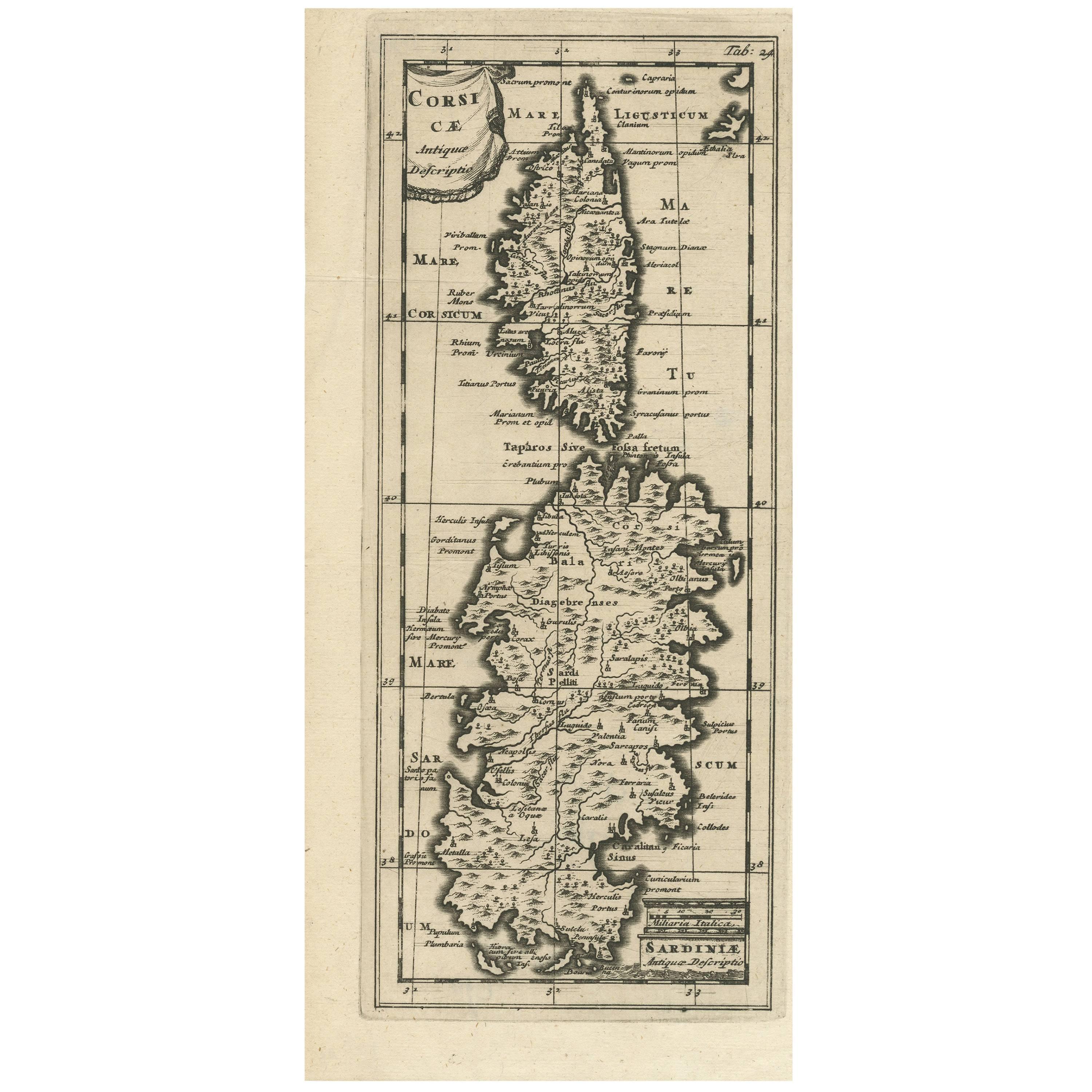
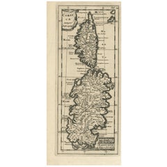
- Antique Map of Corsica and Sardini, 1729Located in Langweer, NLDetailed map of the Islands of Corsica and Sardinia, showing towns, rivers, lakes, mountains, bays, and other features. Cluver's Geography was one of the most enduring works of the ...Category
Antique Early 18th Century Maps
MaterialsPaper
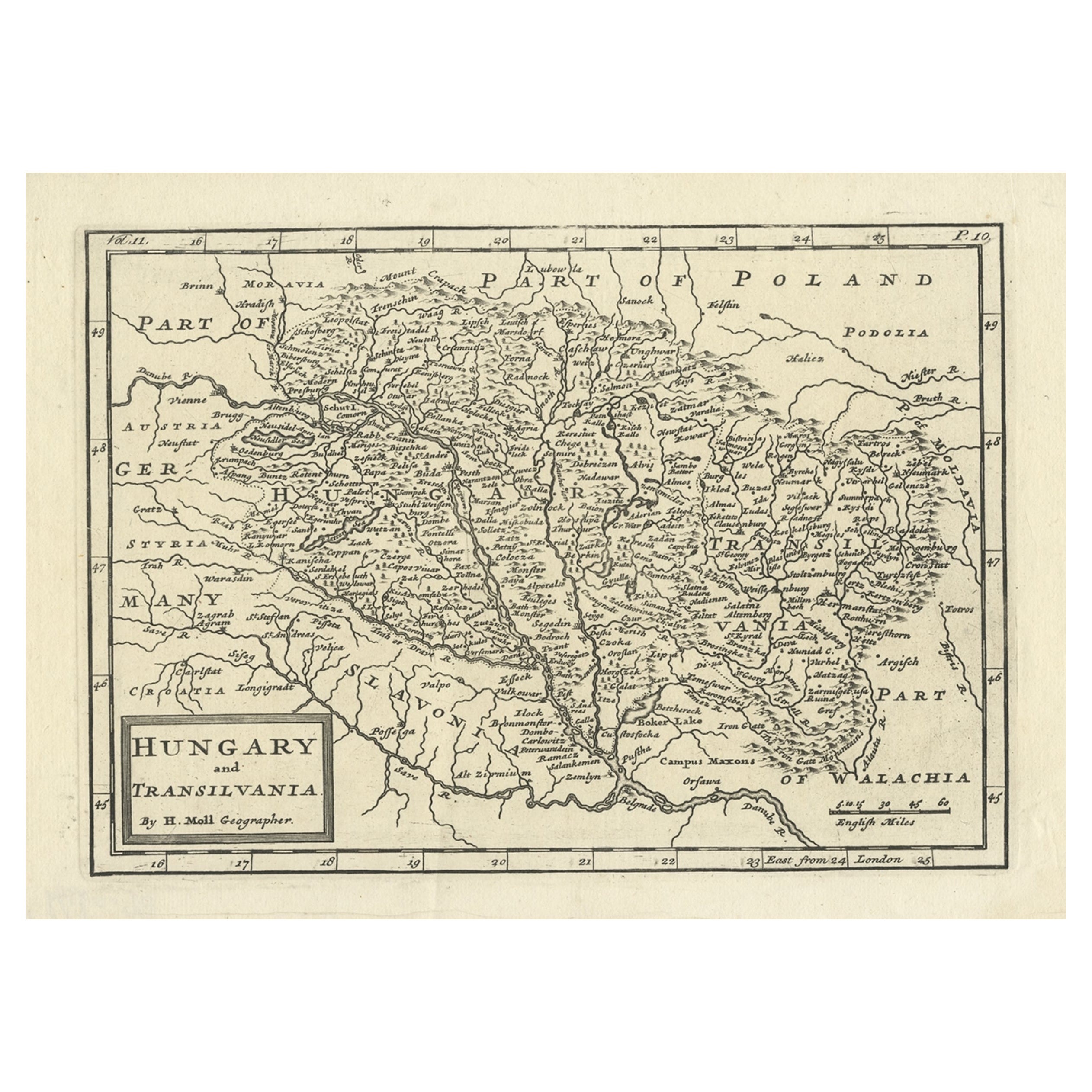
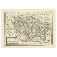
- Antique Engraved Map of Hungary and Transylvania or Romania, c.1710Located in Langweer, NLAntique map titled 'Hungary and Transilvania'. Original antique map of Hungary and Transylvania (modern day Romania), centered on Budapest. Artists and ...Category
Antique 18th Century Maps
MaterialsPaper
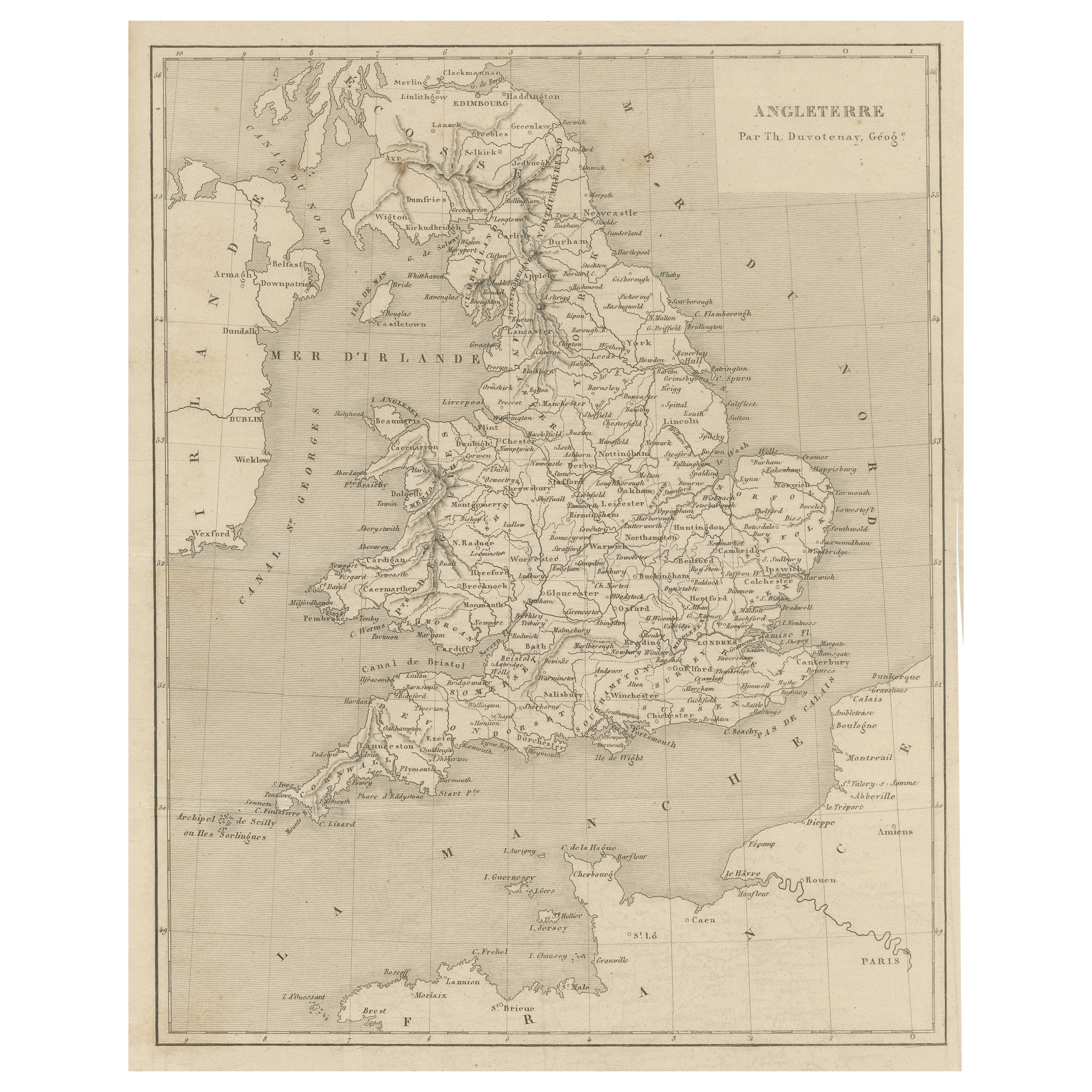
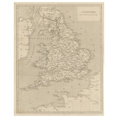
- Steel Engraved Antique Map of EnglandLocated in Langweer, NLAntique map titled 'Angleterre'. Original antique map of England. Engraved by Th. Duvotenay. Originates from 'Complement de L'Encyclopedie Mode...Category
Antique Late 19th Century Maps
MaterialsPaper
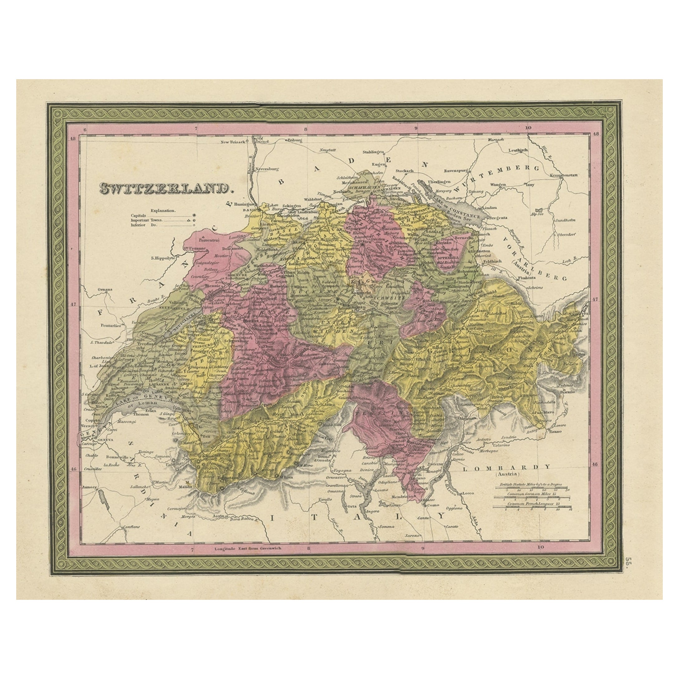
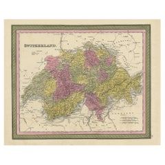
- Colourful Antique Map of Switzerland, 1846Located in Langweer, NLAntique map titled 'Switzerland'. Old map of Switzerland. This map originates from 'A New Universal Atlas Containing Maps of the various Empires...Category
Antique 1840s Maps
MaterialsPaper
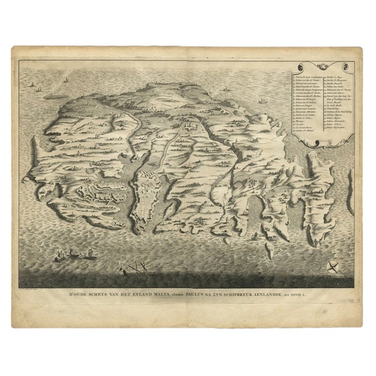
- Rare Antique Bird's-eye View Map of The Island of Malta, 1729Located in Langweer, NLAntique print titled 'D'oude Schets van het Eyland Malta, alwaer, Paulus na zyn Schipbreuk Aenlandde.' This is an uncommon bird's-eye view map of the island of Malta. The map pre...Category
Antique 18th Century Maps
MaterialsPaper
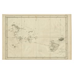
- Antique Engraved Map of the Friendly Islands or Tonga, ca.1785Located in Langweer, NLAntique map titled 'Carte des Isles des Amis'. Map of the Friendly Islands / Tonga. The Tongan people first encountered Europeans in 1616 when the Dutch vessel Eendracht, captain...Category
Antique 1780s Maps
MaterialsPaper
You May Also Like
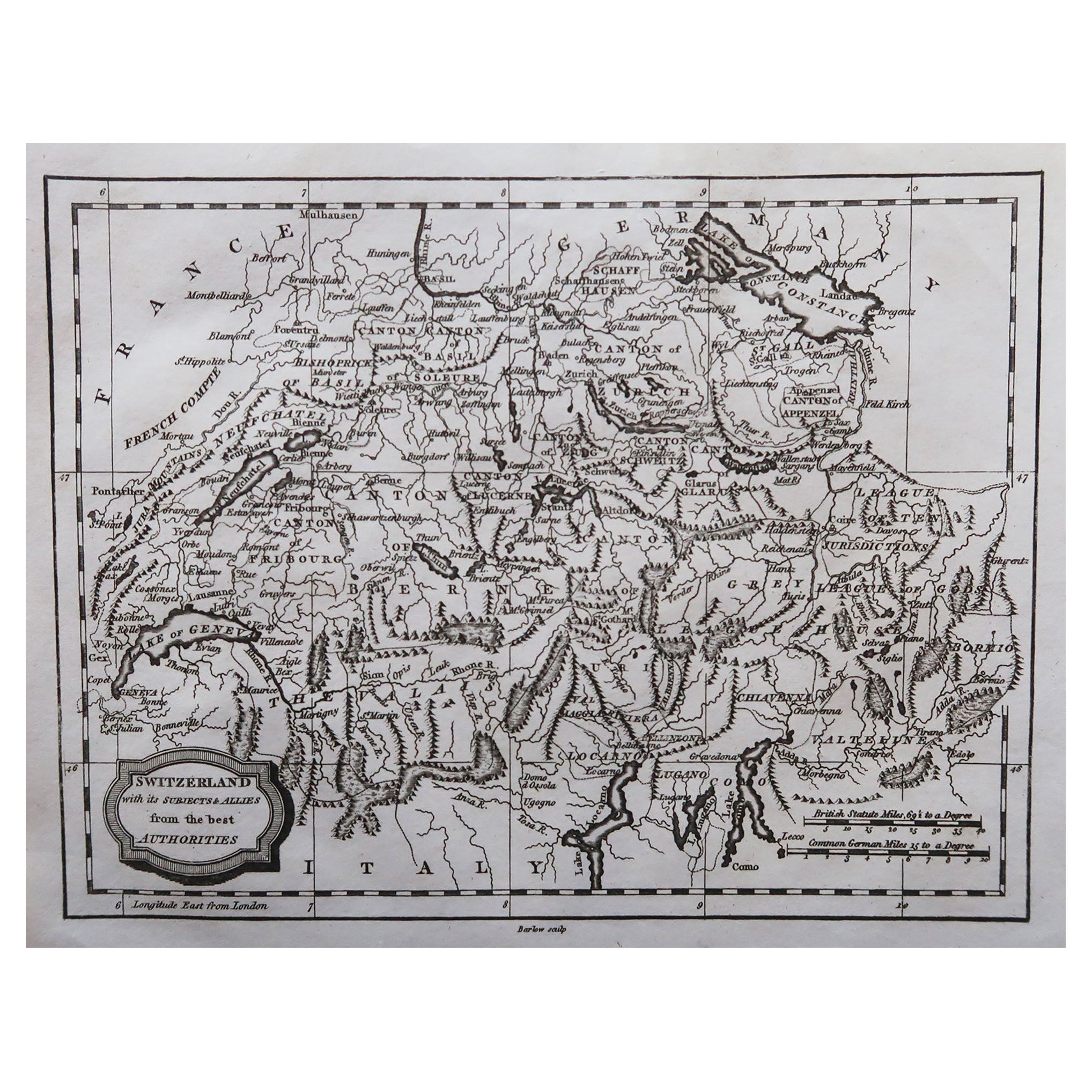
- Original Antique Map of Switzerland, Engraved By Barlow, Dated 1807Located in St Annes, LancashireGreat map of Switzerland Copper-plate engraving by Barlow Published by Brightly & Kinnersly, Bungay, Suffolk. Dated 1807 Unframed.Category
Antique Early 1800s English Maps
MaterialsPaper
- Original Antique Map of Sweden, Engraved by Barlow, 1806Located in St Annes, LancashireGreat map of Sweden Copper-plate engraving by Barlow Published by Brightly & Kinnersly, Bungay, Suffolk. 1806 Unframed.Category
Antique Early 1800s English Maps
MaterialsPaper
- Original Antique Map of Spain and Portugal, Engraved By Barlow, 1806Located in St Annes, LancashireGreat map of Spain And Portugal Copper-plate engraving by Barlow Published by Brightly & Kinnersly, Bungay, Suffolk. 1806 Unframed.Category
Antique Early 1800s English Maps
MaterialsPaper
- Original Antique Map of The Netherlands, Engraved by Barlow, Dated 1807Located in St Annes, LancashireGreat map of Netherlands Copper-plate engraving by Barlow Published by Brightly & Kinnersly, Bungay, Suffolk. Dated 1807 Unframed.Category
Antique Early 1800s English Maps
MaterialsPaper
- Antique Map of Principality of MonacoBy Antonio Vallardi EditoreLocated in Alessandria, PiemonteST/619 - "Old Geographical Atlas of Italy - Topographic map of ex-Principality of Monaco" - ediz Vallardi - Milano - A somewhat special edition ---Category
Antique Late 19th Century Italian Other Prints
MaterialsPaper
- Original Antique Map of Asia. C.1780Located in St Annes, LancashireGreat map of Asia Copper-plate engraving Published C.1780 Two small worm holes to right side of map Unframed.Category
Antique Early 1800s English Georgian Maps
MaterialsPaper


Recently Viewed
View AllMore Ways To Browse
Antique Engraved
Antique Engraver
Antique Engrave
Antique Latin
Antique Words
Antique Terra
Authentic Antique Keys
Antique Ancient Keys
Antique Ancient Key
Lake Geneva Switzerland
Ancient World Map
Antique Map Switzerland
Antique Rummer
Antique Rum
Antique Map Of Switzerland
Lake Constance
Antique World Chart
Used Nautical Charts