Items Similar to Large Antique 1859 Map of North America


Want more images or videos?
Request additional images or videos from the seller
1 of 18
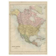
Large Antique 1859 Map of North America
About the Item
This Map was made by Augustus Mitchell in 1859 It is in amazing condition for being 163 years old. This price is for the rolled up easy to ship version of this piece. I will be Framing in the near future and the price will be increased as a framed piece for an added $1500. The details are amazing the population of 1850 North America is included as well as details of all of North and Central America. The size of the western states are unique as well as all the details of this beautiful snapshot in History.
- Dimensions:Height: 65 in (165.1 cm)Width: 65 in (165.1 cm)Depth: 0.01 in (0.26 mm)
- Materials and Techniques:
- Place of Origin:
- Period:
- Date of Manufacture:1859
- Condition:Wear consistent with age and use.
- Seller Location:Sag Harbor, NY
- Reference Number:1stDibs: LU2252327186272
About the Seller
5.0
Vetted Seller
These experienced sellers undergo a comprehensive evaluation by our team of in-house experts.
Established in 2006
1stDibs seller since 2016
100 sales on 1stDibs
Typical response time: 1 hour
- ShippingRetrieving quote...Ships From: Sag Harbor, NY
- Return PolicyA return for this item may be initiated within 3 days of delivery.
More From This SellerView All
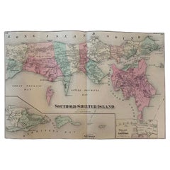
- Antique Map Long Island, Southold, Shelter Island, Orient, New YorkBy Beers Atlas Co.Located in Sag Harbor, NYAntique map of Long Island, Southold, Shelter Island, Orient, Great details, Names of homes, Roads and Businesses in 1870. Unframed. This is...Category
Antique Mid-19th Century American Early Victorian Prints
MaterialsPaper
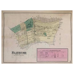
- 1870 Map Flatbush Brooklyn New YorkBy Beers Atlas Co.Located in Sag Harbor, NYAn amazing Antique 1870 Map Flatbush Brooklyn New York, Hand Water colored, Includes Prospect Park in Brooklyn and Flatbush Village. Unframed and in ...Category
Antique Late 19th Century American Antiquities
MaterialsPaper
- Framed Mid-19th Century Wall Map of Long Island, the HamptonsLocated in Sag Harbor, NYA Framed museum quality find. This large wall map dates to the mid-1800s. Detailed inset maps of, Sag Harbor, East Hampton, Amagansett, Shelter Island and most villages in Long Islan...Category
Antique Mid-19th Century American Maps
MaterialsLinen, Paper
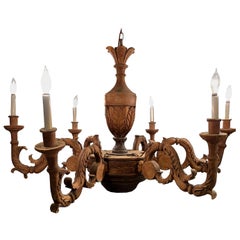
- Large Antique French ChandelierLocated in Sag Harbor, NYA beautiful antique hand carved walnut chandelier. The original chandelier was made for candles and a candle lit chandelier. It looks to have bee...Category
Antique Early 1900s Chandeliers and Pendants
MaterialsWalnut
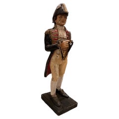
- Large Antique Captain FigureLocated in Sag Harbor, NYThis Statue is a spectacular example of Victorian era folk Art. originally shipped from England to New York 30 years ago, this ships captain stands stoi...Category
Antique Mid-19th Century English Sculptures and Carvings
MaterialsHardwood
- Large Antique Brewery Sign MirrorLocated in Sag Harbor, NYBeautiful Antique advertising mirror for IPA Beer of Younger's Brewery (William Younger & Company) was a brewery in Edinburgh which grew fr...Category
Antique Late 19th Century Scottish Wall Mirrors
MaterialsMirror


You May Also Like
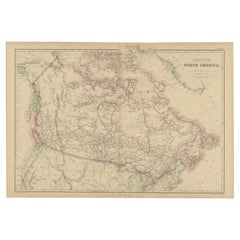
- Antique Map of British North America by W. G. Blackie, 1859Located in Langweer, NLAntique map titled 'British North America'. Original antique map of British North America. This map originates from ‘The Imperial Atlas of Mode...Category
Antique Mid-19th Century Maps
MaterialsPaper
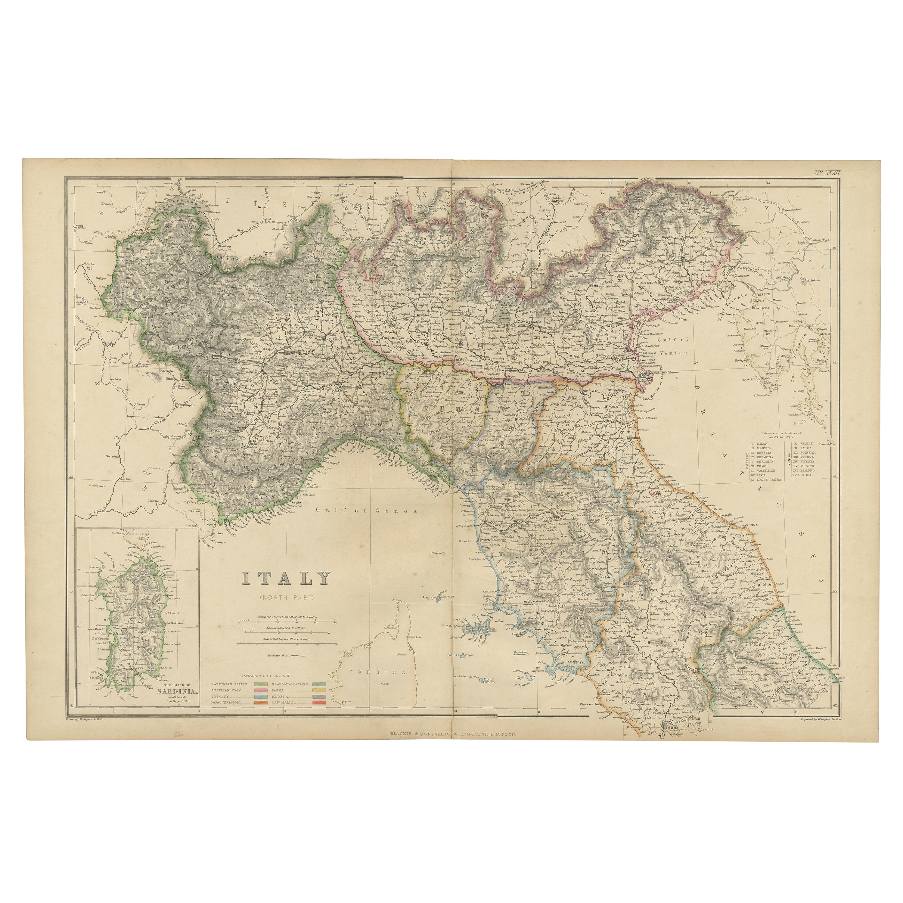
- Antique Map of Italy, North Part, by W. G. Blackie, 1859Located in Langweer, NLThe "Antique Map of Italy, North Part" by W. G. Blackie, dated 1859, is a historically significant cartographic piece, showcasing the northern region of Italy in the mid-19th century...Category
Antique Mid-19th Century Maps
MaterialsPaper
- Antique Map of North America, 1821Located in Langweer, NLAntique map of America titled 'Carte de l'Amerique septentrionale'. Scarce map of North America, shortly after the Louisiana Purchase and the first ...Category
Antique 19th Century Maps
MaterialsPaper
- Antique Map of South America by W. G. Blackie, 1859Located in Langweer, NLAntique map titled 'South America'. Original antique map of South America. This map originates from ‘The Imperial Atlas of Modern Geography’. Published by W. G. Blackie, 1859.Category
Antique Mid-19th Century Maps
MaterialsPaper
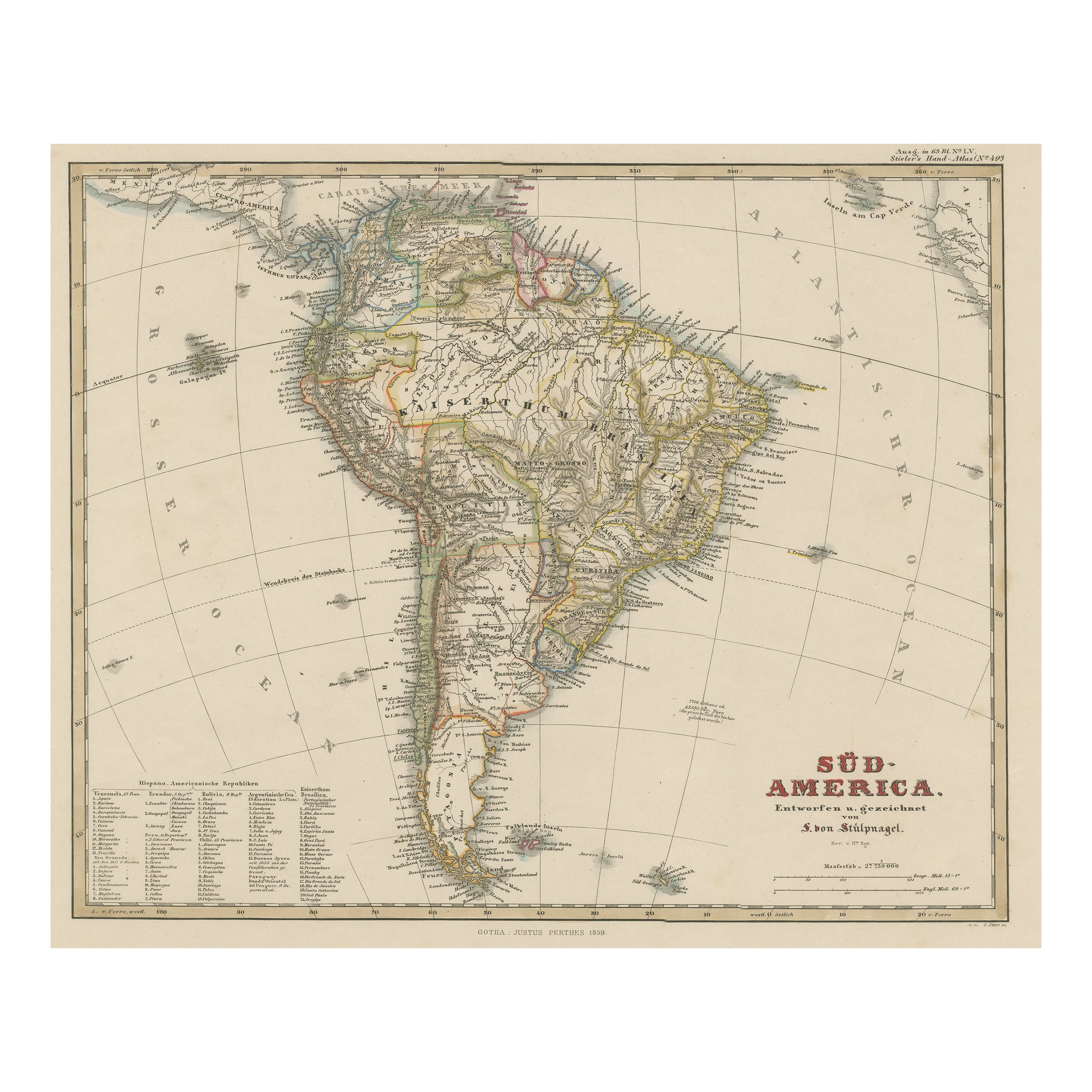
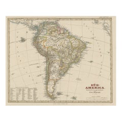
- Antique Map of South America with Many Details, ca.1859Located in Langweer, NLOriginal antique map titled 'Süd-America'. Beautiful old map of South America, with many details and legend. This map originates from Stielers Handatlas, published circa 1859. St...Category
Antique Mid-19th Century Maps
MaterialsPaper
- Antique Map of North America by A & C. Black, 1870Located in Langweer, NLAntique map titled 'North America'. Original antique map of North America. This map originates from ‘Black's General Atlas of The World’. Published by A & C. Black, 1870.Category
Antique Late 19th Century Maps
MaterialsPaper


Recently Viewed
View AllMore Ways To Browse
Population Of Antique
Old American Maps
Antique North America Map
Antique Maps North America
Antique Map North America
Antique Maps Of North America
North America Antique Map
Antique Paper Roll
Antique Map Of North America
Large Framed Maps
Large Framed Antique Maps
Maps Rolled
Roll Map
Large Antique Maps North America
Rollable Map
Central America Map
Antique Map Canvas
Mitchell Antique Maps