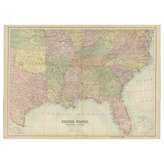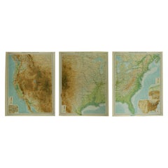
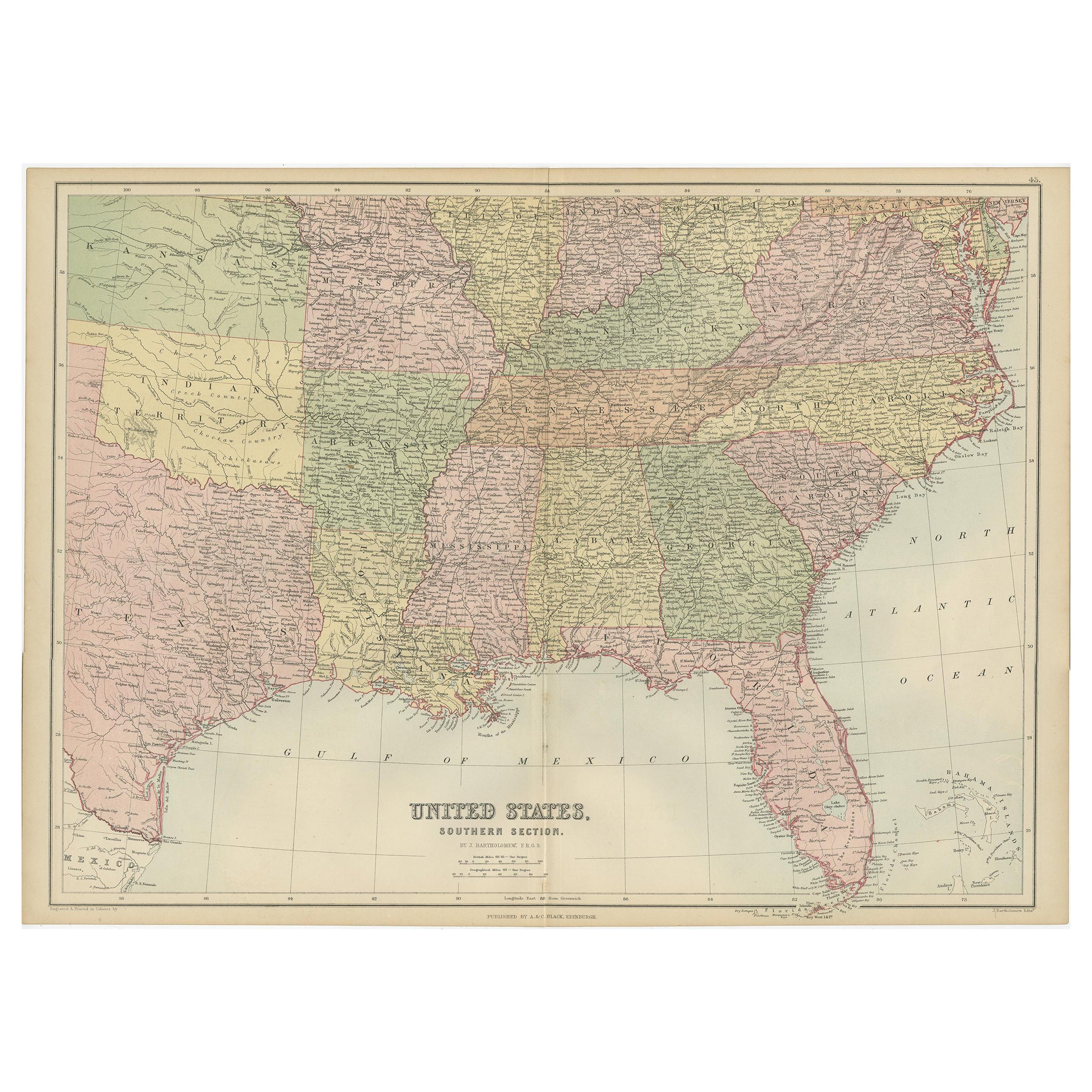
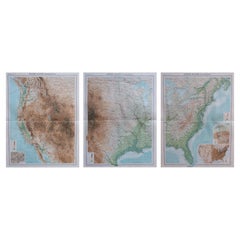
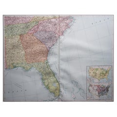
Large Antique Map of the United States, in 4 Sections
View Similar Items


Want more images or videos?
Request additional images or videos from the seller
1 of 6
Large Antique Map of the United States, in 4 Sections
About the Item
- Dimensions:Height: 18 in (45.72 cm)Width: 23 in (58.42 cm)Depth: 0.07 in (1.78 mm)
- Sold As:Set of 4
- Materials and Techniques:Paper,Other
- Place of Origin:
- Period:
- Date of Manufacture:1920
- Condition:Wear consistent with age and use.
- Seller Location:St Annes, GB
- Reference Number:1stDibs: LU1836319388392
About the Seller
4.9
Platinum Seller
These expertly vetted sellers are 1stDibs' most experienced sellers and are rated highest by our customers.
1stDibs seller since 2016
2,531 sales on 1stDibs
Associations
International Confederation of Art and Antique Dealers' Associations
More From This SellerView All
- Large Vintage Maps of the United States, in 3 Sections, 1920Located in St Annes, LancashireGreat maps of the USA in 3 sections Unframed Original color By John Bartholomew and Co. Edinburgh Geographical Institute Published, circa 1920 The measurements given is for just...Category
Vintage 1920s British Maps
MaterialsPaper
- Large Original Antique Map of the United States of America. 1891By Rand McNally & Co.Located in St Annes, LancashireFabulous map of The United States Original color By Rand, McNally & Co. Dated 1891 Unframed Free shipping.Category
Antique 1890s American Maps
MaterialsPaper
- Original Antique Map of The United States of America, circa 1890Located in St Annes, LancashireGreat map of the USA By The Stanford's Geographical Establishment Original colour Unframed.Category
Antique 1890s English Victorian Maps
MaterialsPaper
- Large Original Vintage Map of the United Kingdom, circa 1920Located in St Annes, LancashireGreat map of The United Kingdom Unframed Original color By John Bartholomew and Co. Edinburgh Geographical Institute Published, circa 1920 Free shipping.Category
Vintage 1920s British Maps
MaterialsPaper
- Large Original Vintage Map of The United Kingdom, circa 1920Located in St Annes, LancashireGreat map of The United Kingdom Original color. Published by Alexander Gross Unframed.Category
Vintage 1920s English Maps
MaterialsPaper
- Large Original Vintage Map of the South Eastern States Inc. Florida, circa 1920Located in St Annes, LancashireGreat map of The South Eastern States Original color. Good condition Published by Alexander Gross Unframed.Category
Vintage 1920s English Maps
MaterialsPaper


You May Also Like
- Antique Map of The United States Southern Section by A & C. Black, 1870Located in Langweer, NLAntique map titled 'United States Southern Section'. Original antique map of Map of The United States Southern Section. This map originates from ‘Black's General Atlas of The World’....Category
Antique Late 19th Century Maps
MaterialsPaper
- Small Map of the United StatesLocated in Langweer, NLAntique map titled 'Amérique septe. Physique'. Small map of the United States. lithographed by C. Callewaert brothers in Brussels circa 1870.Category
Antique Mid-19th Century Maps
MaterialsPaper
- Antique Map of The United States of North America, Pacific States, 1882Located in Langweer, NLThe map is from the same 1882 Blackie Atlas and focuses on the Pacific States of the United States of America during that period. Here are some details and historical context about t...Category
Antique 1880s Maps
MaterialsPaper
- Antique Map of the United States by Lowry, '1852'Located in Langweer, NLAntique map titled 'United States'. Four individual sheets of the United States. This map originates from 'Lowry's Table Atlas constructed and engraved from the most recent Authoriti...Category
Antique Mid-19th Century Maps
MaterialsPaper
- Antique Map of the United States by Balbi '1847'Located in Langweer, NLAntique map titled 'Etats-Unis'. Original antique map of the United States. This map originates from 'Abrégé de Géographie (..)' by Ad...Category
Antique Mid-19th Century Maps
MaterialsPaper
 $173 Sale Price20% Off
 - Antique Map of the United States by Titus '1871'Located in Langweer, NLAntique map titled 'The United States of America'. Original antique map of the United States. This map originates from 'Atlas of Prebl...Category
Antique Late 19th Century Maps
MaterialsPaper