Items Similar to Large Framed Map of the Mediterranean

Want more images or videos?
Request additional images or videos from the seller
1 of 7
Large Framed Map of the Mediterranean
About the Item
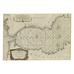
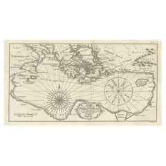
Large map/chart chart of The Mediterranean and the Grecian Archipelago showing Italy, Sardinia, Corsica, part of France, etc. in a black frame.
- Dimensions:Height: 36 in (91.44 cm)Width: 67 in (170.18 cm)Depth: 0.75 in (1.91 cm)
- Style:Mid-Century Modern (Of the Period)
- Place of Origin:
- Period:
- Date of Manufacture:20th Century
- Condition:Wear consistent with age and use.
- Seller Location:New York, NY
- Reference Number:
About the Seller
4.9
Recognized Seller
These prestigious sellers are industry leaders and represent the highest echelon for item quality and design.
Gold Seller
These expertly vetted sellers are highly rated and consistently exceed customer expectations.
Established in 1939
1stDibs seller since 2013
798 sales on 1stDibs
Typical response time: <1 hour
- ShippingRetrieving quote...Ships From: Long Island City, NY
- Return PolicyA return for this item may be initiated within 2 days of delivery.
More From This SellerView All
- Vintage Framed United States MapLocated in New York, NYVintage aged paper map of the United States mounted on particle board and framed in a simple wooden frame.Category
20th Century American Mid-Century Modern Maps
MaterialsWood, Paper
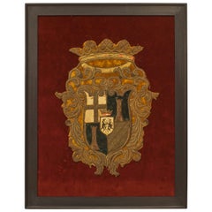
- English Renaissance Framed Crest EmbroideryLocated in New York, NYEnglish Renaissance embroidery of a crest having a crown top mounted on a red velvet background in an ebonized wood frame.Category
Antique 16th Century English Northern Renaissance Decorative Art
MaterialsThread, Velvet, Wood
- Turn of the Century French Art Nouveau Gilt Bronze Ashtray by MarionnetBy Albert MarionnetLocated in New York, NYFrench Art Nouveau gilt bronze ashtray with a floral design and a fluted edge (signed: MARIONNET).Category
Antique Late 19th Century French Art Nouveau Tobacco Accessories
MaterialsOrmolu
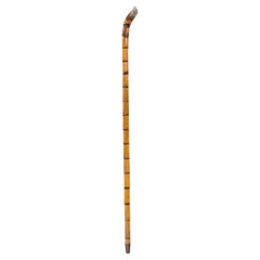
- English Victorian Bamboo Cane with Pewter Cap in the Shape of a HorseshoeLocated in New York, NYEnglish Victorian bamboo cane with pewter cap with an impression of a horseshoe.Category
Antique Late 19th Century British Victorian Sports Equipment and Memorab...
MaterialsSilver
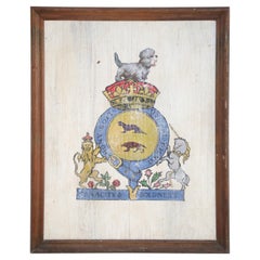
- Tenacity & Boldness Painted Coat of Arms on WoodLocated in New York, NYVintage (20th Century) coat of arms, painted on weathered wood in a rectangular beveled walnut frame, depicting a small gray dog perched on a crown atop a blue and gold crest circling two animal silhouettes, and flanked by a lion and unicorn...Category
20th Century American Mid-Century Modern Arms, Armor and Weapons
MaterialsWood, Walnut
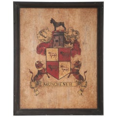
- Munchener Painted Coat of Arms with Giant SchnauzerLocated in New York, NYVintage (20th Century) coat of arms/family crest depicting a black dog atop a red and gold shield of sheep flanked on either side by bulls above a banner reading "Munchener," which c...Category
20th Century Mid-Century Modern Arms, Armor and Weapons
MaterialsAcrylic, Wood


You May Also Like
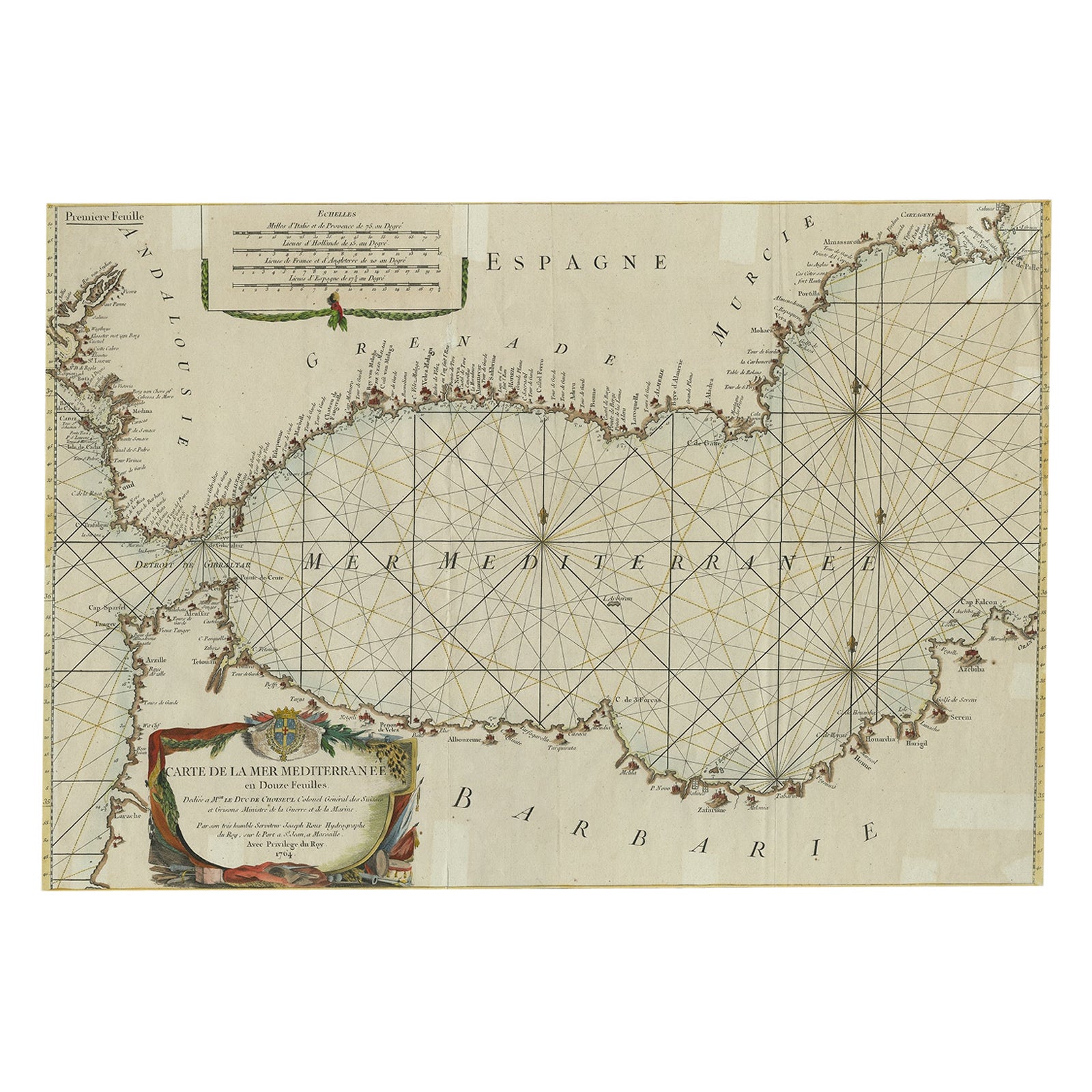
- Large Decorative Antique Map of the Mediterranean, ca.1770Located in Langweer, NLAntique map titled 'Carte de la Mer Mediterranee en Douze Feuilles'. First map out of twelve fine engraved double-page and folding maps that join to create a large wall map...Category
Antique 1770s Maps
MaterialsPaper
- Antique Map of the Eastern Mediterranean, C.1710Located in Langweer, NLAntique map Middle East titled 'De Beschryving van de Reysen Pauli en van de Andere Apostelen'. Antique map of the Eastern Mediterranean with det...Category
Antique 18th Century Maps
MaterialsPaper
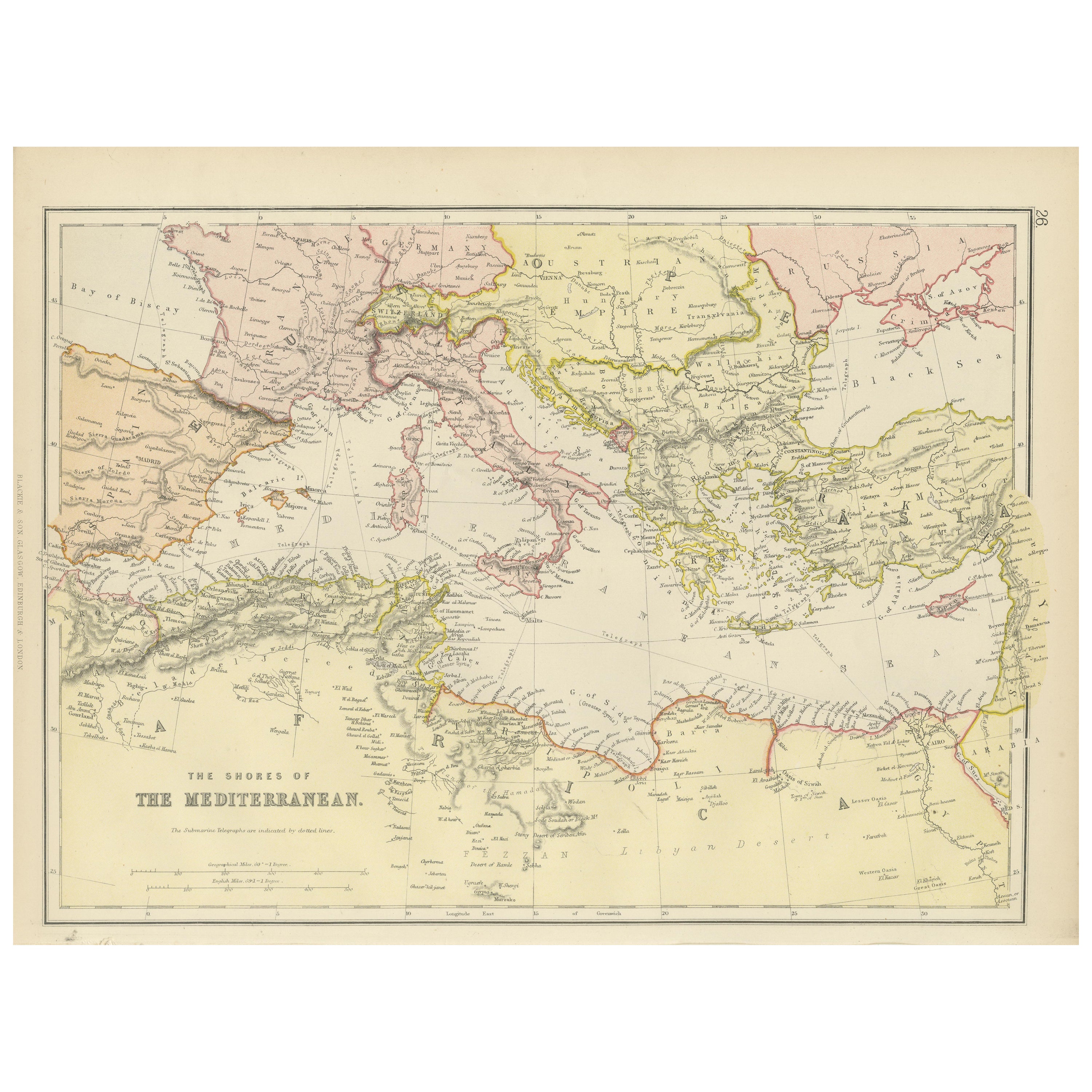
- Mediterranean Tapestry: A 19th Century Map of the Mediterranean Shores, 1882Located in Langweer, NLThis map, titled "The Shores of the Mediterranean," is part of the 1882 atlas by Blackie & Son, and it portrays the coastal regions that surround the Mediterranean Sea. It is a detailed representation of the diverse and historically rich countries that share the Mediterranean coastline, spanning from the Strait of Gibraltar in the west to the Levantine Sea in the east, and from the southern shores of Europe down to the northern coastlines of Africa. The map is a vivid document of the time, with each country along the Mediterranean basin meticulously outlined. The northern coast includes the southern parts of Europe, featuring Spain...Category
Antique 1880s Maps
MaterialsPaper
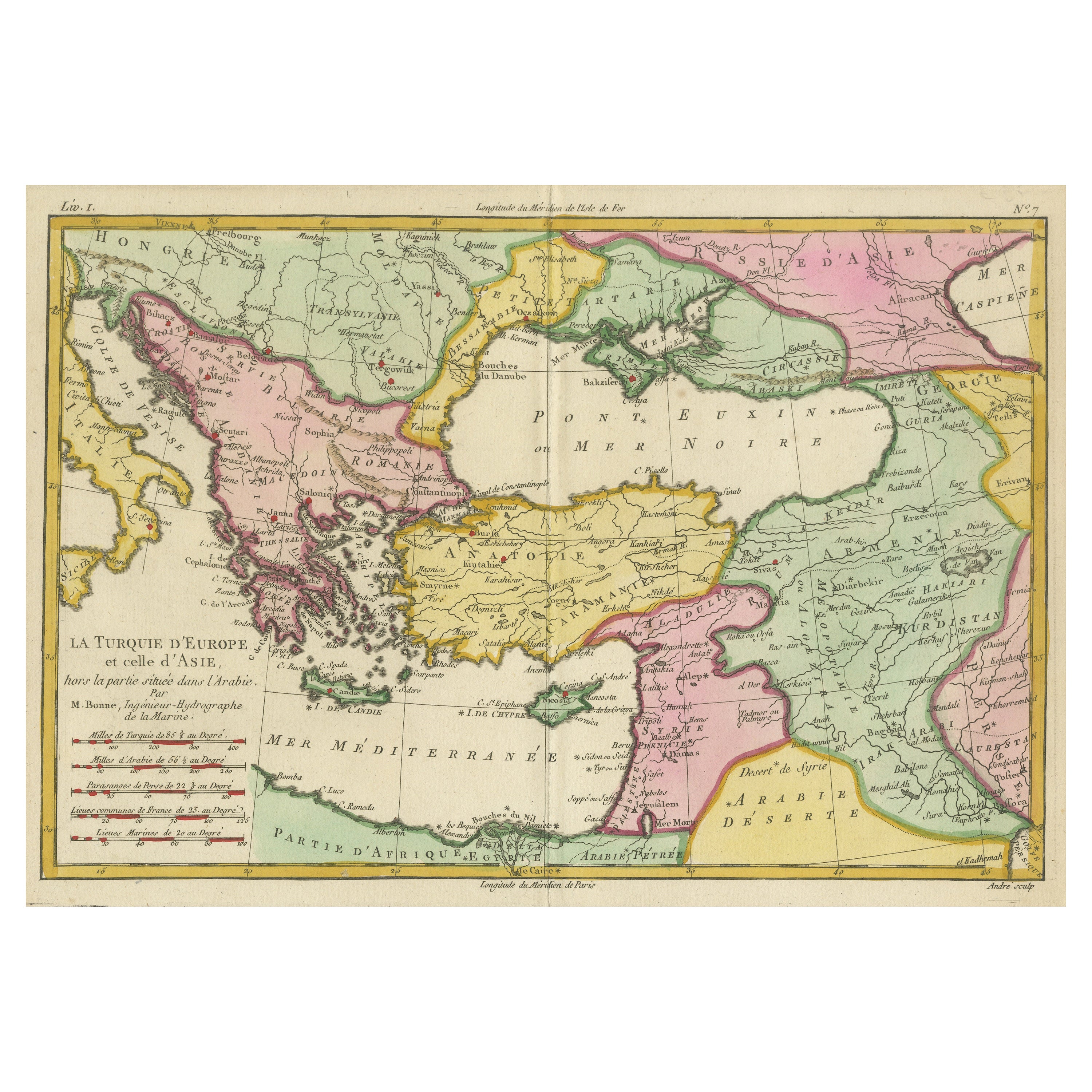
- Antique Map of the Eastern Mediterranean and the BalkansLocated in Langweer, NLAntique map titled 'La Turquie d'Europe et celle d'Asie'. Attractive double page map of the Eastern Mediterranean and the Balkans by R. Bonne. Originates from 'Atlas de Toutes les Pa...Category
Antique Late 18th Century Maps
MaterialsPaper
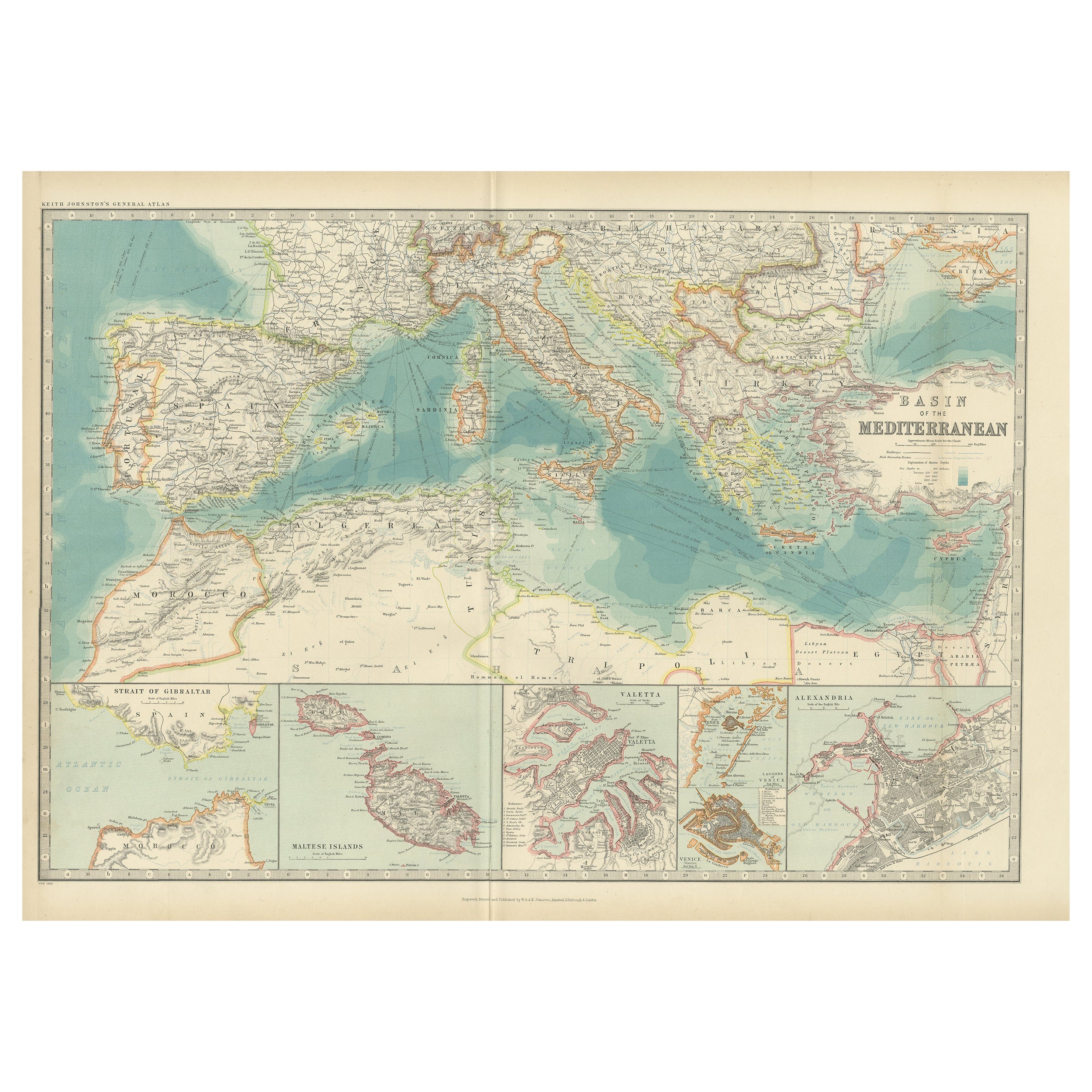
- Antique Map of the Basin of the Mediterranean by Johnston '1909'Located in Langweer, NLAntique map titled 'Basin of the Mediterranean'. Original antique map of the basin of the Mediterranean. With inset maps of the Strait of Gibraltar, Morocco, Maltese Islands, Valetta...Category
Early 20th Century Maps
MaterialsPaper
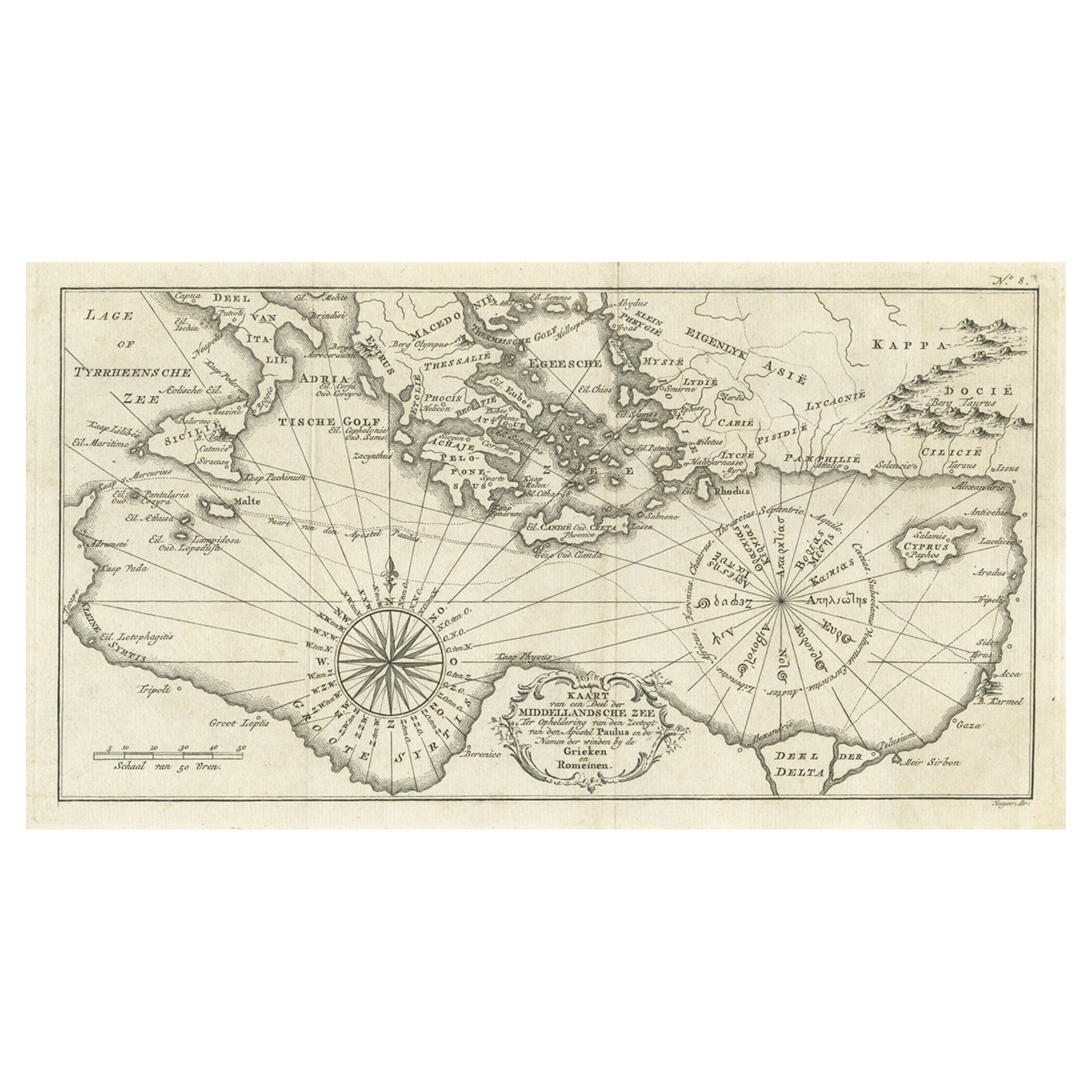
- Old Dutch Map of the Region Around the Mediterranean Sea, 1773Located in Langweer, NLAntique map titled 'Kaart van een Deel der Middelandsche Zee (..)'. Old map of the region around the Mediterranean Sea. Originates from the first Dutch editon of an interesting t...Category
Antique 1770s Maps
MaterialsPaper


Recently Viewed
View AllMore Ways To Browse
Large Framed
The Vintage Map
Mid Century Mediterranean
French Vintage Chart
French Vintage Charts
France Vintage Chart
Italian Chart
Vintage Grecian
Italian Vintage Charts
Italian Vintage Chart
Italy Vintage Chart
Framed Chart
Large Framed Maps
Maps Of Mediterranean
Vintage Chart Map
Map Mediterranean
Large Map Of Italy
Framed Maps Italy