Items Similar to Antique Map of Scotland by A & C. Black, 1870


Want more images or videos?
Request additional images or videos from the seller
1 of 6
Antique Map of Scotland by A & C. Black, 1870
About the Item
Antique map titled 'Scotland'. Original antique map of Scotland with inset map of Shetland island. This map originates from ‘Black's General Atlas of The World’. Published by A & C. Black, 1870.
- Dimensions:Height: 23.63 in (60 cm)Width: 17.52 in (44.5 cm)Depth: 0.02 in (0.5 mm)
- Materials and Techniques:
- Period:
- Date of Manufacture:1870
- Condition:Wear consistent with age and use. General age-related toning. some foxing, Please study image carefully.
- Seller Location:Langweer, NL
- Reference Number:
About the Seller
5.0
Platinum Seller
These expertly vetted sellers are 1stDibs' most experienced sellers and are rated highest by our customers.
Established in 2009
1stDibs seller since 2017
1,914 sales on 1stDibs
Typical response time: <1 hour
- ShippingRetrieving quote...Ships From: Langweer, Netherlands
- Return PolicyA return for this item may be initiated within 14 days of delivery.
More From This SellerView All
- Antique Map of Switzerland by A & C. Black, 1870Located in Langweer, NLAntique map titled 'Switzerland'. Original antique map of Switzerland. This map originates from ‘Black's General Atlas of The World’. Published by A & C. Black, 1870.Category
Antique Late 19th Century Maps
MaterialsPaper
- Antique Map of China by A & C, Black, 1870Located in Langweer, NLAntique map titled 'China'. Original antique map of China. This map originates from ‘Black's General Atlas of The World’. Published by A & C. Black, 1870.Category
Antique Late 19th Century Maps
MaterialsPaper
- Antique Map of Asia by A & C, Black, 1870Located in Langweer, NLAntique map titled 'Asia'. Original antique map of Asia. This map originates from ‘Black's General Atlas of The World’. Published by A & C. Black, 1870.Category
Antique Late 19th Century Maps
MaterialsPaper
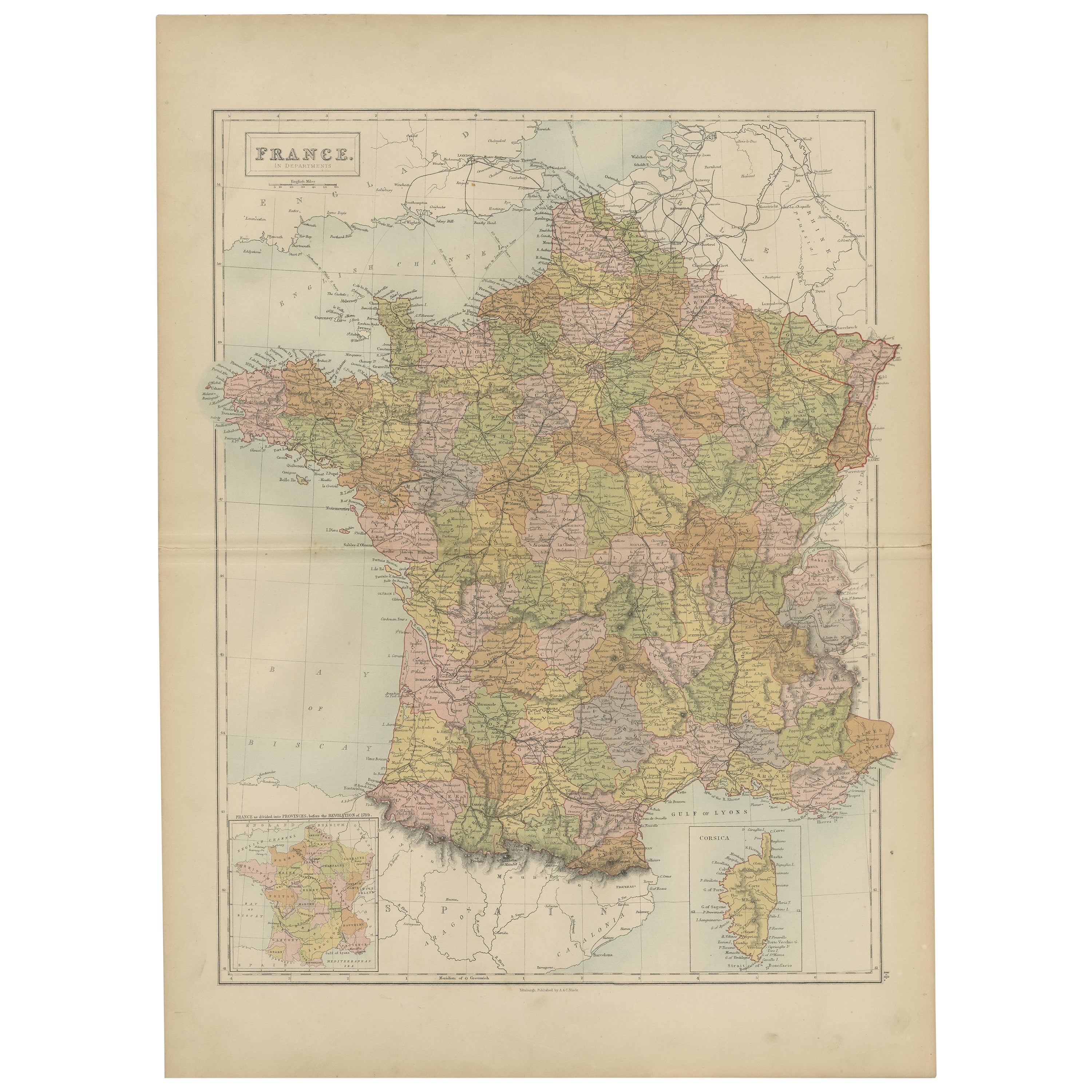
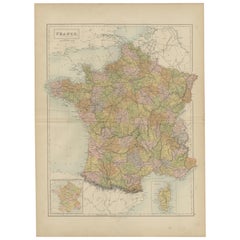
- Antique Map of France by A & C. Black, 1870Located in Langweer, NLAntique map titled 'France'. Original antique map of France with inset map of France as divided into provinces, before the revolution of 1789 and map of Corsica...Category
Antique Late 19th Century Maps
MaterialsPaper
- Antique Map of Africa by A & C, Black, 1870Located in Langweer, NLAntique map titled 'Africa'. Original antique map of Africa. This map originates from ‘Black's General Atlas of The World’. Published by A & C. Black, 1870.Category
Antique Late 19th Century Maps
MaterialsPaper
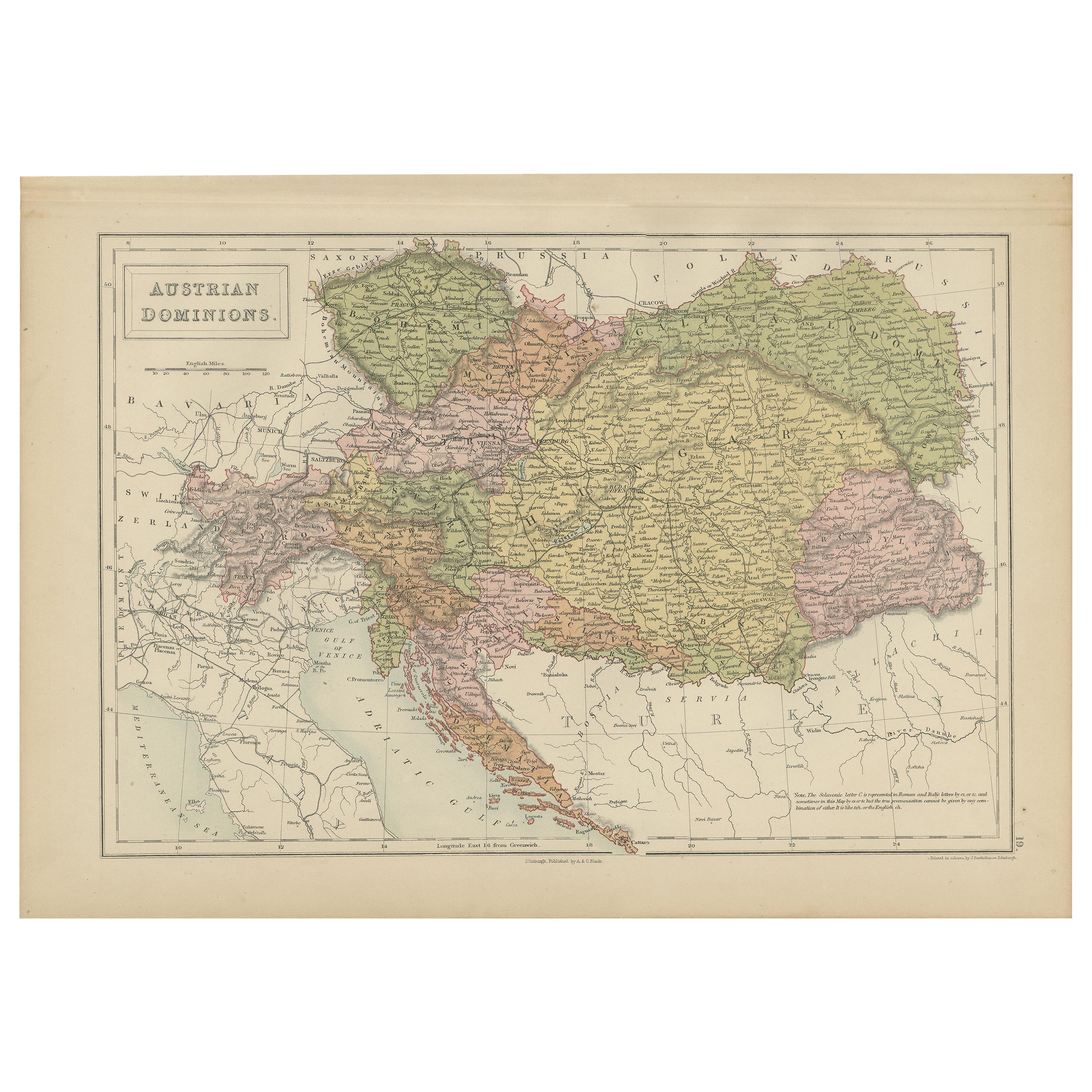
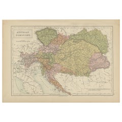
- Antique Map of Austrian Dominions by A & C. Black, 1870Located in Langweer, NLAntique map titled 'Austrian Dominions'. Original antique map of Austrian Dominions. This map originates from ‘Black's General Atlas of The Worl...Category
Antique Late 19th Century Maps
MaterialsPaper


You May Also Like
- England, Scotland & Ireland: A Hand Colored Map of Great Britain by TirionBy Isaak TirionLocated in Alamo, CAThis is a hand-colored double page copperplate map of Great Britain entitled "Nieuwe Kaart van de Eilanden van Groot Brittannien Behelzende de Kon...Category
Antique Mid-18th Century Dutch Maps
MaterialsPaper
- Antique Map of Italy by Andriveau-Goujon, 1843By Andriveau-GoujonLocated in New York, NYAntique Map of Italy by Andriveau-Goujon, 1843. Map of Italy in two parts by Andriveau-Goujon for the Library of Prince Carini at Palazzo Carini i...Category
Antique 1840s French Maps
MaterialsLinen, Paper
- Antique Map of Principality of MonacoBy Antonio Vallardi EditoreLocated in Alessandria, PiemonteST/619 - "Old Geographical Atlas of Italy - Topographic map of ex-Principality of Monaco" - ediz Vallardi - Milano - A somewhat special edition ---Category
Antique Late 19th Century Italian Other Prints
MaterialsPaper
- Original Antique Map of Russia By Arrowsmith. 1820Located in St Annes, LancashireGreat map of Russia Drawn under the direction of Arrowsmith Copper-plate engraving Published by Longman, Hurst, Rees, Orme and Brown, 1820 Unframed.Category
Antique 1820s English Maps
MaterialsPaper
- Northern Scotland: A 16th Century Hand-colored Map by MercatorBy Gerard MercatorLocated in Alamo, CAA framed hand-colored 16th century map of Northern Scotland by Gerard Mercator entitled "Scotiae pars Septentrionalis", published in Amsterdam in 1636. It is a highly detailed map of the northern part of Scotland, with the northwest Highlands and the cities Inverness and Aberdeen, as well as the Orkney Islands and the Hebrides. There is a decorative title cartouche in the upper left corner. The map is presented in an antiqued brown wood...Category
Antique 16th Century Dutch Maps
MaterialsPaper
- Northern Scotland: A 17th Century Hand-colored Map by MercatorBy Gerard MercatorLocated in Alamo, CAThis is a framed hand-colored 17th century map of Northern Scotland by Gerard Mercator entitled "Scotiae pars Septentrionalis", published in Amsterdam in 1636. It is a highly detailed map of the northern part of Scotland, with the northwest Highlands and the cities Inverness and Aberdeen, as well as the Orkney Islands and the Hebrides. There is a decorative title cartouche in the upper left corner. The map is presented in an antiqued brown wood...Category
Antique 1630s Dutch Maps
MaterialsPaper


Recently Viewed
View AllMore Ways To Browse
Scotland Map
Antique Scottish Maps
Antique Map Scotland
Antique Map Of Scotland
Antique Maps Scotland
Antique Scotland Map
Scotland Antique Map
Map Of Scotland
Shetland Map
Antique Furniture In Edinburgh
Victorian Tear
Antique Maps Framed
Antique Map Framers
Antique Framed Maps
Map Globe
Globe Map
Framed Antique Maps
Framed Antique Map