Items Similar to Louisiana: A Framed 19th Century Map by O. W. Gray


Want more images or videos?
Request additional images or videos from the seller
1 of 7
Louisiana: A Framed 19th Century Map by O. W. Gray
About the Item
This framed 19th century map of the Louisiana territory was published in "Gray's Atlas of the United States with General Maps of the World, accompanied by Descriptions Geographical, Historical, Scientific and Statistica" published in 1873 in Philadelphia by O.W. Gray and Son and Stedman, Brown and Lyon. It is a highly detailed map of Louisiana and adjacent portions of Mississippi to the east and Texas to the west, as the borders existed in the late 19th century. It includes portions of the Gulf of Mexico and towns and cities, such as New Orleans, Baton Rouge and Lafayette. Ormando Wyllis (O.W.) Gray (1829-1912) was a Civil and Topographical Engineer who became a cartographer and map atlas publisher.
The map is presented in a light brown distressed bleached wood frame with a cream mat. The frame measures 22.63" wide x 20" high x 0.88" deep. The map is somewhat toned, although the appearance appears in part to be related to its tinting. It is otherwise in very good condition.
There are two other mid-19th century maps of North America in identical style frames and maps that are listed on 1stdibs. They would make for an attractive and interesting display grouping. There is a discount available for multiple purchases. These additional maps may be viewed by entering their reference numbers in the search field: LU5206221574212 or LU5206221506302.
- Creator:Gray and Co (Artist)
- Dimensions:Height: 20 in (50.8 cm)Width: 22.63 in (57.49 cm)Depth: 0.88 in (2.24 cm)
- Style:Other (Of the Period)
- Materials and Techniques:Paper,Engraved
- Place of Origin:
- Period:
- Date of Manufacture:1873
- Condition:Wear consistent with age and use.
- Seller Location:Alamo, CA
- Reference Number:
About the Seller
5.0
Vetted Seller
These experienced sellers undergo a comprehensive evaluation by our team of in-house experts.
1stDibs seller since 2020
12 sales on 1stDibs
- ShippingRetrieving quote...Ships From: Alamo, CA
- Return PolicyA return for this item may be initiated within 7 days of delivery.
More From This SellerView All
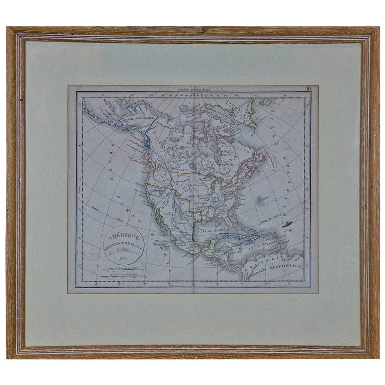
- America "Amérique Septentrionale": A 19th Century French Map by DelamarcheBy Maison Delamarche 1Located in Alamo, CAThis framed mid 19th century map of North America entitled "Amérique Septentrionale" by Felix Delamarche was published in Paris in 1854 by Quay de l'Horloge du Palais, avec les Carte...Category
Antique Mid-19th Century American Other Maps
MaterialsPaper
- South America: Hand-colored 18th Century Framed Map by Thomas JefferysBy Thomas JefferysLocated in Alamo, CAThis detailed hand-colored map of South America by Thomas Jefferys was published in London in 1750. The map shows countries, early colonial possessions, towns, rivers, mountains, and...Category
Antique Mid-18th Century English Maps
MaterialsPaper
- "Africa Vetus": a 17th Century Hand-Colored Map by SansonBy Nicolas SansonLocated in Alamo, CAThis original hand-colored copperplate engraved map of Africa entitled "Africa Vetus, Nicolai Sanson Christianiss Galliar Regis Geographi" was originally created by Nicholas Sanson d...Category
Antique Late 17th Century French Maps
MaterialsPaper
- Northern Scotland: A 16th Century Hand-colored Map by MercatorBy Gerard MercatorLocated in Alamo, CAA framed hand-colored 16th century map of Northern Scotland by Gerard Mercator entitled "Scotiae pars Septentrionalis", published in Amsterdam in 1636. It is a highly detailed map of the northern part of Scotland, with the northwest Highlands and the cities Inverness and Aberdeen, as well as the Orkney Islands and the Hebrides. There is a decorative title cartouche in the upper left corner. The map is presented in an antiqued brown wood...Category
Antique 16th Century Dutch Maps
MaterialsPaper
- Northern Scotland: A 17th Century Hand-colored Map by MercatorBy Gerard MercatorLocated in Alamo, CAThis is a framed hand-colored 17th century map of Northern Scotland by Gerard Mercator entitled "Scotiae pars Septentrionalis", published in Amsterdam in 1636. It is a highly detailed map of the northern part of Scotland, with the northwest Highlands and the cities Inverness and Aberdeen, as well as the Orkney Islands and the Hebrides. There is a decorative title cartouche in the upper left corner. The map is presented in an antiqued brown wood...Category
Antique 1630s Dutch Maps
MaterialsPaper
- Greece, "Graeciae Antiquae"" A 17th Century Hand-colored Map by SansonBy Nicolas SansonLocated in Alamo, CAThis is an original 17th century hand colored copperplate engraved map of Greece entitled "Graeciae Antiquae Tabula Hanc Geographicam" by Nicolas d'Abbeville Sanson, engraved and pub...Category
Antique Mid-17th Century French Maps
MaterialsPaper


You May Also Like
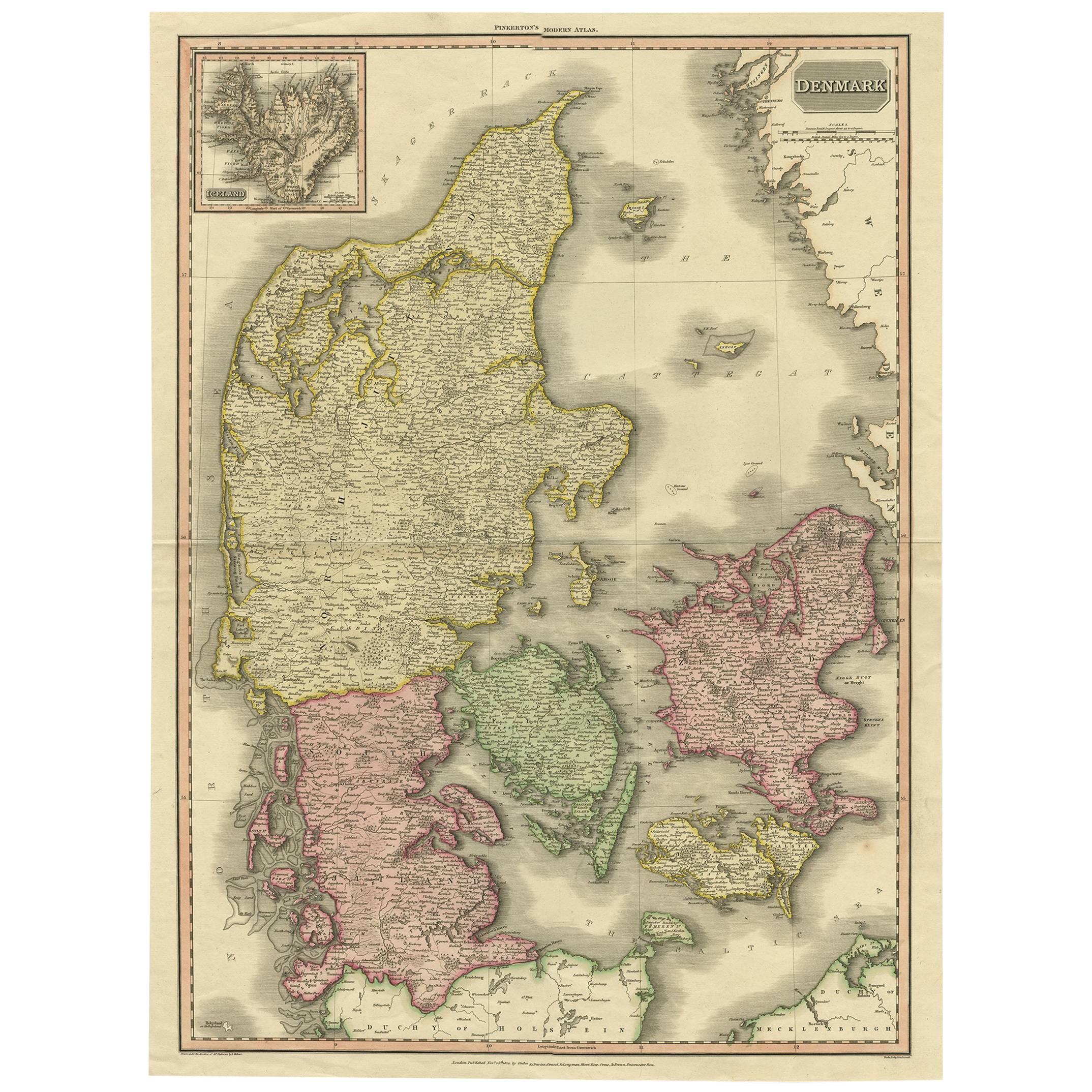
- 19th Century Large Original Antique Map of Denmark by J. Pinkerton, 1812By PinkertonLocated in Langweer, NLHighly detailed map of Denmark. One of the best large format English atlas maps of the period. Pinkerton's maps reflect the fine copperplate engraving work being done in the Britain...Category
Antique Early 19th Century Maps
MaterialsPaper
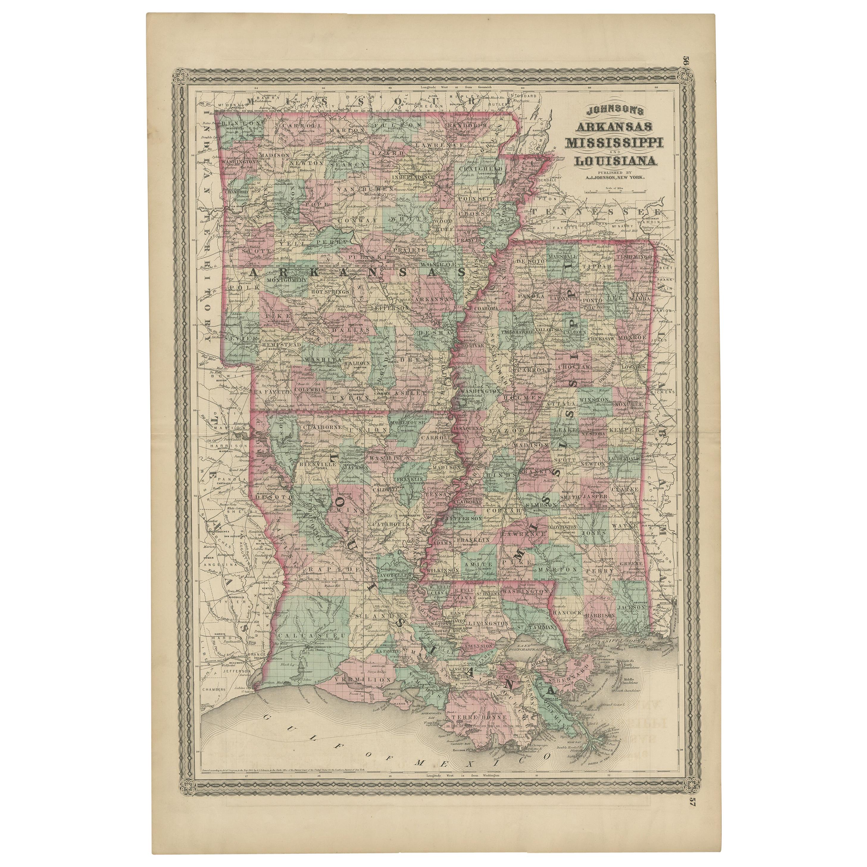
- Antique Map of Arkansas, Mississippi and Louisiana by Johnson, 1872Located in Langweer, NLAntique map titled 'Johnson's Arkansas (..)'. Original map of Arkansas, Mississippi and Louisiana. This map originates from 'Johnson's New Illustrated ...Category
Antique Late 19th Century Maps
MaterialsPaper
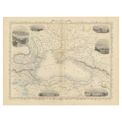
- Mid 19th Century Map of the Black Sea with Decorative Vignettes, 1851Located in Langweer, NLMap of the Black Sea and contingent lands, including Turkey, Russia, Georgia, Azerbaijan, Bulgaria, Crimea and Armenia, with decorative vignettes views of Sebastopol, Varna, Odessa, Sinope, Constantinople and Silistria. Fine antique map...Category
Antique Mid-19th Century Maps
MaterialsPaper
- 17th Century Toulouse, Savve, Sommieres Topographical Map by Iohan PeetersLocated in New York, NYFine topographical 17th century map of Toulouse, Savve and Sommieres by Iohan Peeters Beautiful engraving of the capital of France's Occitanie Region, Toulouse, called La Ville Rose- the Pink City, for the terracotta bricks used in its many buildings, giving the city a distinct apricot-rose hue. An important cultural and educational center, the city's residents included Nobel Prize winners and world renown artists- Henri de Toulouse-Lautrec, Henri Martin, Jean-Auguste-Dominique Ingres, Antonin Mercie, Alexandre Falguiere and more recently Cyril Kongo...Category
Antique 17th Century Dutch Maps
MaterialsPaper
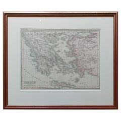
- Original Antique Map in Frame of Greece by Smith '1818'Located in Langweer, NLNicely framed map titled 'Greece'. Original antique map of Greece published by C. Smith, 1818. Frame included.Category
Antique Early 19th Century Maps
MaterialsPaper
- Late 19th Century American Jewish Themed CaricatureLocated in New York, NYAmerican cartoon, USA, 1895. Caption reads: 'A Natural Mistake. Ikenstein: "I vould like to ged a cheap drunk." Salesman: "Next door.'" The cartoon is framed with American frame of...Category
Antique 1890s American Prints
MaterialsPaper


Recently Viewed
View AllMore Ways To Browse
Gray And Cream
Distressed Gray
Map Light
19th Century Mexican Furniture
Antique World Maps And Atlases World Maps
19th Century World Map
Framed Map
Framed Maps
Antique Map Framed
Antique Maps Framed
Antique Map Framers
Antique Framed Maps
Antique Map Framing
Framed Antique Maps
Framed Antique Map
Framing Antique Maps
19th Century Texas
Mid Century New Orleans