Animal Skin Maps
1
1
to
1
1
2
2
2
1
1
40,206
5,366
87
32
31
2
1
1
1
Material: Animal Skin
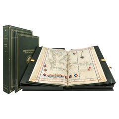
Atlas of Fernão Vaz Dourado / One-Time Only Limited Edition Facsimile
Located in BARCELONA, ES
This is a one-time only facsimile edition limited to 987 copies Atlas of Fernão Vaz Dourado, the famous Portuguese cartographer, made in 1571. We created it by combining the highest ...
Category
2010s Portuguese Renaissance Animal Skin Maps
Materials
Leather
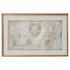
Mid-18th Century Hand Drawn English Farm Map on Vellum, circa 1740s
Located in San Francisco, CA
Mid-18th century hand drawn English farm map on Vellum circa 1740s
Henry Maxted & Isaac Terry, Surveyors.
A Map of a Farm in the Parish of Blean in the County of KENT: Belonging to Mrs Elizabeth Hodgson circa 1743.
A beautiful hand drawn map...
Category
Mid-18th Century English Antique Animal Skin Maps
Materials
Lambskin
Related Items
John Gossage, Limited Edition 'Signed'
Located in Fort Lauderdale, FL
First edition, first and only printing. Limited edition of 500 copies numbered and signed by Gossage (this being #222/500), with 17 black and white illustrations and an original front cover of sleek black linen binding featuring a laid down 8 ½ x 6 ¾" silver gelatin photograph printed by the author.
Designed by Gabriele F. Gotz, Ulrich Gorlich and John Gossage. Text in English.
Photographs made in Berlin between 1982-1986 by John Gossage. Introduction by Jane Livingston, and three legends based on the collection of Jacob and Wilhelm Grimm...
Category
1980s Vintage Animal Skin Maps
Materials
Linen, Paper
Iconic Limited Edition Fred Stein Photo of Albert Einstein
Located in New York, NY
Stunning large gelatin silver limited edition photograph; one of the most iconic images of the 20th century. One of only 450 in the edition.
“In 1946, when Albert Einstein was in residence at Princeton University, Fred Stein...
Category
1940s Vintage Animal Skin Maps
Atlas of Mid-Century Modern Houses
Located in New York City, NY
A groundbreaking global survey of the finest mid-20th century homes - one of the most popular styles of our time
A fascinating collection of more than 400 of the world's most glamorous homes from more than 290 architects, the Atlas of Mid-Century Modern Houses...
Category
21st Century and Contemporary Chinese Animal Skin Maps
Materials
Paper
Decameron of Boccaccio, 2 Volumes, Numbered Limited Edition #483/1000
Located in valatie, NY
The Decameron of Boccaccio, 2 Volumes, Numbered Limited Edition #483/1000. Published by: Lawrence & Bullen, London. Illustrated with 15 plates from paintings by Louis Chalon reproduc...
Category
Late 19th Century English Antique Animal Skin Maps
Materials
Paper
Fantastic Worlds of Frank Frazetta, Numbered, Limited Edition XXL Book
By TASCHEN
Located in Los Angeles, CA
All Hail the King of Fantasy Art.
Frank Frazetta finally gets the big beautiful book he deserves.
Frank Frazetta has reigned as the undisputed lord of...
Category
21st Century and Contemporary Animal Skin Maps
Materials
Aluminum, Foil
Free Shipping
H 15.6 in W 11.4 in D 4 in
Early 18th Century Italian Carved and Dovetailed Walnut Alms Box
Located in San Francisco, CA
Early 18th century Italian carved and dovetailed walnut alms box, circa 1725
Large dovetails and old handwrought nails give this small scale box a hea...
Category
Early 18th Century Italian Baroque Antique Animal Skin Maps
Materials
Iron
Helmut Newton, Baby Sumo, Limited Edition
Located in Los Angeles, CA
BABY SUMO, welcome to the world!
The legendary Helmut Newton SUMO in a spectacular new edition
The Helmut Newton SUMO was overwhelming in every respect: a ...
Category
Late 20th Century Animal Skin Maps
Materials
Stainless Steel
18th Century German Pewter Passover Plate
Located in New York, NY
Pewter passover tray, Germany, 18th century.
The outer rim has wriggle- work engraving of the order of the Seder service, along with a pair of birds fl...
Category
Late 18th Century German Antique Animal Skin Maps
Materials
Pewter
19th Century Italian Cast Iron Coal Powered Iron
Located in Port Jervis, NY
Classic icon from the last century. Once used in every household, now its cherished for its simplicity and beauty. Cast in it's lid is the ancient symbol of Rome, She wolf with her b...
Category
1870s Italian Primitive Antique Animal Skin Maps
Materials
Iron
Early 19th Century New England Child's Chair
Located in Los Angeles, CA
Early 19th century ladder back child's chair from New England in fantastic condition. This early chair is mortised and square nail construction.
Category
1870s American Adirondack Antique Animal Skin Maps
Materials
Wood
Grand Scale Spanish 18th Century Dough Bowl, Trough
Located in Atlanta, GA
A fantastic very large scale 18th century Spanish dough bowl - or trough, carved from a single tree trunk. Perfect by a fireplace to house kindling, or filled with an assortment of c...
Category
18th Century Spanish Antique Animal Skin Maps
Materials
Wood
Spanish 18th Century Primitive Trough
Located in Atlanta, GA
A very handsome primitive trough from the Catalan region of Spain. The trough is beautifully carved from a large solid block of wood. Serves wonderful...
Category
Mid-18th Century Spanish Antique Animal Skin Maps
Materials
Wood
Previously Available Items
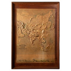
Early 20th C. Relief Maps: Asia Wood and Leather Frames
Located in New York, NY
This early 20th-century set of three relief maps offers a captivating glimpse into the geographical features of Asia. The maps, meticulously crafted, are elevated by their presentat...
Category
Early 20th Century American Victorian Animal Skin Maps
Materials
Leather, Wood, Paper
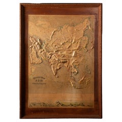
Early 20th C. Relief Maps: Asia Wood and Leather Frames
Located in New York, NY
This early 20th-century set of three relief maps offers a captivating glimpse into the geographical features of South America, Asia, and Africa. The maps, meticulously crafted, are e...
Category
Early 20th Century American Victorian Animal Skin Maps
Materials
Leather, Wood, Paper
1857 Antique Coltons General Atlas World State Country Map Description Book
Located in Dayton, OH
"19th century (1857) J.H. Colton and Company General Atlas, Geographical, Statistical and Historical, Richard Fisher, MD, New York, London, Trubner and Company,
Jumbo size 18” x 15”, weighs almost 10lbs, original Condition.
Hand coloured maps of U.S. States, plans of the major U.S. cities, and the countries of the world. The Atlas includes individual maps by continent, country, state, territory and city. Each regional map is accompanied by: Astronomical Position, Boundaries, Dimensions, Physical Aspects, Political, Population, Industry, Agriculture, Religion, Education, and History. The Atlas was published five years prior to the Civil War, the statistics include slaves and the ""free colored population."" Approximately half of the maps are devoted to the United States with state maps and city plans. Western Americana maps include: ""Nebraska and Kansas Territories,"" ""Oregon and Washington,"" ""Utah and New Mexico,"" etc. Double page jumbo maps of United States...
Category
1850s Victorian Antique Animal Skin Maps
Materials
Leather, Paper
H 17.75 in W 15 in D 2 in
Pocket Globe John and William Cary, London 1791
By Cary’s
Located in Milano, IT
John and William Cary
Pocket globe
London, 1791
The pocket globe is contained in its original case, which itself is covered in shark skin.
Few and slight gaps in the original p...
Category
1790s English George III Antique Animal Skin Maps
Materials
Shagreen, Paper
English Pocket Globe by Lane, London, between 1817 and 1833
By Lane's
Located in Milano, IT
Pocket Globe
Lane, London, between 1817 and 1833
The globe is contained in its original case covered with black leather.
Diameter: globe 2.75 in (7 cm); case 3.26 in (8.3 cm).
Weight: 0.28 lb (128 g)
State of conservation: almost excellent. It has some slight abrasions and some signs of use.
The globe is made up of twelve printed paper gores aligned and glued to the sphere. Two pins are inserted on the poles.
In the North Pacific Ocean, above the Tropic of Cancer, the globe bears a cartouche with the inscription:
LANE’S
Improved
GLOBE
LONDON
and, under cartouche
J. Mynde Sc[ulpsit]
On the globe, much of central Africa is empty and the great lakes Tanganyika and Victoria are not marked (Europeans would begin to explore the area after 1858). Australia is still called New Holland (the new name would be introduced in 1829); Tasmania is listed as an island (Matthew Flinders circumnavigates it in 1798). The routes of Cook's and Anson's various voyages are plotted; on the island of Sandwich, between Guinea and Mexico, in the middle of the Pacific Ocean, the place and date of Cook's killing are reported.
The antipode of London is marked in the south of New Zealand.
The pocket globe was made between 1817 and 1833.
The reconstruction of the history of this dating is due to Elly Dekker (E., Dekker, Globes at Greenwich, Oxford 1999, pp. 128-129).
Around 1757 James Ferguson...
Category
1820s English George IV Antique Animal Skin Maps
Materials
Shagreen, Paper
Pocket Globe John and William Cary, London, 1791
By Cary’s
Located in Milano, IT
John and William Cary
Pocket globe
London, 1791
The pocket globe is contained in its original case, which itself is covered in shark skin.
Few and slight gaps in the original p...
Category
1790s English George III Antique Animal Skin Maps
Materials
Shagreen, Paper
Life of George Washington by John Marshall, 6-Vol with Maps, 1st Ed., 1804-1807
Located in Colorado Springs, CO
“The Only Comprehensive Account by a Great Statesman of The Full Founding of The United States”
Marshall, John. The Life of George Washington. London: Richard Phillips, 1804-1807....
Category
Early 1800s British Antique Animal Skin Maps
Materials
Leather
H 9.25 in W 10.75 in D 6.25 in
Leather Cased Set of Maps of England and Wales, circa 1920
By E. Stanford
Located in London, GB
A pigskin leather case with ‘fish-tail’ handle containing a complete series of Bartholomew's 2 miles to an inch scale, linen backed maps for England and Wales by Edward Stanford of L...
Category
1920s English Vintage Animal Skin Maps
Materials
Metal
Two 19th Century Austrian Parade Pickle Helmets
Located in Buchanan, MI
Two 19th century Austrian parade pickle helmets. Letter with gilt metal mounts.
Category
19th Century Austrian Antique Animal Skin Maps
Materials
Leather
1913 Map of Long Island, NY
By Julius Bien
Located in Sagaponack, NY
1913 topographic map of Long Island N.Y. "Engraved from U.S. Geological Survey Topographic Sheets". Custom made frame in solid oak with natural leat...
Category
Early 20th Century American Animal Skin Maps
Materials
Paper, Oak, Glass, Leather
Recently Viewed
View AllMore Ways To Browse
Antique Sailing Map
Antique Sailing Maps
Bay Area Antique Furniture
West Coat Of Arms
Greek Asia Minor
Hemisphere World Map
Speed Map
Antique Maps Canada
Antique Map Canada
Canada Antique Map
Malaysian Antique
Blaeu World Map
West Indies Map
Charing Cross
Antique Maps Of Canada
Bali Map
Map Of Brazil
Antique Portuguese Plates
