Items Similar to North & South America: A 17th Century Hand-colored Map by Jansson & Goos


Want more images or videos?
Request additional images or videos from the seller
1 of 10
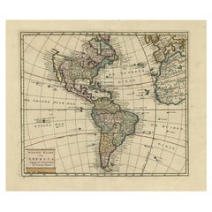
North & South America: A 17th Century Hand-colored Map by Jansson & Goos
About the Item
A 17th century hand-colored map of North & South America entitled "Americae Descriptio" by the cartographer Johannes Jansson, published in Jansson's Atlas Minor in Amsterdam in 1628. It was engraved by Abraham Goos. The map is based on an earlier map by Gerardus Mercator. There are many misconceptions about the new world depicted on this fascination map. Among them is the bulging shape of the Northwest coast of North America and the large land mass that extends to Asia, broken only by two small straits. The eastern most strait presumably represents the theorized (and hoped for) Northwest Passage, which was the goal of many explorations maritime for centuries, including the Vikings, Christopher Columbus, Captain James Cook and many more. A navigatable passage through the Americas would facilitate an efficient trade route between Europe and Asia. The map includes portions of Japan, as well as multiple islands in the Atlantic and Pacific Oceans, many of which do not exist. The St. Lawrence River is greatly elongated, extending to the southwest, ending in the region of present-day Colorado. The map also includes the imaginary large land mass in the southern hemisphere, Terra Australis Incognita, the existence of which was not disproved until Captain James Cook's first voyage approximately 150 years later.
This colorful, attractive and fascinating copperplate engraved map is printed on laid, chain-linked hand-made paper with wide margins, particularly the upper and lower margins. There is Latin text on the verso. The sheet measures 7" high and 8.63" wide. There is some discoloration and spotting in the margins and one tiny spot centrally, but the map is otherwise in very good condition.
Jan Jansson or Johannes Janssonius (1588-1664) was born in Arnhem, Holland. His father was a printer and bookseller. In 1612 he married a Hondius daughter and became part of the prominent cartographic and publishing family business. He published his first map on his own in 1616. He partnered with his brother-in-law, the famous cartographer Henricus Hondius. They published their Atlas Major in eleven volumes. He also worked on newer editions of earlier Mercator/Hondius atlases. He published Jansson's English Country Maps in 1646. His brother-in-law continued the business following Jansson's death in 1664.
Abraham Goos (1590-1643) was a Dutch engraver of maps, sea charts, and globes, based initially in Antwerp and later in Amsterdam. The majority of his work was on maps created by Joannes Jansson, Jocodus Hondius, and John Speed.
- Creator:Johannes Janssonius (Artist)
- Dimensions:Height: 7 in (17.78 cm)Width: 8.63 in (21.93 cm)Depth: 0.07 in (1.78 mm)
- Materials and Techniques:Paper,Engraved
- Place of Origin:
- Period:1620-1629
- Date of Manufacture:1628
- Condition:Wear consistent with age and use.
- Seller Location:Alamo, CA
- Reference Number:
About the Seller
5.0
Vetted Seller
These experienced sellers undergo a comprehensive evaluation by our team of in-house experts.
1stDibs seller since 2020
12 sales on 1stDibs
- ShippingRetrieving quote...Ships From: Alamo, CA
- Return PolicyA return for this item may be initiated within 7 days of delivery.
More From This SellerView All
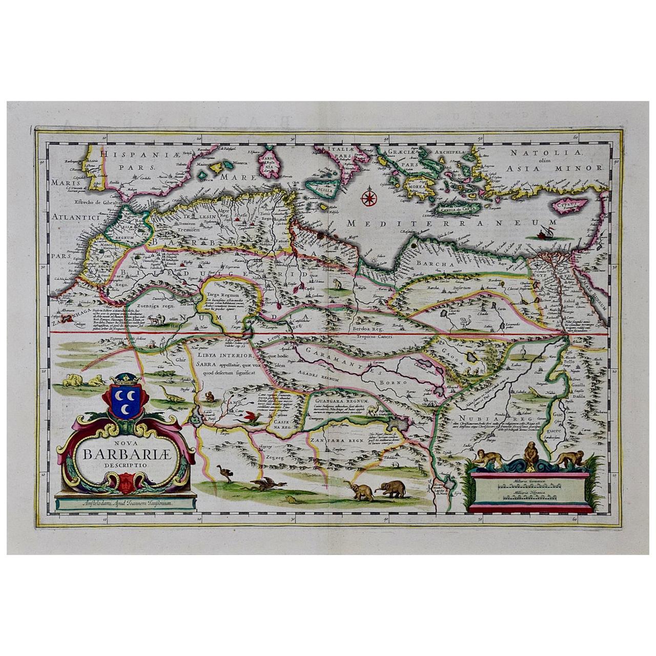
- "Nova Barbariae Descriptio", a 17th Century Hand-Colored Map of North AfricaBy Johannes JanssoniusLocated in Alamo, CAThis original attractive 17th century hand-colored map of North Africa entitled "Nova Barbariae Descriptio" by Johannes Janssonius was published in Paris in 1635. It includes the Med...Category
Antique Mid-17th Century Dutch Maps
MaterialsPaper
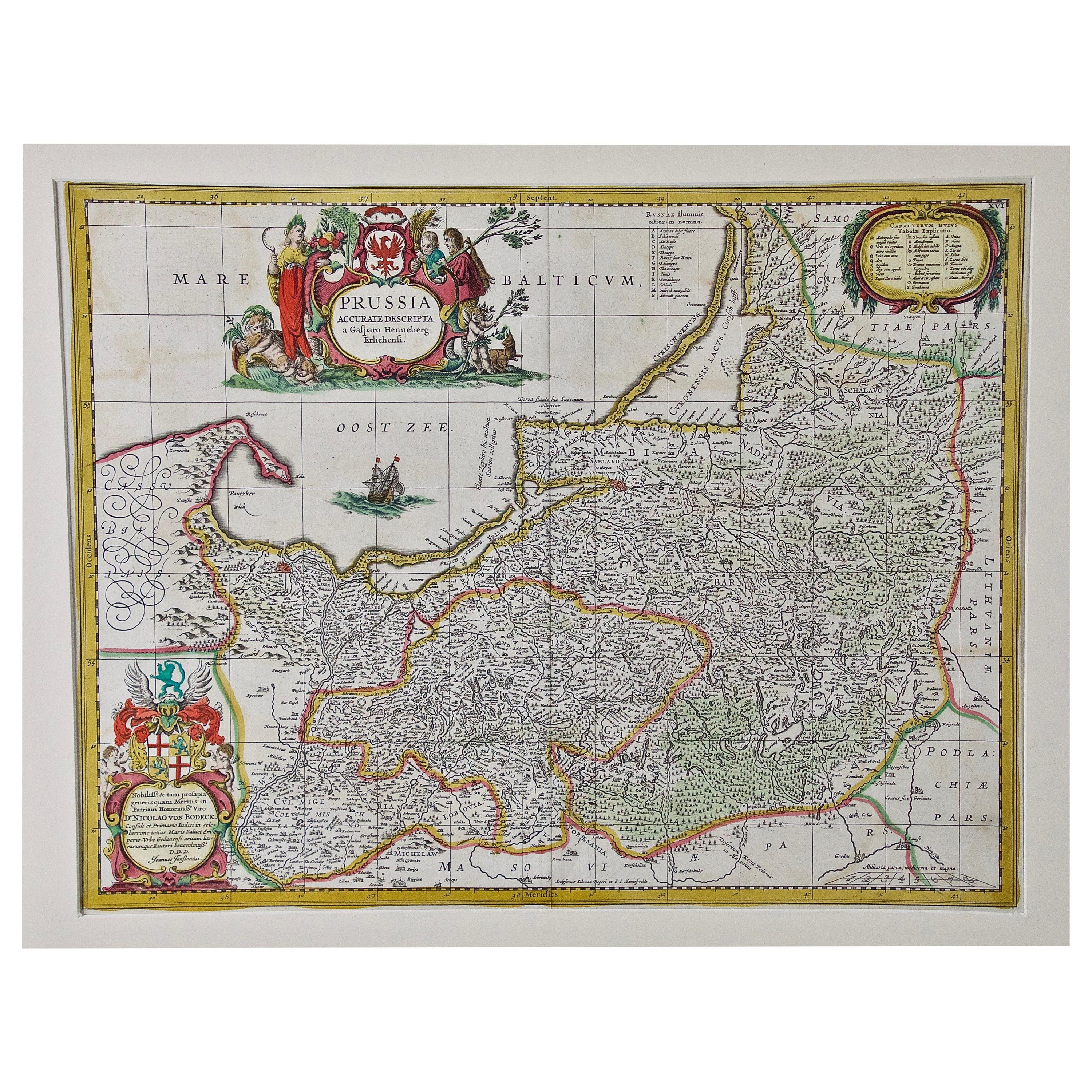
- Prussia, Poland, N. Germany, Etc: A Hand-colored 17th Century Map by JanssoniusBy Johannes JanssoniusLocated in Alamo, CAThis is an attractive hand-colored copperplate engraved 17th century map of Prussia entitled "Prussia Accurate Descripta a Gasparo Henneberg Erlichensi", published in Amsterdam by Joannes Janssonius in 1664. This very detailed map from the golden age of Dutch cartography includes present-day Poland, Latvia, Lithuania, Estonia and portions of Germany. This highly detailed map is embellished by three ornate pink, red, mint green and gold...Category
Antique Mid-17th Century Dutch Maps
MaterialsPaper
- 17th Century Hand-Colored Map of a Region in West Germany by JanssoniusBy Johannes JanssoniusLocated in Alamo, CAThis attractive highly detailed 17th century original hand-colored map is entitled "Archiepiscopatus Maghdeburgensis et Anhaltinus Ducatus cum terris adjacentibus". It was published ...Category
Antique Mid-17th Century Dutch Maps
MaterialsPaper
- Northern Scotland: A 17th Century Hand-colored Map by MercatorBy Gerard MercatorLocated in Alamo, CAThis is a framed hand-colored 17th century map of Northern Scotland by Gerard Mercator entitled "Scotiae pars Septentrionalis", published in Amsterdam in 1636. It is a highly detailed map of the northern part of Scotland, with the northwest Highlands and the cities Inverness and Aberdeen, as well as the Orkney Islands and the Hebrides. There is a decorative title cartouche in the upper left corner. The map is presented in an antiqued brown wood...Category
Antique 1630s Dutch Maps
MaterialsPaper
- "Africa Vetus": a 17th Century Hand-Colored Map by SansonBy Nicolas SansonLocated in Alamo, CAThis original hand-colored copperplate engraved map of Africa entitled "Africa Vetus, Nicolai Sanson Christianiss Galliar Regis Geographi" was originally created by Nicholas Sanson d...Category
Antique Late 17th Century French Maps
MaterialsPaper
- Greece, "Graeciae Antiquae"" A 17th Century Hand-colored Map by SansonBy Nicolas SansonLocated in Alamo, CAThis is an original 17th century hand colored copperplate engraved map of Greece entitled "Graeciae Antiquae Tabula Hanc Geographicam" by Nicolas d'Abbeville Sanson, engraved and pub...Category
Antique Mid-17th Century French Maps
MaterialsPaper


You May Also Like
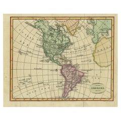
- Antique Hand-Coloured Map of North and South America, ca.1765Located in Langweer, NLDescription: Antique map titled 'Nieuwe Kaart van Amerika.' Attractive map of North and South America, the western part of Africa and south west Europe. Source unknown, to be determi...Category
Antique 1760s Maps
MaterialsPaper
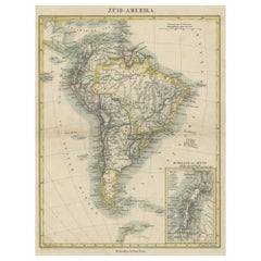
- Antique Map of South America ‘North’ by A.K. Johnston, 1865Located in Langweer, NLAntique map titled 'South America, Northern Sheet'. Depicting Guiana, Ecuador, Brazil, Bolivia the Amazones and more. This map originates from the ‘Royal Atlas of Modern Geography’ b...Category
Antique Mid-19th Century Maps
MaterialsPaper
- Decorative Dutch Antique Map of North and South America, 1841Located in Langweer, NLDescription: Antique map titled 'Amerika'. Small map of North and South America. This map originates from the Dutch publication 'De Aarde, beschouwd in haren Natuurlijken Toestan...Category
Antique 1840s Maps
MaterialsPaper
- Antique Map of North and South America by Schneider and Weigel, 1818Located in Langweer, NLAntique map titled 'America nach Arrowsmiths Weltcharte und dessen Globular Projection (..)'. Map of North and South America. Published by Schneider and Weigel, 1818.Category
Antique Early 19th Century Maps
MaterialsPaper
- Antique Map of South America with inset of the Quito Highlands, Hand-ColoredLocated in Langweer, NLAntique map titled 'Zuid-Amerika'. Original antique map of South America including Brazil, Peru, Colombia, Ecuador, Venezuela, Guyana, Bolivia, Paraguay, Uruguay, Chile, Argentina. Inset map of the mountains of Quito. Published by Otto Petri...Category
Antique Mid-19th Century Maps
MaterialsPaper
- 17th Century Toulouse, Savve, Sommieres Topographical Map by Iohan PeetersLocated in New York, NYFine topographical 17th century map of Toulouse, Savve and Sommieres by Iohan Peeters Beautiful engraving of the capital of France's Occitanie Region, Toulouse, called La Ville Rose- the Pink City, for the terracotta bricks used in its many buildings, giving the city a distinct apricot-rose hue. An important cultural and educational center, the city's residents included Nobel Prize winners and world renown artists- Henri de Toulouse-Lautrec, Henri Martin, Jean-Auguste-Dominique Ingres, Antonin Mercie, Alexandre Falguiere and more recently Cyril Kongo...Category
Antique 17th Century Dutch Maps
MaterialsPaper


Recently Viewed
View AllMore Ways To Browse
Southern America Furniture
Southern American Furniture
Latin American Furniture
Southern New And Used Furniture
English Early 17th Century Furniture
17th Century American Furniture
Map North America
Map Of North America
Map South America
Map Of South America
Colored Globes
Antique Hand Router
Ocean Maps
Ocean Map
Route Map
17th Century World Map
Antique 17th Century World Map
Map Of The Pacific