Items Similar to Old Genuine Antique Map of Tartary in the Russian Far East

Want more images or videos?
Request additional images or videos from the seller
1 of 7
Old Genuine Antique Map of Tartary in the Russian Far East
About the Item
Original antique map titled 'Tartaria sive Magni Chami Imperium'. This great map of Tartary covers all of eastern Asia between the Caspian Sea and northern China and Manchuria. Being one of the most remote regions of Asia, it was among the last to be properly explored and mapped. This map combines the knowledge obtained by the English and Dutch explorers as far as the Ob River with the balance of the map based on the reports of Marco Polo and the Greek classics. The deserts are filled with a wild assortment of devils and dragons, being held at bay from China by the Great Wall. Explorers flank the distance scale and the title is symbolically engraved onto the saddle blanket of a camel, representing the trade over the Silk Road. This map is nearly identical to Jansson's map of the same title, but includes meridians and degrees of longitude at top and bottom. Dutch text on verso, published between 1642-48.
- Dimensions:Height: 18.9 in (48 cm)Width: 24.02 in (61 cm)Depth: 0.02 in (0.5 mm)
- Materials and Techniques:
- Period:Mid-17th Century
- Date of Manufacture:circa 1642
- Condition:Wear consistent with age and use. General age-related toning. Full contemporary color with a centerfold separation that enters 1" into map image at bottom and a short tear in top blank margin that have been archivally repaired. Dutch text on verso, please study images carefully.
- Seller Location:Langweer, NL
- Reference Number:
About the Seller
5.0
Platinum Seller
These expertly vetted sellers are 1stDibs' most experienced sellers and are rated highest by our customers.
Established in 2009
1stDibs seller since 2017
1,909 sales on 1stDibs
Typical response time: <1 hour
- ShippingRetrieving quote...Ships From: Langweer, Netherlands
- Return PolicyA return for this item may be initiated within 14 days of delivery.
More From This SellerView All
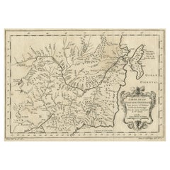
- Original Antique Map of Tartary 'Northern China & Far Eastern Russia', 1757Located in Langweer, NLAntique map titled 'Carte de la Tartarie Orientale (..)'. Original antique map of what is present day northern China and far eastern Russia. Centere...Category
Antique 1750s Maps
MaterialsPaper
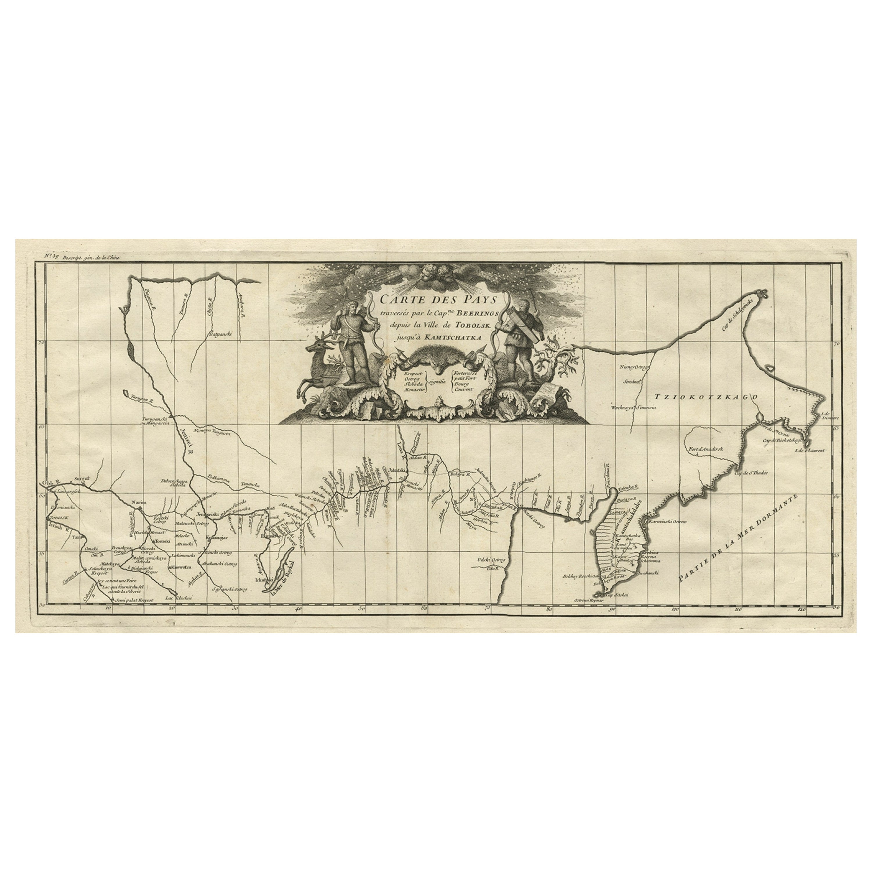
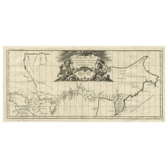
- Antique Map with Details of Berings' Expedition into Russians' Far East, 1737Located in Langweer, NLAntique map titled 'Carte Des Pays traverses par le Capne. Beerings depuis la Ville de Tobolsk jusqua'a Kamtschatka'. This is the first printed map to illustrate Vitus Bering's fir...Category
Antique 1730s Maps
MaterialsPaper
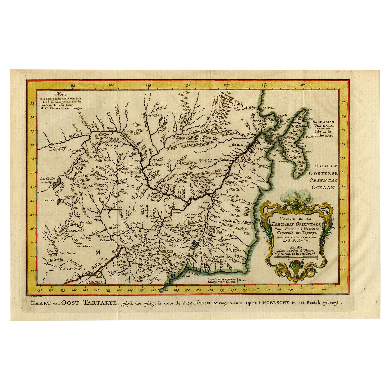
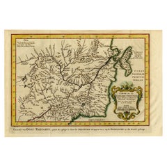
- Antique Map of Eastern Tartary, now the Primorsky Krai Area, Russia, 1758By Jakob van der SchleyLocated in Langweer, NLAntique map titled 'Carte de la Tartarie orientale.' A map of Eastern Tartary. East Tartary is an old names for the Manchu-inhabited territory extending from the River Amur to Sakhal...Category
Antique 18th Century Maps
MaterialsPaper
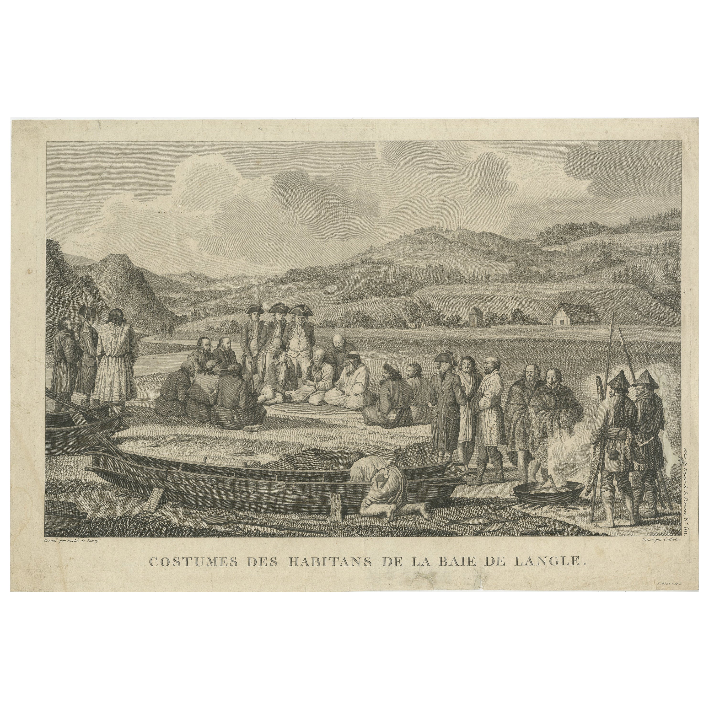
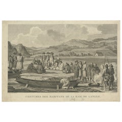
- Old Engraving of French Visiting Tomari, a Village in Far East Russia, 1797Located in Langweer, NLPlate: 'Costumes des Habitants de la Baie de Langle.' (Costumes of the inhabitants of Langle Bay, Russia). Tomari (Russian: ??????) is a coastal town and the administrative cente...Category
Antique 1790s Prints
MaterialsPaper
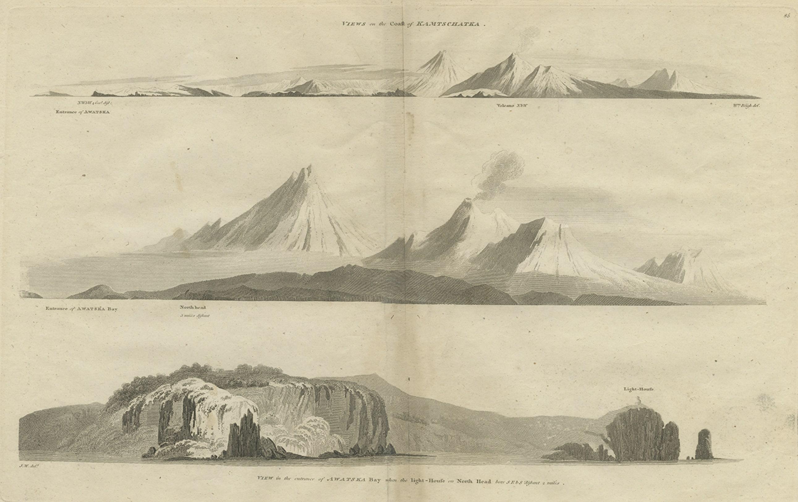
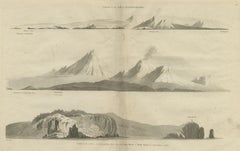
- Antique Print with Coastal Views of Kamchatka in The Russian Far East, c.1784Located in Langweer, NLAntique print titled 'Views of the Coast of Kamtschatka (..)'. Print with coastal views of Kamchatka including volcanoes. Originates from an edition of Cook's Voyages. Artists and ...Category
Antique 18th Century Prints
MaterialsPaper
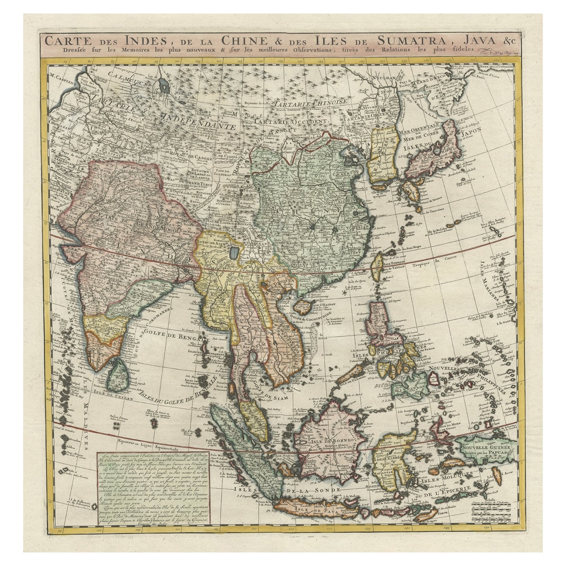
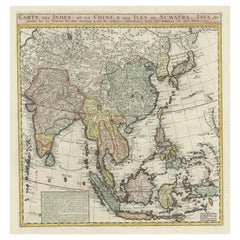
- Detailed Original Antique Map of India, Southeast Asia and the Far East, 1719Located in Langweer, NLAntique map titled 'Carte des Indes, de la Chine & des Iles de Sumatra, Java & c'. Detailed map of India, Southeast Asia and the Far East, extending from Gujerat to the supposed "T...Category
Antique 1710s Maps
MaterialsPaper
You May Also Like
- Original Antique Map of Russia By Arrowsmith. 1820Located in St Annes, LancashireGreat map of Russia Drawn under the direction of Arrowsmith Copper-plate engraving Published by Longman, Hurst, Rees, Orme and Brown, 1820 Unframed.Category
Antique 1820s English Maps
MaterialsPaper
- Original Antique Map of South East Asia, Arrowsmith, 1820Located in St Annes, LancashireGreat map of South East Asia Drawn under the direction of Arrowsmith Copper-plate engraving Published by Longman, Hurst, Rees, Orme and Brown, 1820 Unframed.Category
Antique 1820s English Maps
MaterialsPaper
- Original Antique Map of South East Asia by Becker, circa 1840Located in St Annes, LancashireGreat map of South East Asia Steel engraving with original color outline Engraved by Becker Published by Virtue, circa 1840. Unframed.Category
Antique 1840s English Other Maps
MaterialsPaper
- Old Nautical Map of CorsicaLocated in Alessandria, PiemonteST/556/1 - Old map of Corsica isle, surveyed by Captain Hell, of the French Royal Navy in 1824, engraved and published on 1874, with additions and corre...Category
Antique Early 19th Century English Other Prints
MaterialsPaper
- Old Horizontal Map of EnglandBy TassoLocated in Alessandria, PiemonteST/520 - Old rare Italian map of England, dated 1826-1827 - by Girolamo Tasso, editor in Venise, for the atlas of M.r Le-Sage.Category
Antique Early 19th Century Italian Other Prints
MaterialsPaper
- Original Antique English County Map, East Yorkshire, J & C Walker, 1851Located in St Annes, LancashireGreat map of The East Riding of Yorkshire Original colour By J & C Walker Published by Longman, Rees, Orme, Brown & Co. 1851 Unframed.Category
Antique 1850s English Other Maps
MaterialsPaper


Recently Viewed
View AllMore Ways To Browse
The Silk Road
Antique English 17th Century
Silk Of The Sea
Eastern Russia
Old Saddle
Camel Wall
Antique Balance Scales
Antique Balance Scale
Antique Balance Scales Scales
Antique Balance Scale Scales
Antique Balancing Scales
Antique Balancing Scale
Balance Antique Scales
Balance Scales Antique
Antique Scales And Balances
Russian China
Century Furniture Silk Road
Meridian Furniture