Items Similar to Old Original Hand-Colored Engraving of a Bird's-eye Plan of Amsterdam, ca.1580
Want more images or videos?
Request additional images or videos from the seller
1 of 5
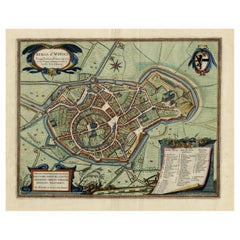
Old Original Hand-Colored Engraving of a Bird's-eye Plan of Amsterdam, ca.1580
About the Item
Description: Antique print, untitled.
Bird's-eye plan of Amsterdam portrayed on a sheet of German text. Remarkably detailed for its size, hundreds of individual buildings and houses are rendered. Dozens of tall ships ply the harbor and the Amstel River, which bisects the city. A coat of arms decorates the plan. There is German text also on the verso.Source unknown, to be determined.
Artists and Engravers: Made by 'Sebastiaan Munster' after an anonymous artist. Sebastian Munster was a German cartographer, cosmographer and Christian scholar. He is best known for Cosmographia, the earliest German description of the world (in 6 parts. He was also the author of Horologiographia, Organum Uranicum and Rudimenta Mathematica. The woodcuts in this publication were made by a group of artists, among which Hans Holbein, Conrad Schnitt, David Kandel and Hans Rudolf Manuel Deutsch.
Condition: Good, given age. Several spots, image not affected. Horizontal crease below image. General age-related toning and/or occasional minor defects from handling. Please study scan carefully.
- Dimensions:Height: 13.47 in (34.2 cm)Width: 8.55 in (21.7 cm)Depth: 0 in (0.02 mm)
- Materials and Techniques:
- Period:
- Date of Manufacture:circa 1580
- Condition:
- Seller Location:Langweer, NL
- Reference Number:
About the Seller
5.0
Platinum Seller
These expertly vetted sellers are 1stDibs' most experienced sellers and are rated highest by our customers.
Established in 2009
1stDibs seller since 2017
1,913 sales on 1stDibs
Typical response time: <1 hour
- ShippingRetrieving quote...Ships From: Langweer, Netherlands
- Return PolicyA return for this item may be initiated within 14 days of delivery.
More From This SellerView All
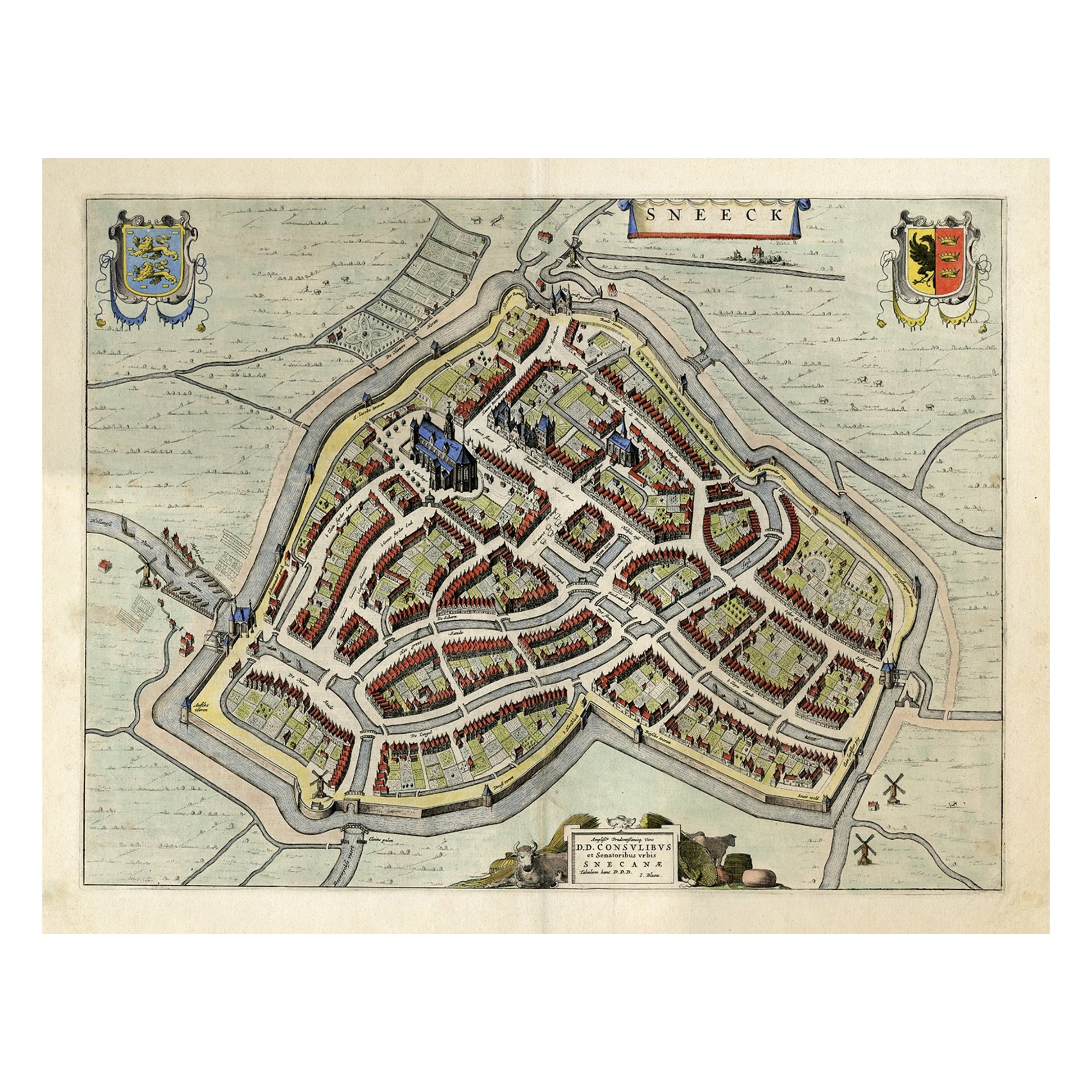
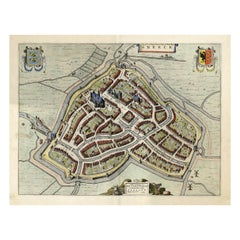
- Original Old Bird's-eye View plan of Sneek, Friesland, The Netherlands, 1649Located in Langweer, NLAntique map titled: 'Sneeck.' Bird's-eye view plan of Sneek, Friesland, The Netherlands. Text in Latin on verso. This plan originates from the famous city Atlas: 'Toneel der Steeden'...Category
Antique 1640s Maps
MaterialsPaper
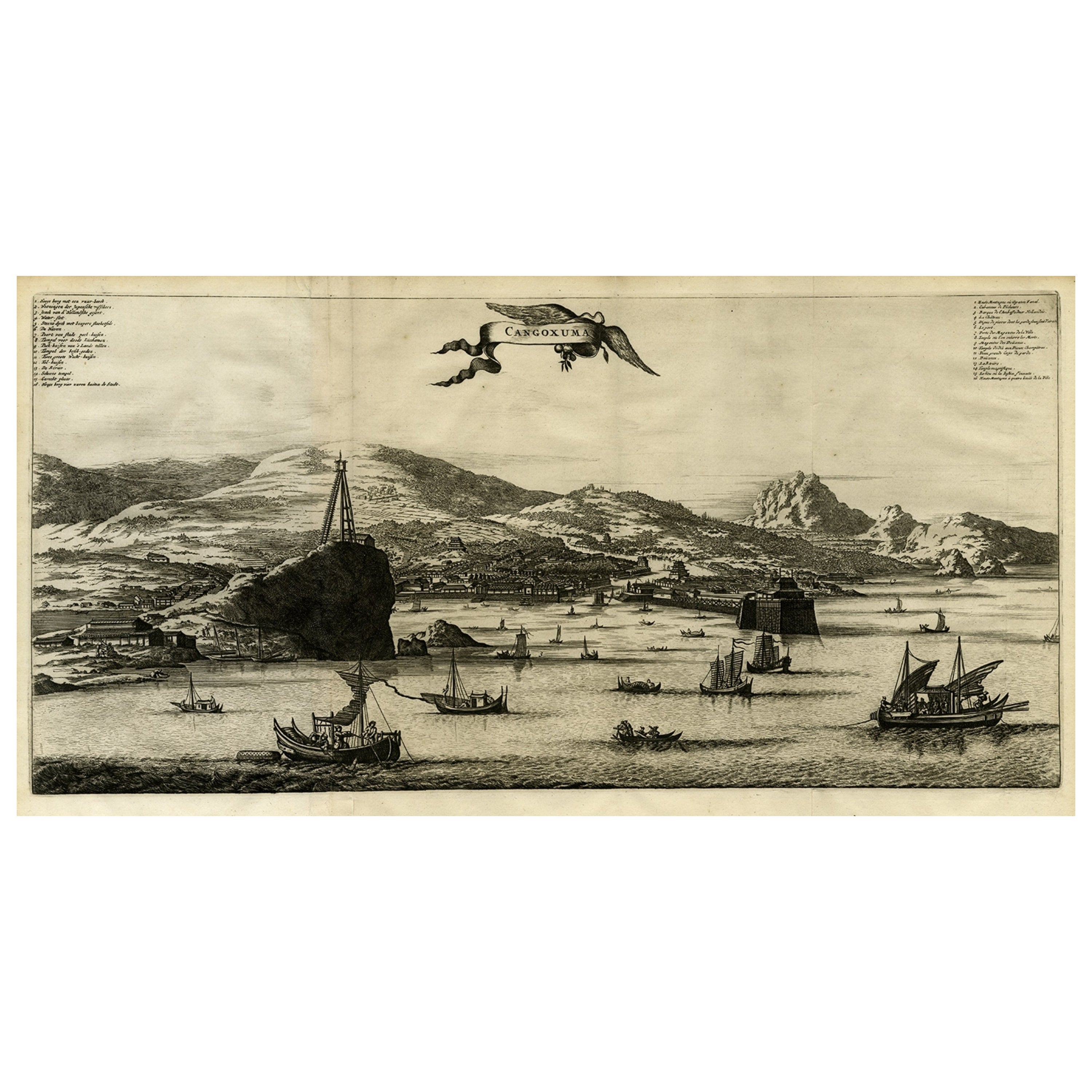
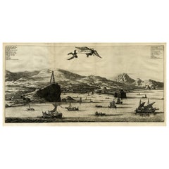
- Original Old Engraving, Bird's Eye View of Cangoxuma (Kagoshima) in Japan, 1669Located in Langweer, NLRare Antique print, titled: 'Cangoxuma.' A stunning bird's eye view of the coastal city Cangoxuma (Kagoshima) in Japan. It shows several boats in the harbour, as well as the ligh...Category
Antique 1660s Maps
MaterialsPaper
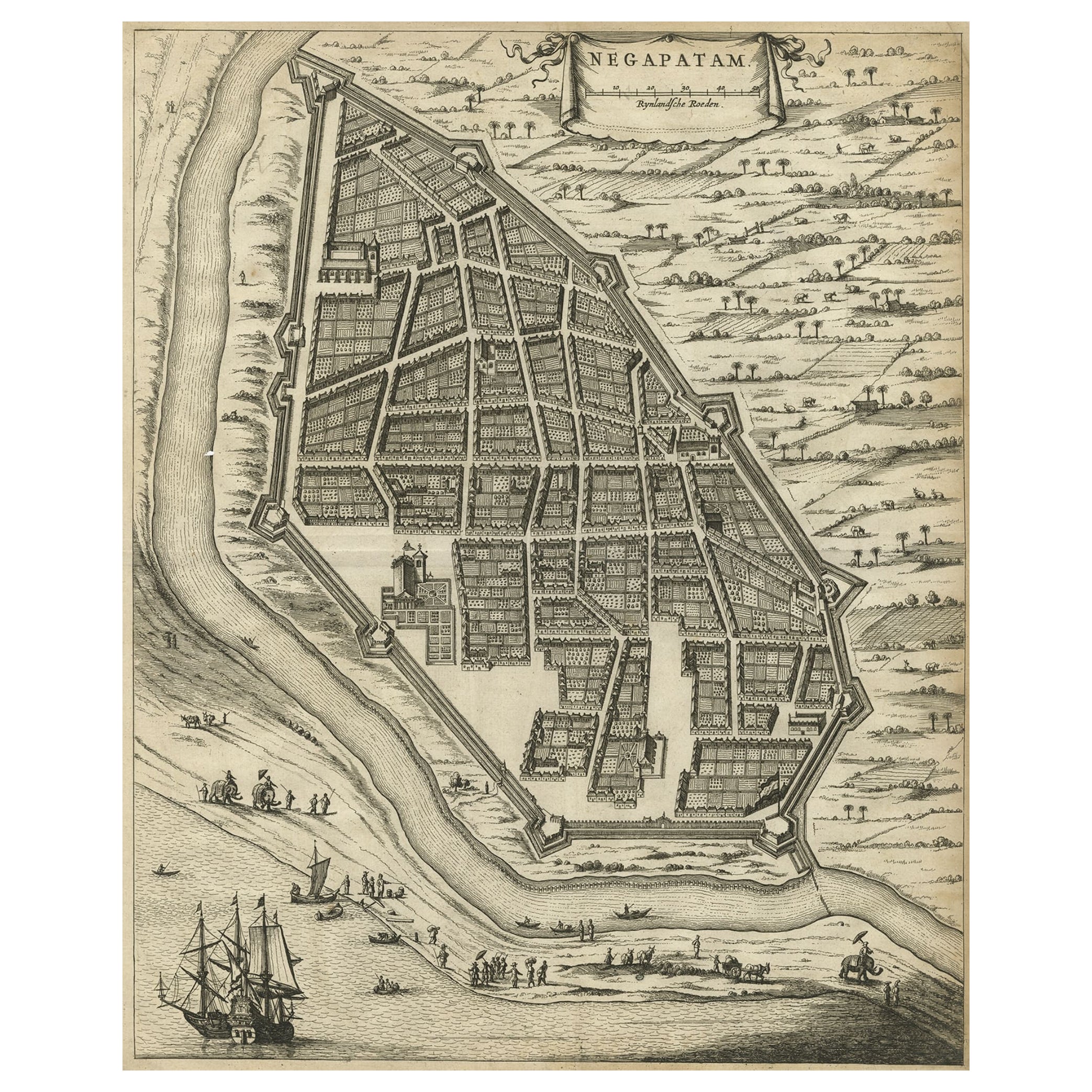
- Antique Engraving of a Bird's-Eye Plan of Nagapattinam or Negapatam, India, 1672Located in Langweer, NLAntique map titled 'Negapatam.' Bird's-eye plan of Nagapattinam or Negapatam, India. This map originates from 'Naauwkeurige Beschryvinge van Malabar en Choromandel…en het machtig...Category
Antique 1670s Maps
MaterialsPaper
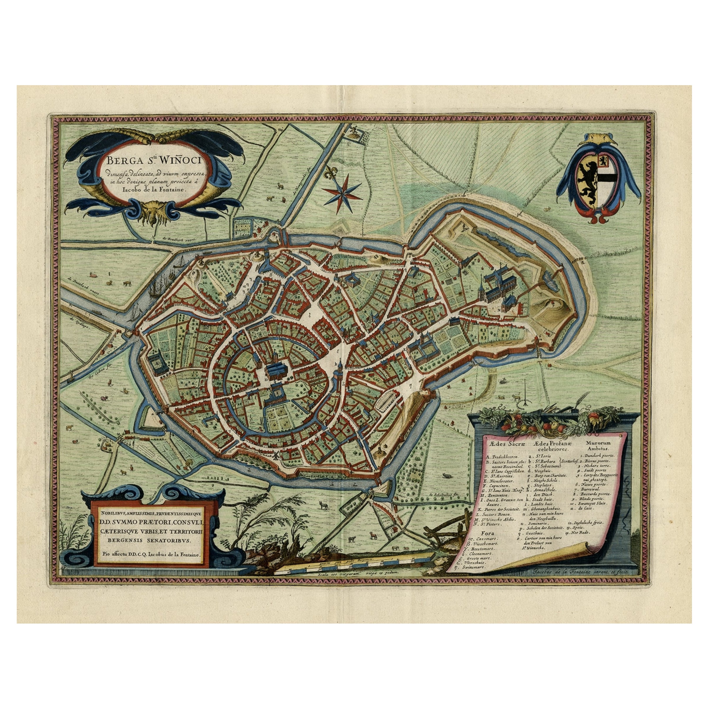
- Original Old Bird's-Eye View Plan of Sint-Winoksbergen or Bergen in France, 1649Located in Langweer, NLAntique map titled 'Berga Sti Winoci.' - Bird's-eye view plan of Sint-Winoksbergen in France, with key to locations and coats of arms. Text in Dutch on verso. This plan originates from the famous city Atlas: 'Toneel der Steeden' published by Joan Blaeu...Category
Antique 1640s Maps
MaterialsPaper
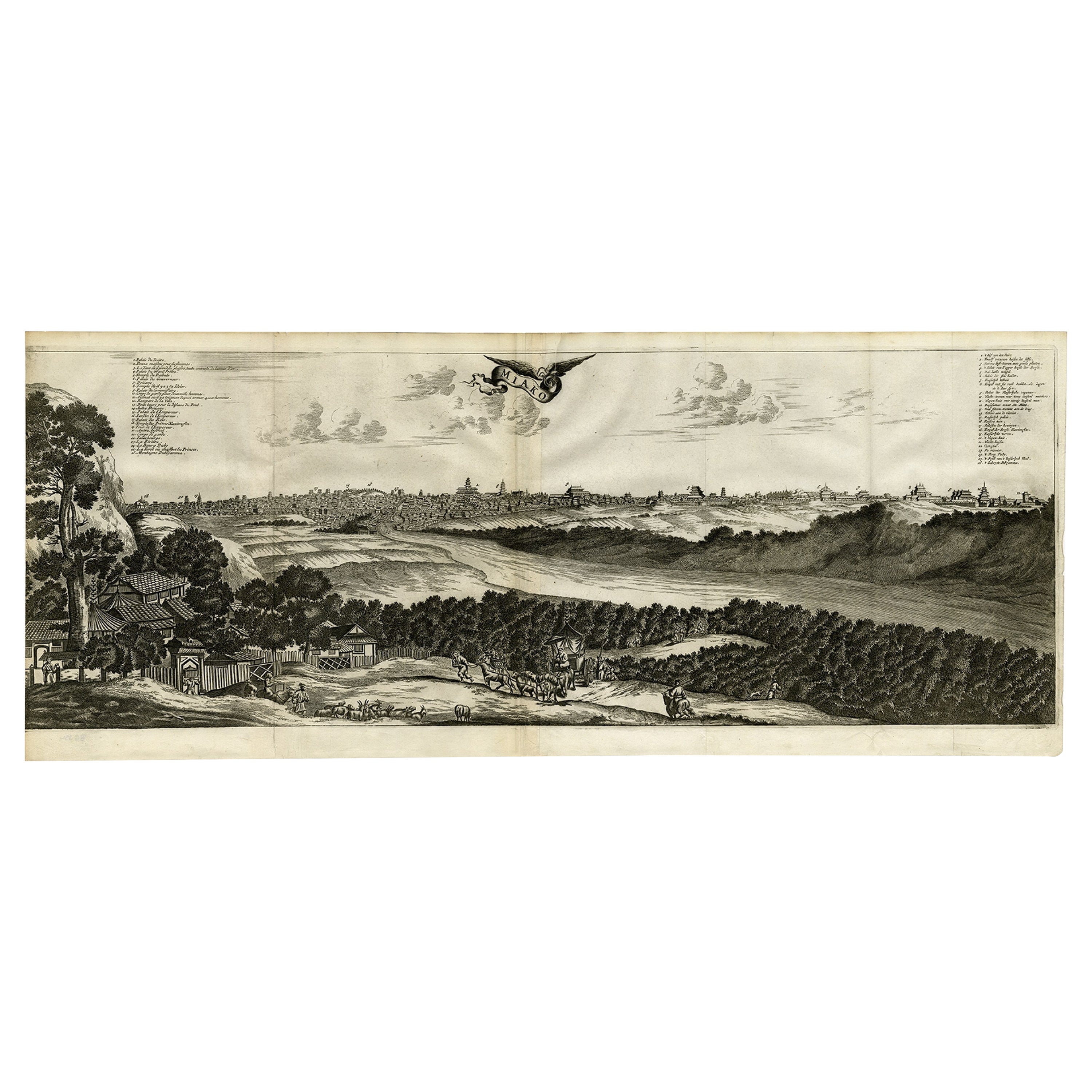
- Old Engraving of A Panoramic Bird's Eye View of Miaco 'Kyoto', Japan, 1669Located in Langweer, NLDescription: Antique print, titled: 'Miako.' - A panaromic bird's eye view of Miaco (Kyoto). Arnoldus Montanus' "Gedenkwaerdige Gesantschappen der Oost-Indische Maatschappy in 't Ver...Category
Antique 1660s Maps
MaterialsPaper
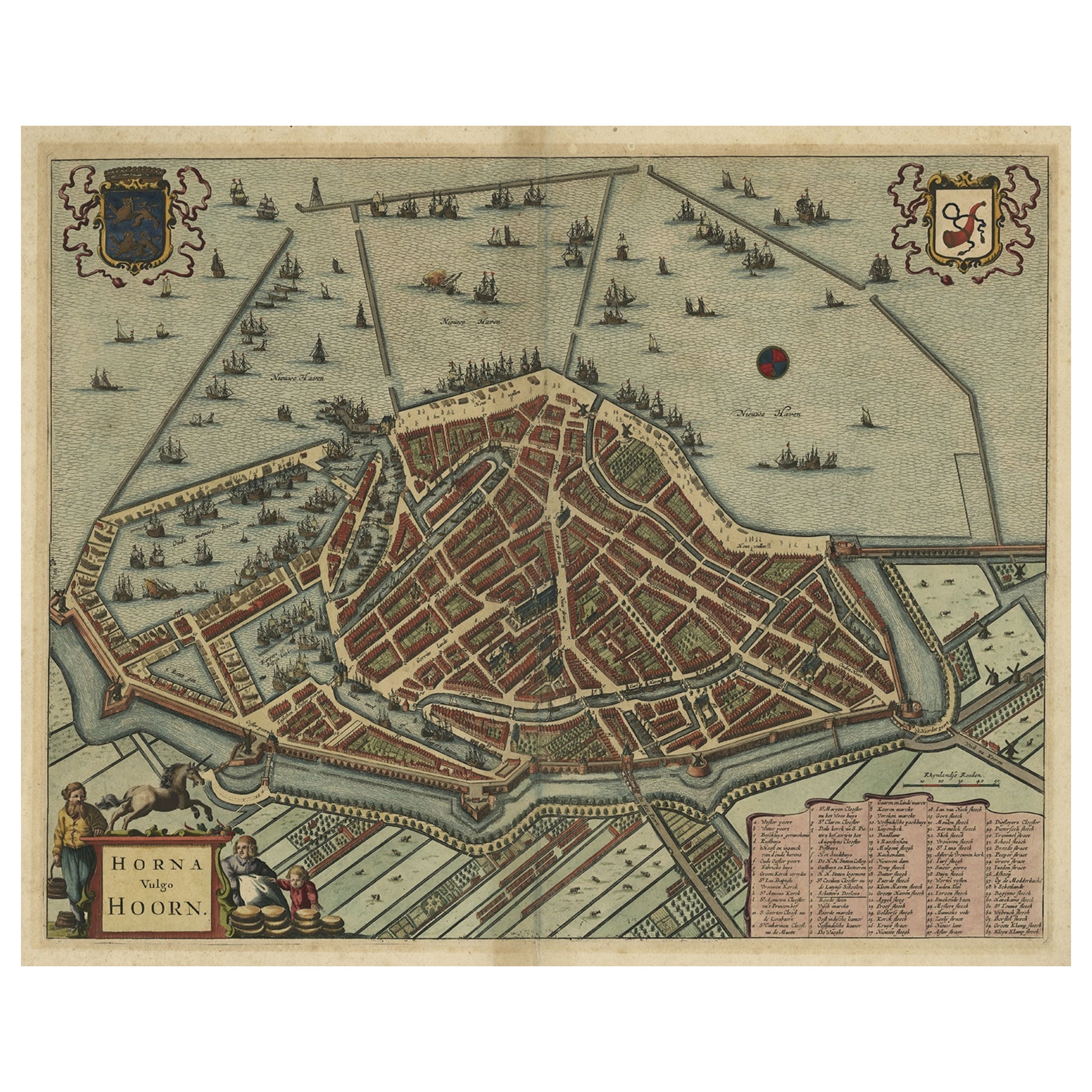
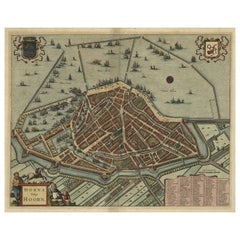
- Original Antique Bird's Eye View Plan of Hoorn, The Netherlands by Blaeu, c.1700Located in Langweer, NLAntique map titled 'Horna vulgo Hoorn'. Bird's eye view plan of Hoorn, The Netherlands. With title cartouche, coats of arms and key. From an atlas published by De Wit, ca. 1698-1...Category
Antique Early 1700s Maps
MaterialsPaper

You May Also Like
- 18th century Set Hand Colored Nautical EngravingsBy M. OgierLocated in Savannah, GASigned M. Ogier (Fecit:by), this set of four hand colored engravings is part of a larger edition of plates. These plates are numbered PL 16, 347, 365 and 386. The subject is probably...Category
Antique 18th Century Unknown Elizabethan Prints
MaterialsGlass, Wood, Paper
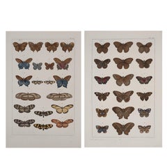
- Antique Albertus Seba Pair 18th Century Hand-Colored Engravings ButterflyBy Albertus Seba 1Located in Washington, DCRare pair of original hand-colored prints from Sir Albertus Seba's cabinet of natural curiosities. Prints come from published volumes in Amste...Category
Antique Mid-18th Century Dutch Prints
MaterialsPaper
- Dutch Map and City Plan of La Roche-sur-Foron, France, 17th Century Hand ColoredBy Coenraet DeckerLocated in Alamo, CA"Rupes Allobrogum vulgo La Roche" by Dutch engraver Coenraet Decker (1650-1685) is from the atlas Theatrum Statuum Regiae Celestudinis Sabaudiae Ducis, published in 1682. This richly...Category
Antique Late 17th Century Dutch Maps
MaterialsPaper
- Set of Twelve Colored Engravings of the Defeat of the Spanish Armada by J. PineLocated in Essex, MABy John Pine considered the foremost heraldic and decorative engraver of his generation. Depicting the defeat of the Spanish by the English Fleet in 1588. These are after a set of tapestries that hung in the House of Commons...Category
Antique 1740s English Prints
MaterialsPaper
- England, Scotland & Ireland: A Hand Colored Map of Great Britain by TirionBy Isaak TirionLocated in Alamo, CAThis is a hand-colored double page copperplate map of Great Britain entitled "Nieuwe Kaart van de Eilanden van Groot Brittannien Behelzende de Kon...Category
Antique Mid-18th Century Dutch Maps
MaterialsPaper
- "Nova Barbariae Descriptio", a 17th Century Hand-Colored Map of North AfricaBy Johannes JanssoniusLocated in Alamo, CAThis original attractive 17th century hand-colored map of North Africa entitled "Nova Barbariae Descriptio" by Johannes Janssonius was published in Paris in 1635. It includes the Med...Category
Antique Mid-17th Century Dutch Maps
MaterialsPaper


Recently Viewed
View AllMore Ways To Browse
Antique Plan
Antique Plans
16th Engraving
16th Century Engraving
Antique Engravings Of Birds
Antique House Plans
Antique Colored Engravings
Antique City Plans
Hand Colored Bird Engraving
Antique Ship Parts
Antique Plyers
Coat Of Arms Engraving
Antique Furniture Building Plans
Coat Of Arms German
Amsterdam Coat Of Arms
16th Century Hand Colored Map
Amsterdam Harbor
David Deutsch