American Maps
3
to
2
1
3
3
3
1
1
80
30
1
20
7
2
11
4
3
1
2
1
3
1
52
49
31
4
3
1
Period: 1920s
Place of Origin: American
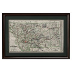
"Clason's Guide Map of Montana" by The Clason Map Company, Circa 1920s
Located in Colorado Springs, CO
Presented is “Clason's Guide Map of Montana,” published in the early 1920s by the Clason Map Company. Issued as a folding map, this map identifies county boundaries, county seats, Na...
Category
1920s Art Deco Vintage American Maps
Materials
Paper
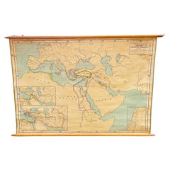
Antique Rand McNally & Company Schoolmap. Ancient Oriental Empires. Historical
By Rand McNally & Co.
Located in ROTTERDAM, ZH
This is a real unique map made by the famous Rand McNally Company. This rare schoolmap is probably made in the late 1920's. The map of all the ...
Category
1920s American Classical Vintage American Maps
Materials
Fabric, Paper
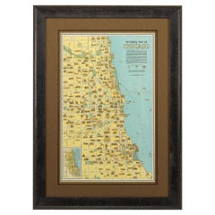
Pictorial Map of Chicago, circa 1926
Located in Colorado Springs, CO
This is a colorful folding pocket map of the city of Chicago, published by The Clason Map Co., circa 1926.
This highly decorative, double sided map features "Pictorial Map of Chicago...
Category
1920s Vintage American Maps
Materials
Paper
Related Items
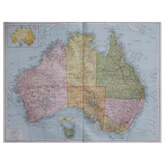
Large Original Vintage Map of Australia, circa 1920
Located in St Annes, Lancashire
Great map of Australia
Original color. Good condition
Published by Alexander Gross
Unframed.
Category
1920s Vintage American Maps
Materials
Paper
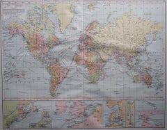
Large Original Vintage Map of The World, circa 1920
Located in St Annes, Lancashire
Great map of The World
Original color.
Good condition / minor foxing
Published by Alexander Gross
Unframed.
Category
1920s Vintage American Maps
Materials
Paper
2 Large Vols Antique Reference Book, Egypt - Historical and Picturesque, English
Located in Hele, Devon, GB
This is 2 large volumes of the antique reference book 'Egypt - Descriptive, Historical and Picturesque by G. Ebers. An English translation by Clara Bell, wi...
Category
Late 19th Century Victorian Antique American Maps
Materials
Textile, Paper
H 14.97 in W 12.01 in D 1.38 in
Historical American Civil War Era Wire Frame Magnifying Eye Glass Spectacles
Located in Philadelphia, PA
A delicate pair of handmade magnifying wire rim eye glasses from the American Civil War era, circa 1860.
A great looking historical conversation p...
Category
Mid-19th Century American Classical Antique American Maps
Materials
Metal
H 1.25 in W 5.5 in D 7 in
Antique Ophthalmometer Eye Machine by General Optical Company
Located in Norwalk, CT
This Antique Universal Ophthalmometer Eye Exam Machine by General Optical Company is stamped “Pat Oct 24th 1911”. This is an optical optometrist device to mea...
Category
Early 20th Century American Maps
Large Original Vintage Map of Greece, circa 1920
Located in St Annes, Lancashire
Great map of Greece
Original color.
Good condition
Published by Alexander Gross
Unframed.
Category
1920s Vintage American Maps
Materials
Paper
Antique Map of Germany by T. Kitchin, circa 1780
Located in Langweer, NL
Attractive map with decorative cartouche from "A New Geographical, Historical, and Commercial Grammar and Present State of the Several Kingdoms of the World by William Guthrie, print...
Category
Late 18th Century Antique American Maps
Materials
Paper
Antique Map of Asia 'circa 1739'
Located in Langweer, NL
Antique map titled 'Asia Dividida em suas Regioens & Principaes Estados'. Rare and uncommon map of Asia. Signed '1739'. Source unknown, to be determined.
...
Category
Mid-18th Century Antique American Maps
Materials
Paper
Large Original Antique Map of Arkansas by Rand McNally, circa 1900
By Rand McNally & Co.
Located in St Annes, Lancashire
Fabulous monochrome map with red outline color
Original color
By Rand, McNally & Co.
Published, circa 1900
Unframed
Minor edge tears.
Category
Early 1900s Edwardian Antique American Maps
Materials
Paper
No Reserve
H 20.5 in W 27.5 in D 0.07 in
Antique Map of the Ancient Greek Colonization
Located in Langweer, NL
Antique map titled 'Map I containing the Western Division of the Grecian Colonies & Conquests'. Original antique map of the ancient Greek colonization. Frontispiece map of 'The Histo...
Category
Late 18th Century Antique American Maps
Materials
Paper
Pictorial Vintage Map of New York City Showing Numerous Landmarks, 1939
Located in Langweer, NL
This pictorial souvenir map focuses on New York City and the site of the 1939 World's Fair. It was drawn by graphic artist George Annand and published by Sinclair Oil...
Category
1930s Vintage American Maps
Materials
Paper
Circa 1920s-30s Pair of Bookends by the Pompeian Bronze Company
Located in Chapel Hill, NC
Circa 1920s-30s pair of bookends by the Pompeian Bronze Company. Copyright 1921. A thin veneer of patinated bronze is molded over a heavy casting. Art Deco motifs with the arts in ba...
Category
Early 20th Century Art Deco American Maps
Materials
Bronze
Previously Available Items
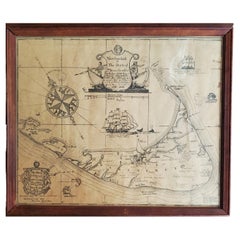
Map of Nantucket by Austin Strong '1881-1952', circa 1925
Located in Nantucket, MA
Map of Nantucket by Austin Strong (1881 - 1952), circa 1925, an original print on paper whimsical map of Nantucket Island by Robert Louis Stevenson's...
Category
1920s Folk Art Vintage American Maps
Materials
Paper
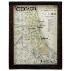
1922 Map of Chicago, Rand McNally Standard Railway Map
Located in Colorado Springs, CO
Presented is an original Rand McNally railway map of the city of Chicago. The map was produced in 1922 as a standard railway terminal map of the city. Blue...
Category
1920s Vintage American Maps
Materials
Paper
1921 Washington, D.C Bird's Eye View, by William Olsen, Vintage Map
Located in Colorado Springs, CO
This is a fabulous bird's-eye view that shows Washington D.C. in amazing detail. Every building is individually drawn, and all roads are shown and named. The view is from the Capitol and the Library of Congress looking north into rural areas of the District and Maryland. Many important buildings and monuments are named directly on the map. Some of the important government buildings illustrated in three dimensions, include the Library of Congress, the Smithsonian Institution (comprised of the Smithsonian Castle...
Category
1920s Vintage American Maps
Materials
Paper
1920s Double Sided Cartocraft Slated School Map, U.S.A. & World Denoyer Geppert
By Denoyer-Geppert
Located in Buffalo, NY
1920s Double Sided Cartocraft Slated School Map, One side depecting the United States, other side depecting the World, Made by Denoyer Geppert ,Pull down retractable, Slated material...
Category
1920s Industrial Vintage American Maps
Materials
Canvas, Wood
H 62 in W 68 in D 1 in
1923 Denoyer-Geppert School House Map of Africa
Located in Garnerville, NY
Amazing size and quality Denoyer-Geppert Map of Africa. Africa's strong colonial influences and exploiters are still fully evident and give a great history lesson. Belgian Kongo, Ita...
Category
1920s Industrial Vintage American Maps
Materials
Oak, Paper
Framed Map of Lake Winnipesaukee Region, NH
By United States Geological Survey
Located in Essex, MA
A framed, very detailed map of lake Winnipesaukee, NH and surrounding areas (the 'Winnipesaukee Quadrangle or Wolfeboro Triangle'), published by the United States Department of the Interior Geological...
Category
1920s Vintage American Maps
Materials
Paper, Walnut
Recently Viewed
View AllMore Ways To Browse
Greek Asia Minor
Antique Maps Canada
Antique Map Canada
Canada Antique Map
West Indies Map
Antique Portuguese Plates
Map Huge
Antique Maps Of Canada
Bali Map
Antique Map South Africa
Antique Map Of South Africa
South Africa Antique Map
Map Of West Indies
Belgium Army
Sweden Antique Map
Belgian Army
Cornelius Company
Antique Nautical Maps
