Items Similar to Original 1910 George Eldridge Chart


Want more images or videos?
Request additional images or videos from the seller
1 of 5
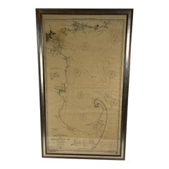
Original 1910 George Eldridge Chart
About the Item
Original framed 1910 George Eldridge chart "E" showing Gloucester to the Kennebec river. Showing the coast of Maine in great detail. Towns include Bath, Camden, Portland, the Coastal Islands etc. Measures: 73" tall x 28" wide.
- Dimensions:Height: 73 in (185.42 cm)Width: 28 in (71.12 cm)Depth: 1 in (2.54 cm)
- Place of Origin:
- Period:
- Date of Manufacture:Unknown
- Condition:
- Seller Location:Norwell, MA
- Reference Number:
About the Seller
5.0
Vetted Seller
These experienced sellers undergo a comprehensive evaluation by our team of in-house experts.
Established in 1967
1stDibs seller since 2015
344 sales on 1stDibs
Typical response time: 3 hours
- ShippingRetrieving quote...Ships From: Norwell, MA
- Return PolicyA return for this item may be initiated within 1 day of delivery.
More From This SellerView All
- 1918 George Eldridge Chart of Massachusetts BayLocated in Norwell, MARare early twentieth century chart of Cape Cod bay by George Eldridge showing Massachusetts Bay, and the coast from Chatham to Gloucester 1918. Signed George Eldridge. This great ch...Category
Vintage 1910s North American Maps
MaterialsPaper
- Long Island Chart from 1828Located in Norwell, MARare original chart of Long Island Sound by E + G Blunt of New York, 179 Water St. "Surveyed in the years 1828, 29 & 30" Exceedingly rare and early chart, titled Long Island Sound fr...Category
Antique 1830s Nautical Objects
MaterialsPaper
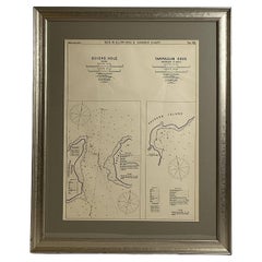
- Mariners Chart of Quicks Hole and Tarpaulin Cove by George Eldridge 1901Located in Norwell, MANautical chart showing the harbor and local waters of Naushon Island Quick Holes. The chart display depths buoys, lightness, etc., The chart shows the cove in Naushon with ships stor...Category
Antique Early 1900s North American Maps
MaterialsPaper
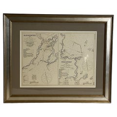
- Mariners Chart of Gloucester and Rockport by George Eldridge 1910Located in Norwell, MANautical chart showing the harbor and local water. The chart display depths buoys, lighthouses, etc., This chart shows Eastern Point, Rocky Neck, Stage head, Thatcher Island, Sandy B...Category
Vintage 1910s North American Prints
MaterialsPaper
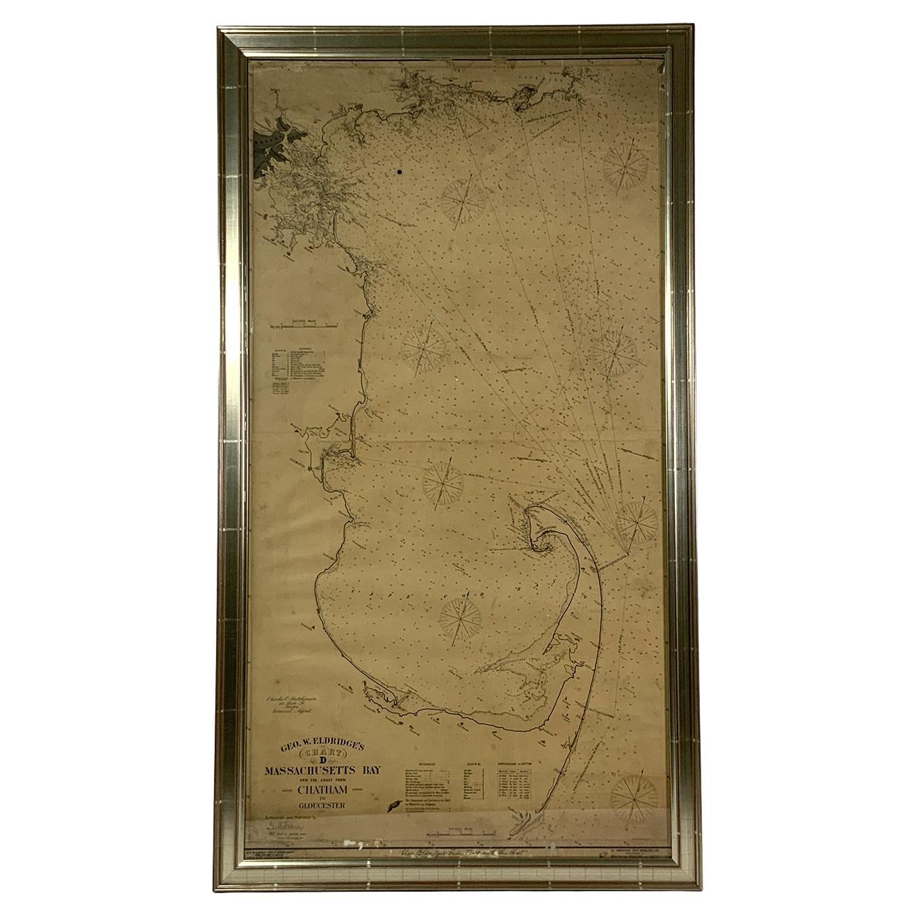
- Ocean Chart of Massachusetts BayLocated in Norwell, MACape Cod Bay chart from 1904 by George W. Eldridge. This chart "D" Massachusetts Bay and the coast from Chatham to Boston. Showing plotted courses, depths, lighthouses, ports, etc.. Excellent graphics. Ports include Barnstable, Sandwich, Duxbury, Plymouth, Cohasset, Hingham, Quincy, Boston, Marblehead, Lynn, Manchester by the Sea...Category
Antique Early 1900s American Nautical Objects
MaterialsPaper
- ICS Flag # 1Located in Norwell, MAInternational code of signals flag representing the number 1. White field with red oval in centre mounted into a shadow box frame. With attached manila rope and wood toggle.Category
20th Century Nautical Objects


You May Also Like
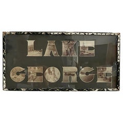
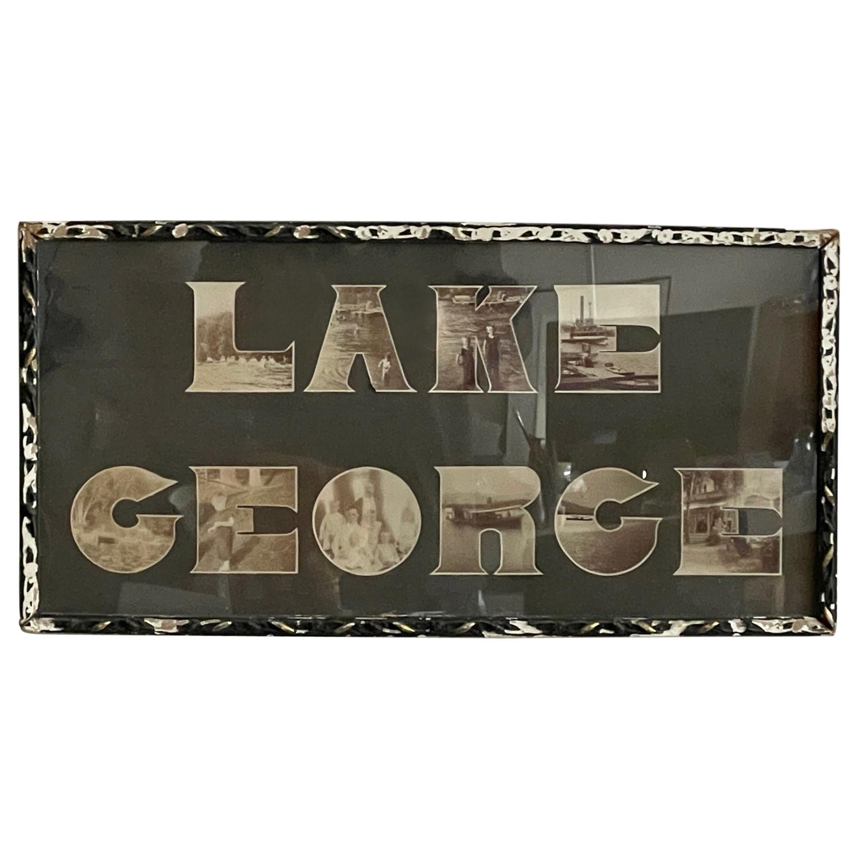
- Lake George Vintage Photograph, circa 1910Located in St.Petersburg, FLAn unusual photograph, circa 1910-1920 where the letters Lake George are made of cutout photographs. Original frame-really a unique object with character and timeless character. Lak...Category
Vintage 1910s North American Modern Nautical Objects
MaterialsPaper
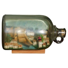
- American Three Masted Clipper Ship in Bottle on Original Wood Stand, Circa 1880Located in Hollywood, SCAmerican three masted clipper ship in bottle with cloth rigging in full sail on a painted sea, flanked by a sea side town with evergreen trees, a pain...Category
Antique 1880s American Folk Art Nautical Objects
MaterialsGlass, Wood, Paint
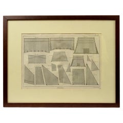
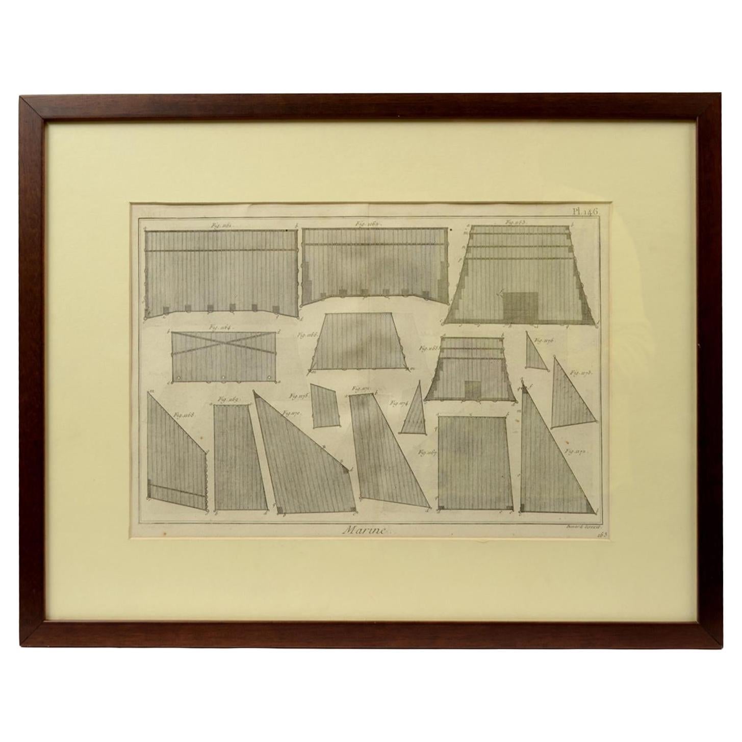
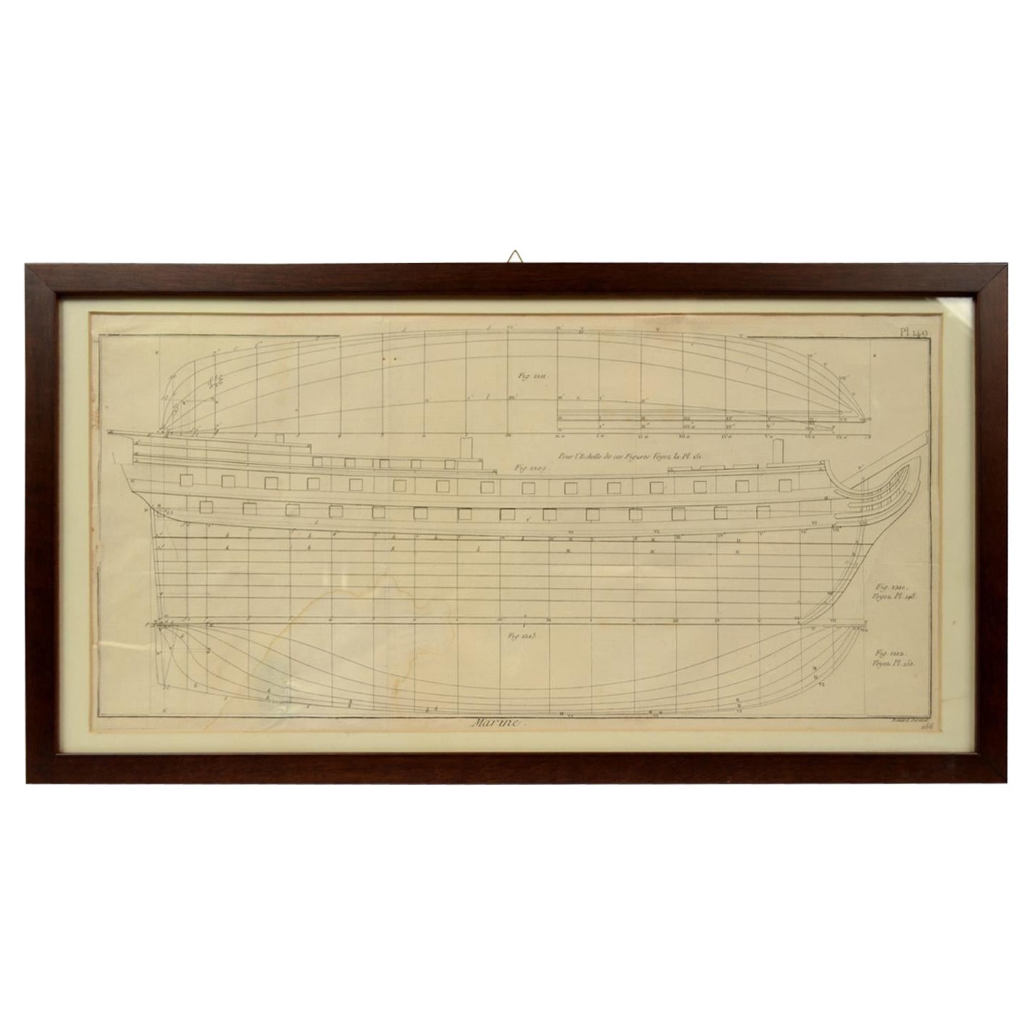
- Old Nautical Print from the Panckoucke Encyclopédie Nautical Subject 1780 circaLocated in Milan, ITPrint by engraving on copper plate from the Panckoucke encyclopédie méthodique, end of the 18th century, volume Marine Planches (more than 1,500 figures dealing with all subjects on the marina: planes, construction, carpentry, tree trunks, armaments of maneuvers, ropes, sails, artillery, ship maneuvers and combat tactics). This is the plate n. 146, pag. 163 fig. 1161-1172; with frame cm 51.2 x 40.8. Some sails are depicted. The Print has the "Benard direxit...Category
Antique 1790s French Nautical Objects
MaterialsPaper
- Old Nautical Print by Engraving on Copper Plate from the Panckoucke EncyclopédieLocated in Milan, ITPrint by engraving on copper plate from the Panckoucke Encyclopédie méthodique, end of the 18th century, volume Marine Planches (more than 1,500 figures dealing with all subjects on the marina: planes, construction, carpentry, tree trunks, armaments of maneuvers, ropes, sails, artillery, ship maneuvers and combat tactics). This is the plate n. 149, page. 166 fig. 1209-1212; with frame cm 57.8 x 31.8. The prospect of the side of a ship is depicted. The Print has the "Benard direxit...Category
Antique 1790s French Nautical Objects
MaterialsPaper
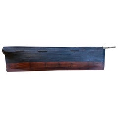
- Large 19th Century Presentation Half Hull Model of a Whale ShipLocated in Nantucket, MA19th Century Presentation Half Hull Model of a Whale Ship, circa 1850, a large plank on frame model of a bluff-bowed and wide abeam whale ship. The model wa...Category
Antique Mid-19th Century American Folk Art Nautical Objects
MaterialsPine
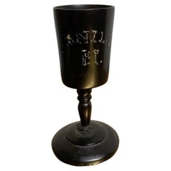
- 19th Century Whaler Made Turned Ebony Stemmed CupLocated in Stamford, CT19th century whaler made carved and turned ebony stemmed cup. "Manila P.I." painted on one side. Manila, Philippine Islands would have been a port of call on ...Category
Antique Mid-19th Century American Folk Art Nautical Objects
MaterialsEbony