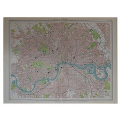
Original Vintage Map of London, circa 1900
View Similar Items
Want more images or videos?
Request additional images or videos from the seller
1 of 5
Original Vintage Map of London, circa 1900
About the Item
- Dimensions:Height: 17.75 in (45.09 cm)Width: 23.5 in (59.69 cm)Depth: 0.07 in (1.78 mm)
- Materials and Techniques:Paper,Other
- Place of Origin:
- Period:
- Date of Manufacture:1847
- Condition:Wear consistent with age and use.
- Seller Location:St Annes, GB
- Reference Number:1stDibs: LU1836318301752
About the Seller
4.9
Platinum Seller
These expertly vetted sellers are 1stDibs' most experienced sellers and are rated highest by our customers.
1stDibs seller since 2016
2,538 sales on 1stDibs
Associations
International Confederation of Art and Antique Dealers' Associations
More From This SellerView All
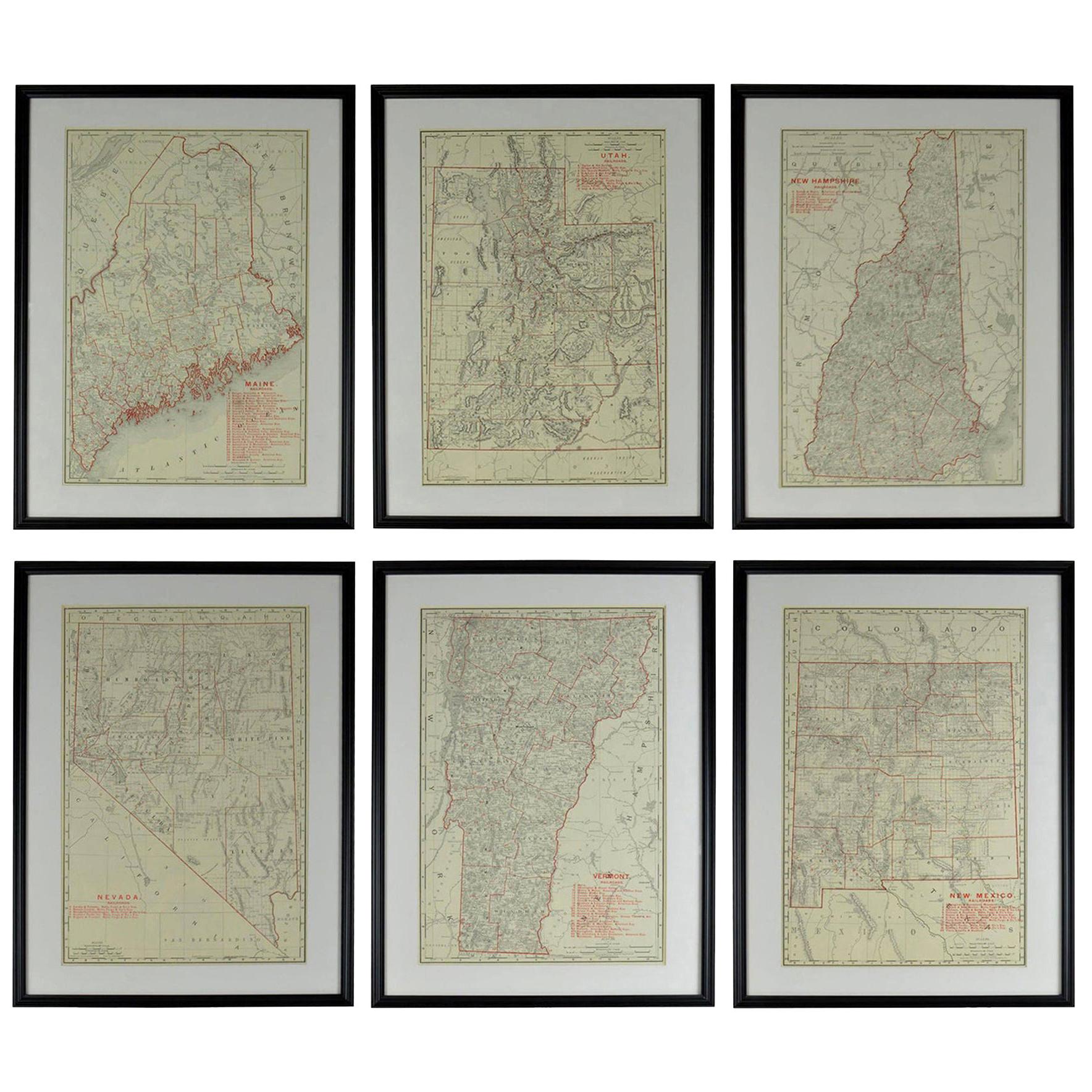
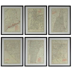
- Set of 6 Original Vintage Maps of American States, circa 1900Located in St Annes, LancashireWonderful set of 6 vintage maps. Random American states including Maine, Utah, New Hampshire, Nevada, Vermont and New Mexico. Monochrome with red color outline. Published by Rand,...Category
Antique Early 1900s American Edwardian Decorative Art
MaterialsPaper
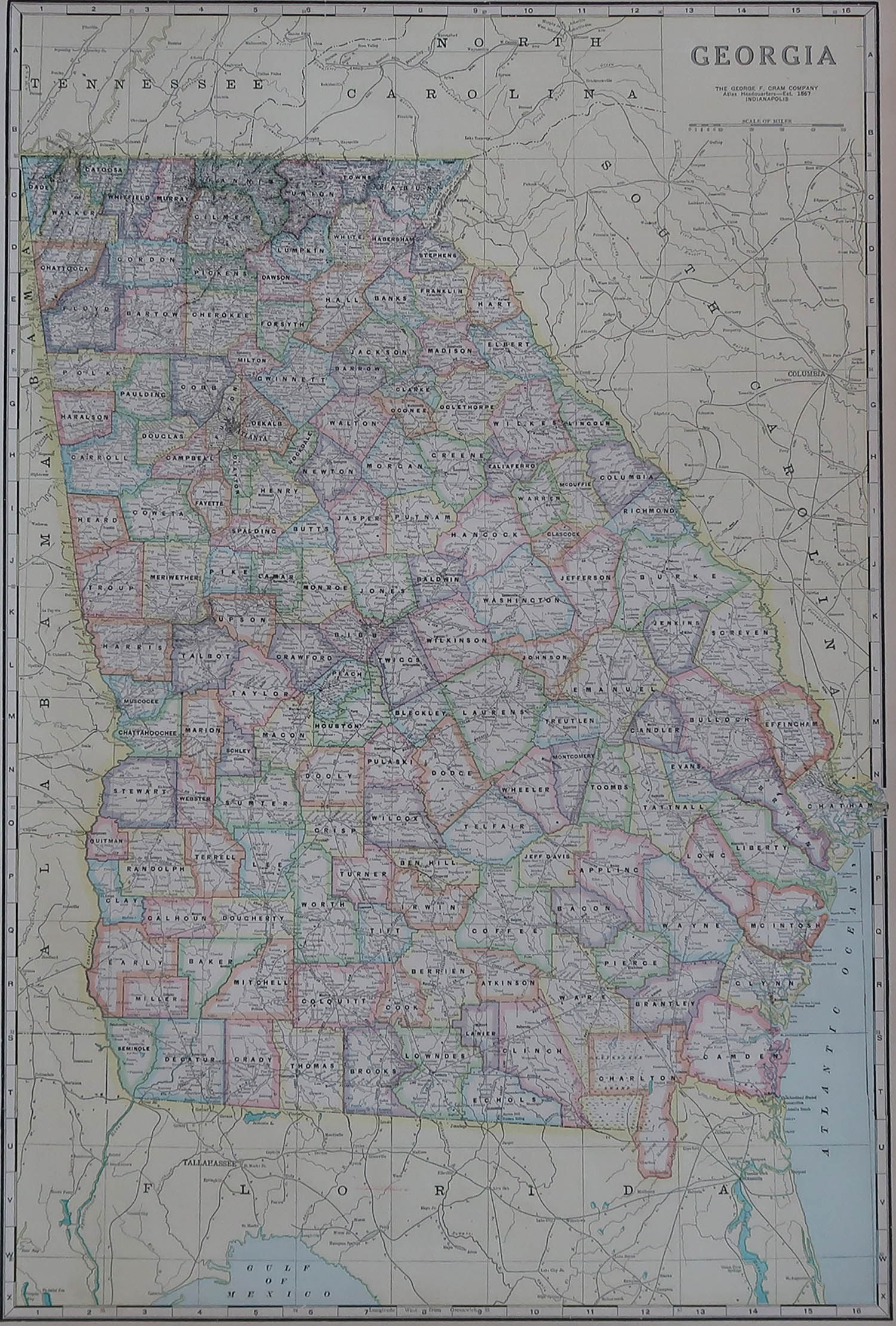
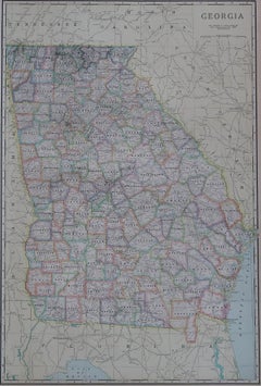
- Large Original Antique Map of Georgia, USA, circa 1900Located in St Annes, LancashireFabulous map of Georgia Original color Engraved and printed by the George F. Cram Company, Indianapolis. Published, circa 1900 UnframedCategory
Antique 1890s American Maps
MaterialsPaper
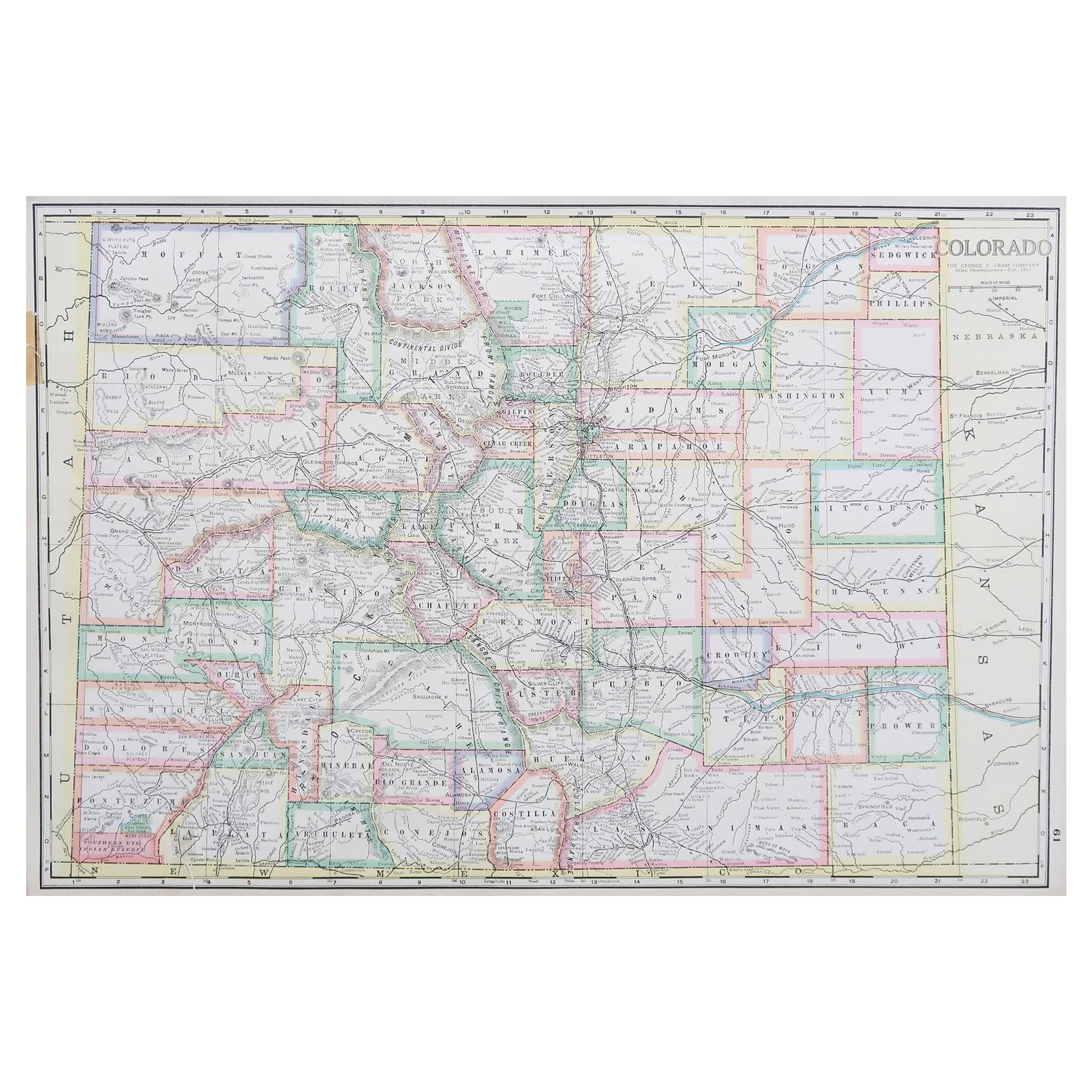
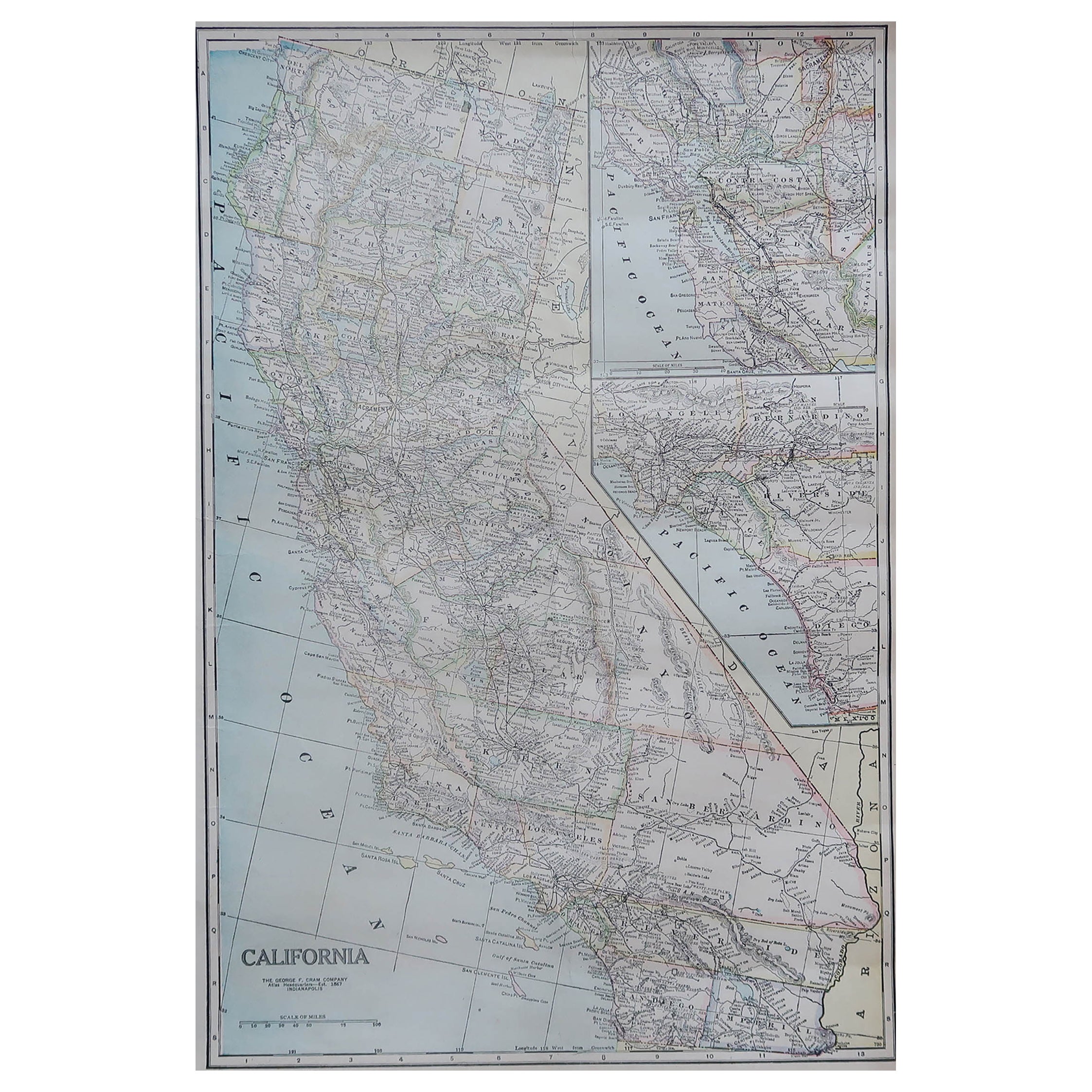
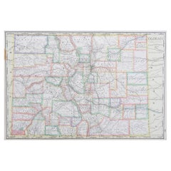
- Large Original Antique Map of Colorado, USA circa 1900Located in St Annes, LancashireFabulous map of Colorado Original color Engraved and printed by the George F. Cram Company, Indianapolis. Published, circa 1900 Unframed Old repairs to short trears on left and ...Category
Antique 1890s American Maps
MaterialsPaper
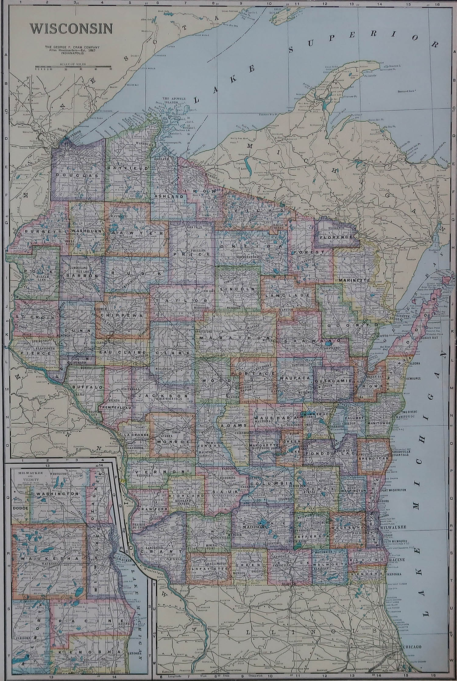
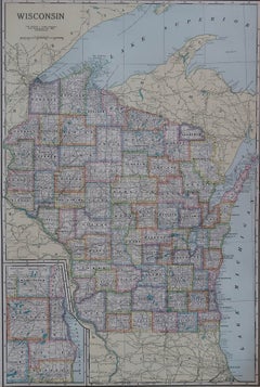
- Large Original Antique Map of Wisconsin, USA, circa 1900Located in St Annes, LancashireFabulous map of Wisconsin Original color Engraved and printed by the George F. Cram Company, Indianapolis. Published, circa 1900 UnframedCategory
Antique 1890s American Maps
MaterialsPaper
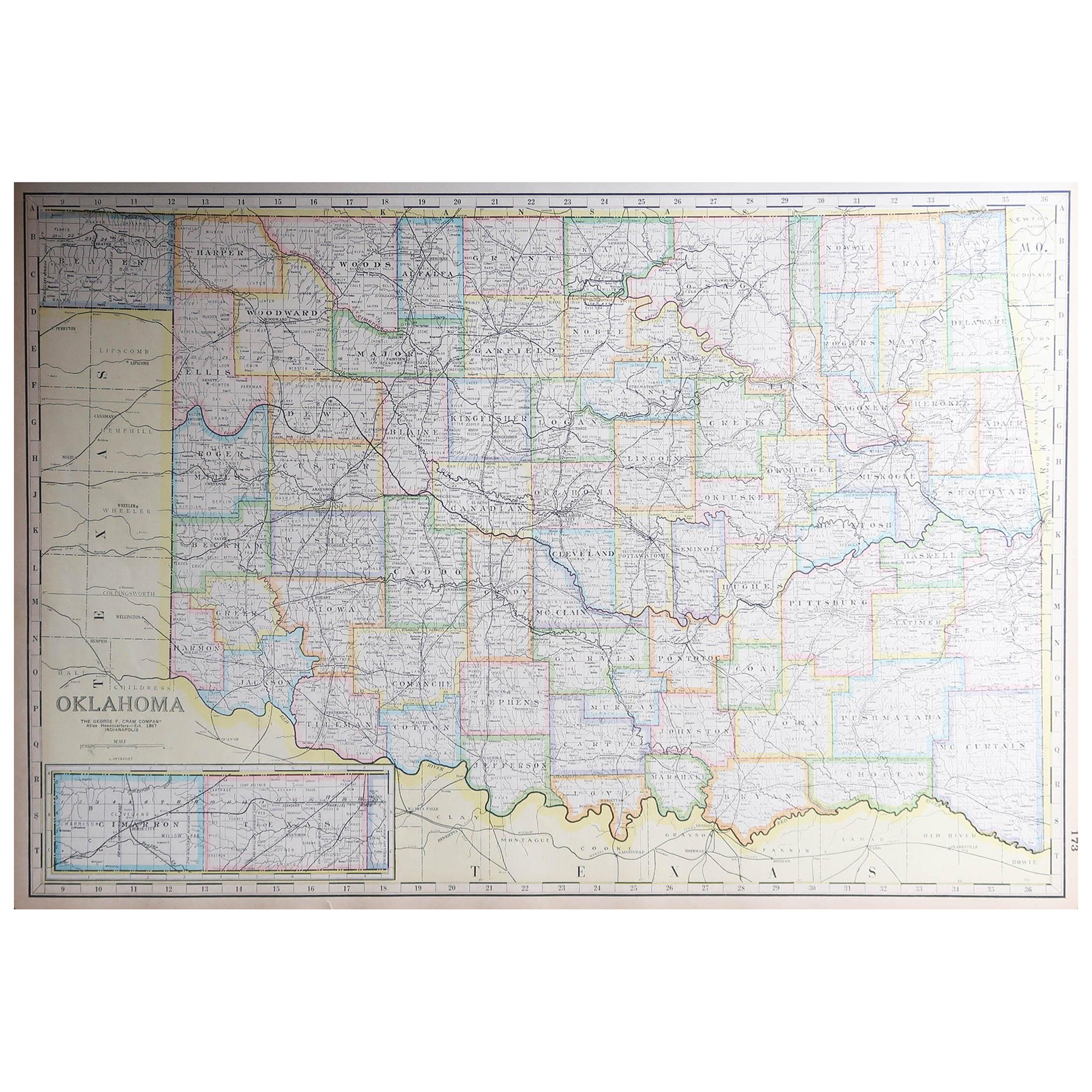
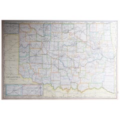
- Large Original Antique Map of Oklahoma, USA, circa 1900Located in St Annes, LancashireFabulous map of Oklahoma Original color Engraved and printed by the George F. Cram Company, Indianapolis. Published, circa 1900 Unframed Repair to...Category
Antique 1890s American Maps
MaterialsPaper
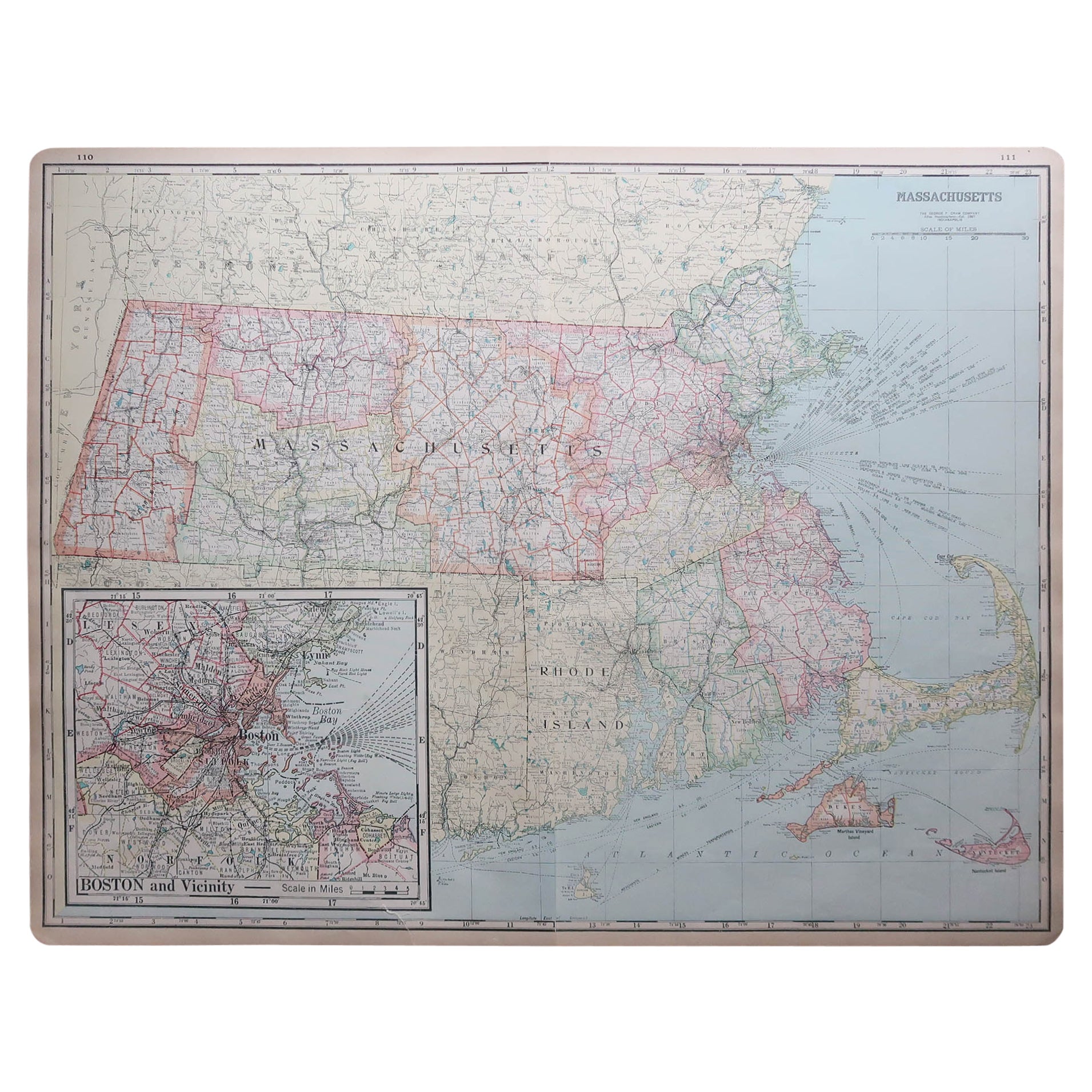
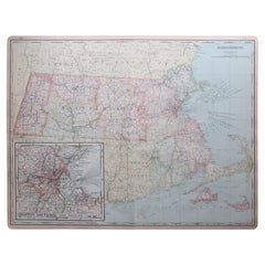
- Large Original Antique Map of Massachusetts, USA, circa 1900Located in St Annes, LancashireFabulous map of Massachusetts In 2 sheets. They can be joined but I have not done it Original color Engraved and printed by the George F. Cram ...Category
Antique 1890s American Maps
MaterialsPaper
You May Also Like
- Antique Map of the Mentawai Islands, Sumatra, 1900Located in Langweer, NLAntique map of the Mentawai Islands, Sumatra. Also depicting the region of Padang. This map originates from 'Atlas van Nederlandsch Oost- en West-Indië' by I. Dornseiffen. Artists ...Category
20th Century Maps
MaterialsPaper
- Antique Map of Paraguay by A. Montanus, circa 1671By Arnoldus MontanusLocated in Langweer, NLAntique map titled 'Paraquaria Vulgo Paraguay Cum adjacentibus'. Antique map extending from Rio de Janiero to the Rio de la Plata basin. The map include...Category
Antique Mid-17th Century Maps
MaterialsPaper
 $524 Sale Price20% Off
 - Antique Map of Chili by Montanus, circa 1671By Arnoldus MontanusLocated in Langweer, NLAntique map titled 'Chili'. A very attractive map covering the known coastal region of Chile. The Andes are shown prominently, with two live volcanoes in the vicinity of Villarrica. ...Category
Antique Mid-17th Century Maps
MaterialsPaper
- Antique Map of Asia by Dufour, circa 1834Located in Langweer, NLAntique map titled 'Asie par A.H. Dufour'. Uncommon map of Asia. Published by or after A.H. Dufour, circa 1834. Source unknown, to be determined.Category
Antique Mid-19th Century Maps
MaterialsPaper
- Antique Map of Africa by Dufour, circa 1834Located in Langweer, NLAntique map titled 'Afrique'. Uncommon map of Africa. Published by or after A.H. Dufour, circa 1834. Source unknown, to be determined.Category
Antique Mid-19th Century Maps
MaterialsPaper
 $174 Sale Price20% Off
 - London 1744 Published Watercolour Antique Map of East Africa by Eman BowenLocated in GBWe are delighted to offer for sale this New and Accurate Map of Nubia & Abissinia, together with all the Kingdoms Tributary Thereto, and bordering upon them published in 1744 by Emanuel Bowen This is a decorative antique engraved map of East Africa...Category
Antique 1740s English George III Maps
MaterialsPaper


