1890s Maps
41
51
to
1
48
3
51
51
51
1
2,902
2,128
416
5
231
32
11
85
7
59
8
3
3
4
5
2
51
43
42
4
1
1
20
Period: 1890s
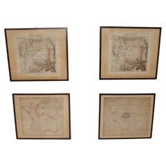
Set of 4 Antique Geographical Maps French-German War 1870-71
Located in Casale Monferrato, IT
Elegant late 19th century set of four antique geographical maps relating to the positioning of the armies in the Franco-German War 1870-71.
A...
Category
Italian Antique 1890s Maps
Materials
Paper
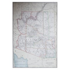
Large Original Antique Map of Arizona, Usa, C.1900
Located in St Annes, Lancashire
Fabulous map of Arizona
Original color.
Engraved and printed by the George F. Cram Company, Indianapolis.
Published, C.1900.
Unframed.
Free shipping.
Category
American Antique 1890s Maps
Materials
Paper
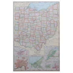
Large Original Antique Map of Ohio, Usa, C.1900
Located in St Annes, Lancashire
Fabulous map of Ohio
Original color.
Engraved and printed by the George F. Cram Company, Indianapolis.
Published, C.1900.
Unframed.
Free shipping.
Category
American Antique 1890s Maps
Materials
Paper
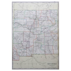
Large Original Antique Map of New Mexico, Usa, C.1900
Located in St Annes, Lancashire
Fabulous map of New Mexico.
Original color.
Engraved and printed by the George F. Cram Company, Indianapolis.
Published, C.1900.
Unframed.
Free shipping.
Category
American Antique 1890s Maps
Materials
Paper
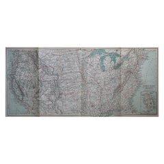
Original Antique Map of The United States of America, circa 1890
Located in St Annes, Lancashire
Great map of the USA
By The Stanford's Geographical Establishment
Original colour
Unframed.
Category
English Victorian Antique 1890s Maps
Materials
Paper
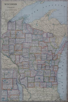
Large Original Antique Map of Wisconsin, USA, circa 1900
Located in St Annes, Lancashire
Fabulous map of Wisconsin
Original color
Engraved and printed by the George F. Cram Company, Indianapolis.
Published, circa 1900
Unframed
Category
American Antique 1890s Maps
Materials
Paper
Large Original Antique Map of Georgia, USA, circa 1900
Located in St Annes, Lancashire
Fabulous map of Georgia
Original color
Engraved and printed by the George F. Cram Company, Indianapolis.
Published, circa 1900
Unframed
Category
American Antique 1890s Maps
Materials
Paper
Large Original Antique Map of California, USA, circa 1900
Located in St Annes, Lancashire
Fabulous map of California
Original color
Engraved and printed by the George F. Cram Company, Indianapolis.
Published, circa 1900
Unframed
Free shipping.
Category
American Antique 1890s Maps
Materials
Paper
Large Original Antique Map of New Jersey, USA, circa 1900
Located in St Annes, Lancashire
Fabulous map of New Jersey
Original color
Engraved and printed by the George F. Cram Company, Indianapolis.
Published, circa 1900
Unframed
Repairs to minor edge tears
Category
American Antique 1890s Maps
Materials
Paper
1891 Map of Plymouth County Mass
Located in Norwell, MA
Original 1891 map showing Sandwich, Bourne, Plymouth Carver, Middleborough, Plympton and Kingston. Showing Long Beach in Plymouth also as well as all shore points. Cape Cod Bay is ma...
Category
North American Antique 1890s Maps
Materials
Paper
Large Original Antique Map of Oklahoma, USA, circa 1900
Located in St Annes, Lancashire
Fabulous map of Oklahoma
Original color
Engraved and printed by the George F. Cram Company, Indianapolis.
Published, circa 1900
Unframed
Repair to...
Category
American Antique 1890s Maps
Materials
Paper
Large Original Antique Map of Kansas, USA, 1894
Located in St Annes, Lancashire
Fabulous map of Kansas
Original color
By Rand, McNally & Co.
Published, 1894
Unframed
Free shipping.
Category
American Antique 1890s Maps
Materials
Paper
Large Original Antique Map of Colorado, USA circa 1900
Located in St Annes, Lancashire
Fabulous map of Colorado
Original color
Engraved and printed by the George F. Cram Company, Indianapolis.
Published, circa 1900
Unframed
Old repairs to short trears on left and ...
Category
American Antique 1890s Maps
Materials
Paper
Large Original Antique Map of Maryland, Delaware & DC, USA, C.1900
Located in St Annes, Lancashire
Fabulous map of Maryland, Delaware And District of Columbia
Original color
Engraved and printed by the George F. Cram Company, Indianapolis.
Pu...
Category
American Antique 1890s Maps
Materials
Paper
Large Original Antique Map of South Carolina, USA, 1894
Located in St Annes, Lancashire
Fabulous map of South Carolina
Original color
By Rand, McNally & Co.
Published, 1894
Unframed
Free shipping.
Category
American Antique 1890s Maps
Materials
Paper
Large Original Antique Map of Maine, USA, C.1900
Located in St Annes, Lancashire
Fabulous map of Maine
Original color
Engraved and printed by the George F. Cram Company, Indianapolis.
Published, C.1900
Unframed
Free shipping.
Category
American Antique 1890s Maps
Materials
Paper
Large Original Antique Map of Kentucky, USA, C.1900
Located in St Annes, Lancashire
Fabulous map of Kentucky
Original color
Engraved and printed by the George F. Cram Company, Indianapolis.
Published, C.1900
Unframed.
Category
American Antique 1890s Maps
Materials
Paper
Large Original Antique Map of Minnesota, USA, C.1900
Located in St Annes, Lancashire
Fabulous map of Minnesota
Original color
Engraved and printed by the George F. Cram Company, Indianapolis.
Published, C.1900
Unframed
Repair to a small tear bottom left corner
...
Category
American Antique 1890s Maps
Materials
Paper
Large Original Antique Map of Massachusetts, USA, circa 1900
Located in St Annes, Lancashire
Fabulous map of Massachusetts
In 2 sheets. They can be joined but I have not done it
Original color
Engraved and printed by the George F. Cram ...
Category
American Antique 1890s Maps
Materials
Paper
Large Original Antique Map of Rhode Island, USA, C.1900
Located in St Annes, Lancashire
Fabulous map of Rhode Island
Original color
Engraved and printed by the George F. Cram Company, Indianapolis.
Published, C.1900
Unframed
Free ...
Category
American Antique 1890s Maps
Materials
Paper
Large Original Antique Map of West Virginia, USA, C.1900
Located in St Annes, Lancashire
Fabulous map of West Virginia
Original color
Engraved and printed by the George F. Cram Company, Indianapolis.
Published, C.1900
Unframed
Free shipping.
Category
American Antique 1890s Maps
Materials
Paper
Large Original Antique Map of Alabama, USA, C.1900
Located in St Annes, Lancashire
Fabulous map of Alabama
Original color
Engraved and printed by the George F. Cram Company, Indianapolis.
Published, C.1900
Unframed
Repair to a minor edge tear top left corner
...
Category
American Antique 1890s Maps
Materials
Paper
Large Original Antique Map of North Dakota, USA, circa 1900
Located in St Annes, Lancashire
Fabulous map of North Dakota
Original color
Engraved and printed by the George F. Cram Company, Indianapolis.
Published, circa 1900
Unframed
Free shi...
Category
American Antique 1890s Maps
Materials
Paper
Large Original Antique Map of Louisiana, USA, C.1900
Located in St Annes, Lancashire
Fabulous map of Louisiana.
Original color.
Engraved and printed by the George F. Cram Company, Indianapolis.
Published, c.1900.
Unframed.
Repair ...
Category
American Antique 1890s Maps
Materials
Paper
Large Original Antique Map of the United States of America. 1891
Located in St Annes, Lancashire
Fabulous map of The United States
Original color
By Rand, McNally & Co.
Dated 1891
Unframed
Free shipping.
Category
American Antique 1890s Maps
Materials
Paper
Large Original Antique Map of North Carolina, USA, 1894
Located in St Annes, Lancashire
Fabulous map of North Carolina
Original color
By Rand, McNally & Co.
Published, 1894
Unframed
Free shipping.
Category
American Antique 1890s Maps
Materials
Paper
Large Original Antique Map of Alaska, USA, C.1900
Located in St Annes, Lancashire
Fabulous map of Alaska
Original color
Engraved and printed by the George F. Cram Company, Indianapolis.
Published, C.1900
Unframed
Free shipping.
Category
American Antique 1890s Maps
Materials
Paper
Large Original Antique Map of Pennsylvania, USA, 1894
Located in St Annes, Lancashire
Fabulous map of Pennsylvania
Original color.
By Rand, McNally & Co.
Published, 1894.
Unframed.
Free shipping.
Category
American Antique 1890s Maps
Materials
Paper
Large Original Antique Map of Michigan 'North', USA, 1894
Located in St Annes, Lancashire
Fabulous map of Michigan North.
Original color.
By Rand, McNally & Co.
Published, 1894.
Unframed.
Free shipping.
Category
American Antique 1890s Maps
Materials
Paper
Large Original Antique Map of Oregon, USA, 1894
Located in St Annes, Lancashire
Fabulous map of Oregon.
Original color.
By Rand, McNally & Co.
Published, 1894.
Unframed.
Free shipping.
Category
American Antique 1890s Maps
Materials
Paper
Large Original Antique Map of Indiana, USA, 1894
Located in St Annes, Lancashire
Fabulous map of Indiana.
Original color.
By Rand, McNally & Co.
Published, 1894.
Unframed.
Free shipping.
Category
American Antique 1890s Maps
Materials
Paper
Large Original Antique City Plan of Baltimore, USA, 1894
Located in St Annes, Lancashire
Fabulous colorful map of Baltimore
Original color
By Rand, McNally & Co.
Published, 1894
Unframed
Free shipping.
Category
American Antique 1890s Maps
Materials
Paper
Large Original Antique Map of Washington, 'State', USA, 1894
Located in St Annes, Lancashire
Fabulous map of Washington.
Original color.
By Rand, McNally & Co.
Published, 1894.
Unframed.
Free shipping.
Category
American Antique 1890s Maps
Materials
Paper
Large Original Antique Map of Utah, USA, 1894
Located in St Annes, Lancashire
Fabulous map of Utah
Original color
By Rand, McNally & Co.
Published, 1894
Unframed
Free shipping.
Category
American Antique 1890s Maps
Materials
Paper
Large Original Antique Map of New York, USA, 1894
Located in St Annes, Lancashire
Fabulous map of New York.
Original color.
By Rand, McNally & Co.
Published, 1894
Unframed
Free shipping.
Category
American Antique 1890s Maps
Materials
Paper
Large Original Antique Map of Iowa, USA, 1894
Located in St Annes, Lancashire
Fabulous map of Iowa.
Original color.
By Rand, McNally & Co.
Published, 1894.
Unframed.
Free shipping.
Category
American Antique 1890s Maps
Materials
Paper
Large Original Antique Map of New Hampshire, USA, 1894
Located in St Annes, Lancashire
Fabulous map of New Hampshire
Original color
By Rand, McNally & Co.
Published, 1894
Unframed
Free shipping.
Category
American Antique 1890s Maps
Materials
Paper
Large Original Antique City Plan of Detroit, USA, 1894
Located in St Annes, Lancashire
Fabulous colorful map of Detroit
Original color
By Rand, McNally & Co.
Published, 1894
Unframed
Free shipping.
Category
American Antique 1890s Maps
Materials
Paper
Large Original Antique City Plan of San Francisco, USA, 1894
Located in St Annes, Lancashire
Fabulous colorful map of San Francisco
Original color
By Rand, McNally & Co.
Published, 1894
Unframed
Free shipping.
Category
American Antique 1890s Maps
Materials
Paper
Original Antique City Plan of Kansas City, USA. 1894
Located in St Annes, Lancashire
Fabulous colorful map of Kansas City
Original color
By Rand, McNally & Co.
Published, 1894
Unframed
Slightly reduced bottom margin.
Free shipping.
Category
American Antique 1890s Maps
Materials
Paper
Original Antique City Plan of Milwaukee, USA, 1894
Located in St Annes, Lancashire
Fabulous colorful map of Milwaukee
Original color
By Rand, McNally & Co.
Published, 1894
Unframed
Free shipping.
Category
American Antique 1890s Maps
Materials
Paper
Large Original Antique Map of Connecticut, USA, 1894
Located in St Annes, Lancashire
Fabulous map of Connecticut and Rhode Island
Original color
By Rand, McNally & Co.
Published, 1894
Unframed
Free shipping.
Category
American Antique 1890s Maps
Materials
Paper
Original Antique City Plan of St Joseph, Missouri, USA, 1894
Located in St Annes, Lancashire
Fabulous colorful map of St Joseph
Original color
By Rand, McNally & Co.
Published, 1894
Unframed
Free shipping.
Category
American Antique 1890s Maps
Materials
Paper
Antique Map of Eastern Europe, Incl Montenegro & Serbia & a Budapest Map, 1890
Located in Langweer, NL
Antique map titled 'Osterreich-Ungarn in 4 Blattern, Blatt 4.'
Map of Eastern Europe, with Montenegro in the lower left corner, the southern ...
Category
Antique 1890s Maps
Materials
Paper
End XIX century Small Terrestrial Globe Signed C.M.C Paris Papier Maché Sphere
Located in Milan, IT
Small terrestrial globe signed C.M.C. Paris, end of XIX century. Papier maché sphere and turned and ebonized wooden base. Height cm 13 - inches 5.1, diameter of sphere cm 6,5 - inche...
Category
French Antique 1890s Maps
Materials
Paper
Globe Table Terrestrial Swedish
Located in BUNGAY, SUFFOLK
A Swedish 12 inch terrestrial globe, circa 1900. Measure: height 59cm
Just purchased more information to follow.
Category
Swedish Baroque Revival Antique 1890s Maps
Materials
Paper
Old Hand-Colored Print of the Guards of the King of France, 1890
Located in Langweer, NL
Antique print titled 'Gardes-du-Crops du Roi'.
Old print of the Guards of the King of France. This print originates from 'Histoire de la maison militaire du roi de 1814 à 1830 : ...
Category
Antique 1890s Maps
Materials
Paper
Uncommon, Large Map of the British Islands to Petshora Bay, 1891
Located in Langweer, NL
Antique map titled 'British Islands to Petshora Bay - White Sea'. Uncommon, large map of the British Islands to Petshora Bay. It shows the White Sea and inse...
Category
Antique 1890s Maps
Materials
Paper
The Hudson, by Wallace Bruce, 1st Ed
Located in valatie, NY
The Hudson by Wallace Bruce. New York: Bryant Literary Union, 1894. 1st Ed hardcover. Illustrated by Alfred Fredericks. Alfred Frederick's photo-engravings ...
Category
American Antique 1890s Maps
Materials
Paper
1899 Poole Brothers Antique Railroad Map of the Illinois Central Railroad
Located in Colorado Springs, CO
This is an 1899 railroad map of the Illinois Central and Yazoo and Mississippi Valley Railroads, published by the Poole Brothers. The map focuses on the continuous United States from the Atlantic to the Pacific Oceans, the Gulf of Mexico, and the Antilles. Remarkably detailed, the rail routes of the Illinois Central RR are marked in red, which each stop labeled. Major stops are overprinted in red, bold letters, with the short rail distances to New York listed above the stop and short rail distances to New Orleans listed below the name.
In addition to the Illinois Central network, numerous different rail lines are illustrated and the company running that line is noted along with many stops along each route. Sea routes from New Orleans to locations in Central America, the Caribbean, and Europe are marked and labeled with destination and distance, along with routes originating from Havana. Inset at bottom left is a map of Cuba; an inset map of Puerto Rico...
Category
American Antique 1890s Maps
Materials
Paper
Recently Viewed
View AllMore Ways To Browse
Greek Asia Minor
Antique Maps Canada
Antique Map Canada
Canada Antique Map
West Indies Map
Antique Maps Of Canada
Bali Map
Map Huge
Antique Portuguese Plates
Sweden Antique Map
Belgian Army
Antique Map South Africa
Antique Map Of South Africa
Map Of West Indies
South Africa Antique Map
Belgium Army
Cornelius Company
Antique Mexican Maps
