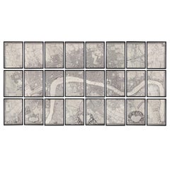
Huge John Rocque Map of London 1746, Republished By Harry Margary
View Similar Items


Want more images or videos?
Request additional images or videos from the seller
1 of 21
Huge John Rocque Map of London 1746, Republished By Harry Margary
About the Item
- Dimensions:Height: 84.06 in (213.5 cm)Width: 162.8 in (413.5 cm)Depth: 0.99 in (2.5 cm)
- Style:George II (In the Style Of)
- Materials and Techniques:
- Place of Origin:
- Period:
- Date of Manufacture:Late 20th Century
- Condition:
- Seller Location:London, GB
- Reference Number:Seller: p009121stDibs: LU984312118741
About the Seller
4.9
Vetted Seller
These experienced sellers undergo a comprehensive evaluation by our team of in-house experts.
Established in 1979
1stDibs seller since 2013
177 sales on 1stDibs
Typical response time: 2 hours
Associations
LAPADA - The Association of Arts & Antiques Dealers
More From This SellerView All
- Carved Oak Fire Surround by John MakepeaceBy John MakepeaceLocated in London, GB1970s Carved oak fire surround by John Makepeace OBE (b.1939), of naturalistic form. Opening width 117 cm x 91 cm high.Category
Vintage 1970s British Fireplaces and Mantels
MaterialsOak
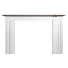
- Sir John Soane Designed White Marble FireplaceBy Sir John SoaneLocated in London, GBA Regency style white marble fireplace, to a design by Sir John Soane, the inverted breakfront shelf above frieze with a band of anthemion carved in rel...Category
21st Century and Contemporary European Regency Fireplaces and Mantels
MaterialsMarble
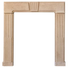
- George II Clipsham Stone Fire SurroundLocated in London, GBA George II Clipsham stone fire surround, of architectural form, the paneled header centred by fluted Keystone on stop-fluted jambs, on block feet....Category
Antique Mid-18th Century European George II Fireplaces and Mantels
MaterialsLimestone
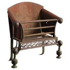
- A George II Iron and Steel Fire GrateLocated in London, GBA George II iron and steel fire grate, circa 1730, the swept and scrolled sides joined by straight wrought bars, with fine fretwork apron on baluster standards. Restoration/refinishi...Category
Antique Mid-18th Century English George II Fireplaces and Mantels
MaterialsSteel, Iron
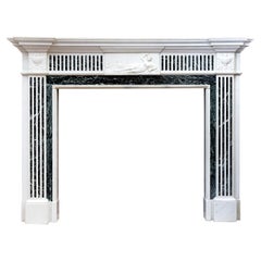
- Early 20th Century George III Style Statuary and Verde Antico ChimneypieceLocated in London, GBAn early twentieth century George III style Statuary and Verde Antico marble chimneypiece, the inverse breakfront shelf above inlaid frieze centred by relief carved frieze of the God...Category
Early 20th Century European George III Fireplaces and Mantels
MaterialsMarble
- Suite of Mahogany Entrance DoorsLocated in London, GBA set of English Mahogany entrance doors, each side with parcel-gilded fielded panels - a pair of square panels, above two long and two short, each side ...Category
Late 20th Century English Doors and Gates
MaterialsMahogany

You May Also Like
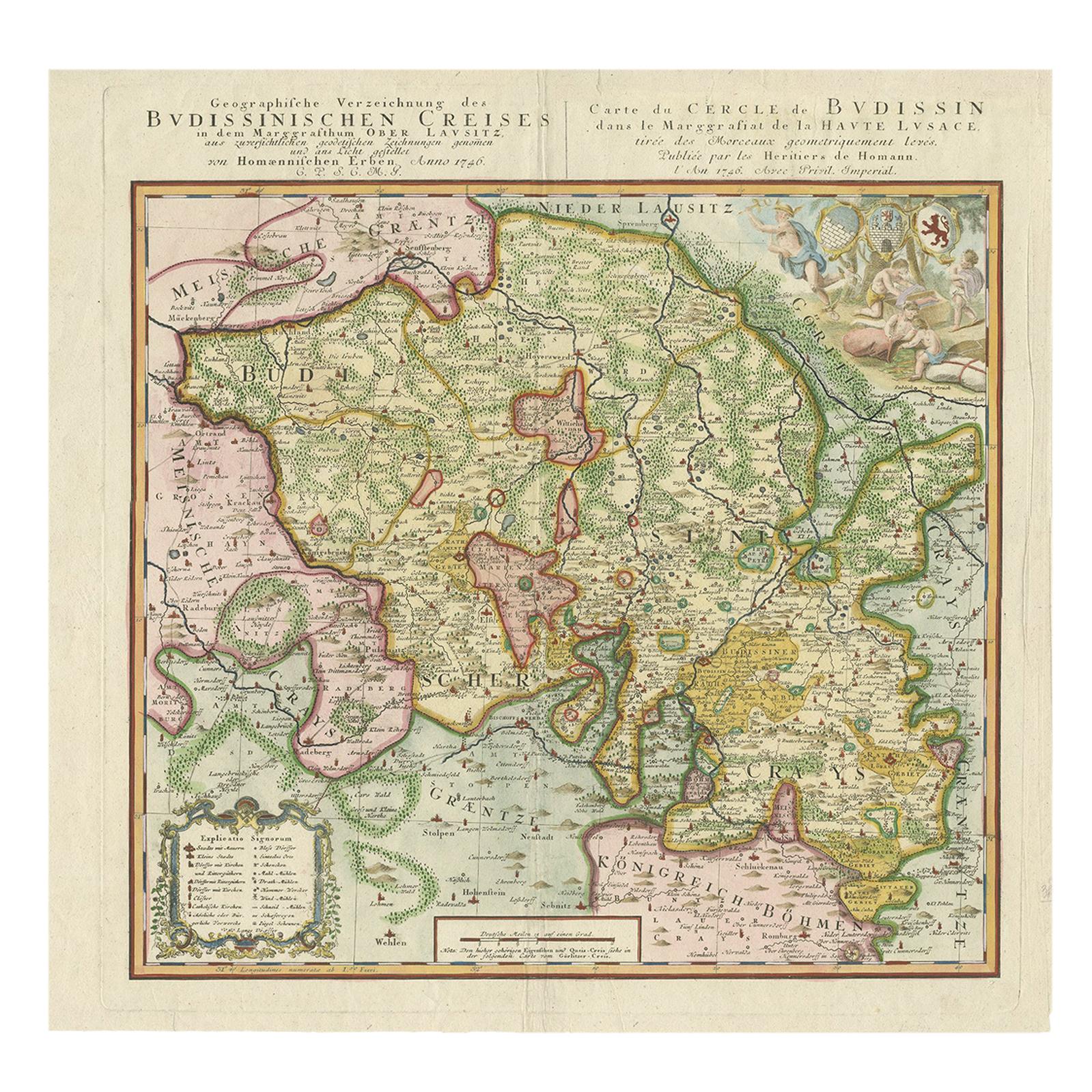
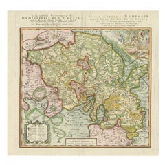
- Antique Map of Oberlausitz by Homann Erben, '1746'Located in Langweer, NLAntique map titled 'Geographische Verzeichnung des Budissinischen Creises (..) - Carte du Cercle de Budissin (..)'. Copper engraved map of Oberlausitz, a historical region of Saxony ...Category
Antique Mid-18th Century Maps
MaterialsPaper
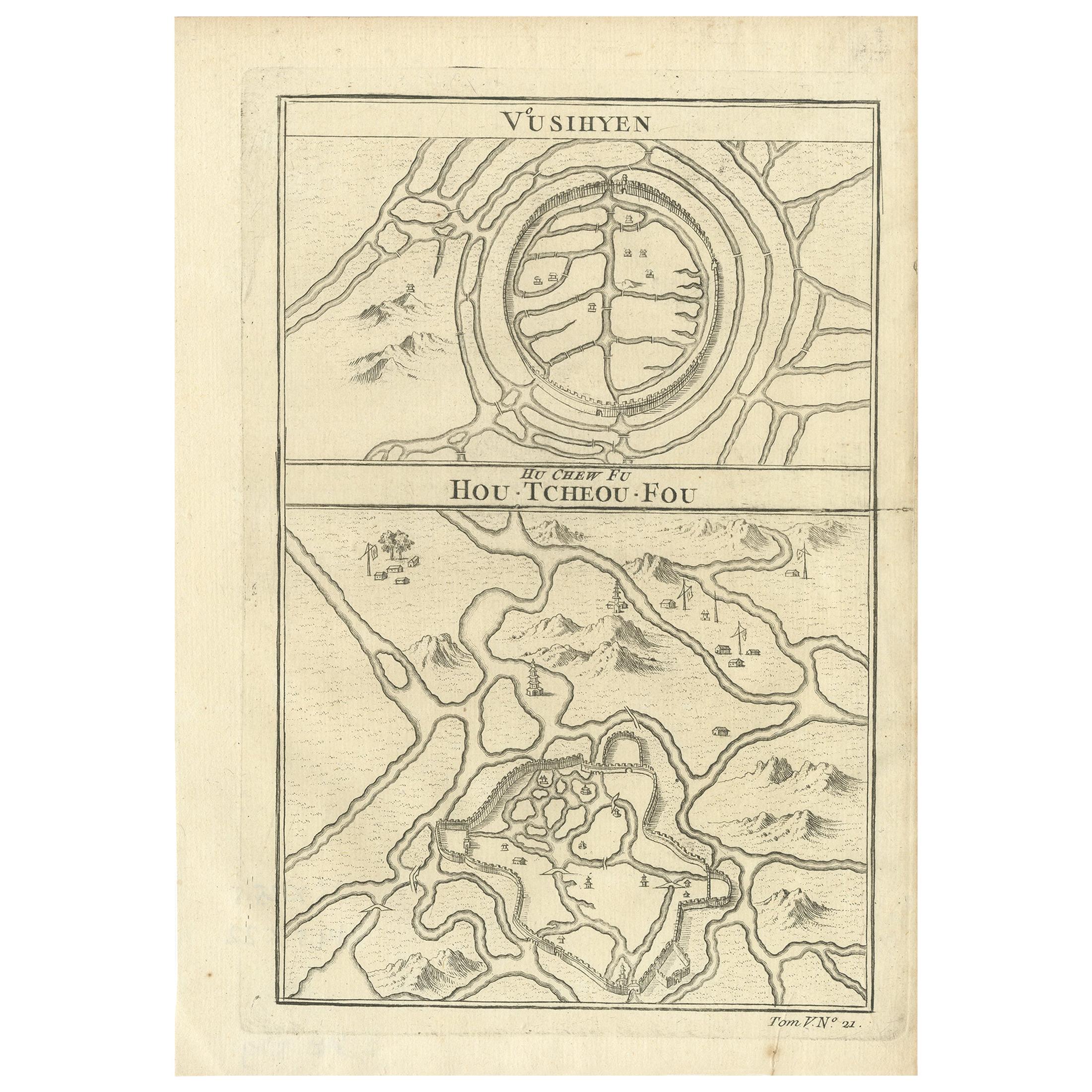
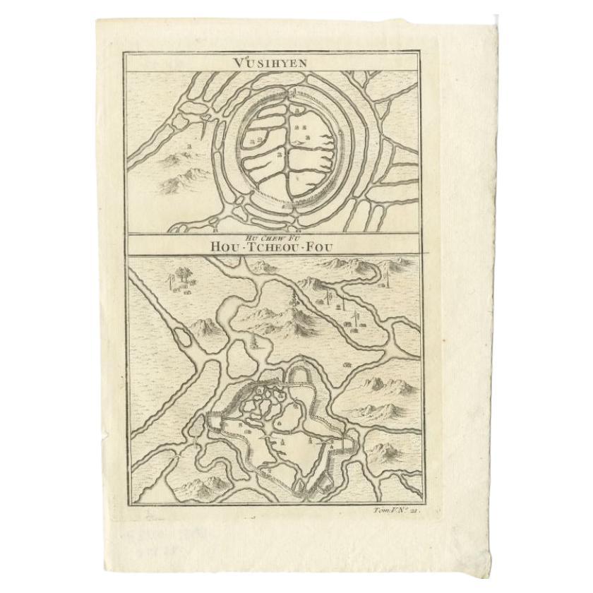
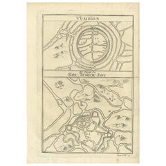
- Antique Map of Wuxi and Huzhou by Prévost '1746'Located in Langweer, NLAntique map titled 'Vusihyen. Hu Chew Fu'. Plans of Wuxi and Huzhou, China. Originates from Prévost's 'Histoire générale des voyages'.Category
Antique Mid-18th Century Maps
MaterialsPaper
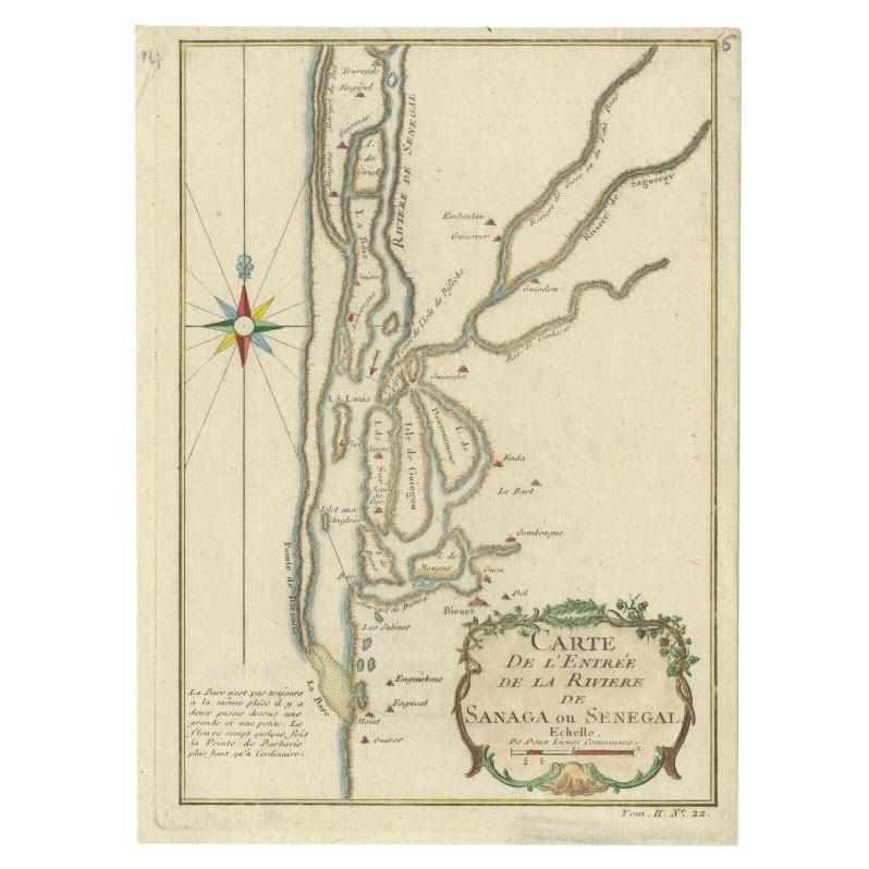
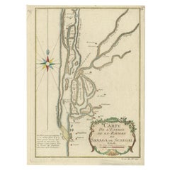
- Antique Map of The Senegal River by Bellin, 1746Located in Langweer, NLAntique map titled 'Carte de l'Entrée de la Rivière de Sanaga ou Senegal'. Map of the mouth of the Senegal River. This map originates from Prevost's 'Histoire Generale des Voyages'. ...Category
Antique 18th Century Maps
MaterialsPaper
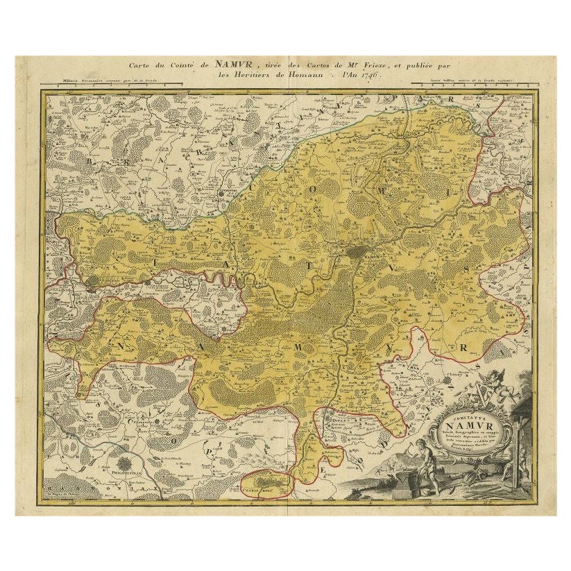
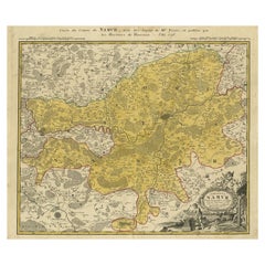
- Antique Map of the Region of Namen by Homann, 1746By Johann Baptist HomannLocated in Langweer, NLAntique map titled 'Comitatus Namur Tabula Geographica ex mappis Frixianis'. Regional map of Namen, Belgium. Artists and Engravers: Homann Heirs was a German publishing firm tha...Category
Antique 18th Century Maps
MaterialsPaper
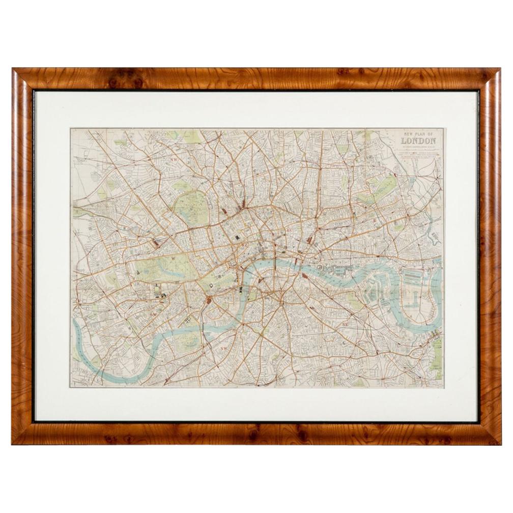
- Antique "New Plan of London" Map by John Bartholomew, 1900Located in Bridgeport, CTProduced for the W.H. Smith guide, folded in the original. The map here is unfolded and framed flat, with transportation routes shown and color details. sight 22 x 32" (original ful...Category
Antique Early 1900s English Victorian Maps
MaterialsPaper
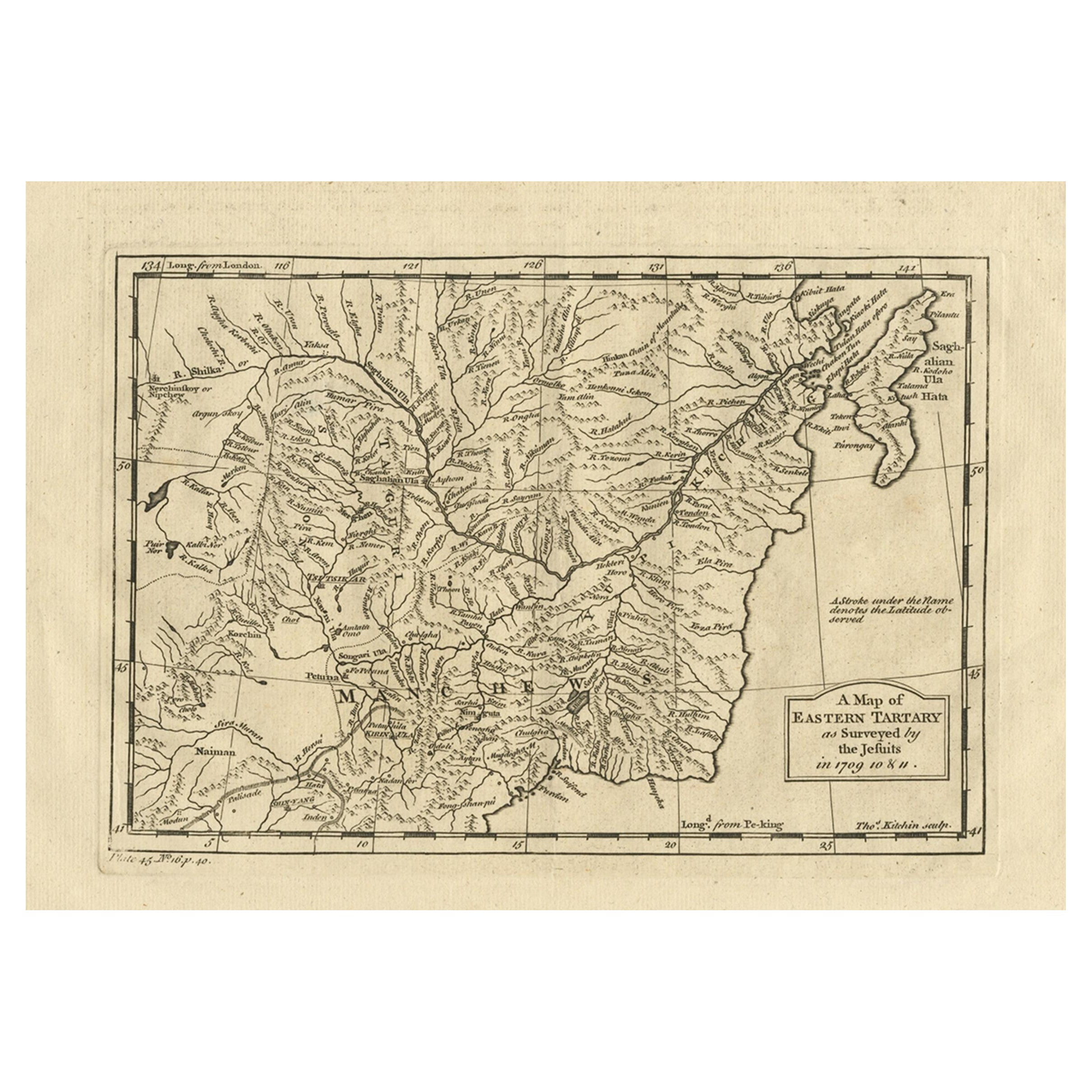
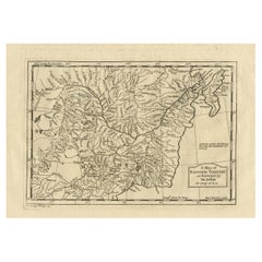
- Antique Map of Eastern Tartary as Surveyed by the Jesuits, 1746By Thomas KitchinLocated in Langweer, NLAntique map titled 'A Map of Eastern Tartary as Surveyed by the Jesuits in 1709, 10 & 11'. The map covers much of the course of the Amur River or Heilong Jiang, the world's tenth lon...Category
Antique 18th Century Maps
MaterialsPaper

Recently Viewed
View AllMore Ways To Browse
Used Church Steeples
Used Furniture New Westminster
Westminster New And Used Furniture
Used Church Steeple
Vintage Bearings
Stock Vintage Copper
Copper Printing Plate
Map Huge
George Vertue
Harry Morgan
Theodolite Used
Huge Vintage Map
Map Of France
Large Maps
Large Map
Antique German Collectibles
Original World Map
World Atlas