Items Similar to Rare Map of South America of Chili, La Plata, Paraguay, Brazil, Peru, c.1775

Want more images or videos?
Request additional images or videos from the seller
1 of 5
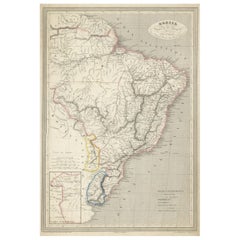
Rare Map of South America of Chili, La Plata, Paraguay, Brazil, Peru, c.1775
About the Item
Antique map titled 'South America agreeable to the most approved maps and charts'.
Rare map of South America depicting Chili, La Plata, Paraguay, Brazil, Peru, the Amazon and surroundings.
Artists and Engravers: Thomas Conder (1747 - June 1831) was an English map engraver and bookseller active in London during the late 17th and early 18th centuries.
- Dimensions:Height: 13.78 in (35 cm)Width: 16.93 in (43 cm)Depth: 0 in (0.02 mm)
- Materials and Techniques:
- Period:1770-1779
- Date of Manufacture:circa 1775
- Condition:Wear consistent with age and use. Condition: Good general age-related toning. Few marginal tears, please study image carefully.
- Seller Location:Langweer, NL
- Reference Number:
About the Seller
5.0
Platinum Seller
These expertly vetted sellers are 1stDibs' most experienced sellers and are rated highest by our customers.
Established in 2009
1stDibs seller since 2017
1,914 sales on 1stDibs
Typical response time: <1 hour
- ShippingRetrieving quote...Ships From: Langweer, Netherlands
- Return PolicyA return for this item may be initiated within 14 days of delivery.
More From This SellerView All
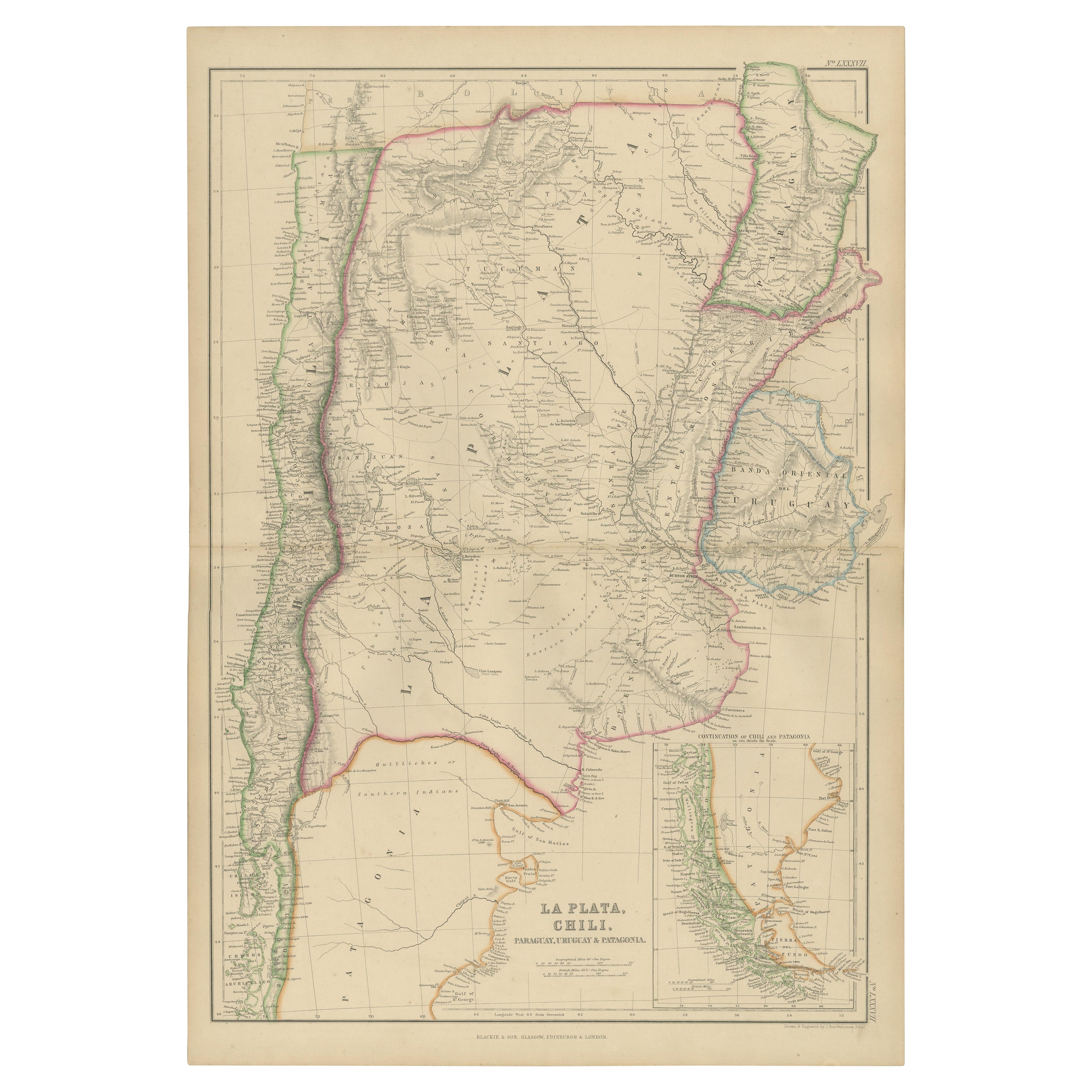
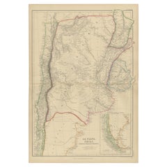
- Antique Map of La Plata, Chili, by W. G. Blackie, 1859Located in Langweer, NLAntique map titled 'La Plata, Chili, Paraguay, Uruguay and Patagonia'. Original antique map of La Plata, Chili, Paraguay, Uruguay and Patagonia with inset m...Category
Antique Mid-19th Century Maps
MaterialsPaper
- Antique Map of South America by J. Cook, 1775Located in Langweer, NLAntique map titled 'Kaart van het Zuidlyk Eind van Amerika'. Map of the sourthern part of South America, focusing on Cook's tracks around the Cape Horn and T...Category
Antique Mid-18th Century Maps
MaterialsPaper
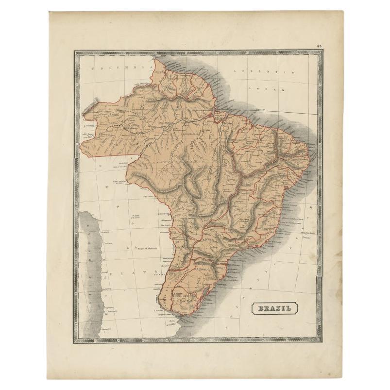
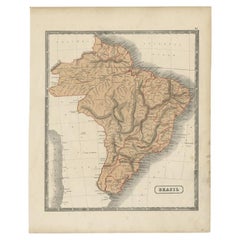
- Antique Map of Brazil, Including Part of Colombia, Peru and Chili, c.1880Located in Langweer, NLAntique map South America titled 'Brazil'. This map depicts Brazil and its surroundings including part of Colombia, Peru and Chili. Source un...Category
Antique 19th Century Maps
MaterialsPaper
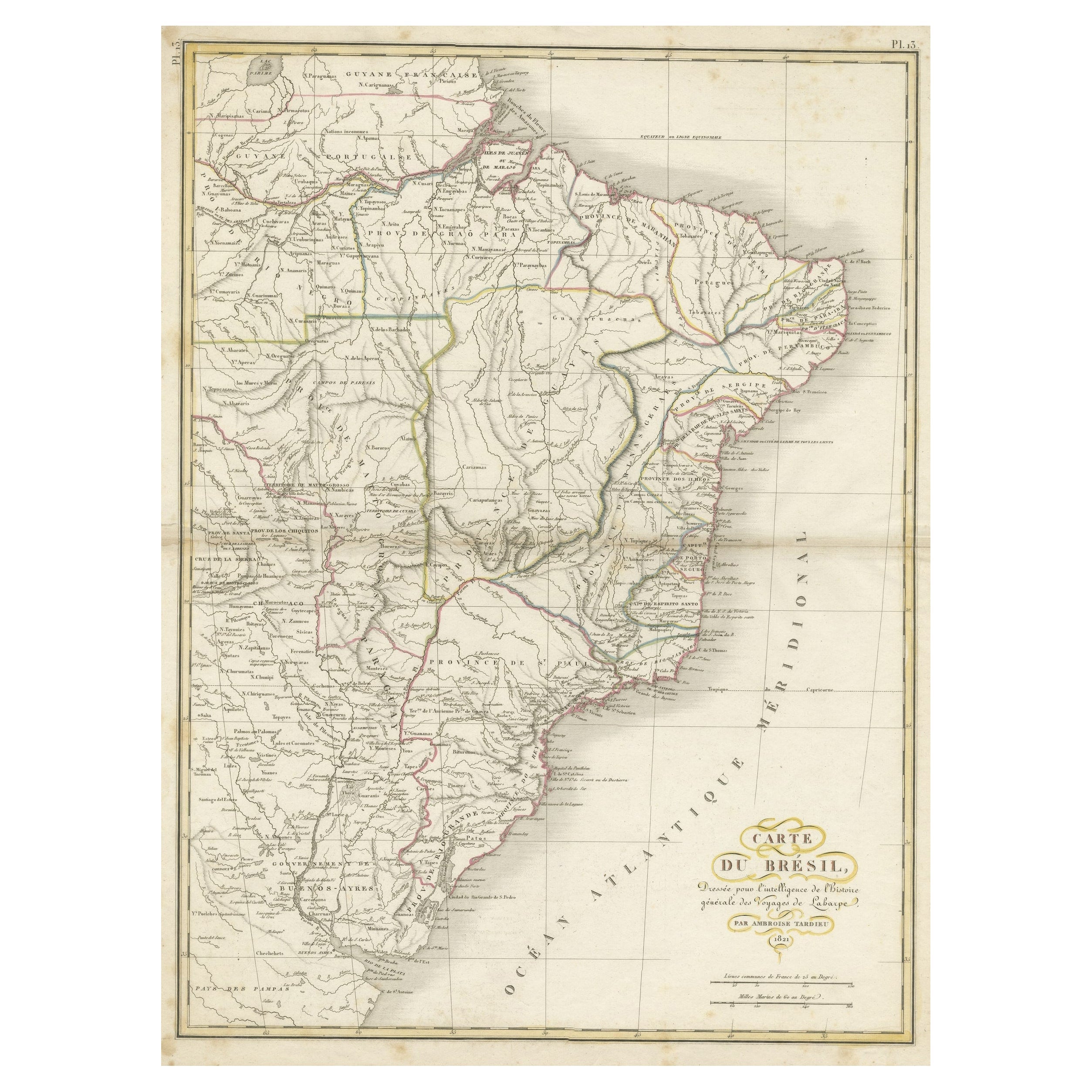
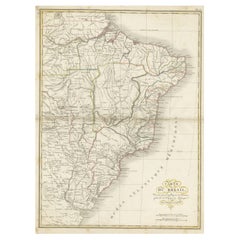
- Antique Map of Brazil Extending South to the Mouth of the Rio de la PlataLocated in Langweer, NLAntique map titled 'Carte du Brésil'. ?Beautiful map of Brazil extending south to the mouth of the Rio de la Plata and Buenos-Aires in Argentina. Published by Tardieu, 1821. Pier...Category
Antique Early 19th Century Maps
MaterialsPaper
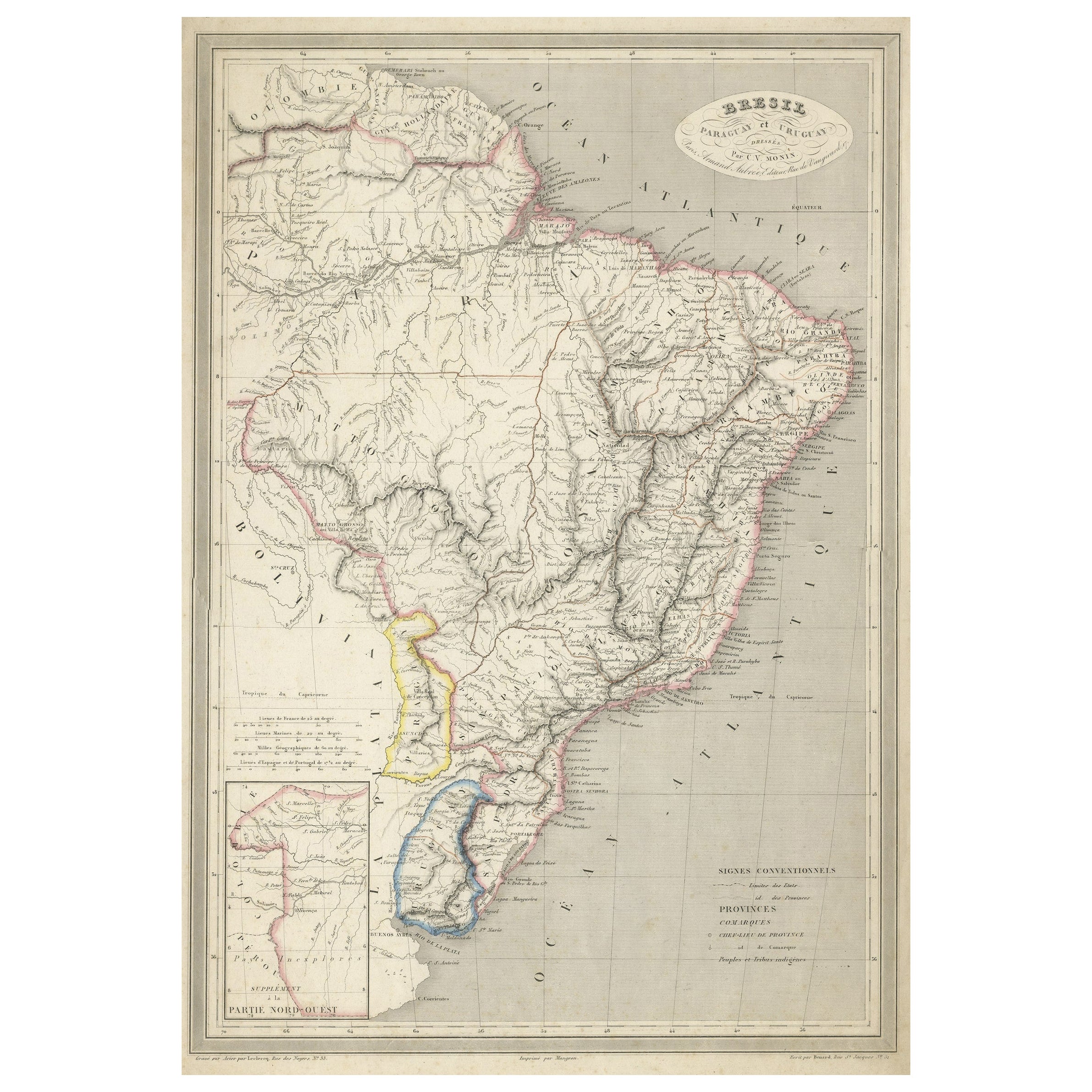
- Antique Map of of Brazil, Paraguay and UruguayLocated in Langweer, NLAntique map titled 'Bresil Paraguay et Uruguay'. Fine steel engraved map of Brazil, Paraguay and Uruguay. Engraved by Leclercq and published by Armand Aubree in "Atlas Classique et U...Category
Antique Mid-19th Century Maps
MaterialsPaper
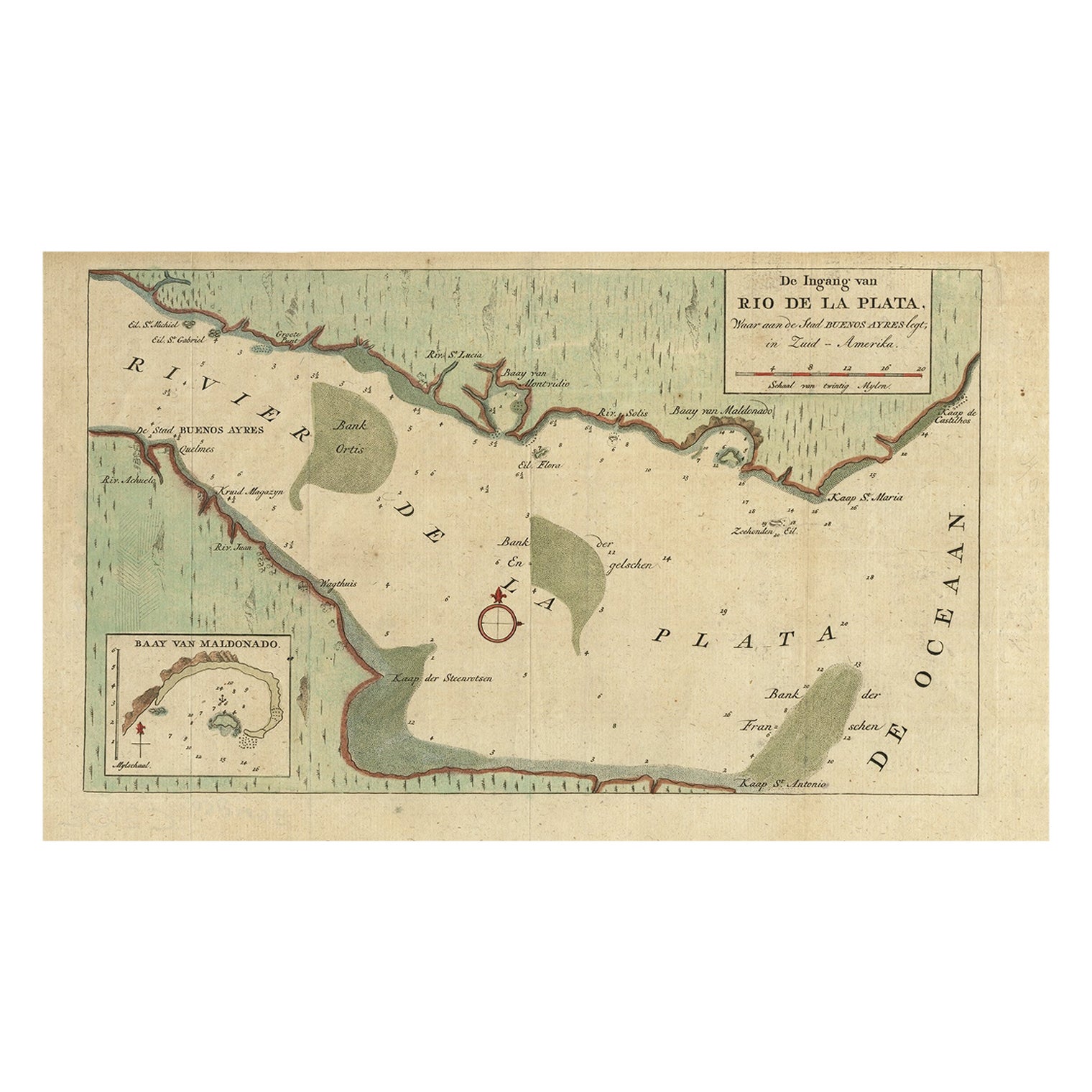
- Rare Antique Map of the Rio De La Plata, Buenos Ayres, Brazil, ca.1760Located in Langweer, NLDescription: Antique map titled 'De Ingang van Rio de la Plata, Waar aan de Stad Buenos Ayres ligt, in Zuid-Amerika'. A map showing the Rio de la Plata es...Category
Antique 1760s Maps
MaterialsPaper

You May Also Like
- Original Antique Map of South America. C.1780Located in St Annes, LancashireGreat map of South America Copper-plate engraving Published C.1780 Two small worm holes to left side of map Unframed.Category
Antique Early 1800s English Georgian Maps
MaterialsPaper
- Original Antique Map of South America, circa 1830Located in St Annes, LancashireGreat map of South America Copper plate engraving Published by Butterworth, Livesey & Co., circa 1830 Unframed.Category
Antique Early 1800s English Other Maps
MaterialsPaper
- Original Antique Map of South America by Thomas Clerk, 1817Located in St Annes, LancashireGreat map of South America Copper-plate engraving Drawn and engraved by Thomas Clerk, Edinburgh. Published by Mackenzie And Dent, 1817 Unframed.Category
Antique 1810s English Maps
MaterialsPaper
- Original Antique Map of South Africa, Arrowsmith, 1820Located in St Annes, LancashireGreat map of South Africa. Drawn under the direction of Arrowsmith. Copper-plate engraving. Published by Longman, Hurst, Rees, Orme and Br...Category
Antique 1820s English Maps
MaterialsPaper
- North & South America: A 17th Century Hand-colored Map by Jansson & GoosBy Johannes JanssoniusLocated in Alamo, CAA 17th century hand-colored map of North & South America entitled "Americae Descriptio" by the cartographer Johannes Jansson, published in Jansson's Atlas Minor in Amsterdam in 1628....Category
Antique 1620s Dutch Maps
MaterialsPaper
- South America: Hand-colored 18th Century Framed Map by Thomas JefferysBy Thomas JefferysLocated in Alamo, CAThis detailed hand-colored map of South America by Thomas Jefferys was published in London in 1750. The map shows countries, early colonial possessions, towns, rivers, mountains, and...Category
Antique Mid-18th Century English Maps
MaterialsPaper


Recently Viewed
View AllMore Ways To Browse
South America
South America Brazil
Brazilian Antiques
Brazil Antique
18th C American
17th Century American Furniture
17th And 18th Century English Furniture
18th C American Furniture
Antique Peruvian Furniture
Map South America
Map Of South America
Late 18th Century Antique American
17th C English
Antique Booksellers
Antique Bookseller
Antique Peru
Antique Furniture Peru
Peruvian Antiques