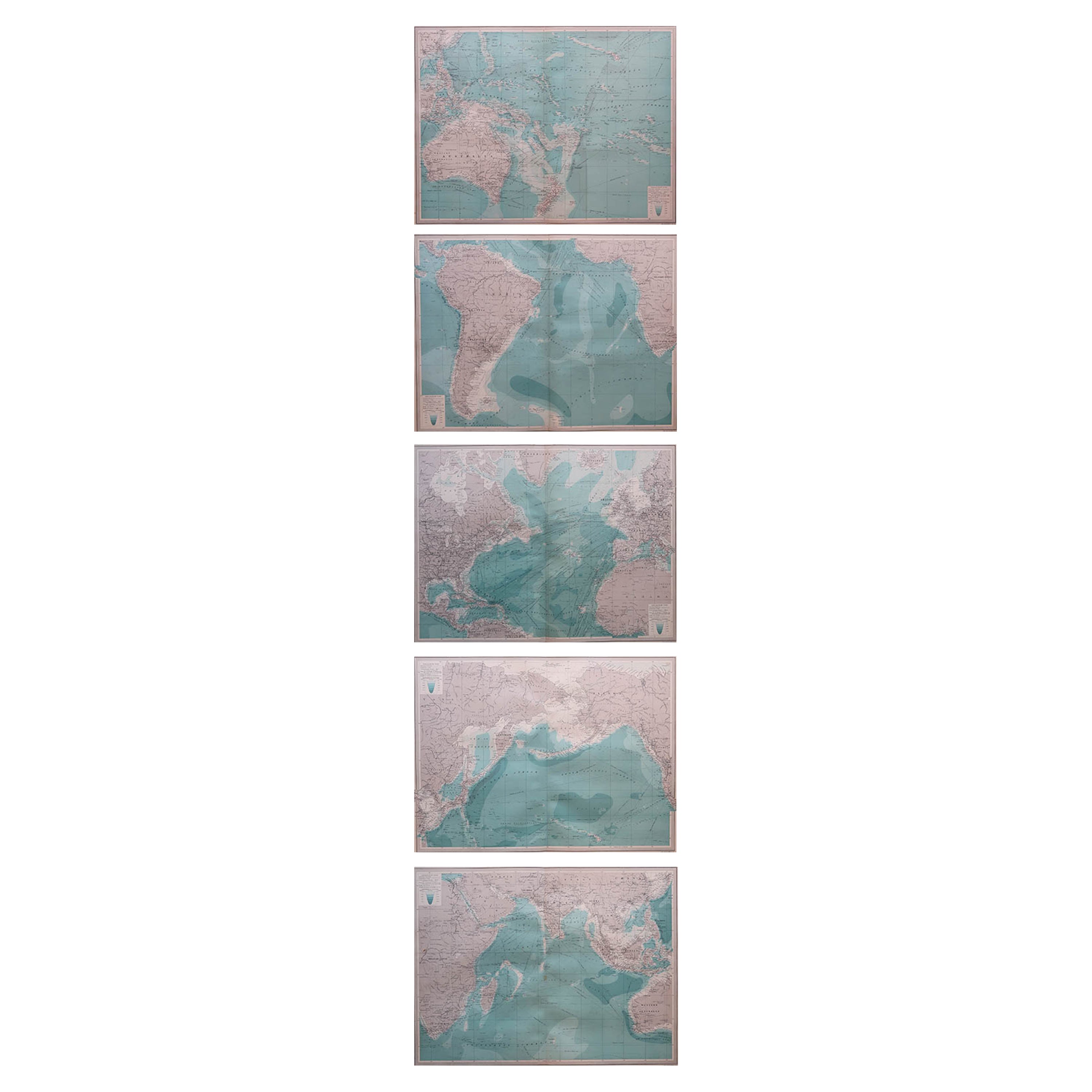
Set of 5 Large Original Vintage Sea Charts
View Similar Items


Want more images or videos?
Request additional images or videos from the seller
1 of 7
Set of 5 Large Original Vintage Sea Charts
About the Item
- Dimensions:Height: 17.5 in (44.45 cm)Width: 22.5 in (57.15 cm)Depth: 0.07 in (1.78 mm)
- Sold As:Set of 5
- Materials and Techniques:Paper,Other
- Place of Origin:
- Period:
- Date of Manufacture:1920
- Condition:Wear consistent with age and use.
- Seller Location:St Annes, GB
- Reference Number:1stDibs: LU1836323805902
About the Seller
4.9
Platinum Seller
These expertly vetted sellers are 1stDibs' most experienced sellers and are rated highest by our customers.
1stDibs seller since 2016
2,538 sales on 1stDibs
Associations
International Confederation of Art and Antique Dealers' Associations
More From This SellerView All
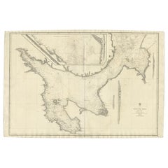
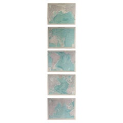
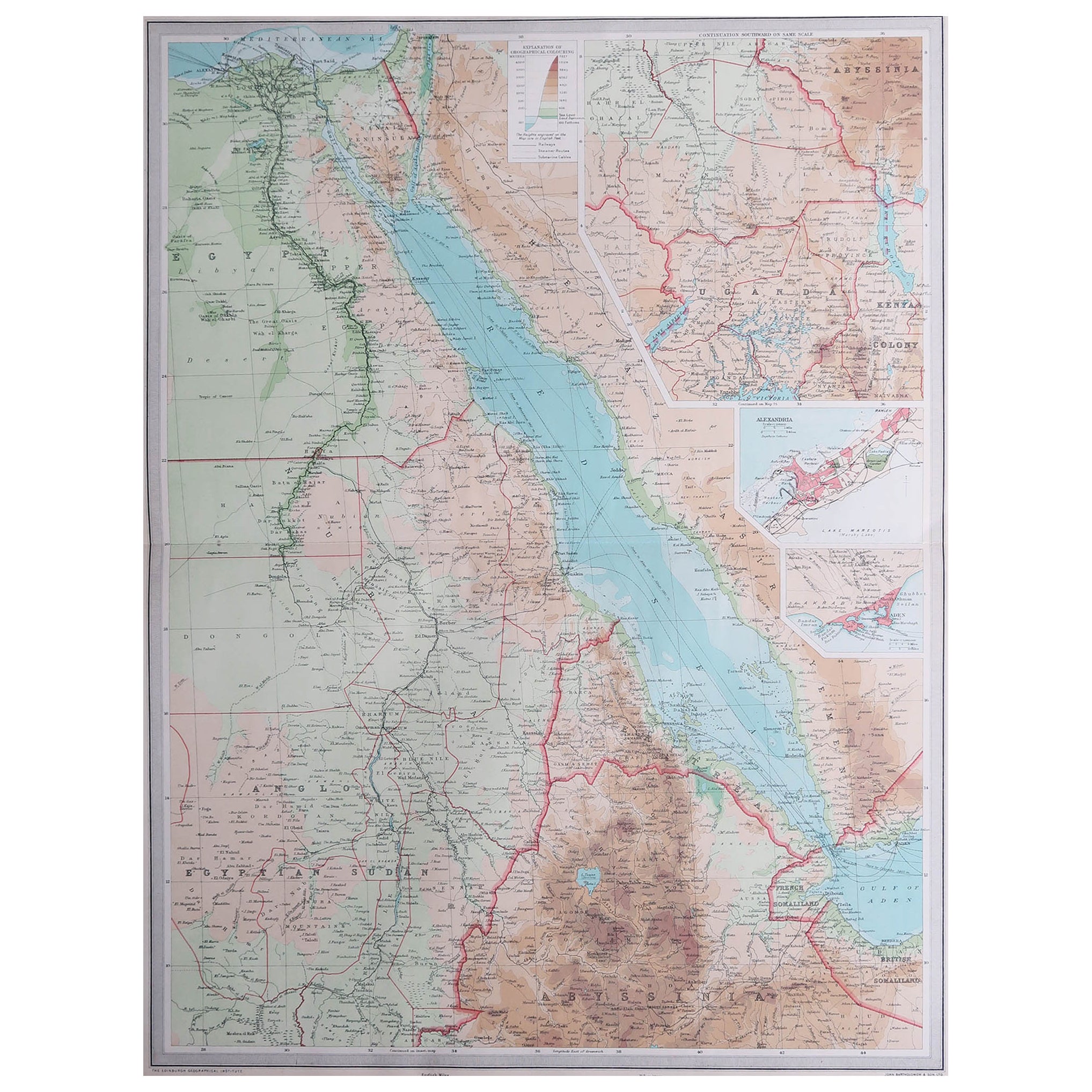
- Set of 5 Large Original Vintage Sea Charts, circa 1920Located in St Annes, Lancashire5 great maps or charts of the oceans I particularly like the color of these maps Unframed Original color By John Bartholomew and Co. Edinburgh Geographical Institute Published, ...Category
Vintage 1920s British Maps
MaterialsPaper

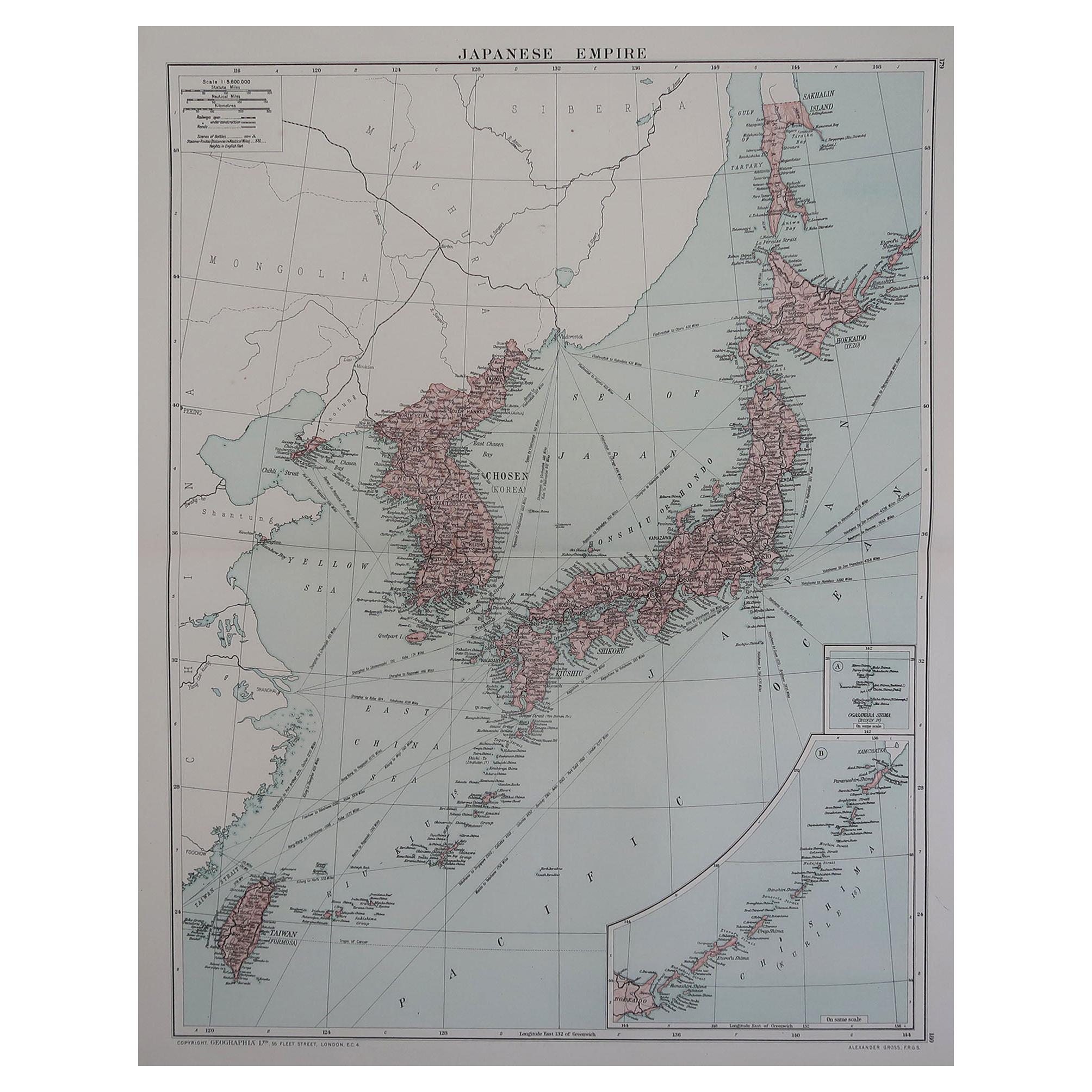
- Large Original Vintage Map of Japan, circa 1920Located in St Annes, LancashireGreat map of Japan Original color. Good condition Published by Alexander Gross Unframed.Category
Vintage 1920s English Victorian Maps
MaterialsPaper
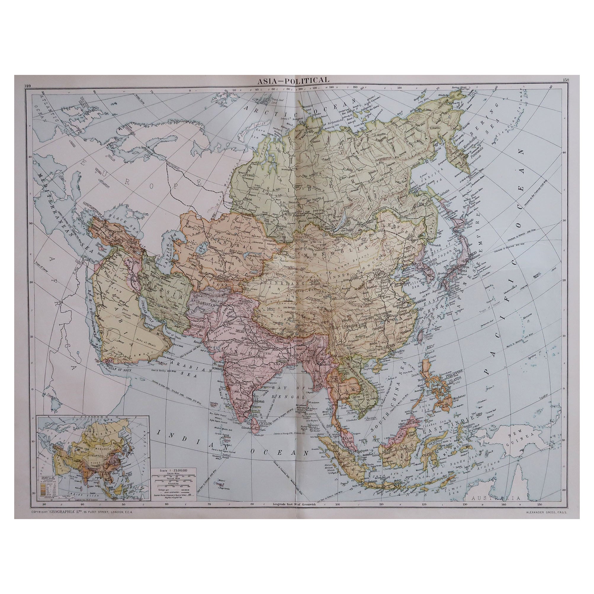
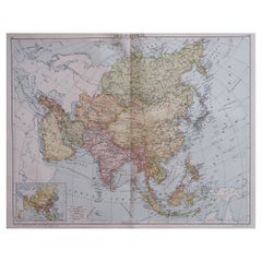
- Large Original Vintage Map of Asia, circa 1920Located in St Annes, LancashireGreat map of Asia Original color. Good condition Published by Alexander Gross Unframed.Category
Vintage 1920s English Edwardian Maps
MaterialsPaper
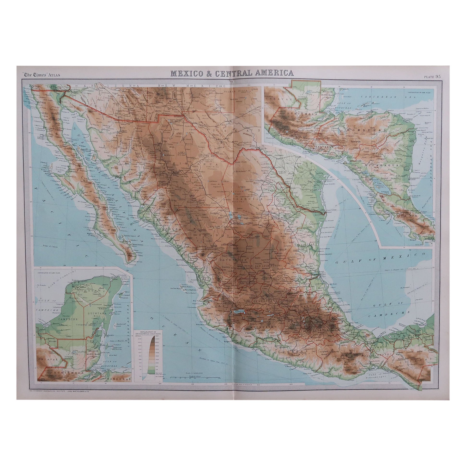
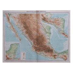
- Large Original Vintage Map of Mexico, circa 1920Located in St Annes, LancashireGreat maps of Mexico. Unframed. Original color. By John Bartholomew and Co. Edinburgh Geographical Institute. Published, circa 1920. Free shipping.Category
Vintage 1920s British Maps
MaterialsPaper
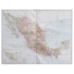
- Large Original Vintage Map of Mexico, circa 1920Located in St Annes, LancashireGreat map of Mexico Original color. Good condition Published by Alexander Gross Unframed.Category
Vintage 1920s English Edwardian Maps
MaterialsPaper
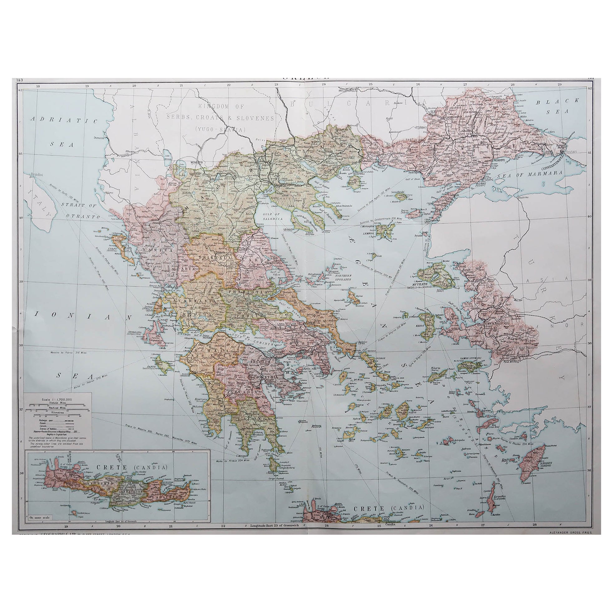
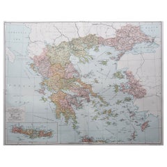
- Large Original Vintage Map of Greece, circa 1920Located in St Annes, LancashireGreat map of Greece Original color. Good condition Published by Alexander Gross Unframed.Category
Vintage 1920s English Maps
MaterialsPaper
You May Also Like
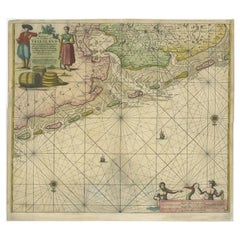
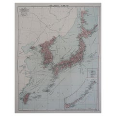
- Old Decorative & Highly Detailed Sea Chart of the North Dutch-German Coast, 1681Located in Langweer, NLAntique map titled 'Paskaart van een gedeelte van Vriesland, Groeninger, en Emderland. Met zyn onderhoorige Eylanden; Strekkende van't Eylant der Schelling'. Decorative and highl...Category
Antique 1680s Maps
MaterialsPaper
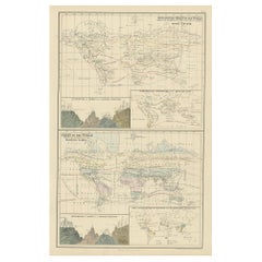
- Antique Zoological Chart of the World, 1854Located in Langweer, NLAntique map titled 'Zoological Chart of the World'. Total of six maps and insets. Insets of the distribution of Animals in a vertical direction, Chart o...Category
Antique 19th Century Maps
MaterialsPaper
- Large Sea Chart of the British Islands, 1918Located in Langweer, NLAntique map titled 'The British Islands'. Large sea chart of the British Islands. It shows Ireland, Scotland, England, the Shetland Islands and part of Fra...Category
Vintage 1910s Maps
MaterialsPaper
 $489 Sale Price20% Off
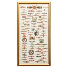
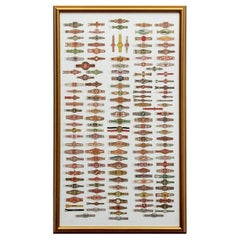
 - Framed Large Collection Of Vintage Cigar BandsLocated in Bridgeport, CTVarious brands including one with a collie, one with a horse, an eagle (Turkish), cows (Turkish), birds (Egyptian Deities, and others). A large one at top for La Reclama, Havana Ciga...Category
20th Century Hollywood Regency Tobacco Accessories
MaterialsLinen, Wood, Paper, Glass
- Large Collection Of Framed Vintage Cigar BandsLocated in Bridgeport, CTMulticolored and gilt bands of different types. Including some Egyptian, Habana and Turkish (upper right ones with a steam ship and a river landscape). Mounted on white linen in a gi...Category
20th Century Tobacco Accessories
MaterialsWood, Paper, Glass, Linen
- Large Antique Chart of The White Sea, Russa 1854Located in Langweer, NLAntique map titled 'The White Sea Index Chart'. Large uncommon map of the White Sea with a smaller inset map of the entrance to the White Sea. The white sea is a southern inlet of th...Category
Antique 19th Century Maps
MaterialsPaper