Items Similar to Vintage Swedish School Map of Europe, Large, Made in Sweden, 1905


Want more images or videos?
Request additional images or videos from the seller
1 of 12
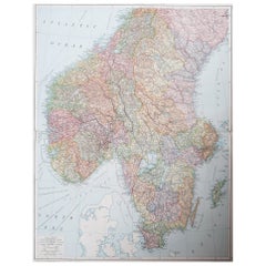
Vintage Swedish School Map of Europe, Large, Made in Sweden, 1905
About the Item
Vintage Swedish School Map of Europe - LARGE - Made in Sweden, 1905
This vintage Swedish school map is so unique and a great example of why these are so collectible.
Wooden poles at the top and bottom of this linen fabric with printed paper attached.
Comes with expected use wear and age one would expect from a piece with usage and considering the materials.
- Dimensions:Height: 63 in (160.02 cm)Width: 62 in (157.48 cm)Depth: 1 in (2.54 cm)
- Materials and Techniques:
- Place of Origin:
- Period:1900-1909
- Date of Manufacture:1905
- Condition:Wear consistent with age and use.
- Seller Location:Los Angeles, CA
- Reference Number:1stDibs: LU5468228269212
About the Seller
5.0
Platinum Seller
These expertly vetted sellers are 1stDibs' most experienced sellers and are rated highest by our customers.
Established in 2017
1stDibs seller since 2020
88 sales on 1stDibs
Typical response time: 1 hour
- ShippingRetrieving quote...Ships From: Los Angeles, CA
- Return PolicyA return for this item may be initiated within 3 days of delivery.
More From This SellerView All
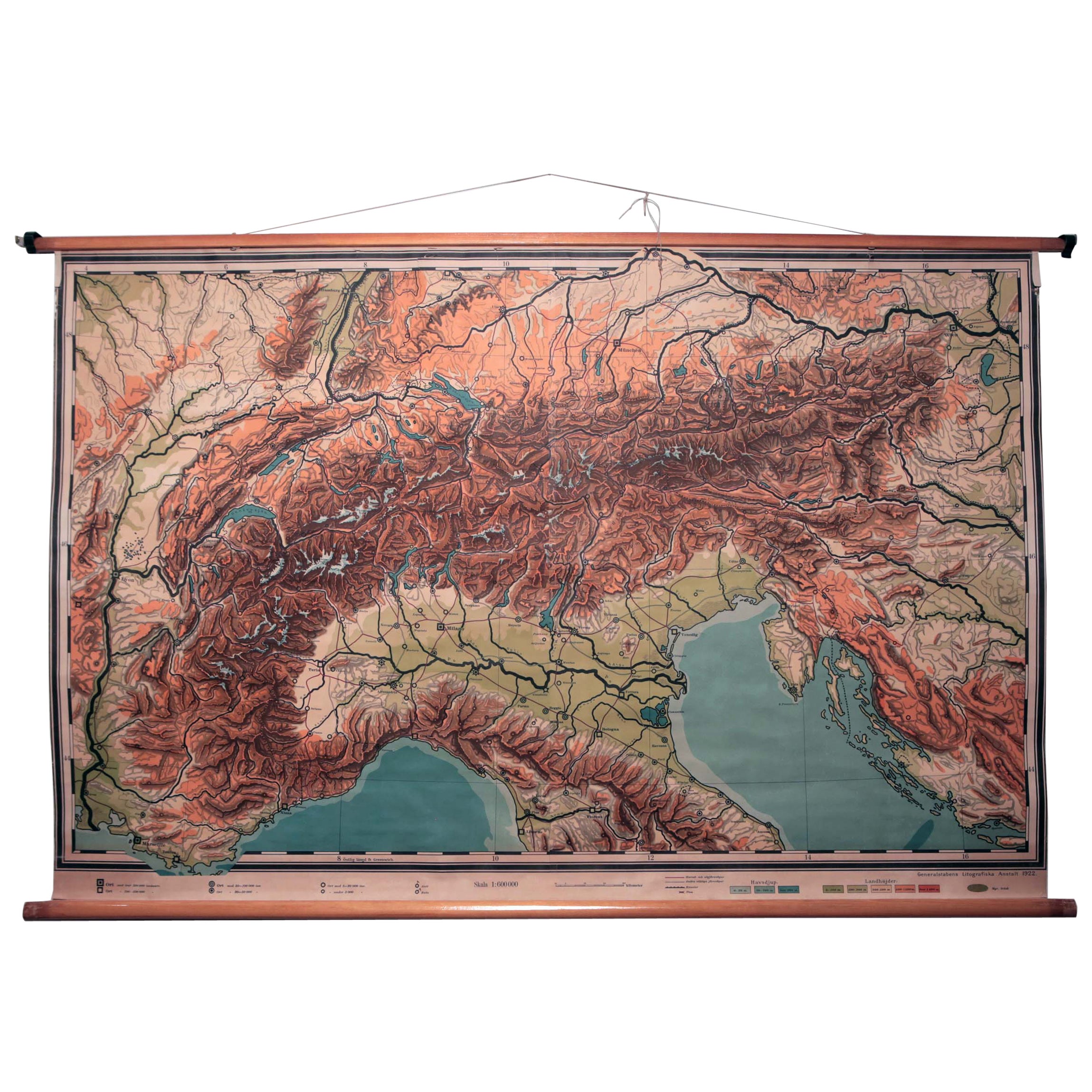
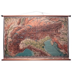
- Vintage Swedish Topographic School Map of European Alps, Made in Sweden 1922Located in Los Angeles, CAVintage Swedish Topographic School map of European Alps, Made in Sweden 1922 This vintage Swedish school map is so unique and a great example of why these are so collectible. W...Category
Vintage 1920s Swedish Maps
MaterialsLinen, Wood, Paper
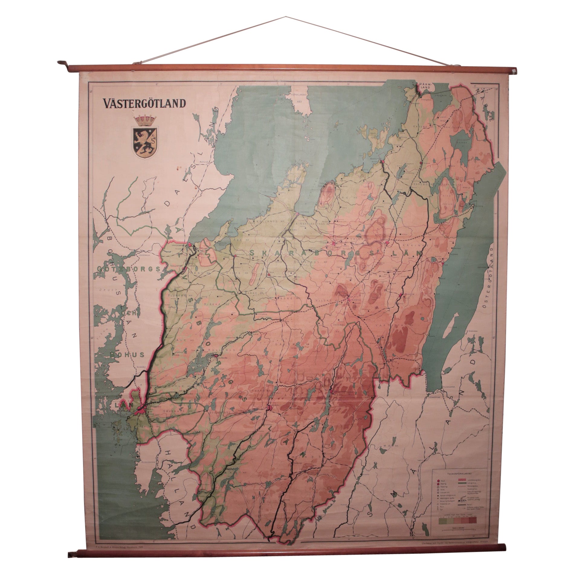
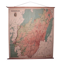
- Vintage Swedish School Map of Vastergötland, Made in Sweden 1920Located in Los Angeles, CAVintage Swedish School Map of Vastergötland, Made in Sweden 1920 Västergötland also known as West Gothland or the Latinized version Westrogothia in older literature, is one of the...Category
Vintage 1920s Swedish Maps
MaterialsLinen, Wood, Paper
- Large Vintage Swedish Flat-Weave Carpet, Sweden, 1960'sLocated in Los Angeles, CALarge vintage Swedish flat-weave carpet - Sweden 1960's Measures: 121.5" x 78.7".Category
Mid-20th Century Swedish Scandinavian Modern Russian and Scandinavian Rugs
MaterialsWool
- Vintage Double Sided Swedish Flat-Weave Carpet, Sweden, 1960'sLocated in Los Angeles, CAVintage double sided Swedish flat-weave carpet, Sweden, 1960's Measures: 146 x 192 cm.Category
Mid-20th Century Swedish Scandinavian Modern Russian and Scandinavian Rugs
MaterialsWool
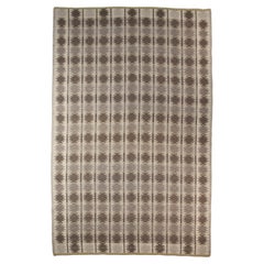
- Agda Österberg Large Flat-Weave Rug No. 210 Signed "AÖ" Sweden 1961By Agda ÖsterbergLocated in Los Angeles, CAAgda Österberg Large Flat-Weave Rug No. 210 Signed "AÖ" Sweden 1961 - 300x210cm This large and unique original piece of textile art by Agda Osterberg w...Category
Mid-20th Century Swedish Scandinavian Modern Russian and Scandinavian Rugs
MaterialsWool
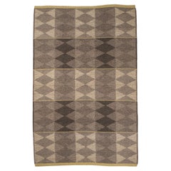
- Erik Lundberg Large "Korall" Flat-Weave Rug, Sweden, 1960s - 302cm x 200cmBy Erik LundbergLocated in Los Angeles, CAErik Lundberg Large "Korall" Flat-Weave Rug, Sweden, 1960s - 302cm x 200cm This huge ((9'11" x 6'6" feet)) and unique geometrically forward design by Erik Lundberg is a Stand out of...Category
Mid-20th Century Swedish Mid-Century Modern Russian and Scandinavian Rugs
MaterialsWool, Linen
You May Also Like
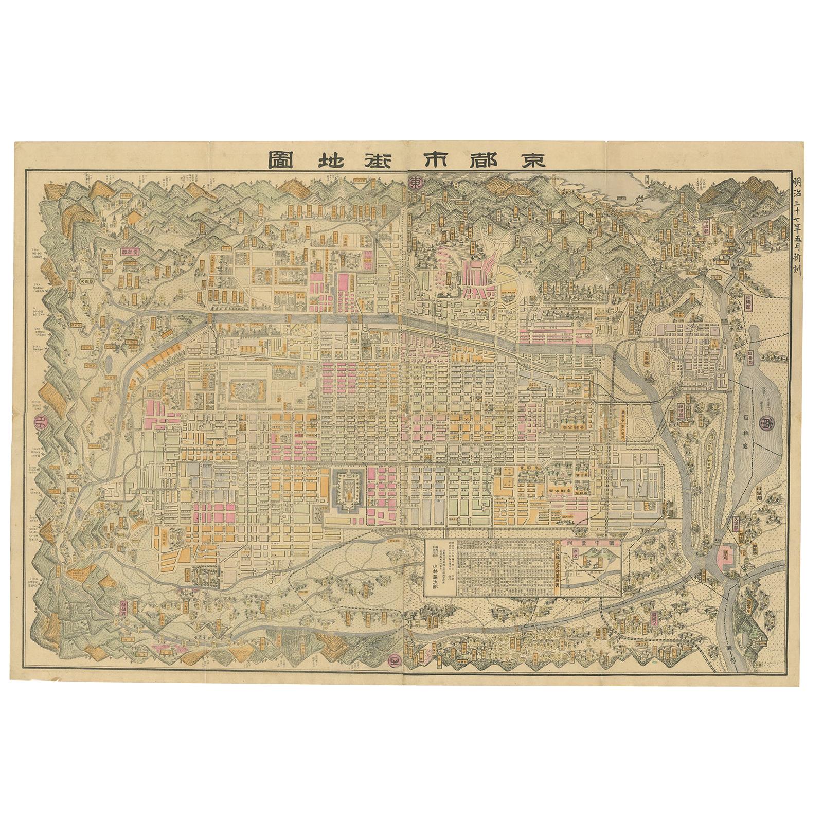
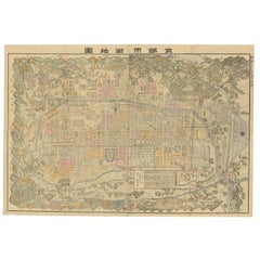
- Large Antique Map of Kyoto in Japan by Kobayashi, '1905'Located in Langweer, NLOld map of Kyoto, Japan. Published by Kobayashi, 1905.Category
Early 20th Century Maps
MaterialsPaper
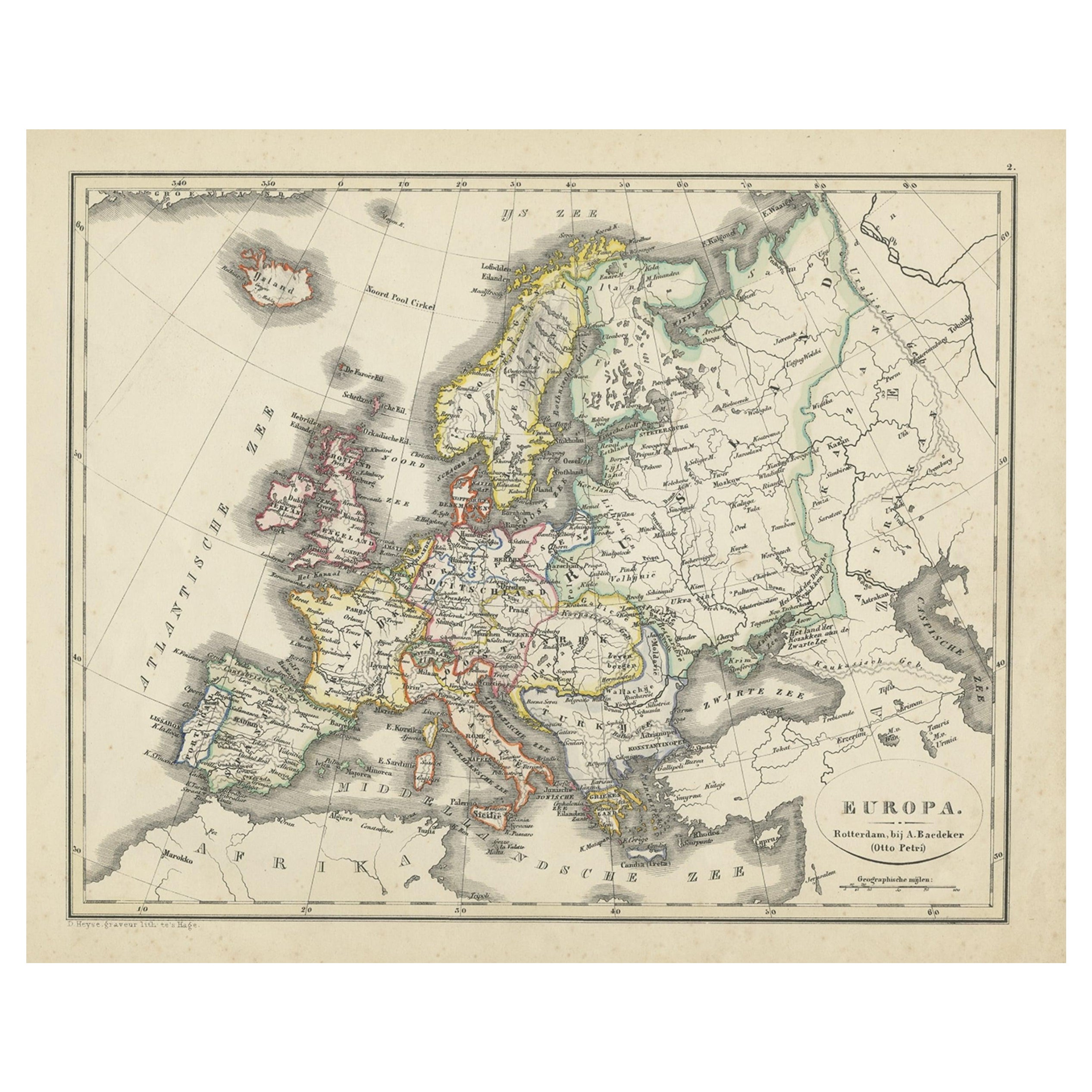
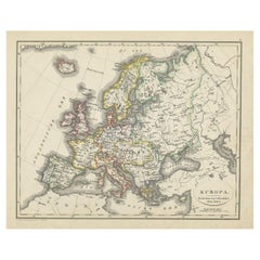
- Antique Map of Europe from an Old Dutch School-Atlas, 1852Located in Langweer, NLAntique map titled 'Europa'. Map of Europe. This map originates from 'School-Atlas van alle deelen der Aarde' by Otto Petri. Artists and Engravers: Published by A. Baedeker (Otto...Category
Antique 19th Century Maps
MaterialsPaper
- Antique Map of Russia in Europe, 1842Located in Langweer, NLAntique map titled 'Carte de la Russie d'Europe'. Map of Russia in Europe. This map originates from 'Atlas universel de géographie ancienne et moderne (....Category
Antique 19th Century Maps
MaterialsPaper
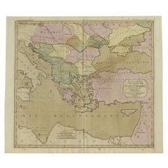
- Antique Map of Turkey in Europe, c.1780Located in Langweer, NLAntique map titled 'Bowles's new pocket map of Turky in Europe divided into its Provinces'. Large map of Turkey in Europe. Source unknown, to be determined. Artists and Engravers: Made by 'Thomas & Carington Bowles' after an anonymous artist. Thomas Bowles, born around 1712, was map publisher and seller in London...Category
Antique 18th Century Maps
MaterialsPaper
- Large Original Vintage Map of Sweden and Norway circa 1920Located in St Annes, LancashireGreat map of Sweden and Norway Original color. Good condition Published by Alexander Gross Unframed.Category
Vintage 1920s English Victorian Maps
MaterialsPaper
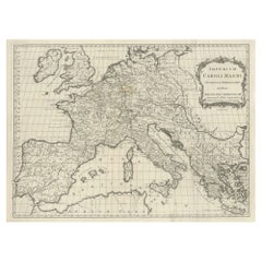
- Large Antique Map of Europe, Showing the Empire of CharlemagneLocated in Langweer, NLAntique map titled 'Imperium Caroli Magni (..)'. Large antique map of Europe, showing the Empire of Charlemagne in the 8th Century. Engraved by T. Kitchin. Published J. Blair, circa ...Category
Antique Late 18th Century Maps
MaterialsPaper

Recently Viewed
View AllMore Ways To Browse
Vintage Swedish Furniture
Vintage Sweden
Vintage Swedish
Vintage School Furniture
Antique Linen Fabric
Antique Vintage Linens
Vintage Sweden Fabric
European Antique Fabrics
Vintage Swedish Fabric
Antique European Linens
Large Vintage Maps
Large Vintage Map
Map Of Sweden
Antique Linen Map
Map Sweden
Sweden Antique Map
Antique Map Fabric
Large Antique Compass