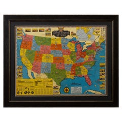
Map of United States, World War II Vintage Pictorial Map, circa 1943
View Similar Items


Want more images or videos?
Request additional images or videos from the seller
1 of 5
Map of United States, World War II Vintage Pictorial Map, circa 1943
About the Item
- Dimensions:Height: 33 in (83.82 cm)Width: 26.5 in (67.31 cm)Depth: 1 in (2.54 cm)
- Materials and Techniques:
- Place of Origin:Canada
- Period:
- Date of Manufacture:1943
- Condition:Wear consistent with age and use.
- Seller Location:Colorado Springs, CO
- Reference Number:Seller: M2531stDibs: LU909711815623
About the Seller
4.9
Platinum Seller
These expertly vetted sellers are 1stDibs' most experienced sellers and are rated highest by our customers.
Established in 2010
1stDibs seller since 2011
400 sales on 1stDibs
More From This SellerView All
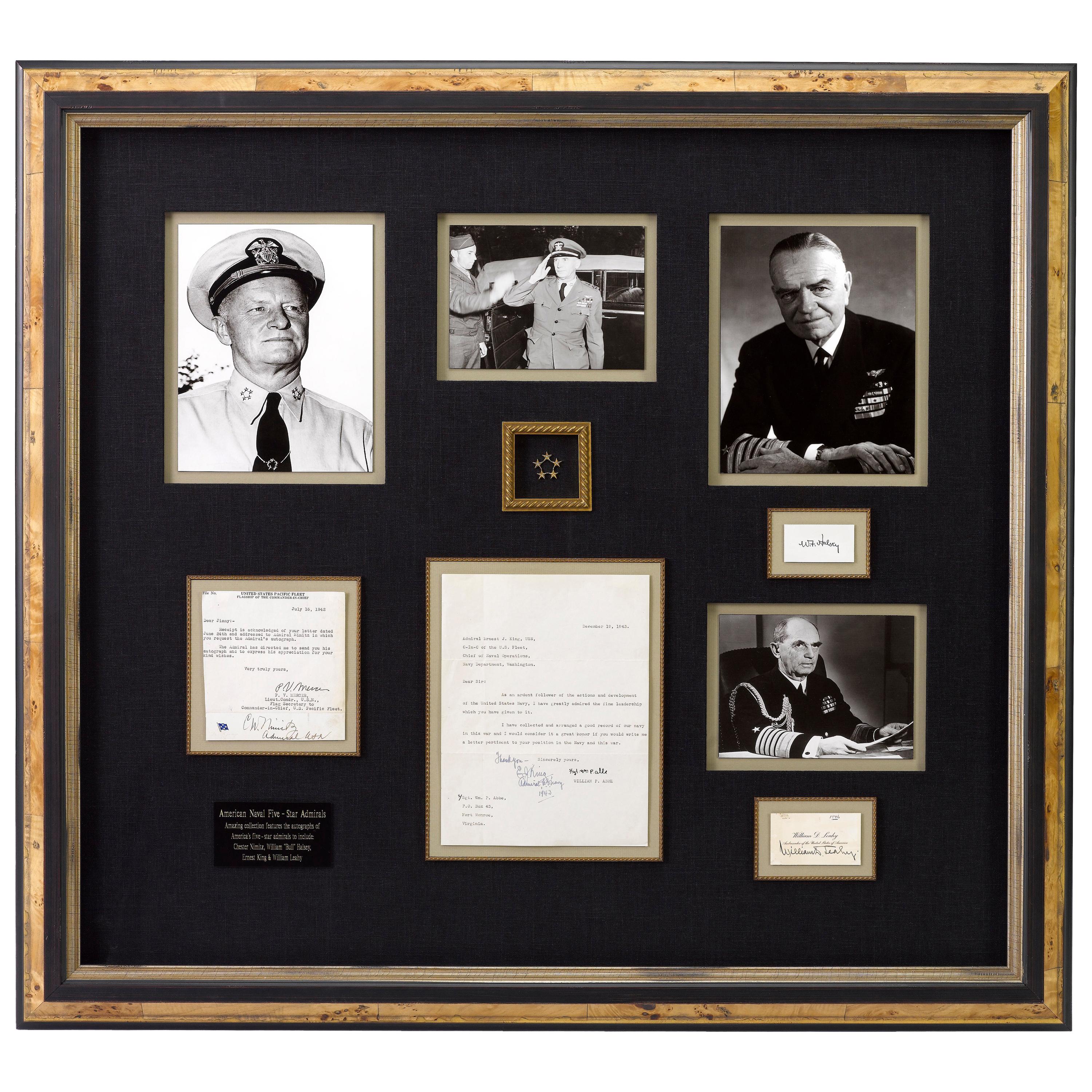
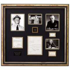
- Navy Five-Star Admirals Signatures, United States World War IILocated in Colorado Springs, COThis amazing piece of U.S. Naval history features signed items from all four World War II Navy Admirals to ever wear the five-star rank. All are cons...Category
Mid-20th Century American Historical Memorabilia
MaterialsPaper
- 1859 "Map of the United States of America..." by J. H. ColtonBy J.H. ColtonLocated in Colorado Springs, COPresented is an 1859 “Map of the United States of America, the British Provinces, Mexico, the West Indies and Central America with Part of...Category
Antique 1850s American Maps
MaterialsPaper
- 1847 Ornamental Map of the United States & Mexico by H. PhelpsLocated in Colorado Springs, COOffered is an original 1847 ornamental map of the U.S. entitled "Ornamental Map of the United States & Mexico" by Humphrey Phelps. The map was issued as an act of Congress by Phelps on Fulton Street, New York. The broadside is elaborately hand-colored. This is a very detailed and graphic propaganda map of the United States expressing U.S. dominance of the North American continent. The hand-colored map proclaims the Manifest Destiny, with the recent acquisition of Upper California and Texas at the conclusion of the Mexican-American War. The newly acquired land is boldly colored, standing in stark contrast to the rest of the U.S. The map details a potential route for a railroad running from New York City, to Buffalo, to Chicago, then west along the Oregon Trail to Oregon City. This route anticipates the construction of the transcontinental railroad by nearly 20 years. The map includes elaborately detailed renderings of George Washington, Hernan Cortez, and Montezuma at top to represent European expansion to the Americas. At bottom are four inset designs with text showing the following: a chronological history of the U.S. beginning from settlement to the U.S. victory in the Mexican-American war; an illustration of General Zachary Taylor with details on the Oregon Territory; an illustration of the Aztec Temple of the Sun in Tenochtitlan and a chronology of the Conquest of the Aztec Empire under Cortez; a portrait of General Antonio Lopez de Santa Anna...Category
Antique 1840s American Maps
MaterialsPaper
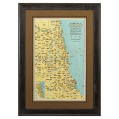
- Pictorial Map of Chicago, circa 1926Located in Colorado Springs, COThis is a colorful folding pocket map of the city of Chicago, published by The Clason Map Co., circa 1926. This highly decorative, double sided map features "Pictorial Map of Chicago...Category
Vintage 1920s American Maps
MaterialsPaper
- 1866 Ensign & Bridgman's Rail Road Map of the United StatesLocated in Colorado Springs, COPresented is an 1866 issue of “Ensign & Bridgeman’s Rail Road Map of the United States, showing Depots & Stations.” First published in 1856, this is the third edition, following anot...Category
Antique 1860s American Late Victorian Maps
MaterialsPaper
- 1812 United States Map, by Pierre Tardieu, Antique French Map Depicting the U.S.By Pierre François TardieuLocated in Colorado Springs, CO1812 "United States of Nth America -- Carte des Etats-Unis De L'Amerique Septentrionale" Two-Sheet Map by Tardieu This attractive map, published in Paris in 1812, is one of the most rare large format maps from the period. It features a view of the East Coast of the U.S. from Maryland to just below South Carolina. Additionally, Ellicott’s plan for the City of Washington D.C. is included at the top right and an illustration of Niagara Falls is shown at the bottom right with a description in both French and English. This extremely detailed map not only depicts the mountainous regions of the southeastern U.S., but also includes names of regions, rivers, and towns. Based on the first state of Arrowsmith’s 4-sheet map of the United States, this map is completely engraved by Tardieu in Paris and showcases high quality engravings. This detailed map of the recently independent United States includes one of the largest and earliest examples of the Ellicott plan of Washington DC. The artist, Pierre François Tardieu (PF Tardieu) was a very well-known map engraver, geographer, and illustrator. Awarded a bronze medal by King Louis-Phillipe for the accuracy and beauty of his map-making, Tardieu produced many fine works including maps of Louisiana...Category
Antique 1810s French Maps
MaterialsPaper


You May Also Like
- Old Decorative Pictorial Map of the United States, circa 1953Located in Langweer, NLAntique map titled 'A Pictorial Map of the United States of America Showing Principal Regional Resources, Products, and Natural Features'. This information-packed map was create by the General Drafting Company for the New Jersey Bell Telephone Company. The main map features over 700 drawings in full color including points of interest, natural resources, and agricultural products. At bottom are inset maps showing railroad lines, air routes, telephone lines, as well as a pictorial map of New Jersey...Category
20th Century Maps
MaterialsPaper
 $614 Sale Price24% Off
 - Vintage Framed United States MapLocated in New York, NYVintage aged paper map of the United States mounted on particle board and framed in a simple wooden frame.Category
20th Century American Mid-Century Modern Maps
MaterialsWood, Paper
- Small Map of the United StatesLocated in Langweer, NLAntique map titled 'Amérique septe. Physique'. Small map of the United States. lithographed by C. Callewaert brothers in Brussels circa 1870.Category
Antique Mid-19th Century Maps
MaterialsPaper
- Antique Map Colton's United States of AmericaLocated in Langweer, NLAntique map titled 'Colton's United States of America'. Show railroads, canals, state capitals, major cities and towns, military posts, historic trails, Pony Express and U.S. mail routes; Dakota [Territory] extending deep into Nebraska, and Idaho [Territory] encompassing [modern day] Montana and Wyoming; Indian Territory...Category
Antique Mid-19th Century Maps
MaterialsPaper
- Original Antique Map of The United States of America, circa 1890Located in St Annes, LancashireGreat map of the USA By The Stanford's Geographical Establishment Original colour Unframed.Category
Antique 1890s English Victorian Maps
MaterialsPaper
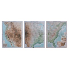
- Large Vintage Maps of the United States, in 3 Sections, 1920Located in St Annes, LancashireGreat maps of the USA in 3 sections Unframed Original color By John Bartholomew and Co. Edinburgh Geographical Institute Published, circa 1920 The measurements given is for just...Category
Vintage 1920s British Maps
MaterialsPaper


Recently Viewed
View AllMore Ways To Browse
Framed World Map
Vintage Chart Map
New York City Vintage Map
New York City Map Vintage
Vintage Map Of New York City
Wooden Capitals
Vintage Map New York
Vintage Camping Furniture
World War 2 Navy
Canada Map
Maps Canada
Map Of Canada
Flower Chart Vintage
Vintage Map Framed
Custom Vintage Maps
Vintage Livestock
Camp Flag
Wwii Maps