Items Similar to 1844 French Antique Nautical Portolano of Golfe De St. Drely by Antoine Roux

Want more images or videos?
Request additional images or videos from the seller
1 of 11
1844 French Antique Nautical Portolano of Golfe De St. Drely by Antoine Roux
About the Item
Antique portolano, nautical map of Golfe De St. Drely engraved on a copper plate by Antoine Roux, Marseille France 1844, from his work Recueil des principaux plans des ports et de Rades de la Mer Méditerranée et la Mer Noire. Very good condition. Measures with frame cm 38 x 31 - inches 15 x 12.
Joseph Roux came from a family of hydrographers and with his son Joseph Junior had a specialized tipography in Marseille. In 1764 Roux made a work named Recueil des principaux plans des ports et de Rades de la Mer Méditerranée et la Mer Noire, small, very handy because of its maneuverability and in fact reprinted several times until 1848.
Shipping is insured by Lloyd's London.
- Creator:Antoine Roux (Maker)
- Dimensions:Height: 12.21 in (31 cm)Width: 14.97 in (38 cm)Depth: 0.79 in (2 cm)
- Materials and Techniques:
- Place of Origin:
- Period:
- Date of Manufacture:1844
- Condition:
- Seller Location:Milan, IT
- Reference Number:1stDibs: LU1020220362532
About the Seller
4.9
Platinum Seller
These expertly vetted sellers are 1stDibs' most experienced sellers and are rated highest by our customers.
Established in 1999
1stDibs seller since 2014
370 sales on 1stDibs
Typical response time: <1 hour
- ShippingRetrieving quote...Ships From: Milan, Italy
- Return PolicyA return for this item may be initiated within 3 days of delivery.
More From This SellerView All
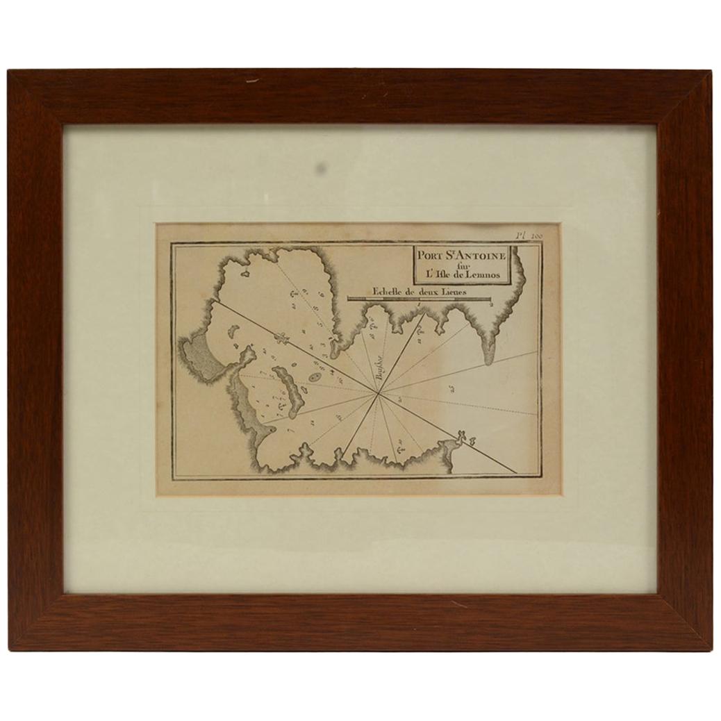
- Antique Nautical Portolano of Port St. Antoine by Antoine Roux, France, 1844By Antoine RouxLocated in Milan, ITAntique portolano, nautical map of Port St. Antoine engraved on a copper plate by Antoine Roux, Marseille, France, 1844, from his work Recueil des principaux plans des ports et de Ra...Category
Antique 1840s French Nautical Objects
MaterialsPaper
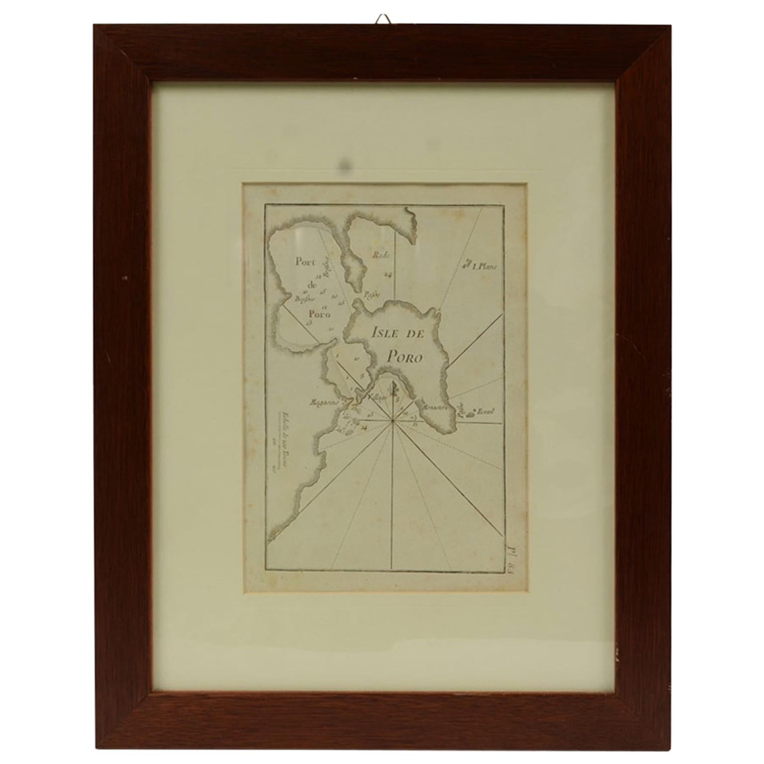
- Antique Nautical Portolano of Isle De Poro by Antoine Roux, France, 1844By Antoine RouxLocated in Milan, ITAntique portolano, nautical map of Isle De Poro engraved on a copper plate by Antoine Roux, Marseille France 1844, from his work Recueil des principaux plans des ports et de Rades de...Category
Antique 1840s French Nautical Objects
MaterialsPaper
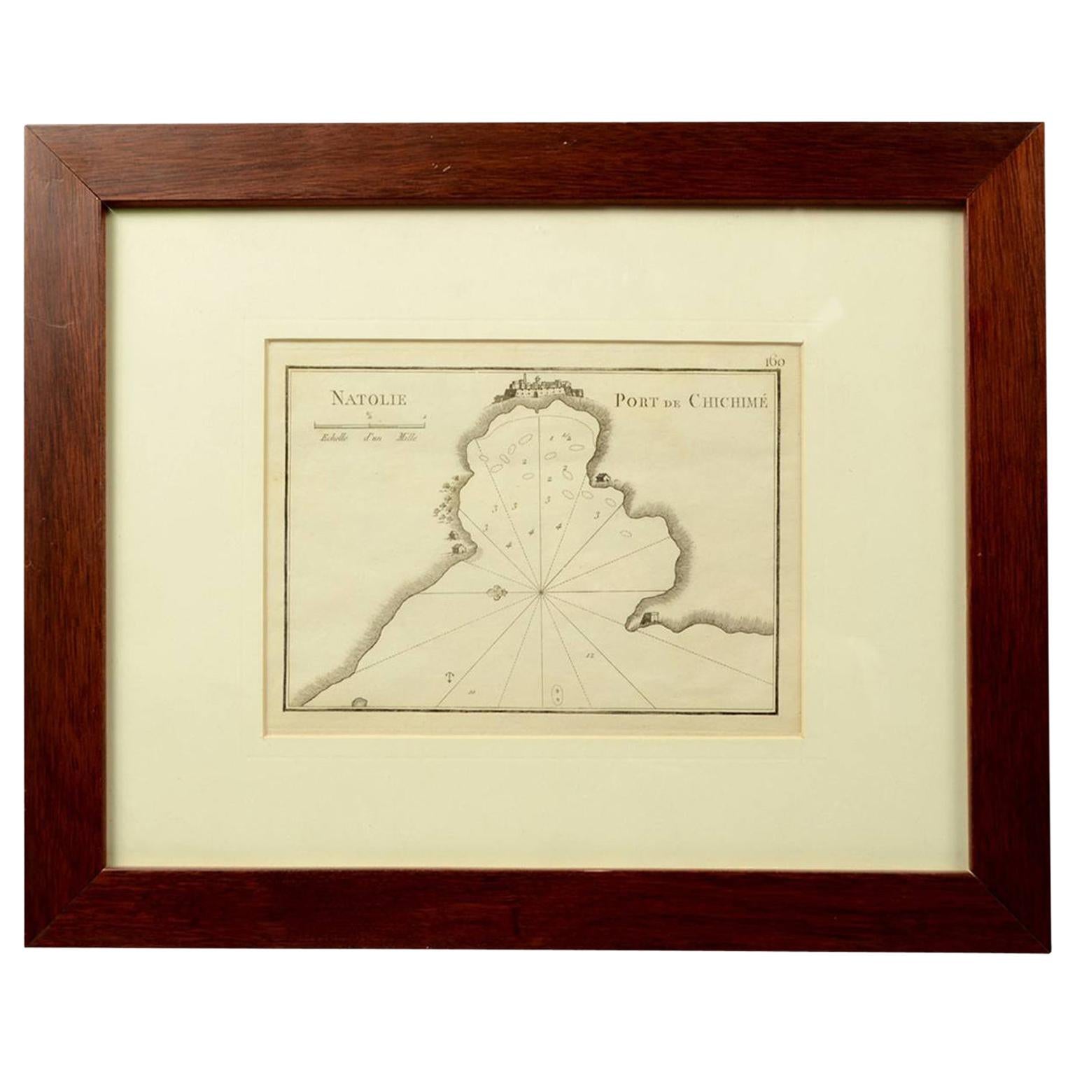
- 1844 French Nautical Portolano of Port De Chichimé Natolie by Antoine RouxBy Antoine RouxLocated in Milan, ITAntique portolano, nautical map of Port De Chichimé Natolie engraved on a copper plate by Antoine Roux, Marseille France 1844, from his work Recueil des principaux plans des ports et...Category
Antique 1840s French Nautical Objects
MaterialsPaper
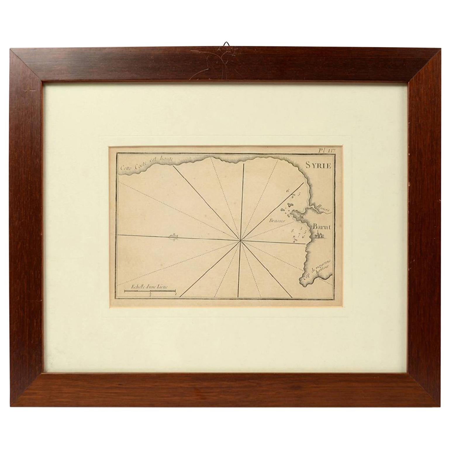
- 1844 French Antique Nautical print Engraved Portolano of Syrie by Antoine RouxBy Antoine RouxLocated in Milan, ITAntique portolano, nautical map of Syrie engraved on a copper plate by Antoine Roux, Marseille France 1844, from his work Recueil des principaux plans des ports et de Rades de la Mer...Category
Antique 1840s French Nautical Objects
MaterialsPaper
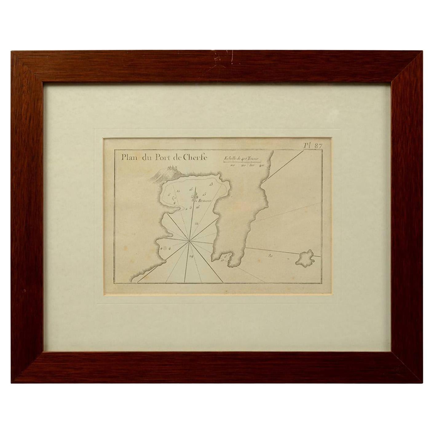
- 1844 French Antique Nautical Portolan of Plan du Port de Cherfe by Antoine RouxBy Antoine RouxLocated in Milan, ITAntique portolano, nautical map of Plan du Port de Cherfe engraved on a copper plate by Antoine Roux, Marseille France 1844, from his work Recueil des principaux plans des ports et d...Category
Antique 1840s French Nautical Objects
MaterialsPaper
- Old Nautical Print Depicting the Bombardment of Cadiz by the French Navy 1823Located in Milan, ITPrint by engraving on copper plate of the first half of the 19th century, depicting the bombardment of Cadiz by the French Navy, 23 September 1823. The print is signed peint par Crep...Category
Antique 1830s French Nautical Objects
MaterialsPaper


You May Also Like
- Antique Map of New Zealand by Arrowsmith '1844'Located in Langweer, NLAntique map titled 'Map of the colony of New Zealand from official documents'. A scarce map of New Zealand. First issued in the 1830s, this state sh...Category
Antique Mid-19th Century Maps
MaterialsPaper
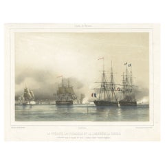
- Antique Litograph of a Combat Between French and British Ships, 1844Located in Langweer, NLAntique print titled 'La Fregate la Courageuse et la Canonnière la Terréur'. This print illustrates the combat between French ships and the British ships...Category
Antique 1840s Prints
MaterialsPaper
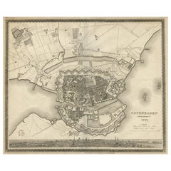
- Antique Map of the City of Copenhagen ‘Denmark’ by J. Meyer, 1844Located in Langweer, NLAntique map titled 'Copenhagen (Kiöbenhaven)'. With city view and German explanation. Originates from Meyer's Handatlas.Category
Antique Mid-19th Century Maps
MaterialsPaper
- Large Antique Map of France by De Wit, c.1680By Frederick de WitLocated in Langweer, NLAntique map titled 'Accuratissima Galliae Tabula vulgo Royaume de France'. Detailed map of France. Shows provinces, cities, rivers etc. Artists and Engravers: Frederick de Wit (1...Category
Antique 17th Century Maps
MaterialsPaper
- George Washington by Henry Sadd, Antique Engraving, circa 1844Located in Colorado Springs, COThis is an 1844 engraving of President George Washington. The print was issued by G. Stuart in Albion, New York and engraved by H. S. Sadd. This standing portrait shows President George Washington in front of neoclassical columns. In his right hand, he holds a dress sword...Category
Antique 1840s American Prints
MaterialsPaper
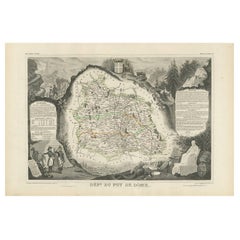
- Antique Map of Puy de Dôme ‘France’ by V. Levasseur, 1854By Victor LevasseurLocated in Langweer, NLAntique map titled 'Dépt. du Puy de Dôme'. Map of the French department of Puy De Dome, France. This mountainous department includes Auvergne, one of the l...Category
Antique Mid-19th Century Maps
MaterialsPaper


Recently Viewed
View AllMore Ways To Browse
Lloyd London
French Antique Plates Small
St Joseph Antique
French St Joseph
Nautical Map
Nautical Maps
Nautical Antique Plates
Antique Nautical Map
Antique Nautical Maps
La Roux
Map Of Marseille
Mediterranee Antiques
Antique Dres
Mahogany Boat
Nautical Vintage Anchor
Rare Antique Nautical
Ships Wheel Antique
Ship Wheel Antique