Items Similar to Engraving Depicting 16th Century Map of Terra Sancta

Want more images or videos?
Request additional images or videos from the seller
1 of 2
Engraving Depicting 16th Century Map of Terra Sancta
About the Item
Abraham Ortelius (Flemish, 1527-1598) Terra Sancta.
Engraving depicting 16th century map of Terra Sancta. Site 15" x 19.5.
- Dimensions:Height: 23.75 in (60.33 cm)Width: 29.25 in (74.3 cm)Depth: 1 in (2.54 cm)
- Materials and Techniques:
- Period:
- Date of Manufacture:18th Century
- Condition:
- Seller Location:Buchanan, MI
- Reference Number:1stDibs: LU81992587242
About the Seller
5.0
Vetted Seller
These experienced sellers undergo a comprehensive evaluation by our team of in-house experts.
Established in 1985
1stDibs seller since 2006
190 sales on 1stDibs
Typical response time: 1 hour
- ShippingRetrieving quote...Ships From: Buchanan, MI
- Return PolicyA return for this item may be initiated within 2 days of delivery.
More From This SellerView All
- COLLECTION OF EARLY 20TH CENTURY SPORTING PHOTO'SLocated in Buchanan, MICOLLECTION OF EARLY 20TH CENTURY SPORTING PHOTO'S BELIEVE THAT THESE ARE REPRINTSCategory
Early 20th Century American Photography
- 19th Century English Cased Drawing Set Length of Longest ToolLocated in Buchanan, MIAn 19th century English cased drawing set length of longest tool. Measures: 6 1/4 inches.Category
Antique 19th Century English Desk Sets
MaterialsBrass
- 19th Century Austrian HelmetLocated in Buchanan, MIHandsome 19th century Austrian helmet. Helmet has been separated into two parts so they can be flush mounted to a wall.Category
Antique 19th Century European Arms, Armor and Weapons
MaterialsMetal
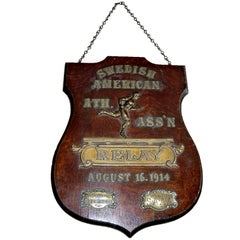
- Early 20th Century Relay Trophy PlaqueLocated in Buchanan, MISpectacular early 20th century relay trophy plaque.Category
Early 20th Century American Sports Equipment and Memorabilia
MaterialsBronze
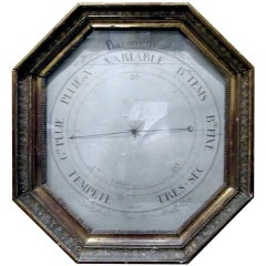
- 18th Century French Barometer in Giltwood FrameLocated in Buchanan, MI18th century French barometer in giltwood frame.Category
Antique 19th Century French Scientific Instruments
MaterialsGiltwood, Glass
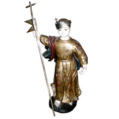
- 19th Century Carved Wood Santos with Gilt DecorationLocated in Buchanan, MI19th century carved wood Santos with gilt decoration.Category
Antique 19th Century Italian Religious Items
MaterialsGold Leaf
You May Also Like
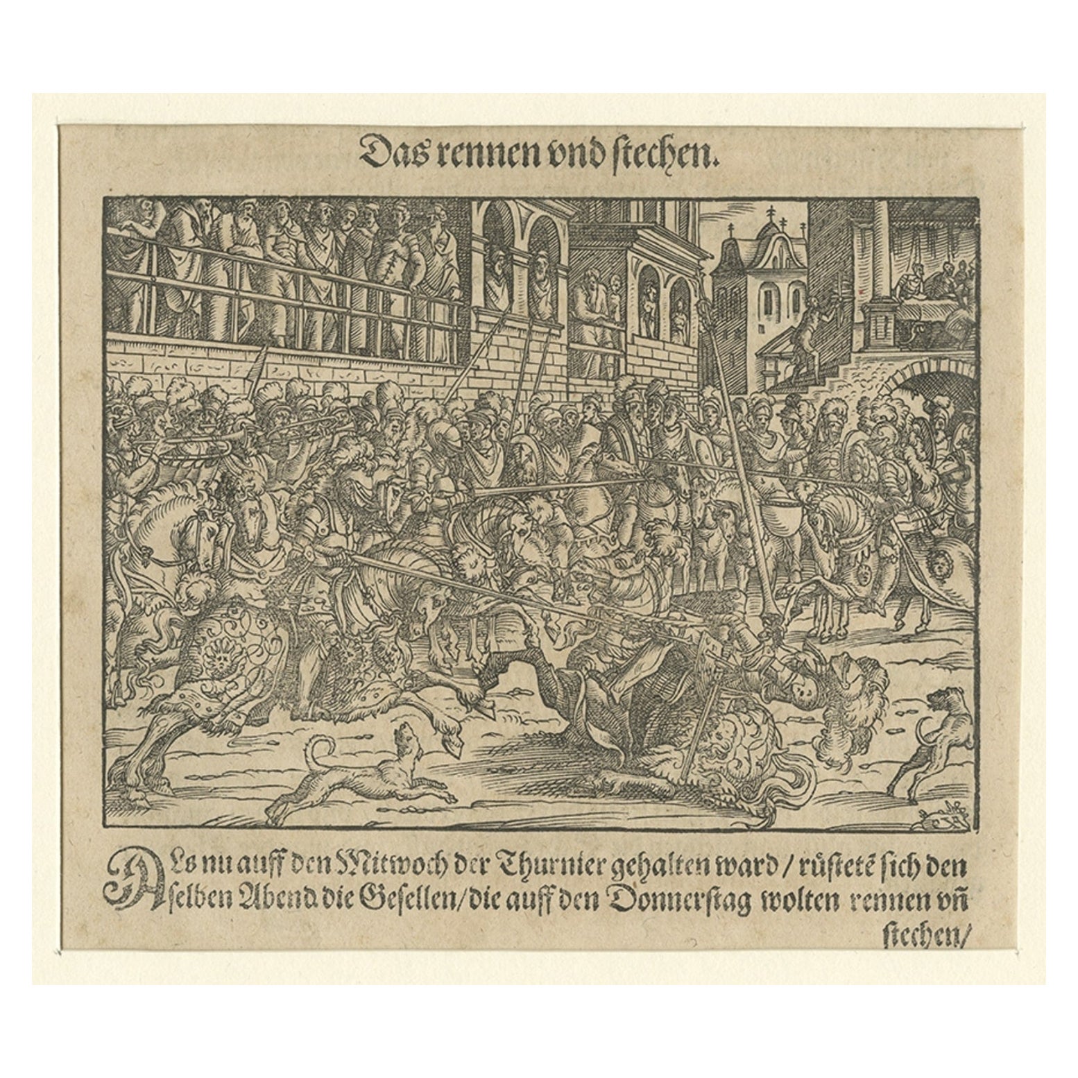
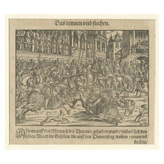
- Original 16th Century Engraving of a Medieval Tournament, ca.1578Located in Langweer, NLAntique print titled 'Das rennen und stechen'. Engraving of a Medieval tournament. This print originates from 'Thurnier Buch. Von Anfang, Ursachen, ursprung und herkommen (..)' b...Category
Antique 16th Century Prints
MaterialsPaper
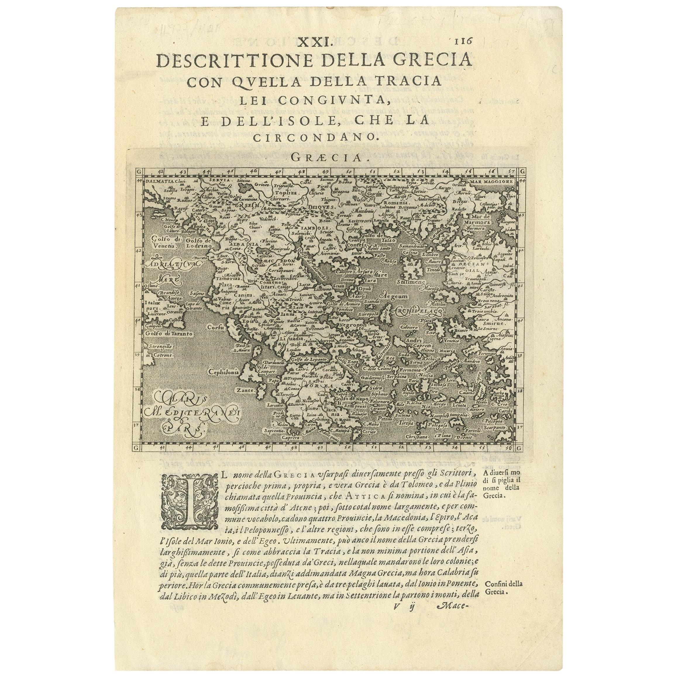
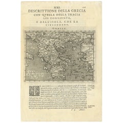
- Rare Original 16th Century Antique Map of Greece, 1598Located in Langweer, NLBeautiful and rare antique map of Greece with Albania, Mecedonia, Romania, Dalmatia and the peninsula of Salento to the Golf of Taranto. Also clearly shown the islands of the Aegaian...Category
Antique 16th Century Maps
MaterialsPaper
- Northern Scotland: A 16th Century Hand-colored Map by MercatorBy Gerard MercatorLocated in Alamo, CAA framed hand-colored 16th century map of Northern Scotland by Gerard Mercator entitled "Scotiae pars Septentrionalis", published in Amsterdam in 1636. It is a highly detailed map of the northern part of Scotland, with the northwest Highlands and the cities Inverness and Aberdeen, as well as the Orkney Islands and the Hebrides. There is a decorative title cartouche in the upper left corner. The map is presented in an antiqued brown wood...Category
Antique 16th Century Dutch Maps
MaterialsPaper
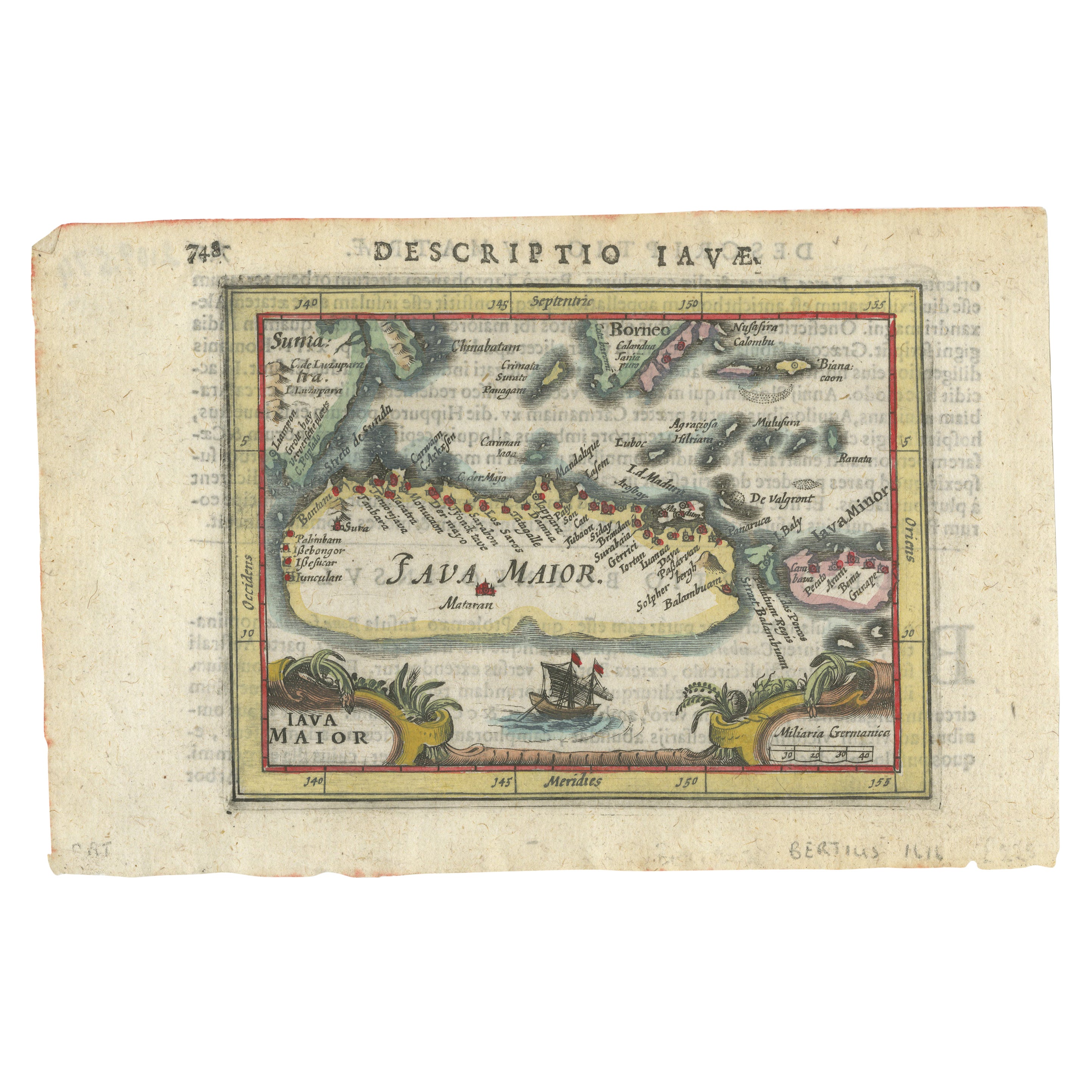
- Rare 16th Century Original Handcolored Miniature Map of Java, Indonesia, 1616Located in Langweer, NLVery handsome original old coloured copper engraving by Bertius of the island of Java in the early days of the Dutch colonisation - at that time named The Dutch East Indies or nowada...Category
Antique 1610s Maps
MaterialsPaper
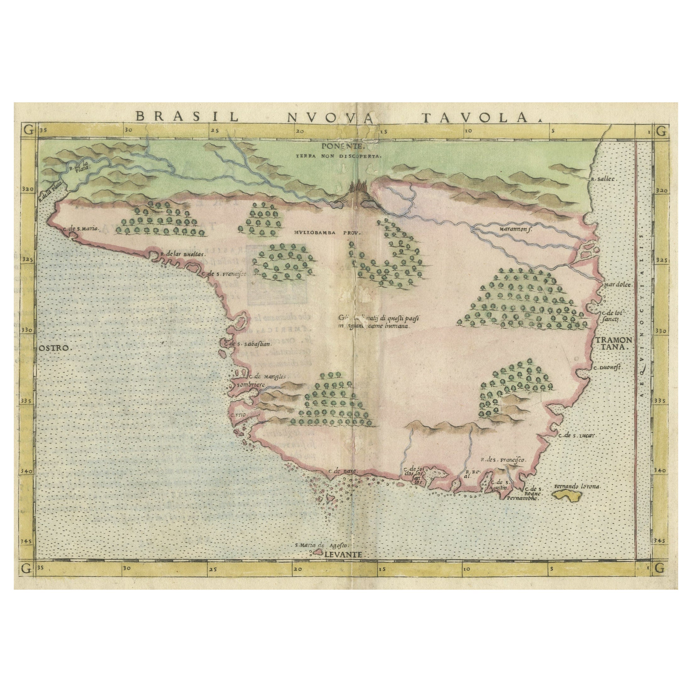
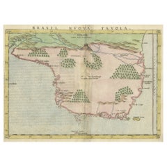
- Original Antique Map of Brasil, Published in the 16th Century, 1561Located in Langweer, NLThis important Ruscelli map of Brazil, from his work La Geografia di Claudio Tolomeo Alessandrino, is one of the earliest obtainable modern maps of the re...Category
Antique 1660s Maps
MaterialsPaper
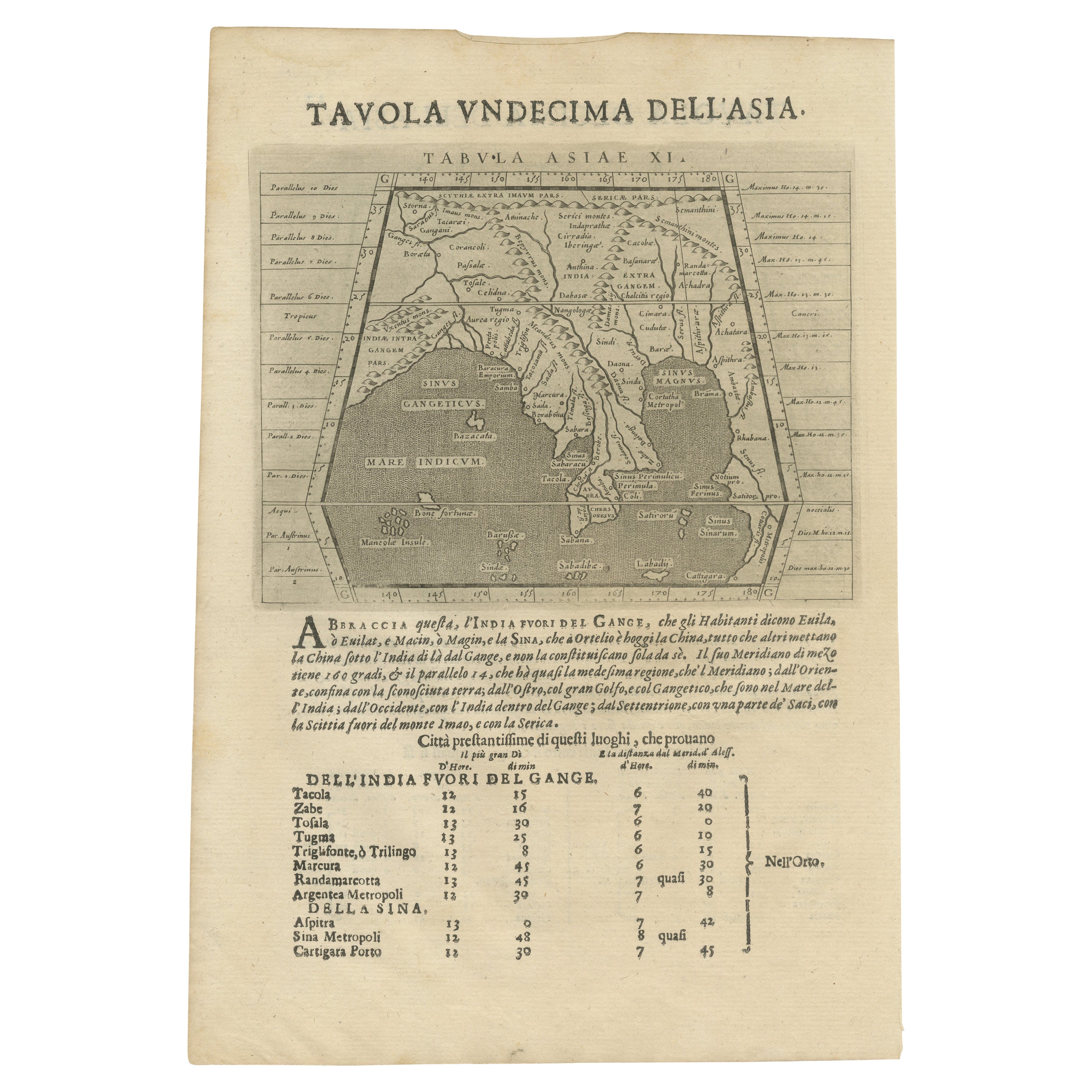
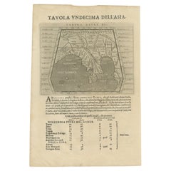
- Late 16th Century Sheet with Copper Engravings of India, Pakistan, etc, 1598Located in Langweer, NLOne sheet with two engraved maps, one on each site, and text in Italian. Late 16th century copper engravings in great condition, considering its age. "Tavola Decima Dell'Asia" - Tabula Asiae X" Plate X (10). Pakistan, Cashmir, Bangla Desh, North-India...Category
Antique 16th Century Maps
MaterialsPaper


Recently Viewed
View AllMore Ways To Browse
Flemish 16th Century
16th Engraving
16th Century Engraving
Terra Sancta
Antique Maps Germany
Antique Collectible Market
Antique Collectable Market
Antique Map Of Germany
Antique Maps Of Germany
Antique House Windows
Antique Texas Furniture
Texas Antique Furniture
Cross Decor
Antique Large Maps
Britain Map
American West Antiques
Antique Furniture Long Island
Antique Maps London