Glass Maps
26
to
1
15
11
26
26
26
3
3
1
1
1
1
1
1
5
14
7
1
4
1
2
5,371
87
32
32
26
19
8
6
6
6
2
Material: Glass
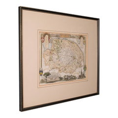
Antique County Map, Norfolk, English, Framed Lithography, Cartography, Victorian
Located in Hele, Devon, GB
This is an antique lithography map of Norfolk. An English, framed atlas engraving of cartographic interest, dating to the mid 19th century and later.
Superb lithography of Norfolk a...
Category
Mid-19th Century British Victorian Antique Glass Maps
Materials
Glass, Wood
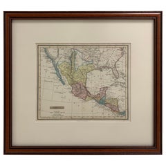
Framed 1838 Mexico & Gulf of Mexico Map
Located in Stamford, CT
Framed 1838 Mexico & Gulf of Mexico map. Printed by Fisher, Son & Co. of London in 1838. As found framed condition. Map has not been examined outside of th...
Category
1830s English American Classical Antique Glass Maps
Materials
Glass, Wood, Paper
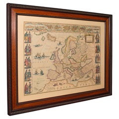
Vintage Reproduction 17th Century Map of Europe, American, Cartography, Blaeuw
Located in Hele, Devon, GB
This is a vintage reproduction map of Europe. An American, paper stock cartography print in frame after the work by Blaeuw, dating to the late 20t...
Category
Late 20th Century Central American Mid-Century Modern Glass Maps
Materials
Glass, Wood, Paper
Mid-Century Illuminated Replogle World Floor Globe in Wood and Glass, Chicago
Located in Haddonfield, NJ
American 1950's back light green painted floor globe by Replogle, Mid-Century Modern.
Remarkable and charming Chicago made world globe featur...
Category
Mid-20th Century American Mid-Century Modern Glass Maps
Materials
Steel
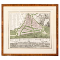
Framed 1731 Color Engraving, Map of Rotterdam by Matthaus Seutter, "Roterodami"
Located in Bridgeport, CT
"Roterodami". Seutter (1678-1757) was an important German 18th century map maker. Bird's eye view of the city above with full details, neoclassi...
Category
18th Century European Renaissance Antique Glass Maps
Materials
Glass, Wood, Paper
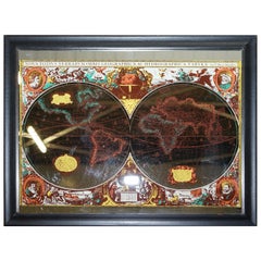
Vintage World Map Mirror Based on the Original by Johnson 1882 Military Campaign
Located in GB
We are delighted to offer for sale this lovely Antique style pictorial plan map of the globe based on the original by Johnson in 1882
This is a very interesting and decorative pie...
Category
20th Century English Campaign Glass Maps
Materials
Mirror
Floor Model Light Up Globe by Replogle Ca. 1950/1960's
Located in New York, NY
Exceptional light up floor model globe, by Replogle Globes Inc. The globe is 16 in. in diameter, it features an interior light, and restrain a solid mahogany frame. This example is i...
Category
Mid-20th Century American Mid-Century Modern Glass Maps
Materials
Glass, Mahogany, Paper
Framed Original Land Map Survey of Tyler Park, Jersey City Railroad
Located in Lambertville, NJ
A framed and matted historical map of Tyler park jersey city New Jersey Railroad. The paper on canvas in later appropriate frame. Good condition with some creasing and age discolorat...
Category
1870s American Antique Glass Maps
Materials
Canvas, Glass, Wood
French Framed Copper Engraved Hand Colored Map of Carolina & Georgia, Circa 1757
Located in Hollywood, SC
French copper engraved hand colored map of Carolina & Georgia matted under glass with a painted frame, mid-18th century
Category
1750s French Louis XV Antique Glass Maps
Materials
Glass, Wood, Paint, Paper
1705 Golfe de Mexico and Florida Framed Map
Located in Stamford, CT
Framed map of Mexico & Florida circa 1705, Paris. Small map with Mexico and the Gulf Coast. Inset text indicating Panama, Acapulco, Mexico City and the Mississippi. Extends North to ...
Category
Early 1700s French Spanish Colonial Antique Glass Maps
Materials
Glass, Wood, Paper
English Engraved Hand Colored Map of the North Eastern United States, circa 1817
Located in Hollywood, SC
English copper engraved hand colored map of the North Eastern United States matted under glass in a gilt frame, Early 19th Century. Drawn and Engraved for Thomson's New General Atlas...
Category
1810s English George III Antique Glass Maps
Materials
Glass, Giltwood, Paint, Paper
French 1930s Map of Paris à Vol d'Oiseau under Glass in Custom Iron Frame
Located in Atlanta, GA
A French map of Paris from the early 20th century, with custom iron frame. Created in Paris during the second quarter of the 20th century, this map of Paris à vol d'oiseau (as the Cr...
Category
Early 20th Century French Glass Maps
Materials
Iron
Early 19th Century Original Framed Land Indenture, England, 1810
Located in Lambertville, NJ
A large hand written land indenture document England, 1810, framed. The beautifully hand written document mounted on board with a red velvet border and ...
Category
1810s English Regency Antique Glass Maps
Materials
Giltwood, Parchment Paper, Glass
Large European 1930's Nautical Map Reader Magnifying Glass
Located in Haddonfield, NJ
This European set of two nautical magnifying glass map-readers are quite unusual and rarely found. It is fully encased in it's heavy wooden and metal enforced box. Hailing from betwe...
Category
1930s German Industrial Vintage Glass Maps
Materials
Metal
Oil Lamp with an Illuminating Globe Shade, circa 1885
Located in London, GB
A rare late 19th century oil lamp with a globe shade and base decorated with a castle set in a rural scene, circa 1885.
Northern Europe...
Category
Late 19th Century European Antique Glass Maps
Materials
Glass
Framed 1839 Hand Colored Map of the United States
Located in Stamford, CT
Framed hand colored map of the United States of America from 1839. Newly framed in a giltwood frame.
Category
1830s American American Classical Antique Glass Maps
Materials
Giltwood, Paper, Glass
1830 Mexico and United States Framed Map
Located in Stamford, CT
Map of North America published circa 1830. Map shows United States into Canada. Mexico extending into the upper California territory. Texas appears in name but prior to the period of...
Category
1830s American American Classical Antique Glass Maps
Materials
Glass, Wood, Paper
Framed 1820s Hand Colored Map of the United States
Located in Stamford, CT
Framed 1820s hand colored map photos of North America and South America. As found framed in giltwood frame.
Category
1820s American Spanish Colonial Antique Glass Maps
Materials
Giltwood, Paper, Glass
1850 Old French Map Depicting the Entire Earth's Surface Divided into Two Parts
Located in Milan, IT
Geographical map depicting the entire earth's surface divided into two parts that correspond to the two hemispheres where the emerged lands are depicted which have been classified wi...
Category
Mid-19th Century French Antique Glass Maps
Materials
Glass, Wood, Paper
Framed Mercator Hondius Hispania Nova Atlas Minor Map
Located in Stamford, CT
Framed colored example of this decorative and important minature map. Newly framed in brown wood frame with gold trim.
Mercator Hondius “Atlas Minor” pu...
Category
17th Century Dutch Spanish Colonial Antique Glass Maps
Materials
Glass, Wood, Paper
1850 Old French Map Depicting the Entire Earth's Surface Divided into Two Parts
Located in Milan, IT
Map depicting the entire earth's surface divided into two parts corresponding to the two hemispheres and showing the Arctic to Antarctic polar circle, the tropics of Cancer and Capri...
Category
Mid-19th Century French Antique Glass Maps
Materials
Glass, Wood, Paper
1850 Old French Map Depicting the Entire Earth's Surface Divided into Two Parts
Located in Milan, IT
Geographical map depicting the entire earth's surface divided into two parts that correspond to the two hemispheres or globes, the map deals with the earth in general. Detailed expla...
Category
Mid-19th Century French Antique Glass Maps
Materials
Glass, Wood, Paper
1731 Original German Engraving Print Chart of European Distances by T. Mayer
Located in Milan, IT
Tabula Poliometrica Germaniae ac Praecipuorum quorundam locorum Europae Nuremberg, 1731.
Author: T. Mayer; publisher: Homman.
Chart printed by engraving on copper plate, coeval color...
Category
1730s German Antique Glass Maps
Materials
Glass, Wood, Paper
Old Map Depicting the Entire Earth's Surface Divided into Six Parts France 1850
Located in Milan, IT
Map depicting the entire earth's surface divided into six parts which depicts the position of peoples on Earth based on the assumption that it is impossible for each people to have t...
Category
Mid-19th Century French Antique Glass Maps
Materials
Paper, Glass, Wood
1850 Old French Map Depicting the Entire Earth's Surface Divided into Two Parts
Located in Milan, IT
Geographical map depicting the entire earth’s surface divided into two parts that correspond to the two hemispheres or globes, the map deals with the latitudes and longitudes, the me...
Category
Mid-19th Century French Antique Glass Maps
Materials
Glass, Wood, Paper
20th Century Art Deco Glass Globe Lamp c.1930
Located in Royal Tunbridge Wells, Kent
Crafted in Great Britain during the early 20th century, this extraordinary glass globe table lamp stands as a testament to rare and timeless design. The lamp showcases an elegant fus...
Category
1930s British Art Deco Vintage Glass Maps
Materials
Metal
Related Items
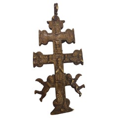
Cross of Caravaca 17th Century
Located in Madrid, ES
Cross of caravaca XVII century.
Very beautiful cross of caravaca made in bronze. 17th Century. Measurements: 14X6 cm.
Good condition.
Category
17th Century Italian Gothic Antique Glass Maps
Materials
Bronze
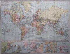
Large Original Vintage Map of The World, circa 1920
Located in St Annes, Lancashire
Great map of The World
Original color.
Good condition / minor foxing
Published by Alexander Gross
Unframed.
Category
1920s English Vintage Glass Maps
Materials
Paper
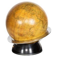
Replogle Terrestrial Floor Globe
Located in Asbury Park, NJ
This floor globe by Replogle floats within a ring of walnut, supported by four 'turned' chrome stiles, which connect to a base of walnut. The ...
Category
1960s American Mid-Century Modern Vintage Glass Maps
20th Century Vintage Globemaster World Globe
Located in Chula Vista, CA
20th Century Vintage Globemaster World Globe
15.5 h x 13 d x. 11.5 w
Paper Plastic
Some damage to paper.
Unrestored original vintage condition.
Re...
Category
Late 20th Century Mid-Century Modern Glass Maps
Materials
Plastic, Paper
Terrestrial Library Globe Replogle Chicago w/Astrological Banded Stand
Located in San Francisco, CA
Terrestrial Library globe Replogle Chicago with banded astrological holder/floor stand circa 1930's/1940's
Category
1930s Vintage Glass Maps
Materials
Wood, Paper
Engraving of a Map of Florida, the Gulf Coast, Caribbean & Central America, 1728
Located in Langweer, NL
This exceptional antique map, titled "Nouvelle Carte Marine de Toute les Cotes de l´Amerique" and alternatively known as "Nieuwe groote en seer Curieuse Paskaart van Geheel-WestIndie...
Category
Mid-18th Century European Antique Glass Maps
Materials
Paper
Free Shipping
H 24.61 in W 40.56 in D 0.02 in
Large Original Vintage Map of Greece, circa 1920
Located in St Annes, Lancashire
Great map of Greece
Original color.
Good condition
Published by Alexander Gross
Unframed.
Category
1920s English Vintage Glass Maps
Materials
Paper
1950s Replogle Glass Illuminated Precision Globe
Located in Brooklyn, NY
This 10" 'Precision' Globe was manufactured in the early 1950s by Replogle (Chicago, IL) and edited by cartographer, Gustav Brueckmann. Composed of paper gores over glass with a cast...
Category
1950s American Mid-Century Modern Vintage Glass Maps
Materials
Metal, Brass
Jens Risom Deisgned Illuminated Globe on Teak Stand
Located in Brooklyn, NY
This beautiful vintage globe turns on its axis as mounted on a vintage teak stand. Complete with casters and interior illumination this vintage Replogle...
Category
20th Century Mid-Century Modern Glass Maps
Materials
Teak
Cross of Caravaca 17th Century
Located in Madrid, ES
Cross of caravaca xvii century
Very beautiful cross of Caravaca made in bronze. 17th century. Measurements: 12 x 6cm
Good condition.
Category
17th Century Italian Gothic Antique Glass Maps
Materials
Bronze
1960s Replogle Globe World Classic Series
Located in Chula Vista, CA
1960s Replogle Globe World Classic Series
15.5 h x 13.25 w x 11.5 d
made in USA
maker stamp
Preowned original unrestored vintage condition
Refer to images.
Category
1960s American Mid-Century Modern Vintage Glass Maps
Materials
Metal
Mid-Twentieth Century Illuminated Terrestrial Glass Globe by George F. Cram
Located in Brooklyn, NY
Electrified glass 10.5" Terrestrial Globe by George F. Cram Co (ca. 1951, Indianapolis, IN, USA). Composed of paper gores over glass with ocean finishes in an attractive aqua with bo...
Category
1950s American Mid-Century Modern Vintage Glass Maps
Materials
Metal
H 15 in W 11.5 in D 10.5 in
Previously Available Items
20th Century Art Deco Glass Globe Lamp c.1930
Located in Royal Tunbridge Wells, Kent
Crafted in Great Britain during the early 20th century, this extraordinary glass globe table lamp stands as a testament to rare and timeless design. The lamp showcases an elegant fus...
Category
1930s British Art Deco Vintage Glass Maps
Materials
Metal
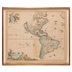
Antique Framed Hand Colored Map of the Americas by Frederick De Wit, circa 1675
Located in Morristown, NJ
Frederick De Wit (Dutch, 1629-1706), "Novissima et Accuratissima totius Americae Descriptio", hand-colored map engraving of North and South America with California depicted as an island, decorated with images of Native Americans and indigenous flora and fauna, framed under glass, 19.5"h x 23"l (sheet), 22.5"h x 1.75"d x 26"w (frame), From the collection of an NY corporation.
A fine example of De Wit’s map of the Americas, first published ca. 1675. This map is fascinating. It was the first Dutch map to include all five Great Lakes; Lac Superieur (Lake Superior), Lac des Puans (Lake Michigan), Mare Dulce (Lake Huron...
Category
1670s Dutch Baroque Antique Glass Maps
Materials
Glass, Wood, Giltwood, Paint, Paper
H 22.5 in W 26 in D 1.75 in
English Map of West Indies with a Gilt Wood Frame Under Glass, Late 19th Cent
Located in Hollywood, SC
English hand colored accurate map of the West Indies with a foliage gilt wood and gesso frame under glass, Late 19th century. Long West from London.
Category
Late 19th Century English Victorian Antique Glass Maps
Materials
Gesso, Glass, Giltwood, Paint, Paper
H 13.75 in W 16.75 in D 0.75 in
Framed Britannia Map Hand Tinted and Colored, Signed Matthaus Seutter, C. 1725
Located in Hollywood, SC
Framed and Matted Britannia Map hand tinted and colored with gilt frame.
Signed Matthaus Seutter, 1725
Seutter was one of the most important and prolific German map publishers of t...
Category
1720s German George II Antique Glass Maps
Materials
Glass, Giltwood, Paper
H 33 in W 28.75 in D 1.25 in
Antique World Map Published in Vienna 1786 by Franz Anton Schraembl
Located in Milan, IT
Large world map by cartographer Jean Baptist D'Anvile revised and republished in Vienna in 1786 by Franz Anton Schraembl. It is a geographical map prin...
Category
1780s Austrian Antique Glass Maps
Materials
Glass, Wood, Paper
World Map Published in June 1783 by Stackhouse and Engraved by S.J. Neele London
Located in Milan, IT
World map published in June 1783 by Stackhouse and engraved by S.J. Neele. It is a geographical map printed by engraving on a copper plate, coeval coloring, which depicts the entire earth's surface divided into two parts that correspond to the two hemispheres. The map is significant because it is complete with the routes relating to the travels of the English astronomer and navigator James Cook in the 18th century. Good condition, some cracks on the left side, beautiful non-coeval frame of cherrywood. Measures: With frame 93.8 x 54.5 cm - 36.9 x 21.4 inches, thickness 2 cm - 0.78 inches.
Samuel John Neele (1758-1824) was an important British engraver and cartographer, known to have produced maps and portraits. He operated a print shop in London with his sons between 1782 and 1833. Trade engraver, with business in the strand, produced also illustrations and financial documents.
He worked for prominent cartographers and publishers such as Faden, Laurie, Stackhouse, Thomson and others. He engraved maps for "Lake District Maps" by Crosthwaite (along with Ashby and Ellis), "New Map of Ireland, Civil and Ecclesiastical" Daniel August Beaufort in 1792, and for atlases such as the "New General Atlas" and "Atlas of Scotland" by Thomson in 1817, "Atlas Of England And Wales" by Robin in 1819 and "Geological Map...
Category
1780s British Antique Glass Maps
Materials
Glass, Wood, Paper
H 21.26 in W 36.93 in D 0.79 in
1856s The Constellations Map for Each Month in the Year by FJ Huntington N.Y.
Located in Milan, IT
Map VI and VII depicting the constellations titled The Constellations for each Month in the Year. "Entered according to Act of Congress in the year 1856 by FJ Huntington in the Clerk...
Category
1850s American Antique Glass Maps
Materials
Glass, Wood, Paper
H 18.71 in W 32.17 in D 0.6 in
Large French 1950s Paris Metro Map Under Glass with Custom Made Iron Frame
Located in Atlanta, GA
A large French framed map of the Parisian Metro from the mid-20th century, with custom iron frame. Featuring a Paris metro map from the midcentury peri...
Category
Mid-20th Century French Mid-Century Modern Glass Maps
Materials
Iron
Leather Cased Set of Maps of England and Wales, circa 1920
By E. Stanford
Located in London, GB
A pigskin leather case with ‘fish-tail’ handle containing a complete series of Bartholomew's 2 miles to an inch scale, linen backed maps for England and Wales by Edward Stanford of L...
Category
1920s English Vintage Glass Maps
Materials
Metal
Antique Map of Denmark by C. F. Weiland, 1829
Located in Haddonfield, NJ
Antique map of Denmark in a black wooden frame and glass screen.
Made by German C. F. Weiland, Weimar in 1829.
Category
Early 19th Century German Antique Glass Maps
Materials
Glass, Paper
19th Century Map of Amsterdam
By The Society for the Diffusion of Useful Knowledge
Located in Essex, MA
A strikingly graphic map, or city plan, of the City of Amsterdam, in black and white, with the canals and waterways in their original green color, published by the Society for the Di...
Category
Mid-19th Century English Antique Glass Maps
Materials
Glass, Wood, Paper
Period Map of America, circa 1700
Located in Hudson, NY
This large-scale map published by P. Schenk created by cartographer and geographer Adam Freiderick Zurner in 1700 is in a fine state of preservation and retains much of its original ...
Category
Early 18th Century Dutch Antique Glass Maps
Materials
Glass, Wood, Paper
Recently Viewed
View AllMore Ways To Browse
Antique Sailing Map
Antique Sailing Maps
Bay Area Antique Furniture
West Coat Of Arms
Greek Asia Minor
Hemisphere World Map
Speed Map
Antique Maps Canada
Antique Map Canada
Canada Antique Map
Malaysian Antique
Blaeu World Map
West Indies Map
Charing Cross
Antique Maps Of Canada
Bali Map
Map Of Brazil
Antique Portuguese Plates
