Gilt Maps
2
to
2
2
2
2
1
1
1
1
1
1
1
1
1
2
1
1
1
Technique: Gilt
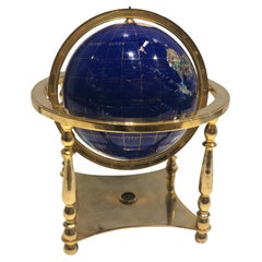
Globe, Solid Rotating Brass Frame with Spinning Globe
Located in Dallas, TX
Globe, solid rotating brass frame with spinning globe, faux hardstone.
Category
Mid-20th Century French Gilt Maps
Materials
Brass
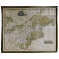
English Engraved Hand Colored Map of the North Eastern United States, circa 1817
Located in Hollywood, SC
English copper engraved hand colored map of the North Eastern United States matted under glass in a gilt frame, Early 19th Century. Drawn and Engraved for Thomson's New General Atlas...
Category
1810s English George III Antique Gilt Maps
Materials
Glass, Giltwood, Paint, Paper
Related Items
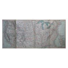
Original Antique Map of The United States of America, circa 1890
Located in St Annes, Lancashire
Great map of the USA
By The Stanford's Geographical Establishment
Original colour
Unframed.
Category
1890s English Victorian Antique Gilt Maps
Materials
Paper
Animal Wind-up toy dog with spin tail, 1950s
Located in Delft, NL
Animal Wind-up toy dog with spin tail, 1950s
A wind-up animal toy, colored yellow with brown spots in velvety soft mohair and green glass eyes. On the belly the winding system wit...
Category
Mid-20th Century European Gilt Maps
Materials
Mohair, Straw
Original Antique Hand-colored Map of the United States, circa 1845
Located in Langweer, NL
Antique map titled 'United States'. Old map of the United States, includes the last part of the North West Territory (present day Wisconsin and part of Minnesota). It also marks Ft. Crawford at the confluence of the Mississippi River and the Ouisconsin River (present day Wisconsin River). Published by Orr & Company; Amen Corner...
Category
Mid-19th Century Antique Gilt Maps
Materials
Paper
Brass Frame Desk Magnifying Glass with Horn Handle
Located in Los Angeles, CA
Horn Handle desk style magnifying glass with brass framework and stem. The horn is quite substantial and has good weight and presence.
The horn has a ribbed detail down a portion ...
Category
20th Century Gilt Maps
Materials
Brass
Antique Map of The United States of North America, 1882
Located in Langweer, NL
This is a historical map titled "The United States of North America, Central Part" from the 1882 Blackie Atlas. It depicts the continental United States with a high level of detail, ...
Category
1880s Antique Gilt Maps
Materials
Paper
Globe Cigarette Dispenser with Music Playing Globe Lighter, Brass, Germany, 1950
Located in Vienna, AT
Globe cigarette dispenser with music playing globe lighter, brass, Germany, 1950s.
Category
1950s Vintage Gilt Maps
Materials
Brass
H 8.27 in W 3.94 in D 3.94 in
Solid Brass Ships Porthole Highly Polished with Lacquer Finish
Located in Norwell, MA
Highly polished ships porthole with clear lacquer finish. Hinged door with five bolts. Ring is engraved Endast Securitglas, Wojidkows, Sweden. Quality piece.
Weight: 51 LBS.
Over...
Category
1950s European Vintage Gilt Maps
Materials
Brass
Solid Brass Porthole from a Yacht
Located in Norwell, MA
Highly polished boat porthole with hinged door with two latches. Great nautical relic. Clear glass.
Weight: 14 LBS
Overall Dimensions: 2” H x 21” L x ...
Category
1940s North American Vintage Gilt Maps
Materials
Brass
Carl Auböck Model #5615 'Star' Solid Brass Keyring with Signature
Located in Glendale, CA
Carl Auböck Model #5615 'Star' solid brass keyring with signature. Designed in the 1950s, this incredibly refined and sculptural object is hand fabricate...
Category
21st Century and Contemporary Austrian Mid-Century Modern Gilt Maps
Materials
Brass
Solid Brass Ships Porthole
Located in Norwell, MA
Highly polished ships porthole with hinged door and four dog bolts. Meticulously polished and lacquered. The tempered glass has some imperfections from y...
Category
1930s European Vintage Gilt Maps
Materials
Brass
Solid Brass Ships Telephone
Located in Norwell, MA
Solid brass ships telephone on pedestals. Phone is fitted inside an incredibly strong solid brass box that is highly polished and lacquered. Weight is ...
Category
1950s Vintage Gilt Maps
Materials
Brass
Old Decorative Pictorial Map of the United States, circa 1953
Located in Langweer, NL
Antique map titled 'A Pictorial Map of the United States of America Showing Principal Regional Resources, Products, and Natural Features'.
This information-packed map was create by the General Drafting Company for the New Jersey Bell Telephone Company. The main map features over 700 drawings in full color including points of interest, natural resources, and agricultural products. At bottom are inset maps showing railroad lines, air routes, telephone lines, as well as a pictorial map of New Jersey...
Category
20th Century Gilt Maps
Materials
Paper
Previously Available Items
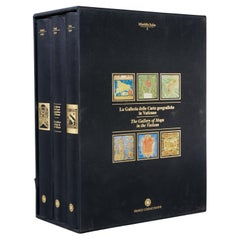
La Galleria Delle Carte Geografiche in Vaticano, Maps in the Vatican, 3 Vols
By Fra Egnazio Danti
Located in Morristown, NJ
La Galleria delle Carte geografiche in Vaticano / The Gallery of Maps in the Vatican, Mirabilia Italiae / Franco Cosimo Panini, (3) vols. in black silk cloth, slipcase with golden ti...
Category
1990s Italian Renaissance Gilt Maps
Materials
Linen, Paper
H 13 in W 5.5 in D 10 in
Antique Framed Hand Colored Map of the Americas by Frederick De Wit, circa 1675
Located in Morristown, NJ
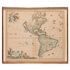
Frederick De Wit (Dutch, 1629-1706), "Novissima et Accuratissima totius Americae Descriptio", hand-colored map engraving of North and South America with California depicted as an island, decorated with images of Native Americans and indigenous flora and fauna, framed under glass, 19.5"h x 23"l (sheet), 22.5"h x 1.75"d x 26"w (frame), From the collection of an NY corporation.
A fine example of De Wit’s map of the Americas, first published ca. 1675. This map is fascinating. It was the first Dutch map to include all five Great Lakes; Lac Superieur (Lake Superior), Lac des Puans (Lake Michigan), Mare Dulce (Lake Huron...
Category
1670s Dutch Baroque Antique Gilt Maps
Materials
Glass, Wood, Giltwood, Paint, Paper
H 22.5 in W 26 in D 1.75 in
English Map of West Indies with a Gilt Wood Frame Under Glass, Late 19th Cent
Located in Hollywood, SC
English hand colored accurate map of the West Indies with a foliage gilt wood and gesso frame under glass, Late 19th century. Long West from London.
Category
Late 19th Century English Victorian Antique Gilt Maps
Materials
Gesso, Glass, Giltwood, Paint, Paper
H 13.75 in W 16.75 in D 0.75 in
Imperial Map Desk of the Habsburg Empire
Located in New Orleans, LA
This monumental, one-of-a-kind map desk hails from the Imperial Palace of the Habsburg Emperor Franz Joseph I, ruler of both Austria and Hungary from 1848 until 1916. The incredible, massive desk features 28 flat drawers — seven on each side — which were used to store not only important maps of the empire, but also irreplaceable architectural drawings of palaces, cathedrals and other civil structures. Biedermeier in style, it is crafted from birch, which was then one of the rarest, most expensive materials used by cabinet makers. It is absolutely, without question, the finest desk of its kind in existence, and it is certainly without peer in terms of engineering, craftsmanship and provenance.
The entire surface of the giant desk...
Category
19th Century Austrian Other Antique Gilt Maps
Materials
Wood, Satinwood, Walnut
Rouge Marble Globe Clock
Located in New Orleans, LA
This extraordinary globe clock is an impeccable example of the complex artistry of French timepieces. The terrestrial globe is rendered in painstaking deta...
Category
19th Century French Other Antique Gilt Maps
Materials
Marble, Silver, Bronze
Framed 18th Century Copy of French World Map by Francois Santini
Located in Sheffield, MA
18th century French world map: Nouvelle Mappe Monde dedee au progres de nos connoissances. The map is drawn and engraved, matted and has a gilt frame. The originally map was made by ...
Category
18th Century French Antique Gilt Maps
Materials
Wood
Large-Scale Map of the World After Mercator, 1569, 20th Century Printing
Located in West Palm Beach, FL
Large-scale map of the world after Mercator, 1569, 20th century printing, in 2.5 deep walnut and gilt frame.
This item is at our Atlanta GA, Location, not Pa...
Category
Late 20th Century Renaissance Gilt Maps
Materials
Plexiglass, Walnut, Paper
H 42.5 in W 59.5 in D 2.5 in
French European Framed Map Printed on Linen, Signed, Circa 1781
Located in Hollywood, SC
French European framed map printed on linen with a colorful outlines and border under glass. Late 18th Century.
Measures: Map dimensions 22" Tall / 31.5" Wide,
frame dimensions 30...
Category
1780s French Louis XVI Antique Gilt Maps
Materials
Glass, Linen, Wood
A Rare French Engraved Map of The Southeastern United States. R.Bonne Circa 1780
Located in Hollywood, SC
A rare framed French engraved map on paper of the southeastern United States including Virginia, North Carolina, South Carolina, and Georgia. Rigobert Bonne, Paris Circa 1780. Plat...
Category
1780s French Louis XVI Antique Gilt Maps
Materials
Paper, Wood
H 16.5 in W 21 in D 1 in
18th Century Map of Cambridgeshire
Located in Austin, TX
A handsome 18th century English map of Cambridgeshire, mounted and framed under glass.
Printed in 1722 - From an edition of Camden's Britannia (Map by Robert Morden)
Great as a gif...
Category
18th Century English Antique Gilt Maps
Materials
Glass, Wood, Paper
Recently Viewed
View AllMore Ways To Browse
East Africa Map
Antique Prints Dublin
Iran Map
18th Century Globe Of The World
Antique Maps West Indies
Middle East Maps
Map Nautical Chart
Antique Turkish Map
West Indies Antique Map
Large Maps Of Paris
Antique Map Of Turkey
Pacific Ocean Antique Map
Map Of Middle East
Antique Maps Texas
Antique Texas Map
Used Furniture Dundee
Antique Texas Maps
Antique Maps Of Texas
