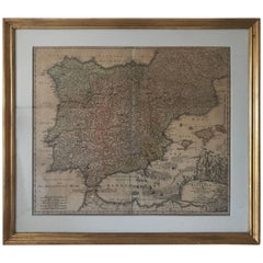
Rare Map 1710 Johann Homann Regnorum Hispaniae et Portugalliae Taula Generalis
View Similar Items


1 of 9
Rare Map 1710 Johann Homann Regnorum Hispaniae et Portugalliae Taula Generalis
About the Item
- Creator:Johann Baptist Homann (Illustrator)
- Dimensions:Height: 25.2 in (64 cm)Width: 28.35 in (72 cm)Depth: 0.79 in (2 cm)
- Materials and Techniques:
- Place of Origin:
- Period:1710-1719
- Date of Manufacture:1710
- Condition:Wear consistent with age and use. Minor structural damages. The map has foldings and minor stains but overall in a fantastic condition regarding it's age.
- Seller Location:Drottningholm, SE
- Reference Number:1stDibs: LU269239674221
You May Also Like
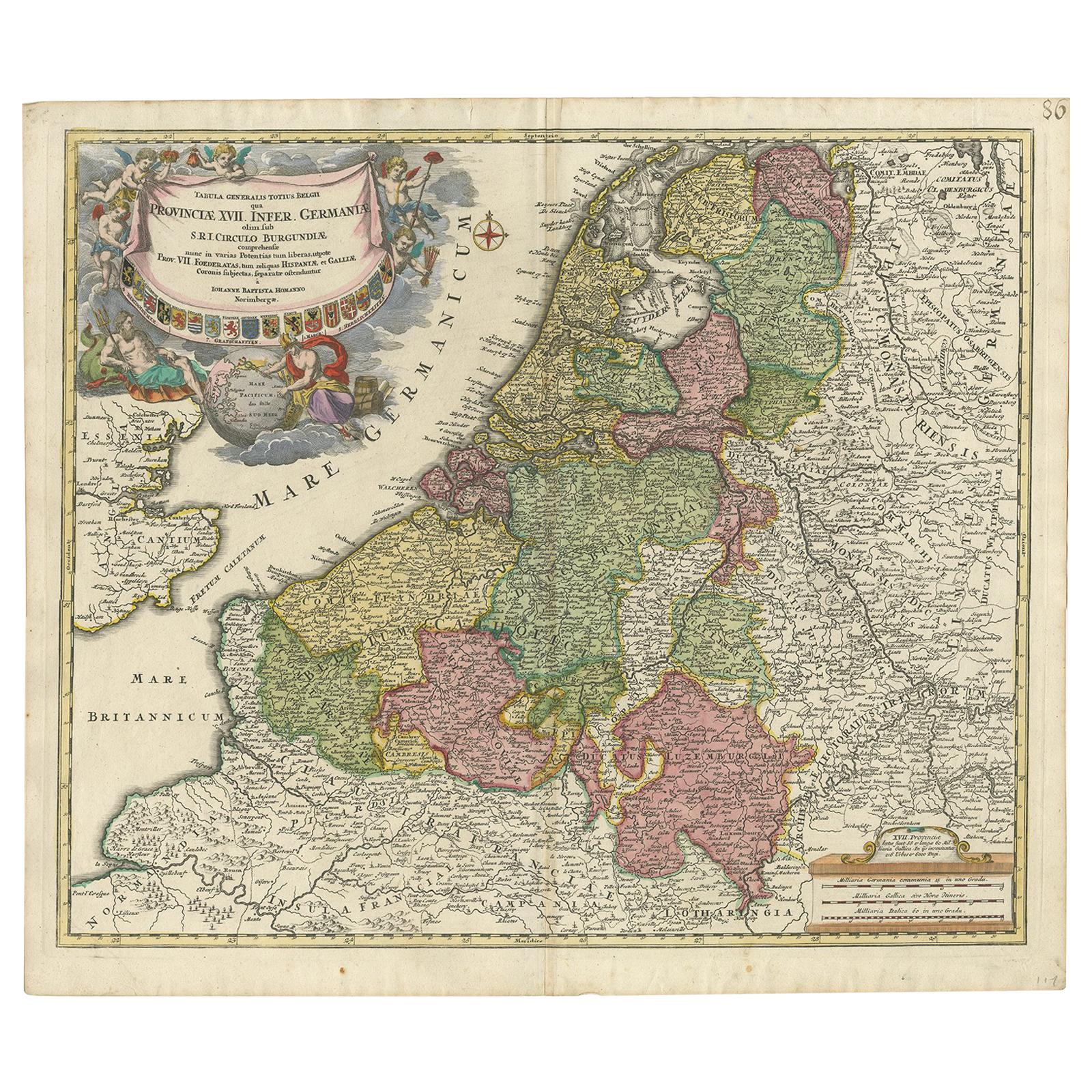
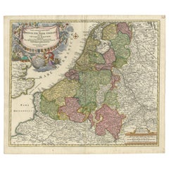
- Antique Map of the Netherlands and Belgium by Homann, circa 1710By Johann Baptist HomannLocated in Langweer, NLAntique map titled 'Tabula Generalis Totius Belgii Provinciae XVII. Infer. Germaniae (..)'. Map of the Benelux countries by Johann Baptist Homann. Shows the area between the Seine es...Category
Antique Early 18th Century German Maps
MaterialsPaper
- Antique Map Eastern Mediterranean by D. Stoopendaal 'circa 1710'Located in Langweer, NLAntique map Middle East titled 'De Beschryving van de Reysen Pauli en van de Andere Apostelen'. Antique map of the Eastern Mediterranean with details of the travels by Apostle Paul...Category
Antique Early 18th Century Dutch Maps
MaterialsPaper
 $304 Sale Price20% Off
 - Antique Map of Switzerland by J.B. Homann, 1751By Johann Baptist HomannLocated in Langweer, NLDecorative example of Homann's map of Switzerland, with decorative cartouche and the coat of arms of each of the 13 Cantons.Category
Antique Mid-18th Century Maps
MaterialsPaper
 $481 Sale Price24% Off
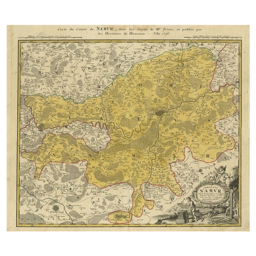
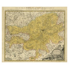
 - Antique Map of the Region of Namen by Homann, 1746By Johann Baptist HomannLocated in Langweer, NLAntique map titled 'Comitatus Namur Tabula Geographica ex mappis Frixianis'. Regional map of Namen, Belgium. Artists and Engravers: Homann Heirs was a German publishing firm tha...Category
Antique 18th Century Maps
MaterialsPaper
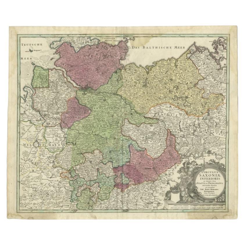
- Antique Map of the Lower Saxony Region by Homann, c.1730By Johann Baptist HomannLocated in Langweer, NLAntique map titled 'Circulus Saxoniae Inferioris (..)'. Map of the Circle of Lower Saxony. The map covers most of present-day northern Germany, as far south as Göttingen, including m...Category
Antique 18th Century Maps
MaterialsPaper
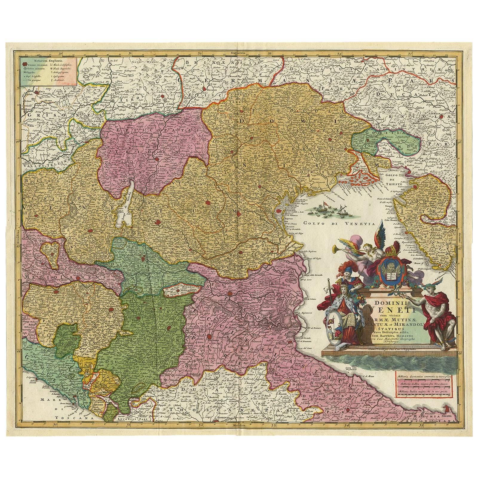
- Stunning Antique Map of Northern Italy by J.B. Homann, circa 1745By Johann Baptist HomannLocated in Langweer, NLThis beautiful hand-colored map covers from Bergamo east as far as Albona (Labin) and from Vipiteno Sterzing south as far as Florence. The map is exceptionally detailed, noting towns, rivers, lakes, cities and a host of additional topographical features. Includes neighboring Parma, Modena, Mantua and Mirandol. The map depicts the Veneto region and its vicinity during the decline of the Republic of Venice. A key in included in the top left quadrant of the map, while a beautifully engraved title cartouche adorns the lower right quadrant. This map was issued in Homann Heirs circa 1745 edition of Atlas Novus Terrarum Orbis.Category
Antique Mid-18th Century Maps
MaterialsPaper
 $566 Sale Price25% Off

Recently Viewed
View AllMore Ways To Browse
Johann Baptist Homann On Sale
Uruguay Antique Map
Nevada Antique Map
Arizona Map
Map Of Arizona
Panama Antique Map
Antique Iowa Map
Maltese Falcon
Map Of Dc
Map Of Iowa
Map Of Majorca
Metal Knight Statue
Antique Map Ontario
Antique Map Puzzle
Antique Maps Ontario
Antique Puerto Rico Map
Derbyshire Antique Map
Antique Furniture Oklahoma City