Items Similar to W&A K Johnston’s Charts of Physical Maps by G W Bacon


Want more images or videos?
Request additional images or videos from the seller
1 of 7
W&A K Johnston’s Charts of Physical Maps by G W Bacon
About the Item
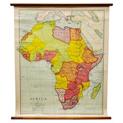
Large University chart “Africa Physical Political” by Bacon
W&A K Johnston’s charts of physical maps by G W Bacon,
This is a Physical Political map of Africa, it is lithograph set on Linen mounted on wooden rods, the chart is in very good bright condition, it is 52” high and 41” wide
GB85.
- Dimensions:Height: 132 in (335.28 cm)Width: 41 in (104.14 cm)Depth: 1 in (2.54 cm)
- Style:Rustic (In the Style Of)
- Materials and Techniques:
- Period:
- Date of Manufacture:1920
- Condition:
- Seller Location:Chillerton, GB
- Reference Number:
About the Seller
4.9
Platinum Seller
These expertly vetted sellers are 1stDibs' most experienced sellers and are rated highest by our customers.
Established in 1980
1stDibs seller since 2017
690 sales on 1stDibs
Typical response time: 2 hours
- ShippingRetrieving quote...Ships From: Chillerton, United Kingdom
- Return PolicyA return for this item may be initiated within 7 days of delivery.
More From This SellerView All
- Large University Chart “Physical Map of Africa” by BaconLocated in Chillerton, Isle of WightLarge university chart “Physical Map of Africa” by Bacon W&A K Johnston’s Charts of Physical Maps By G W Bacon, This is colorful Physical map of North America, it is large lithograph set...Category
Early 20th Century Folk Art Posters
MaterialsLinen
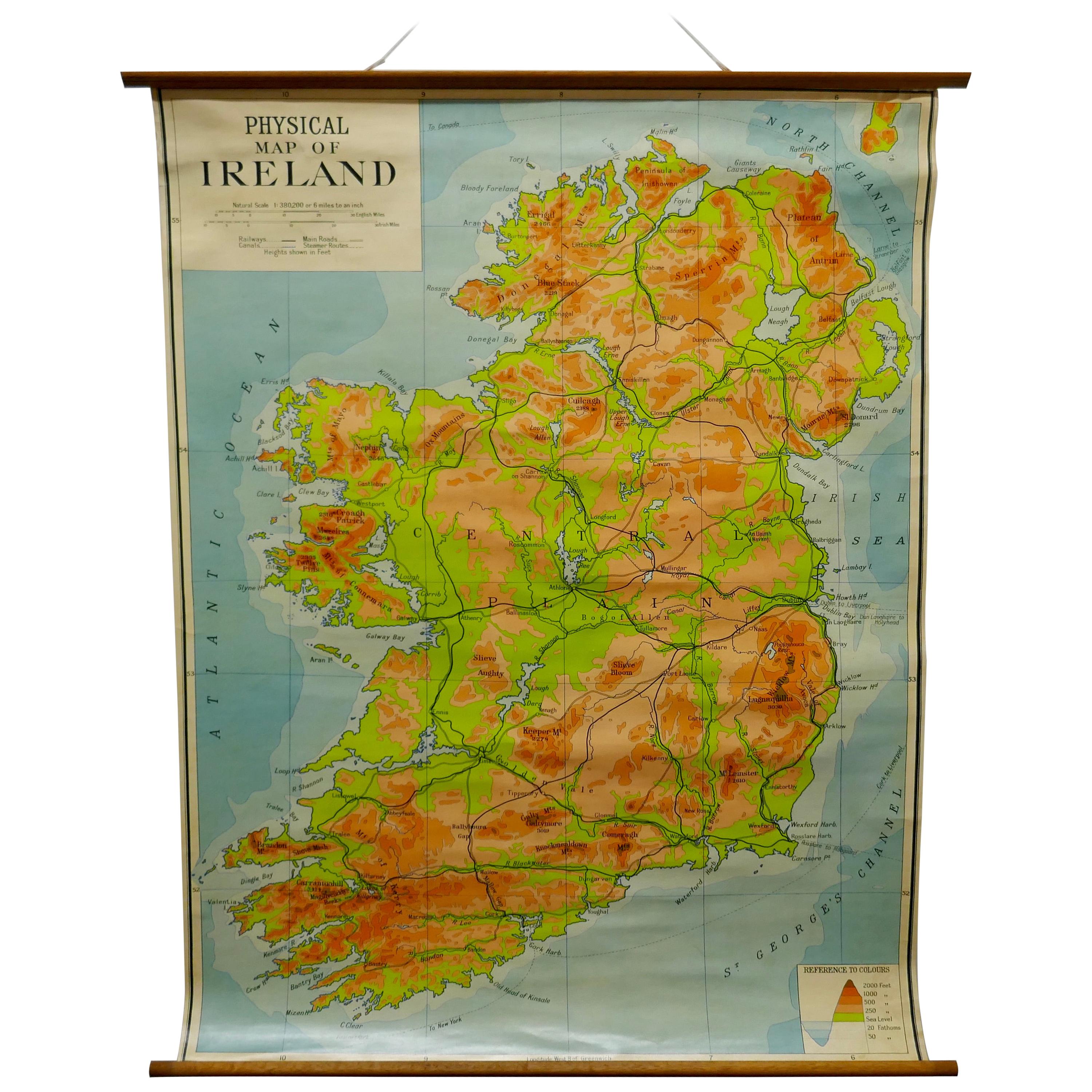
- Large University Chart “Physical Map of Ireland” by BaconLocated in Chillerton, Isle of WightLarge University Chart “Physical Map of Ireland” by Bacon W&A K Johnston’s Charts of Physical Maps By G W Bacon, This is colorful Physical map of Ireland, it is large lithograph set...Category
Early 20th Century International Style Posters
MaterialsLinen
- Large University Chart “Political Map of North America” by BaconLocated in Chillerton, Isle of WightLarge University Chart “Political Map of North America” by Bacon W&A K Johnston’s Charts of Physical Maps By G W Bacon, This is colourful Physical map ...Category
Early 20th Century American Empire Posters
MaterialsLinen
- Large University Chart “Political Map of North America” by BaconLocated in Chillerton, Isle of WightLarge University chart “Political Map of North America” by Bacon W&A K Johnston’s Charts of Political Maps by G W Bacon, This is colorful Physical ...Category
Early 20th Century American Empire Posters
MaterialsLinen
- Large University Chart “Africa Physical ” by BaconLocated in Chillerton, Isle of WightLarge University chart “Africa Physical ” by Bacon W&A K Johnston’s charts of physical maps by G W Bacon, This is a Physical map of Africa, it is lithograph set on Linen mounte...Category
Early 20th Century Beaux Arts Maps
MaterialsLinen
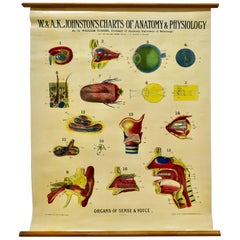
- Large University Anatomical Chart “Organs of Sense & Voice” by TurnerLocated in Chillerton, Isle of WightLarge University anatomical chart “Organs of Sense & Voice” by Turner W&A K Johnston’s Charts of Anatomy and Physiology By Dr William Turner, Professor of Anatomy University of Edinburgh/A J Nystrom & Co US Agents Chicago This is plate 9, Organs of Sense & Voice, by Turner, it is large lithograph set...Category
Early 20th Century Beaux Arts Posters
MaterialsLinen


You May Also Like
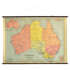
- Antique Vintage Australia Wall Map By W & A K JohnstonBy W. & A.K. JohnstonLocated in Stockbridge, GBVintage Australia Wall Map By W & A K Johnston A vintage school pull down wall map of Australia. The map has a wooden hanging pole at the top...Category
Mid-20th Century British Schoolhouse Posters
MaterialsCanvas, Wood
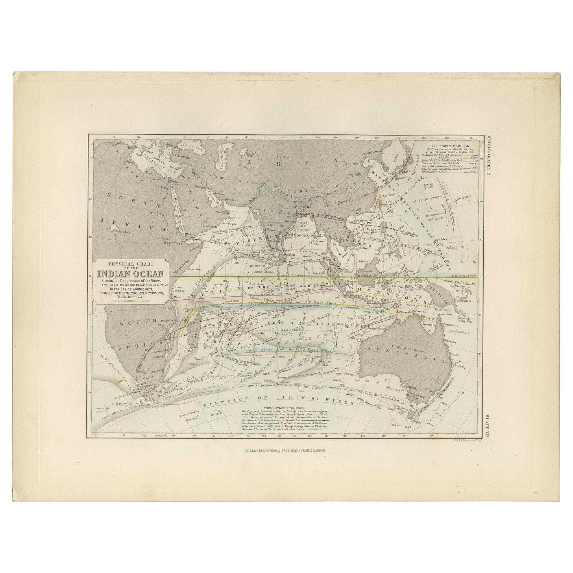
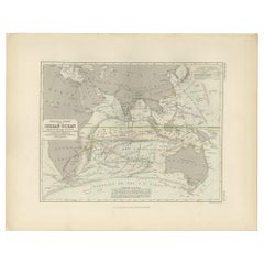
- Antique Physical Chart of the Indian Ocean by Johnston '1850'Located in Langweer, NLAntique map titled 'Physical Chart of the Indian Ocean showing the temperature of the water'. Original antique chart of the Indian Ocean. This map originates from 'The Physical Atlas...Category
Antique Mid-19th Century Maps
MaterialsPaper
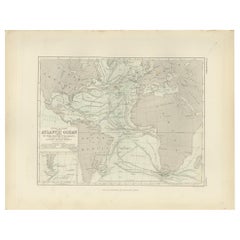
- Antique Physical Chart of the Atlantic Ocean by Johnston '1850'Located in Langweer, NLAntique map titled 'Physical Chart of the Atlantic Ocean showing the form and direction of the currents'. Original antique chart of the Atlantic Ocean. This map originates from 'The ...Category
Antique Mid-19th Century Maps
MaterialsPaper
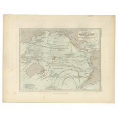
- Antique Physical Chart of the Pacific Ocean by Johnston, '1850'Located in Langweer, NLAntique map titled 'Physical Chart of the Pacific Ocean showing the currents and temperature of the ocean'. Original antique chart of the Pacific Ocean. This map originates from 'The...Category
Antique Mid-19th Century Maps
MaterialsPaper
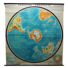
- Southern Hemisphere of the Earth Rollable Map Vintage Wall ChartLocated in Berghuelen, DEA great pull-down map or vintage wall chart illustrating the southern hemisphere of the earth, published by Prof. Dr. C. Troll, Flemmings Verlag Hamburg. Colorful print on paper rein...Category
Mid-20th Century German Country Prints
MaterialsCanvas, Wood, Paper
- Vintage Wall Chart of a Landscape and Geographic Map, circa 1955Located in Langweer, NLVintage wall chart titled 'Kaart en Landschap'. This wall chart shows a mountain range and geographic map. Published by J.B. Wolters, circa 1955.Category
Mid-20th Century Prints
MaterialsPaper

Recently Viewed
View AllMore Ways To Browse
Large Wall Maps
Antique Political Posters
Large Antique Wall Map
Antique Map Poster
Star Wars Movie Posters
Vintage Fab
Large Vintage Wall Map
Flying Birds Wall
Antique French Travel Posters
Retro Style Movie Posters
Retro Style Movie Poster
Retro Posters Australia
Retro Australian Posters
Vintage Car Logo
Retro Hollywood Posters
Alex Vintage Furniture
Comedy Movie Poster
Retro Seaside Posters