Items Similar to 18th Century Map of Paris


Want more images or videos?
Request additional images or videos from the seller
1 of 7
18th Century Map of Paris
About the Item
18th century map of Paris.
- Dimensions:Height: 23 in (58.42 cm)Width: 32 in (81.28 cm)Depth: 1 in (2.54 cm)
- Materials and Techniques:
- Place of Origin:
- Period:
- Date of Manufacture:1775
- Condition:Wear consistent with age and use.
- Seller Location:Washington, DC
- Reference Number:
About the Seller
4.7
Gold Seller
These expertly vetted sellers are highly rated and consistently exceed customer expectations.
1stDibs seller since 2009
154 sales on 1stDibs
Typical response time: <1 hour
- ShippingRetrieving quote...Ships From: Washington , DC
- Return PolicyA return for this item may be initiated within 3 days of delivery.
More From This SellerView All
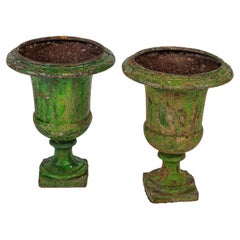
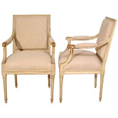
- A pair of 18th century large green painted urns.Located in Washington, DC18th century painted medici urn. Nice large size. Patina is wonderful, this pair of painted medici urns would enhance any room, inside or out. The square bases are 11.5" Square.Category
Antique 18th Century French Urns
MaterialsIron
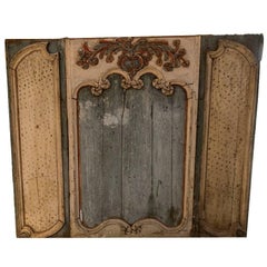
- 18th Century Painted Boiserie PanelLocated in Washington, DCA 18th century painted boiserie panel.Category
Antique 18th Century French Decorative Art
MaterialsWood, Paint
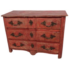
- Danish 18th Century Arbalete CommodeLocated in Washington, DCA Danish 18th century commode in the arbalete form. This piece is soundly constructed in painted wood. The patina and painted finished are wonderful. Wh...Category
Antique 18th Century Danish French Provincial Commodes and Chests of Dra...
MaterialsPaint, Wood
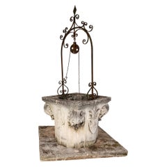
- 18th Century Vincenza Stone WellheadLocated in Washington, DCAn 18th century Vincenza stone wellhead. This came from a palazzo in Veneto region of Italy.Category
Antique 18th Century Italian Baroque Architectural Elements
MaterialsStone
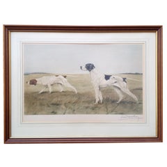
- Lithograph of Two PointersLocated in Washington, DCSigned Lithograph of Two Pointers. Artist is Leon DanchinCategory
20th Century French Prints
MaterialsPaper, Lithograph, Wood
- Pair of 18th Century Painted Square Back Louis XVI FauteuilsLocated in Washington, DCPair of 18th Century Painted Square Back Louis XVI FauteuilsCategory
Antique 18th Century French Louis XVI Armchairs
MaterialsUpholstery, Wood, Paint
You May Also Like
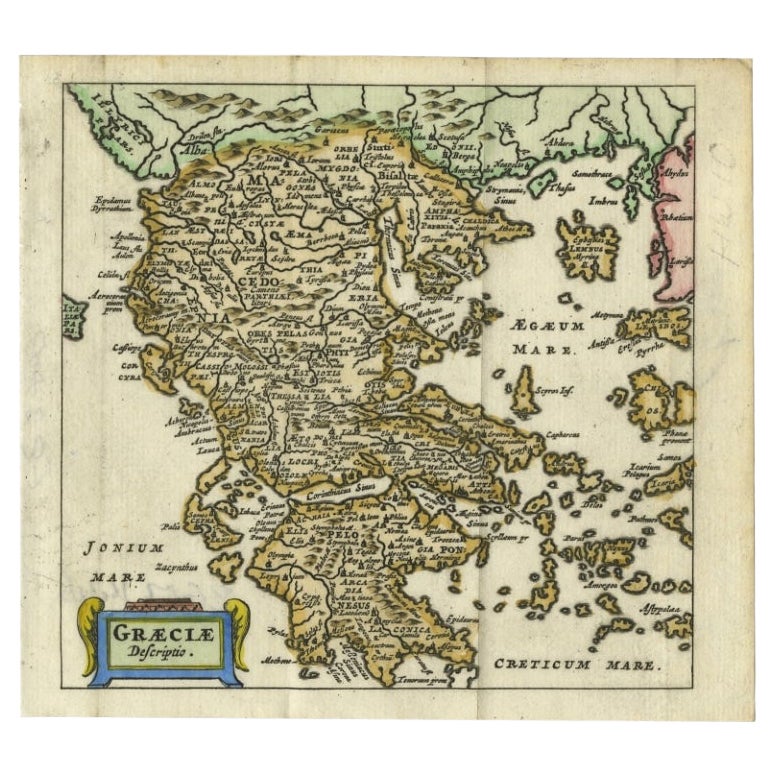
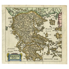
- Charming 18th Century Miniature Map of Greece, 1685Located in Langweer, NLAntique map titled 'Graeciae Descriptio.' Charming miniature map of Greece from the pocket atlas 'Introductionis in Universam Geographiam tam Veterem qu...Category
Antique 17th Century Maps
MaterialsPaper
- Antique 18th Century Map of the Province of Pensilvania 'Pennsylvania State'Located in Philadelphia, PAA fine antique of the colony of Pennsylvania. Noted at the top of the sheet as a 'Map of the province of Pensilvania'. This undated and anonymous map is thought to be from the Gentleman's Magazine, London, circa 1775, although the general appearance could date it to the 1760's. The southern boundary reflects the Mason-Dixon survey (1768), the western boundary is placed just west of Pittsburgh, and the northern boundary is not marked. The map has a number of reference points that likely refer to companion text and appear to be connected to boundaries. The western and southern boundaries are marked Q, R, S, for example. A diagonal line runs from the Susquehanna R to the Lake Erie P. A broken line marked by many letters A, B, N, O, etc., appears in the east. There are no latitude or longitude markings, blank verso. Framed in a shaped contemporary gilt wooden frame and matted under a cream colored matte. Bearing an old Graham Arader Gallery...Category
Antique 18th Century British American Colonial Maps
MaterialsPaper
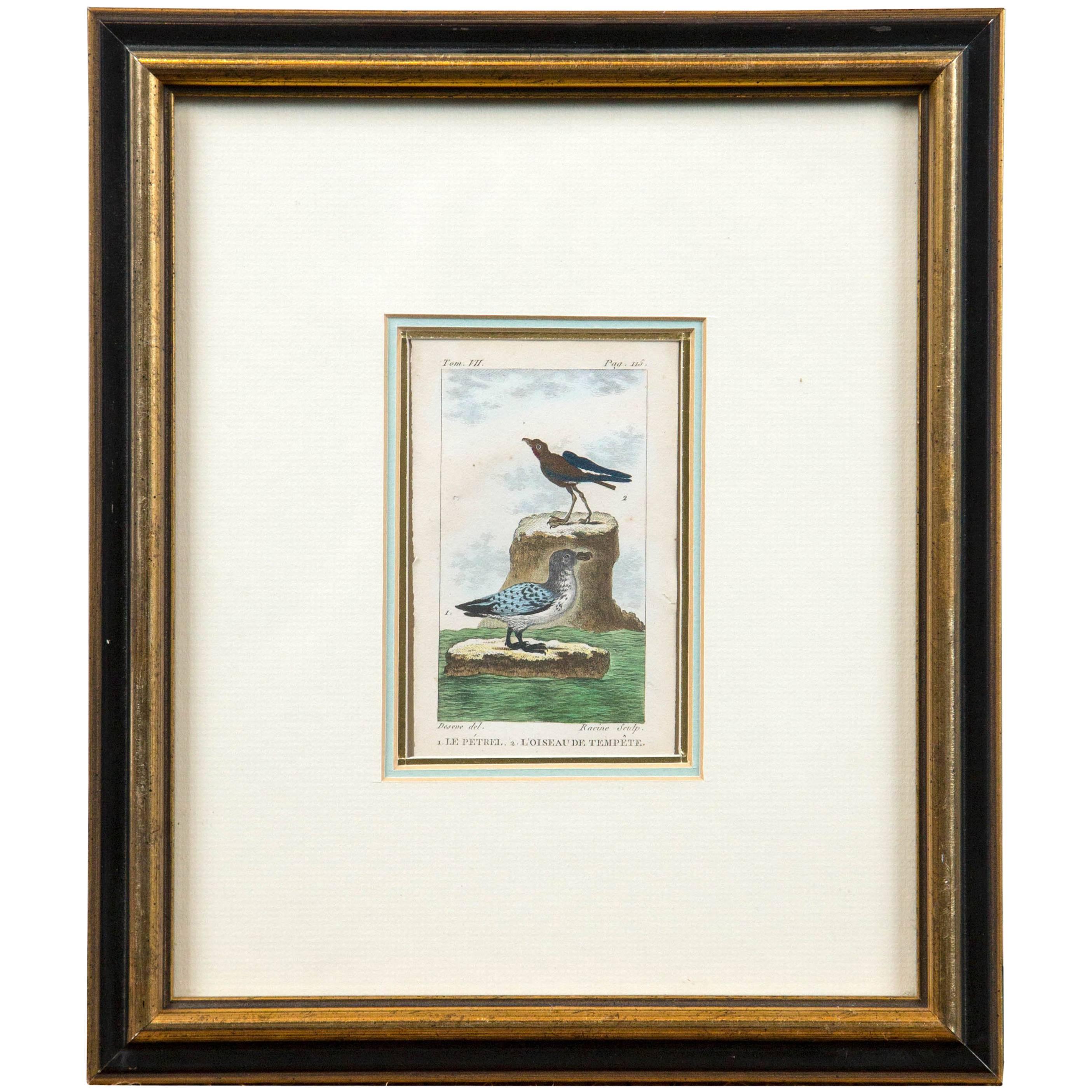
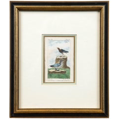
- Antique French Engraving of Birds, Paris, Late 18th CenturyBy François Nicolas MartinetLocated in Chappaqua, NYAntique French engraving of birds, Paris, late 18th century. From the Histoire Naturelle des Oiseaux published from 1770-1786. A hand-colored,...Category
Antique Late 18th Century French Prints
MaterialsPaper
- 18th Century Hand Colored Map of Spain and Portugal by VisscherBy Nicolaes Visscher IILocated in Alamo, CAThis is an early 18th century map of Spain and Portugal, with attractive original hand-coloring, entitled "Hispaniae et Portugalliae Regna per Nicolaum Visscher cum Privilegio Ordinu...Category
Antique Early 18th Century Dutch Maps
MaterialsPaper
- Scandinavia & Portions of Eastern Europe: 18th Century Hand-Colored Homann MapBy Johann Baptist HomannLocated in Alamo, CAAn early 18th century hand-colored copper-plate map entitled "Regni Sueciae in omnes suas Subjacentes Provincias accurate divisi Tabula Generalis" by Johann Baptist Homann (1663-1724...Category
Antique Early 18th Century German Maps
MaterialsPaper
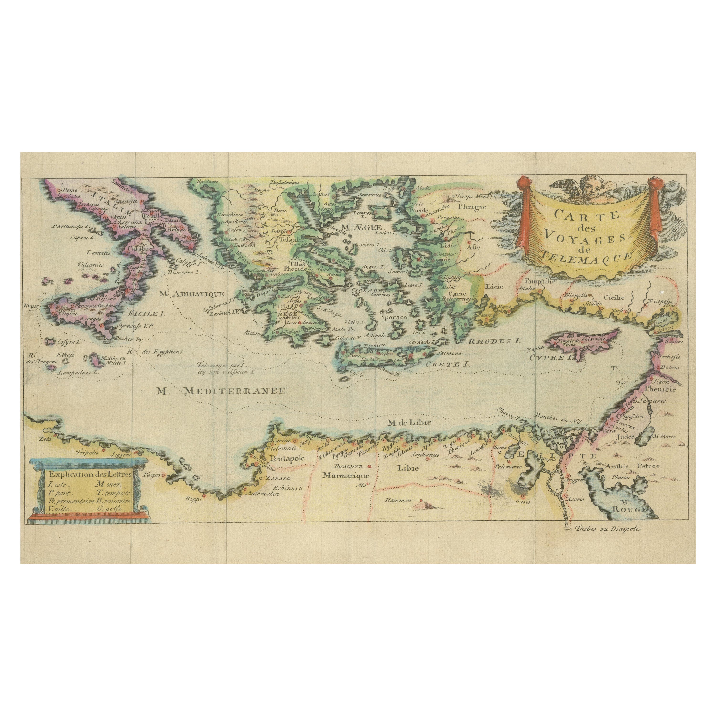
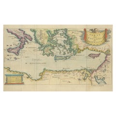
- Antique Map of the Mediterranean, Telemachus' Journey, Publ. Early 18th CenturyLocated in Langweer, NLTitle: Carte des voyages de Télémaque. Description: Antique map of Telemachus journey, the son of Odysseus and Penelope (Greek mythology ). This map appeared for the first time, e...Category
Antique Early 18th Century Maps
MaterialsPaper


Recently Viewed
View AllMore Ways To Browse
Ruffed Grouse
Antique Chameleon Print
John James Audubon Mallard Duck
Jacob Strutt
Mucha Documents Decoratifs
Francois Montagne
Oda Mayumi
Peintres Flamands
Salto Lithograph
Dirty Dogs Of Paris
Antique Circus Decor
Alexandre Serebriakoff
Dali Dantes Inferno
Volkamer Prints
Joao Barbosa
Lucy Dawson
Jacob George Strutt
The Dirty Dogs Of Paris