Items Similar to Antique City Plan of Rotterdam in Frame, ca.1850


Want more images or videos?
Request additional images or videos from the seller
1 of 5
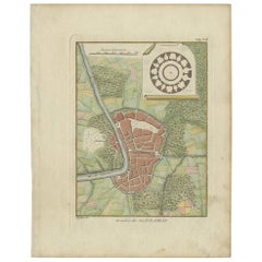
Antique City Plan of Rotterdam in Frame, ca.1850
About the Item
Antique map titled 'Grondkaart der stad Rotterdam (..)'. Original antique city plan of Rotterdam, the Netherlands. Published circa 1850.
Artists and Engravers: Published by Van der Meer en Verbruggen.
Condition: Good, general age-related toning. Minor wear and foxing. Frame included, few small defects. Please study image carefully.
Date: c.1850
Overall size: 75 x 70 cm
Image size: 53 x 46 cm
We also offer thousands of antique prints covering fields of interest as diverse as architecture, natural history, religion, ethnology and many more. Antique prints have long been appreciated for both their aesthetic and investment value. They were the product of engraved, etched or lithographed plates. These plates were handmade out of wood or metal, which required an incredible level of skill, patience and craftsmanship. Whether you have a house with Victorian furniture or more contemporary decor an old engraving can enhance your living space.
- Dimensions:Height: 27.56 in (70 cm)Width: 29.53 in (75 cm)Depth: 0 in (0.01 mm)
- Materials and Techniques:
- Period:
- Date of Manufacture:circa 1850
- Condition:
- Seller Location:Langweer, NL
- Reference Number:
About the Seller
5.0
Platinum Seller
These expertly vetted sellers are 1stDibs' most experienced sellers and are rated highest by our customers.
Established in 2009
1stDibs seller since 2017
1,909 sales on 1stDibs
Typical response time: <1 hour
- ShippingRetrieving quote...Ships From: Langweer, Netherlands
- Return PolicyA return for this item may be initiated within 14 days of delivery.
More From This SellerView All
- Antique Plan of the City of Bayonne, FranceLocated in Langweer, NLAntique map titled 'Plan de Bayonne'. Original old plan of the city of Bayonne, France. This map originates from 'Le Petit Atlas Maritime (..)' by J.N. Bellin. Published 1764. Be...Category
Antique Mid-18th Century Maps
MaterialsPaper
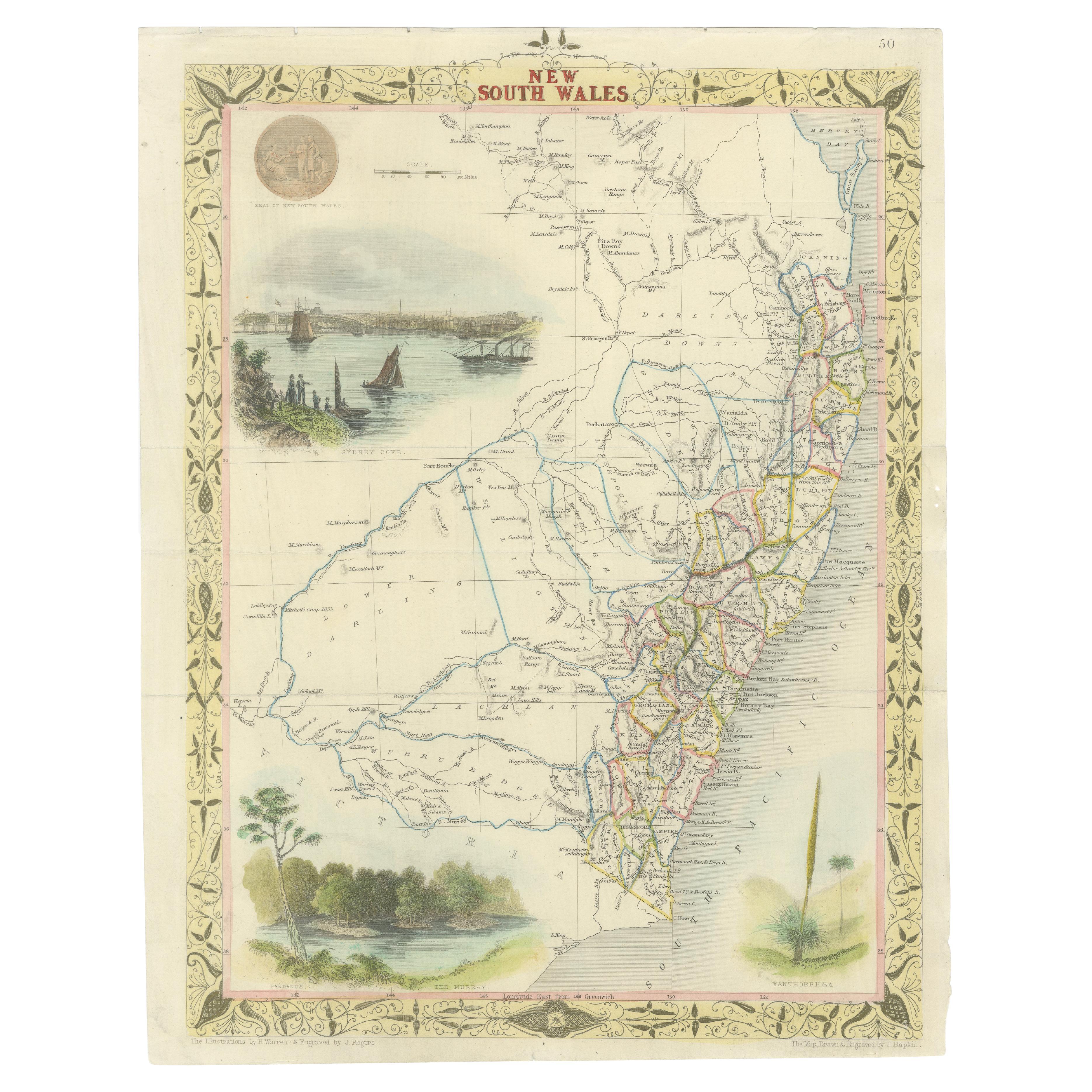
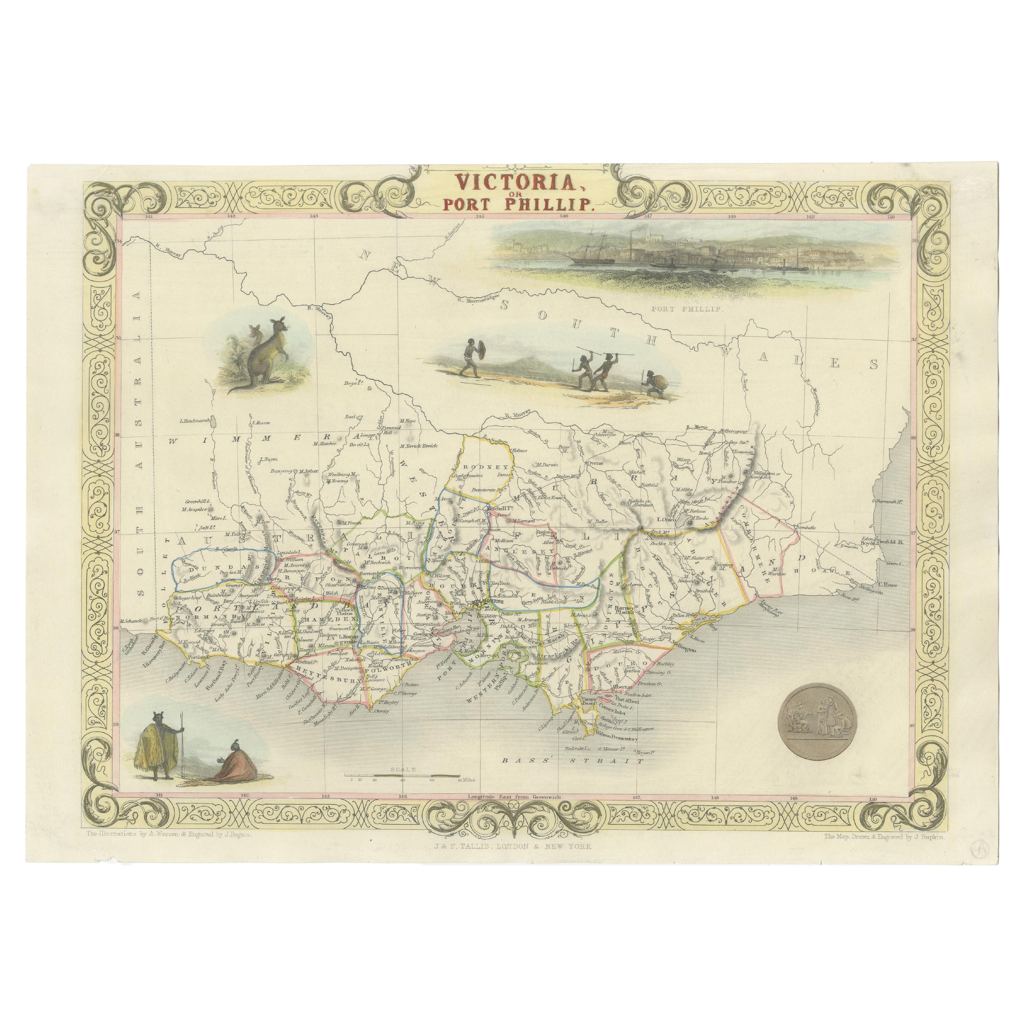
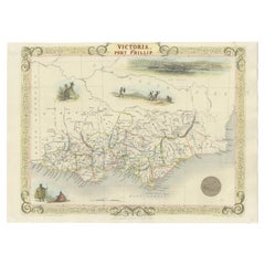
- Antique Map of New South Wales in Australia, ca. 1850Located in Langweer, NLAntique map of Victoria, or Port Phillip (12.7 x 10.0") in Australia. Superb map of Victoria roughly centered on Melbourne. Vignettes of Aborigines, a ...Category
Antique Mid-19th Century European Maps
MaterialsPaper
- Antique Map of Victoria, or Port Phillip in Australia, ca. 1850Located in Langweer, NLThis antique map, measuring approximately 12.7 x 10.0 inches, showcases Victoria, specifically centered around Melbourne, Australia. Crafted by John Tallis around 1850, this map is p...Category
Antique Mid-19th Century European Maps
MaterialsPaper
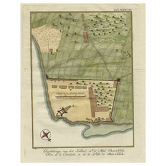
- Original Antique Plan of the Fortress of Charedsch in Persia or Iran, ca.1780Located in Langweer, NLAntique map, titled: 'Plan de la Citadelle de la Ville de Charedsch.' Plan of the fortress of Charedsch, Iran / Persia. This original antique print originates from 'Reize naar Ar...Category
Antique 1780s Maps
MaterialsPaper
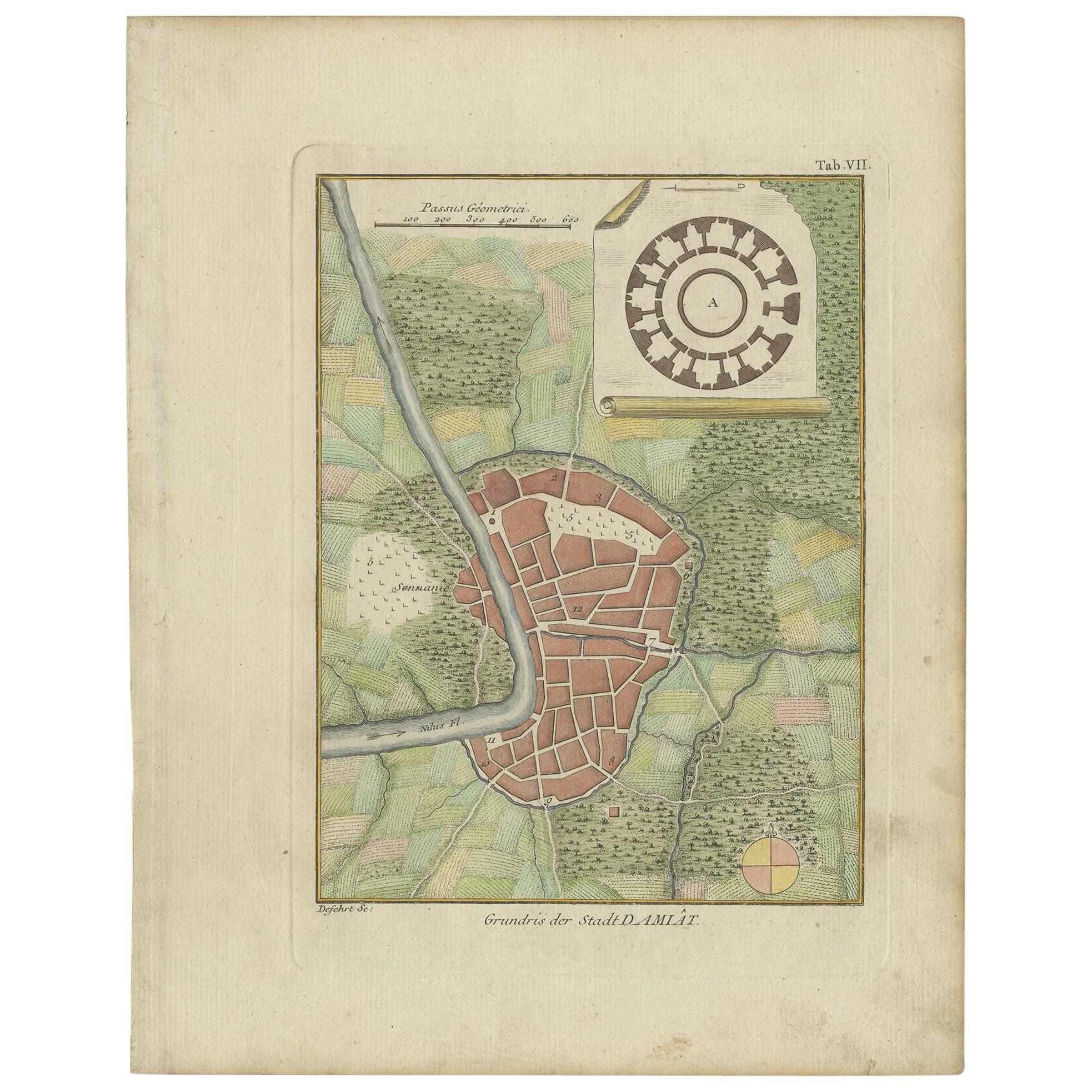
- Antique Plan of the City of Damietta Egypt by C. Niebuhr, 1774Located in Langweer, NLAntique print titled 'Grundris der Stadt Damiât'. This print originates from 'Reisebeschreibung nach Arabien und andern umliegenden Ländern' by C. Niebuhr, 1774.Category
Antique Late 18th Century Prints
MaterialsPaper
- Antique Plan of the City of Calcutta 'India' by Letts, 1883Located in Langweer, NLBeautiful colored plan showing buildings (with key), Fort William, race ground, canals, railroads, etc. This plan originates from Letts's Popular Atlas.Category
Antique Late 19th Century Maps
MaterialsPaper


You May Also Like
- Original Antique Map / City Plan of Brussels by Tallis, circa 1850Located in St Annes, LancashireGreat map of Brussels. Steel engraving. Published by London Printing & Publishing Co. (Formerly Tallis), C.1850 Free shipping.Category
Antique 1850s English Maps
MaterialsPaper
- Catalogue of Engraved Views, Plans, Etc., Of New York City, 1st EdLocated in valatie, NYA catalogue of engraved views, plans, etc., Of New York City, (The Collection of Percy R. Pyne II). Privately Printed by The De Vinne Press, New York, 1912. Limited to 100 copies. Gr...Category
Early 20th Century American Books
MaterialsPaper
- Lithographic print on paper, depicting the atlas of the hand, France 1850 ca.Located in Milan, ITAn anatomical lithographic print on paper, depicting the anatomical atlas of the hand. Black lacquered fir wood frame with golden ramin wood batting. N. H. Ja...Category
Antique Mid-19th Century French Prints
MaterialsGlass, Wood, Paper
- Original Antique Map of Belgium by Tallis, Circa 1850Located in St Annes, LancashireGreat map of Belgium Steel engraving Many lovely vignettes Published by London Printing & Publishing Co. ( Formerly Tallis ), C.1850 Origin...Category
Antique 1850s English Maps
MaterialsPaper
- Dutch Map and City Plan of La Roche-sur-Foron, France, 17th Century Hand ColoredBy Coenraet DeckerLocated in Alamo, CA"Rupes Allobrogum vulgo La Roche" by Dutch engraver Coenraet Decker (1650-1685) is from the atlas Theatrum Statuum Regiae Celestudinis Sabaudiae Ducis, published in 1682. This richly...Category
Antique Late 17th Century Dutch Maps
MaterialsPaper
- Original Antique Print, Portrait of Lord Nelson, circa 1850Located in St Annes, LancashireGreat image of Lord Nelson Fine steel engraving by H.Robinson After J.Hoppner Published circa 1850 Unframed.Category
Antique 1850s English Prints
MaterialsPaper


Recently Viewed
View AllMore Ways To Browse
Framed Architectural Engravings
Green Tapestry
Green Kitchen Cabinets
Large Wooden Cabinet
Ralph By Ralph Lauren
Antique Brass Door Lock
Mid Century Cabinet Gold
Painted Wooden Cabinet
Pair Of Cabinets With Glass Doors
Miss Vintage
Pair French Side Cabinets
Antique Kitchen Cabinet Painted
Antique Large Display Cabinet
Tapestry Wall Hanging
Lacquer Display Cases
Make Up Cabinet
Large Antique Display Cabinets
Large Antique Display Cabinet