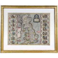
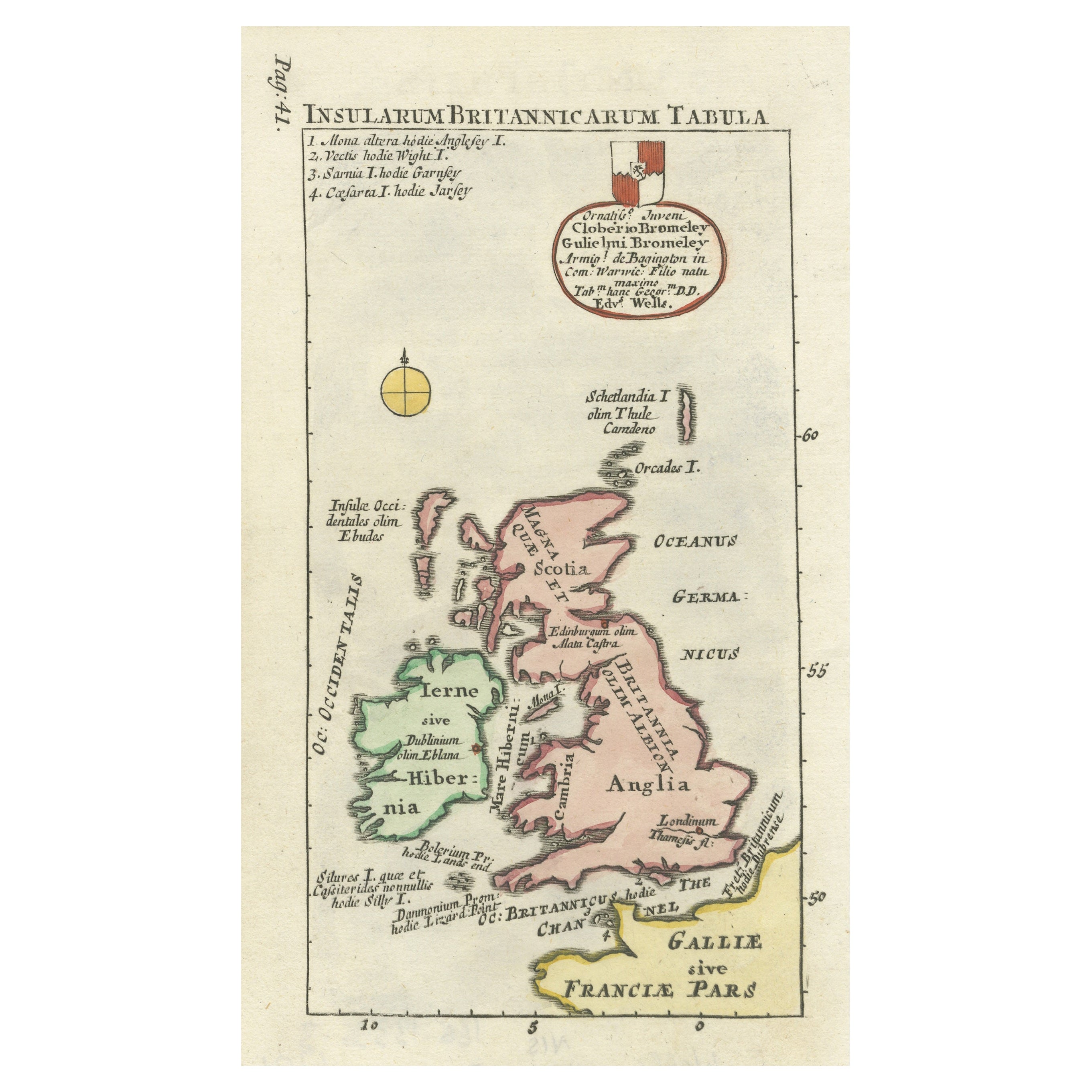
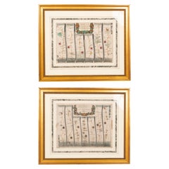
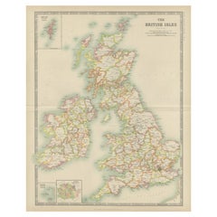
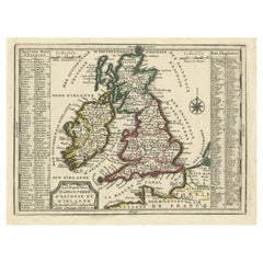
Framed Map of the British Isles by John Speed
View Similar Items


Want more images or videos?
Request additional images or videos from the seller
1 of 10
Framed Map of the British Isles by John Speed
About the Item
- Dimensions:Height: 22 in (55.88 cm)Width: 26.5 in (67.31 cm)Depth: 1.25 in (3.18 cm)
- Period:
- Date of Manufacture:1645
- Condition:Image H 15.25 x 20 w.
- Seller Location:Essex, MA
- Reference Number:1stDibs: LU83819762161
About the Seller
4.9
Gold Seller
These expertly vetted sellers are highly rated and consistently exceed customer expectations.
Established in 1985
1stDibs seller since 2007
813 sales on 1stDibs
Typical response time: 2 hours
Associations
The Art and Antique Dealers League of America
More From This SellerView All
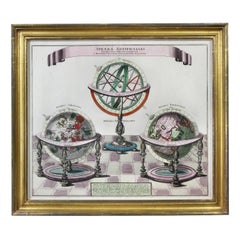
- Framed Engraving By Matthaus Seutter Of Sphaerae ArtificialesLocated in Essex, MACartographer from Germany 1678-1757. Hand colored. Gilt wood frame. Estate of William Hodgins.Category
Antique Early 1700s German Prints
MaterialsPaper
- Set of Twelve Colored Engravings of the Defeat of the Spanish Armada by J. PineLocated in Essex, MABy John Pine considered the foremost heraldic and decorative engraver of his generation. Depicting the defeat of the Spanish by the English Fleet in 1588. These are after a set of tapestries that hung in the House of Commons...Category
Antique 1740s English Prints
MaterialsPaper
- Pair of Road Maps of England by John OgilbyLocated in Essex, MAThe first road maps of England. London to Holyhead and London to Carlisle. Nicely framed and matted. These are plates removed from a book. These are fir...Category
Antique 1690s English Prints
MaterialsPaper
 $1,850 / set
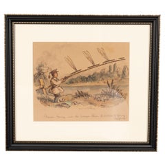
 - Framed Watercolor By Illustrator John LeechLocated in Essex, MAA famous illustrator and caricaturist best known for his illustrations for Punch magazine. He died at age 47 in 1864. Titled " Master George and The Dragon Flies". "A Caution to Youn...Category
Antique 1850s English Books
MaterialsGlass, Paper
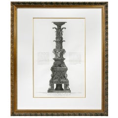
- Framed Engraving of a Candelabrum by Francisco PiranesiLocated in Essex, MANicely framed and matted with a wonderful classical engraving with notations and title.Category
Antique 18th Century Italian Classical Roman Prints
MaterialsPaper
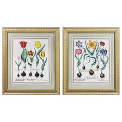
- Pair of Framed Hand Colored Engravings of Tulips by Basilius BeslerBy Basilius BeslerLocated in Essex, MAEach with crisp vivid colors of the most desirable tulip series.Category
Antique Mid-17th Century European Prints
MaterialsPaper

You May Also Like
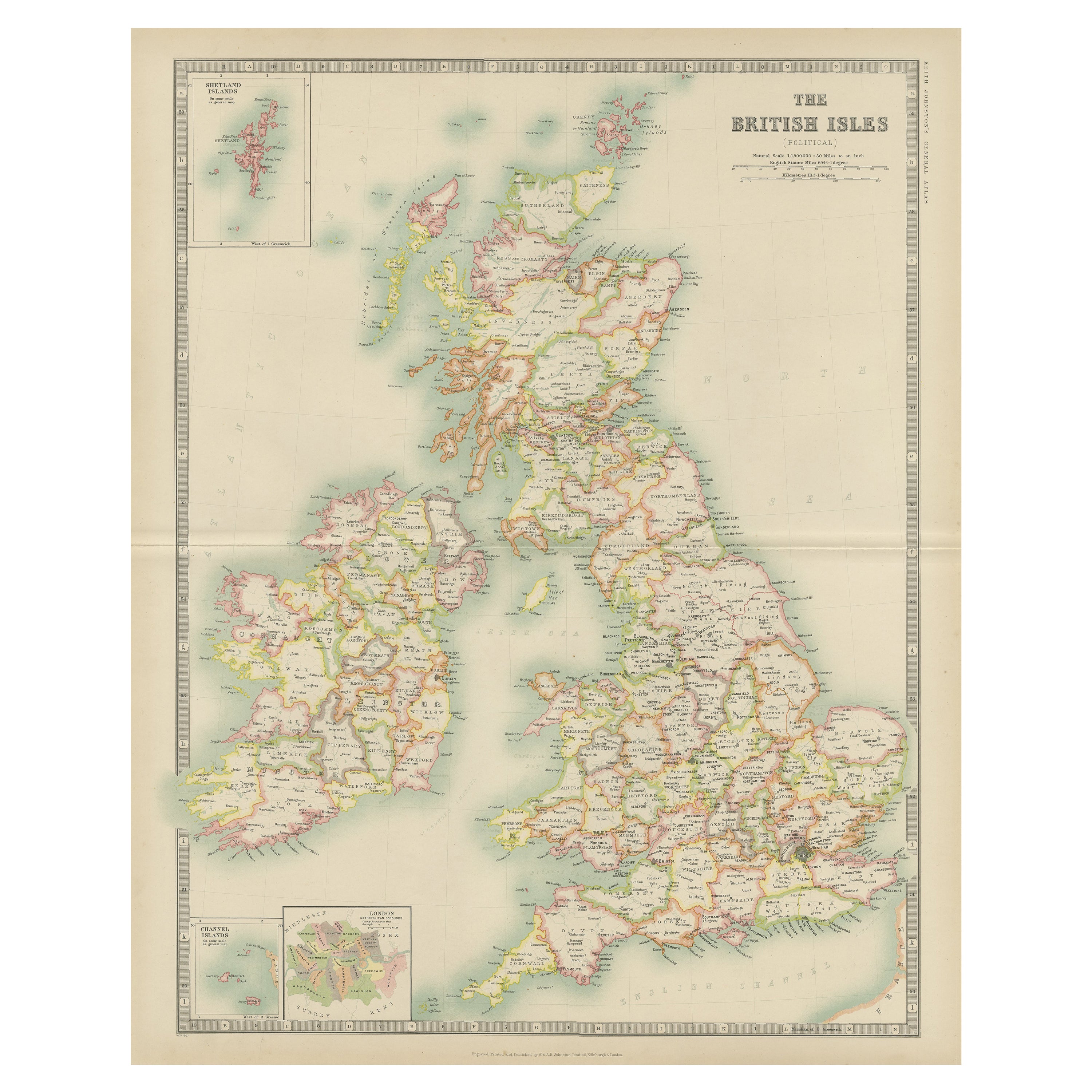
- Antique Map of the British Isles by Johnston '1909'Located in Langweer, NLAntique map titled 'The British Isles'. Original antique map of the British Isles. With inset maps of the Shetland Islands, Chanel Islands, and London. T...Category
Early 20th Century Maps
MaterialsPaper
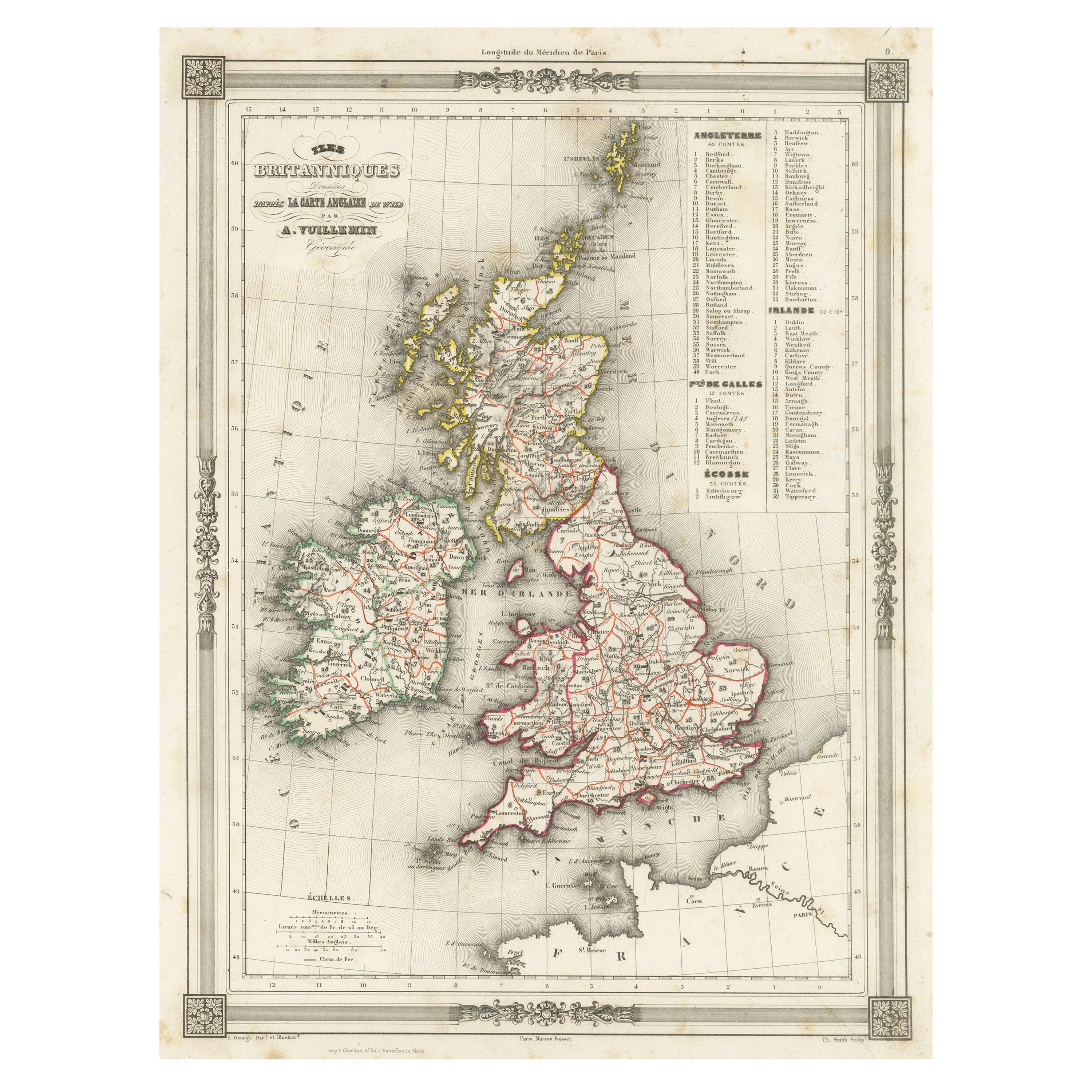
- Antique Map of the British Isles by Balbi '1847'Located in Langweer, NLAntique map titled 'Iles Britanniques'. Original antique map of the British Isles. This map originates from 'Abrégé de Géographie (..)' by Adrien Balbi. ...Category
Antique Mid-19th Century Maps
MaterialsPaper
- Antique Map of the British Isles by H. Chatelain, 1719By Henri-Abraham ChatelainLocated in Langweer, NLBeautiful hand colored large format map of the British Isles, with large insets of the Eastern and Western Hemispheres and the coats of arms for Engl...Category
Antique Early 18th Century Maps
MaterialsPaper
 $614 Sale Price24% Off
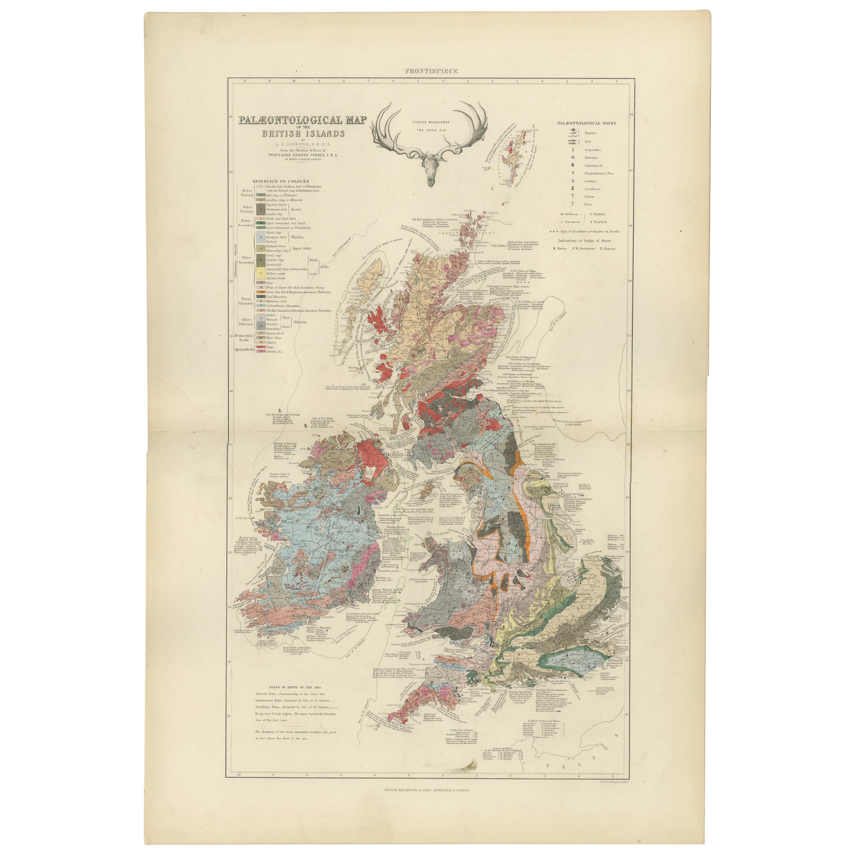
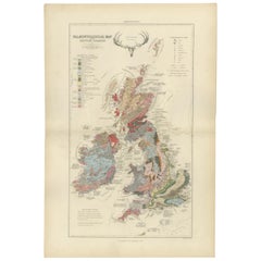
 - Antique Map of the Palaeontology of the British Isles by Johnston '1850'Located in Langweer, NLAntique map titled 'Palaeontological Map of the British Islands'. Original antique map showing the palaeontology of the British Isles. This map originates from 'The Physical Atlas of...Category
Antique Mid-19th Century Maps
MaterialsPaper
- Antique Map of the British Isles with Outline ColoringLocated in Langweer, NLAntique map titled 'Iles Britanniques'. Attractive map of the British Isles. Details England, Scotland and Ireland as well as parts of neighboring France. Upper right corner features...Category
Antique Mid-19th Century Maps
MaterialsPaper
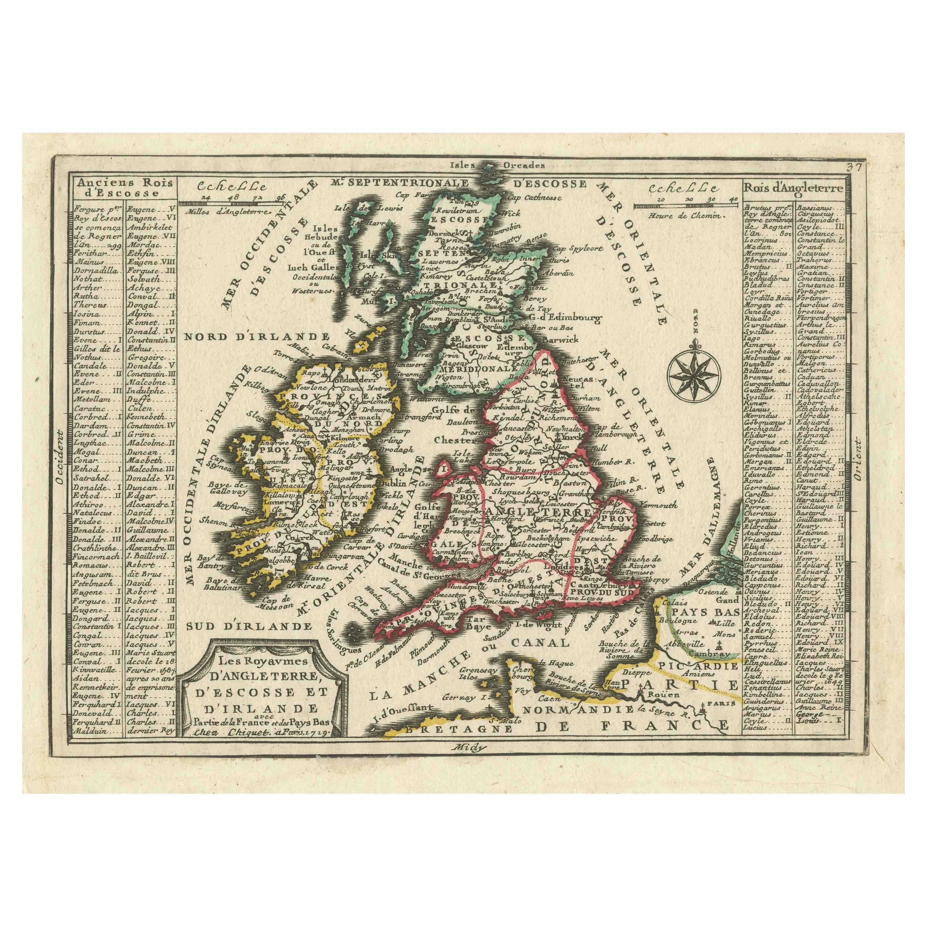
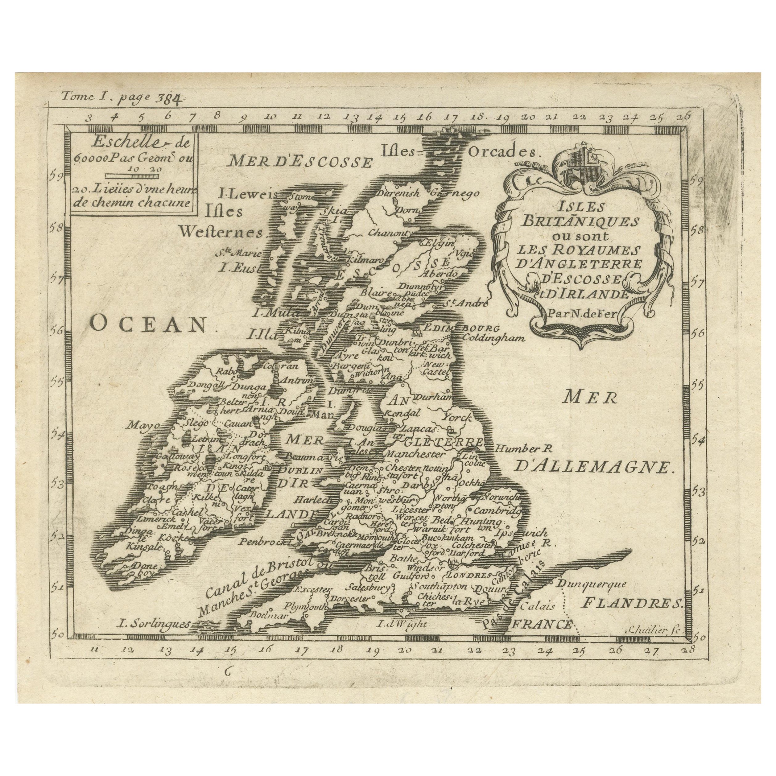
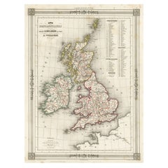
- Map of the British Isles with Historical Kings, 1719Located in Langweer, NLThis antique map, titled "Les Royaumes d'Angleterre d'Escosse et d'Irlande," offers a detailed view of the British Isles, including England, Wales, Scotland, and Ireland. Additionall...Category
Antique Early 18th Century Maps
MaterialsPaper

Recently Viewed
View AllMore Ways To Browse
Letterpress Furniture
Speed Map
British Empire Map
British Isles Antique Map
John Speed Maps
John Speed Map
John Speed Antique Maps
Antique French Walnut Chests
Antique Corner Glass Cabinet
French Art Deco Dress
Pair Of Louis Chest
Art Nouveau Finnish
French Antique Chest Walnut
English Oak Chest Of Drawers
French Table Flowers Set
French Neoclassical Panels
Mid Century Door Commodes
Short Shelves