Items Similar to Krevelt, Map, Coast of Brazil, South America, Amazon, Hand Coloured
Want more images or videos?
Request additional images or videos from the seller
1 of 7
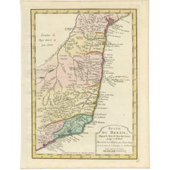
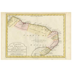
Krevelt, Map, Coast of Brazil, South America, Amazon, Hand Coloured
About the Item
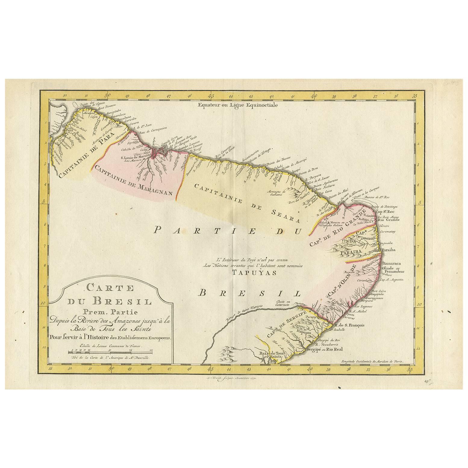
Carte Du Bresil
Prem. Partie Depuis la Riviere des Amazones jusqu' à la Baie de Tous les Saints Pour servir à l'Histoire des Etablissemens Europeens.
A. v. Krevelt, sculpsit, Amsterdam 1772
Detailed regional map of the coast of Brazil, from Maracana to Baye de Tous les Saints.
Covers Capitanie De Maragnan, Seara, Rio Grande, Paraiba, D'Olinde and Sergipe.
Includes a decorative title cartouche. One of the maps produced by Nichlas Bellin for Prevost d'Exiles influential travel book, L'Histoire Generale des Voyages.
Measures: 43 x 24.8 cm.
Upper margin tight. Trimmed to plate line.
- Dimensions:Height: 9.77 in (24.8 cm)Width: 16.93 in (43 cm)Depth: 0.04 in (1 mm)
- Materials and Techniques:
- Place of Origin:
- Period:
- Date of Manufacture:1772
- Condition:Wear consistent with age and use.
- Seller Location:Norwich, GB
- Reference Number:1stDibs: LU7031230832582
About the Seller
No Reviews Yet
Vetted Seller
These experienced sellers undergo a comprehensive evaluation by our team of in-house experts.
Established in 1992
1stDibs seller since 2022
8 sales on 1stDibs
- ShippingRetrieving quote...Ships From: Norwich, United Kingdom
- Return PolicyA return for this item may be initiated within 14 days of delivery.
More From This SellerView All
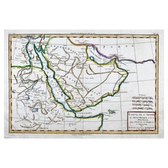
- Bonne, Map of Middle East, Persia, Red Sea, Egypt, Nubia Hand ColouredLocated in Norwich, GBRigobert Bonne. Carte de L'Arabia du Golfe Persique et de la Mer Rouge, avec l’Egypte, la Nubia et l’Abissinie From Bonne's Atlas de toutes les parties connues du Globe Terres...Category
Antique 1780s French Prints
MaterialsPaper
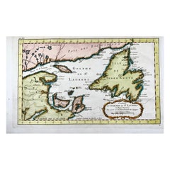
- Bellin, Canada, Gulf of Saint Lawrence, Hand Coloured EngravingBy Jacques-Nicolas BellinLocated in Norwich, GBJ.V. Schley after Bellin ‘Carte du Golphe de St. Laurent et Pays Voisins’ Size: 14.2 x 8.6 inches 36.1 x 21.8 cm First state of this nice copper engraved map of St. Lawrence Bay with Anticosti Island, Prince Edward Island, Cape Breton...Category
Antique 1780s French Prints
MaterialsPaper
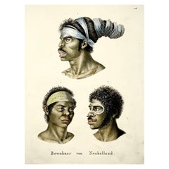
- Brodtmann, Aborigines of Australia, Folio, Stone Lithograph, Hand ColouredBy Brodtmann, K.J.A.Located in Norwich, GBPortraits of Australian aborigines based on Nicholas Petit’s engravings issued in the Baudin voyage account. 1. Top: Aboriginal man with his hair wrapped in paperbark strips told ...Category
Antique 1840s American Early Victorian Prints
MaterialsPaper
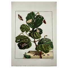
- Butterlies, Metamorphosis of Insects, Large Folio, L'Admiral, Hand ColouredLocated in Norwich, GBAntique print, untitled. From: 'Naauwkeurige waarnemingen omtrent de veranderingen van veele insekten …' Published 1740. Overall size: 36.5 x 26.2 cm Original hand colour. ...Category
Antique 1740s Dutch Prints
MaterialsPaper
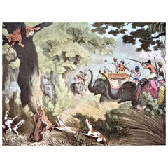
- Th. Williamson, Tiger Hunt, hand coloured aquatintBy Samuel HowittLocated in Norwich, GBThomas Williamson (1758-1817) and Samuel Howitt (1765-1822) Tiger Hunt From: Oriental Field Sports being a complete, detailed, and accurate descriptio...Category
Antique Early 1800s English Georgian Prints
MaterialsPaper
- Merian, Butterflies, Moths, Folio, Hand Coloured EngravingLocated in Norwich, GBFolio Leaf: 37 x 23 cms. Hand colored copper engraving. Matthäus Merian der Ältere (or "Matthew", "the Elder", or "Sr."; 22 September 1593 - 19 June 1650) was a Swiss-born engr...Category
Antique Early 1700s German Baroque Prints
MaterialsPaper

You May Also Like
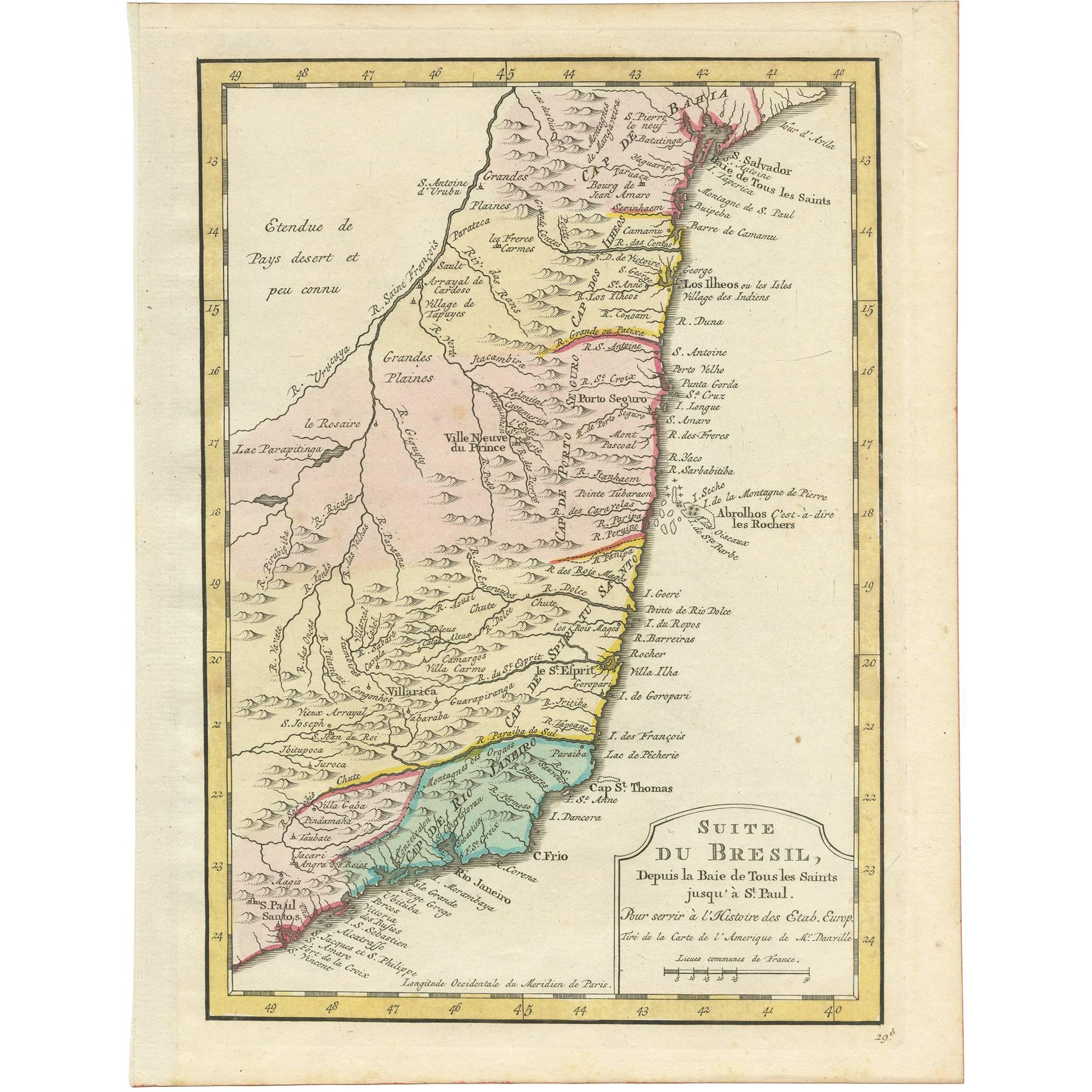
- Antique Map of the Brazilian Coast by A. Van KreveltLocated in Langweer, NLUncommon edition of this accurate map of part of Brazil, from San Salvador till Rio de Janeiro and S.Paulo. In lower right engraved "29b." Originates from 'Atlas Portatif pour servir...Category
Antique Late 18th Century Brazilian Maps
MaterialsPaper
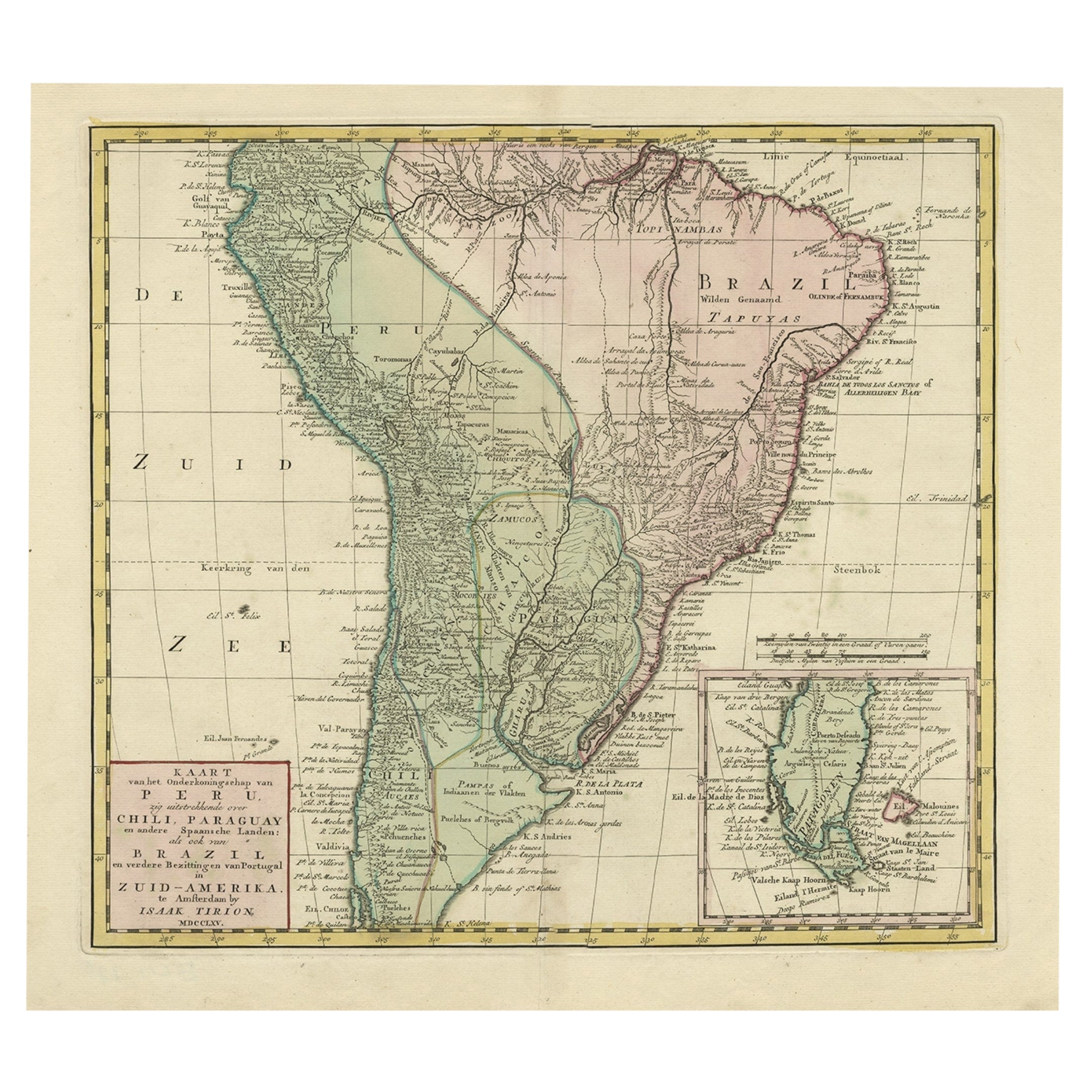
- Attractive Antique Hand-Coloured Map of South America, ca.1765Located in Langweer, NLAntique map titled 'Kaart van het Onderkoningschap van Peru zig uitstrekkende: over Chile, Paraguay en andere Spaansche Landen als ook van Brazil en verdere Bezittingen van Portugal ...Category
Antique 1760s Maps
MaterialsPaper
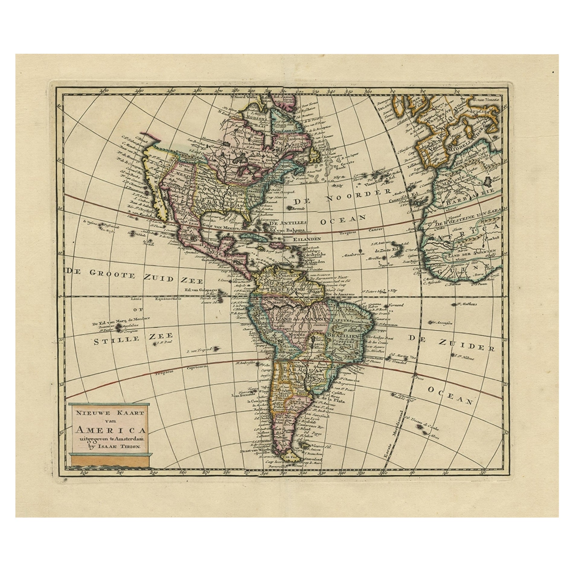
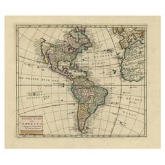
- Antique Hand-Coloured Map of North and South America, ca.1765Located in Langweer, NLDescription: Antique map titled 'Nieuwe Kaart van Amerika.' Attractive map of North and South America, the western part of Africa and south west Europe. Source unknown, to be determi...Category
Antique 1760s Maps
MaterialsPaper
- Antique Map of the Eastern Part of Brazil by A. Van Krevelt, 1772Located in Langweer, NLRare edition of this accurate map of eastern part of Brazil. This map originates from 'Atlas Portatif pour servir a l'intelligence de l'Histoire Philosophique et Politique des etabli...Category
Antique Late 18th Century Maps
MaterialsPaper
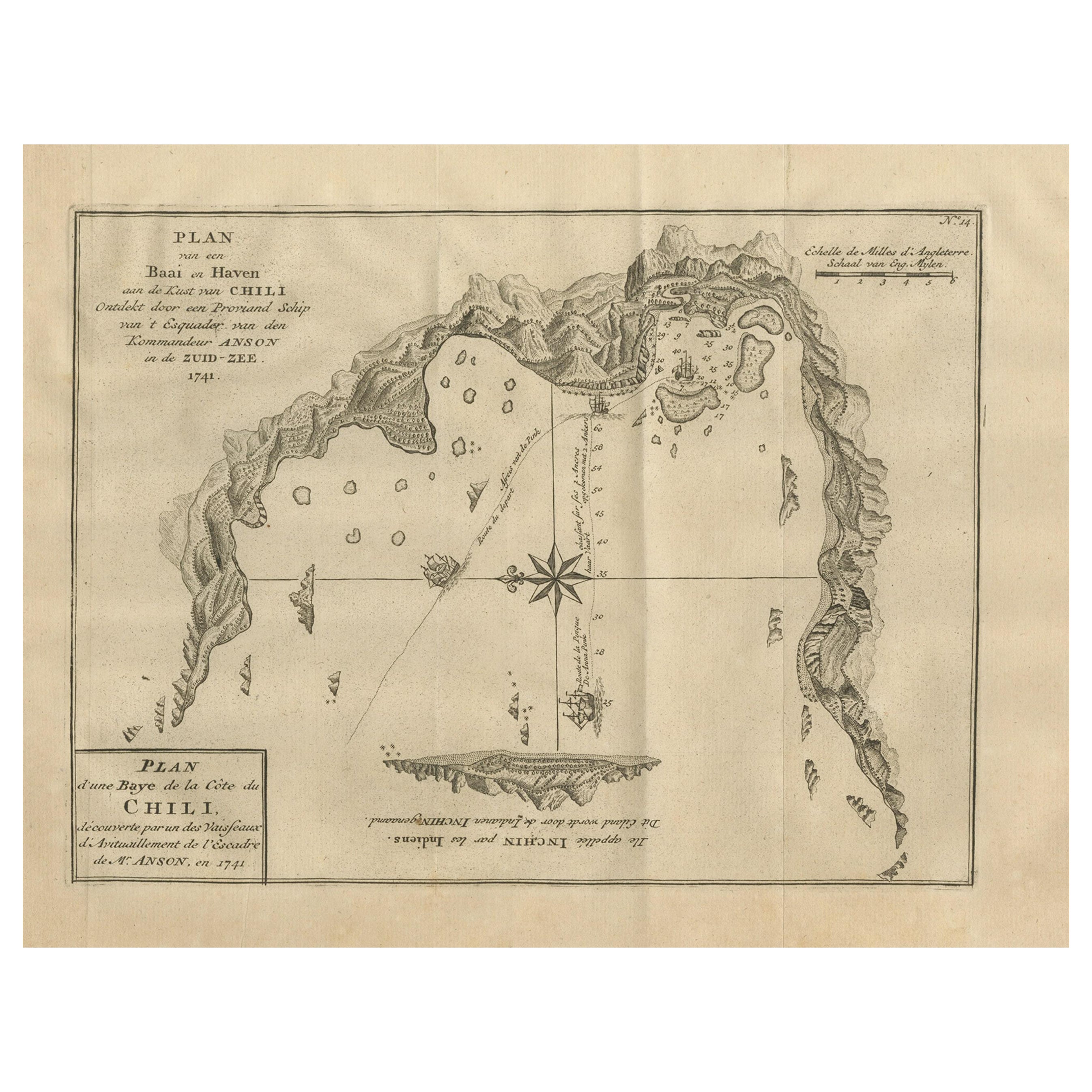
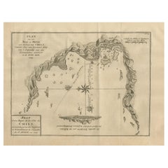
- Antique Map of a Bay on the Coast of Chile, South America, c.1749Located in Langweer, NLAntique map titled 'Plan van een Baai en Haven aan de Kust van Chili (..) - Plan d'une Baye de la Côte du Chili (..)'. Original antique map of a bay on the coast of Chile discovered ...Category
Antique 18th Century Maps
MaterialsPaper
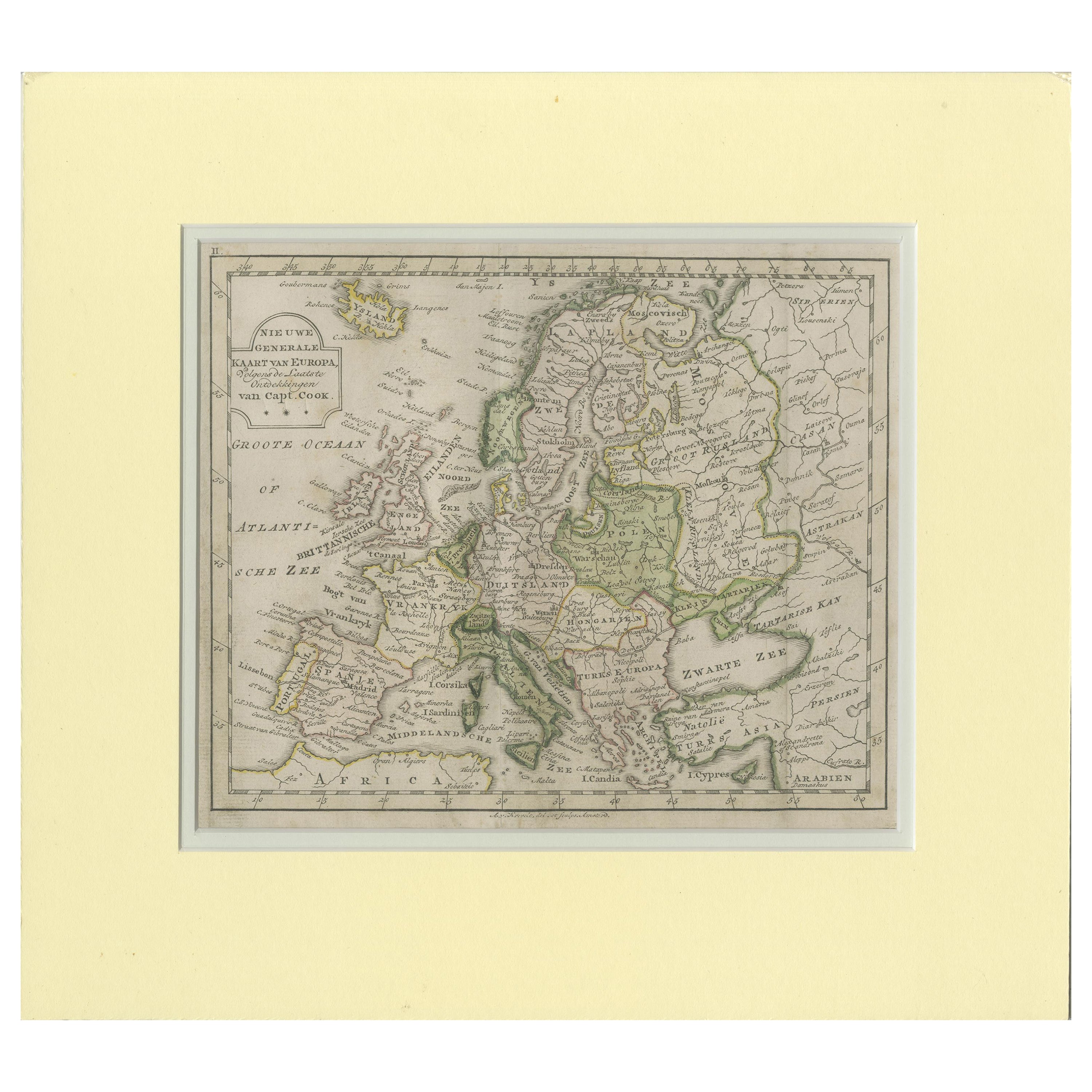
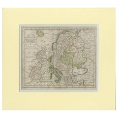
- Antique Map of Europe by Krevelt '1786'Located in Langweer, NLAntique map titled 'Nieuwe Generale Kaart van Europa (..)'. Original antique map of Europe. This map originates from 'Compleete zak-atlas, van de...Category
Antique Late 18th Century Maps
MaterialsPaper

Recently Viewed
View AllMore Ways To Browse
18th Century French Travel
Map Of Brazil
Brazil Map
Antique Map Brazil
Antique Map Of Brazil
Map Amazon
Herman Miller Time Life Chair
Used Wooden Front Doors
Victorian Small Cabinet
Vintage Brass Wall Hook
17 South Antiques
Mid Century Modern Desk Chair Wood
Mid Century Modern Wood Desk Chairs
Chinese Elm Doors
Thompson France
Modern China Cabinet
Antique Wooden Shelves
Mid Century Herman Miller Desk