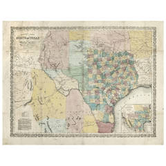
Richardson's New Map of the State of Texas
View Similar Items


1 of 1
Richardson's New Map of the State of Texas
About the Item
- Creator:Charles Desilver (Author),Willard Richardson 1 (Artist)
- Dimensions:Height: 22.75 in (57.79 cm)Width: 30.25 in (76.84 cm)Depth: 0.5 in (1.27 cm)
- Style:Other (Of the Period)
- Place of Origin:
- Period:
- Date of Manufacture:1860
- Condition:Wear consistent with age and use. Minor fading.
- Seller Location:Houston, TX
- Reference Number:1stDibs: LU129322134202
You May Also Like
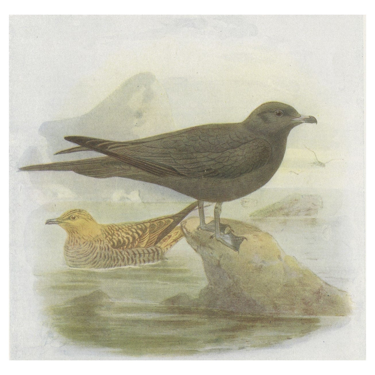
- Antique Bird Print of Richardson's Skua, 1907Located in Langweer, NLAntique Bird Print of Richardson's Skua. This print originates from 'Birds of Britain' by J. Lewis Bonhote. Artists and Engravers: J. Lewis Bonhote was an English ornithologist. ...Category
20th Century Prints
MaterialsPaper
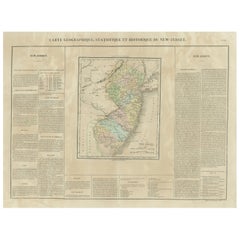
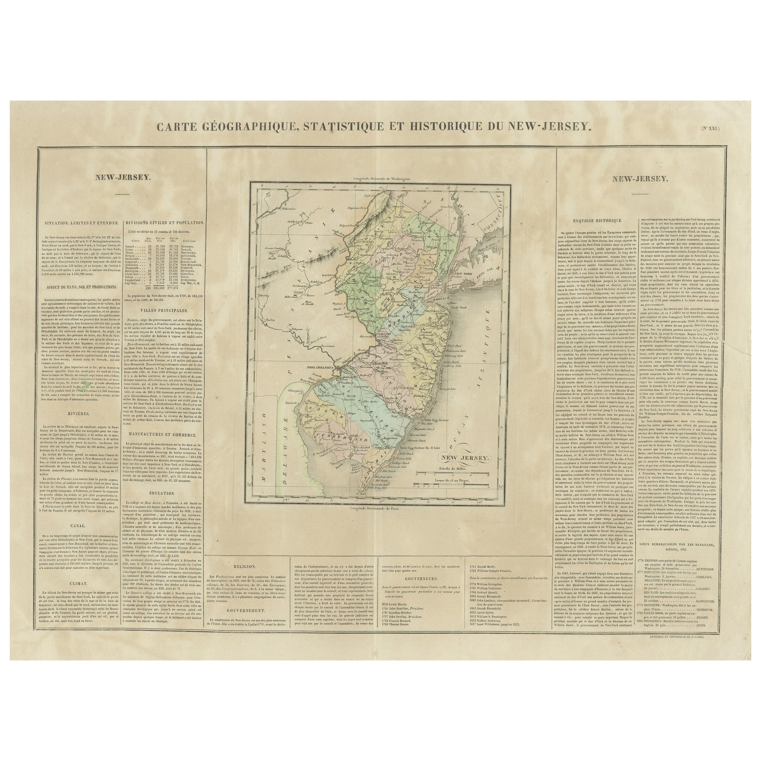
- Original Antique Map of the State of New Jersey Published in FranceLocated in Langweer, NLOriginal antique map titled 'Carte Géographique Statistique et Historique du New-Jersey'. One of the earliest obtainable maps of the State of New Jersey published outside of the Unit...Category
Antique Early 19th Century Maps
MaterialsPaper
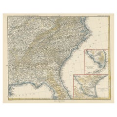
- Antique Map of the Eastern United States with Inset Map of TexasLocated in Langweer, NLAntique map titled 'Verein-Staaten von Nord-America mit Ausnahme Florida's und der Westlichen Territorien'. This map extends as far west as Louisiana and only includes the northern p...Category
Antique Mid-19th Century Maps
MaterialsPaper
 $468 Sale Price20% Off
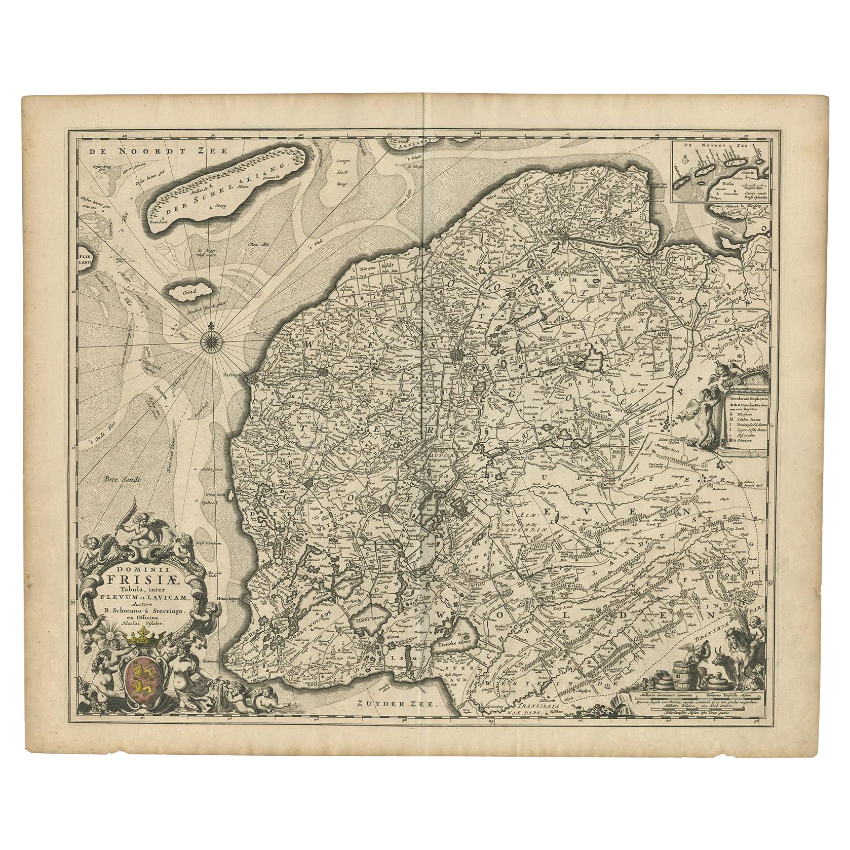
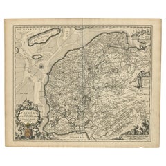
 - Beautiful First State Map of Friesland, the Netherlands, c.1665Located in Langweer, NLAntique map titled 'Dominii Frisiae Tabula, inter Flevum et Lavicam'. Beautiful first state map of Friesland, the Netherlands. With small inset map of the Frisian Wadden islands Vlie...Category
Antique 17th Century Maps
MaterialsPaper
 $759 Sale Price20% Off
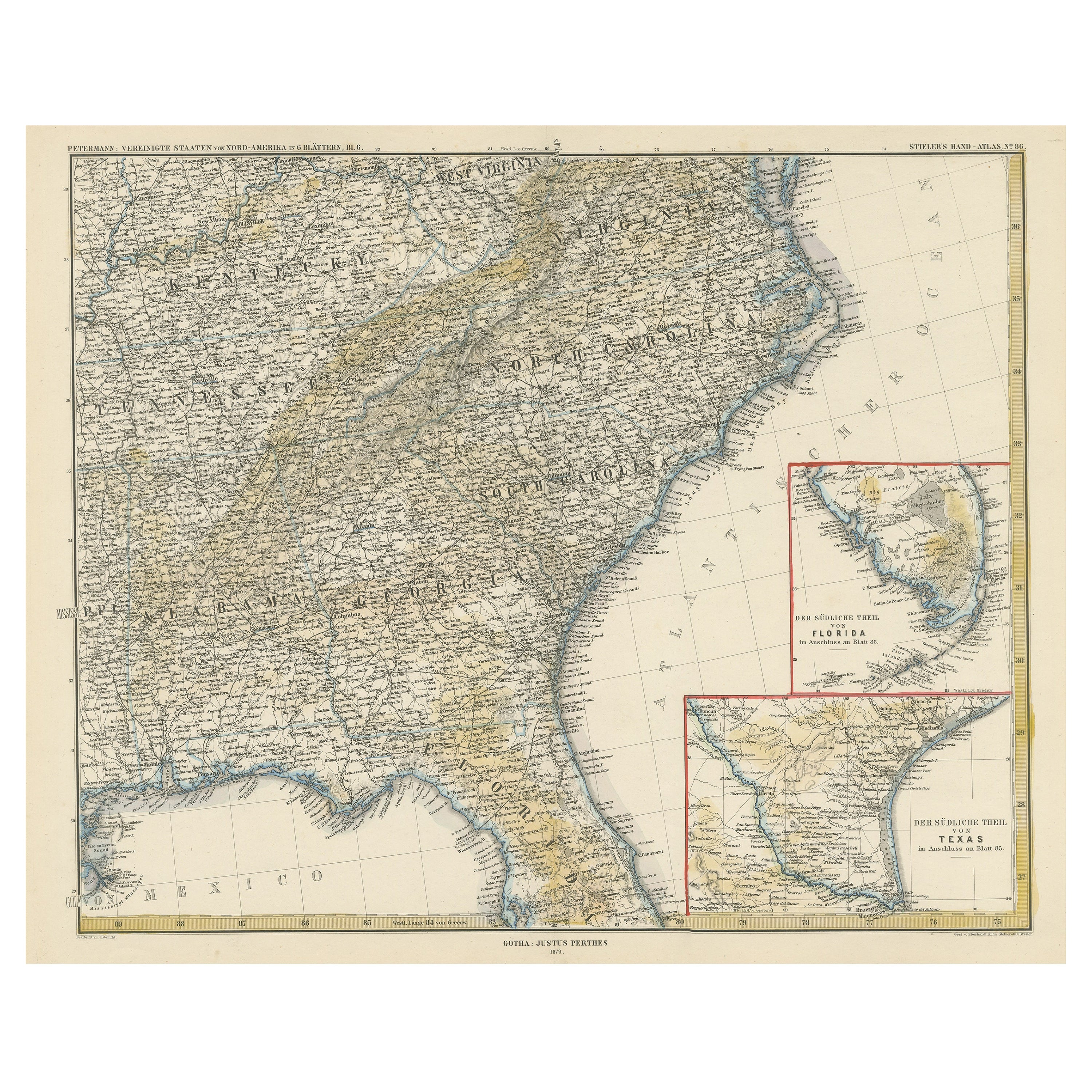
 - Antique Map of the Region of Georgia with Inset Maps of Florida and TexasLocated in Langweer, NLAntique map of part of the United States showing Alabama, Georgia, North Carolina, South Carolina, Tennessee, Kentucky, Virginia and part of Florida. With inset maps of the southern ...Category
Antique Late 19th Century Maps
MaterialsPaper
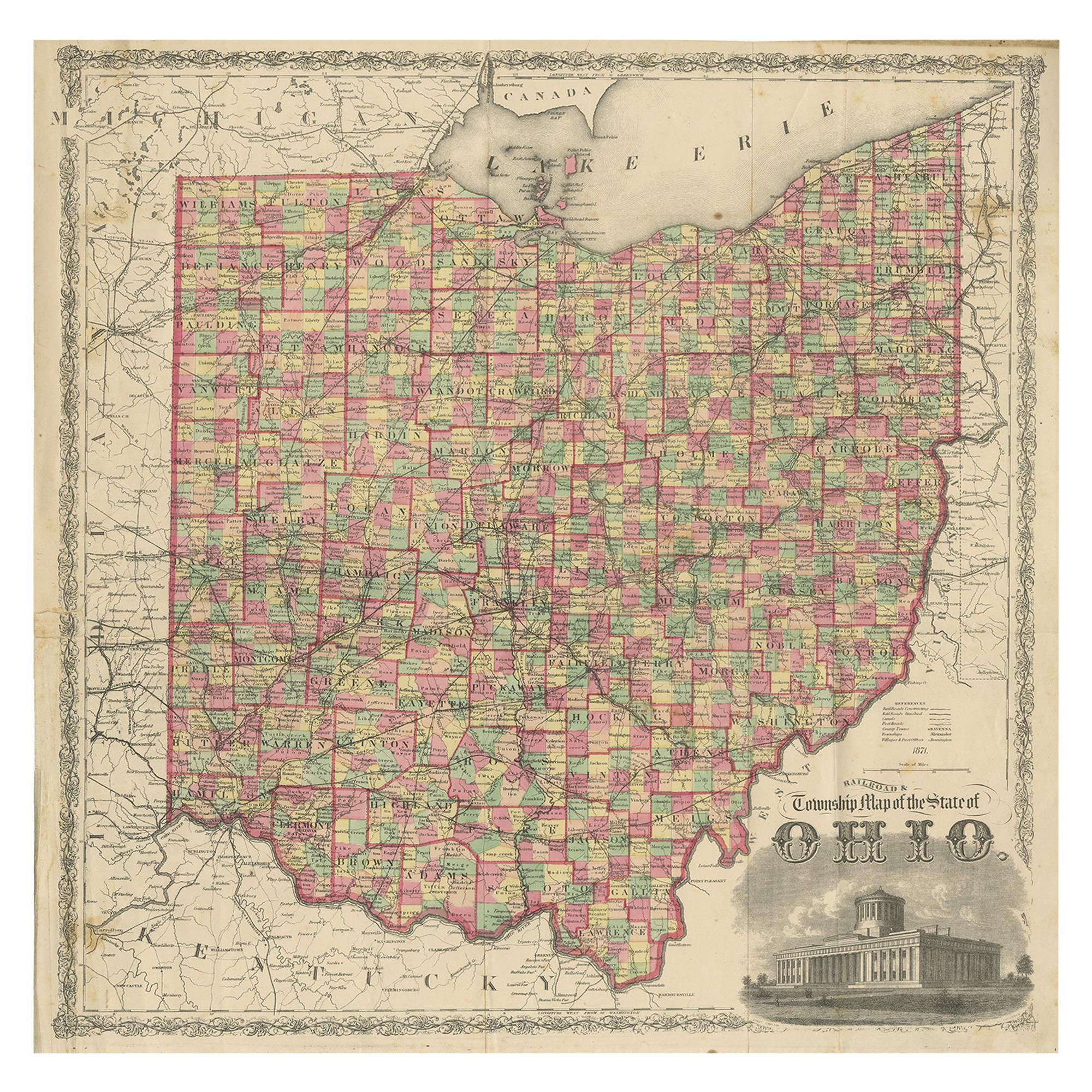
- Antique Map of the State of Ohio by Titus '1871'Located in Langweer, NLAntique map titled 'Railroad & Township Map of the State of Ohio'. Original antique map of the State of Ohio. This map originates from 'Atlas of Preble County Ohio' by C.O. Titus. Pu...Category
Antique Late 19th Century Maps
MaterialsPaper
 $976 Sale Price25% Off