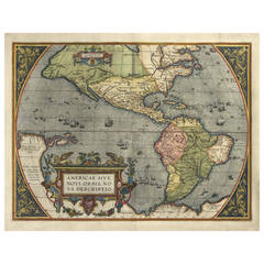
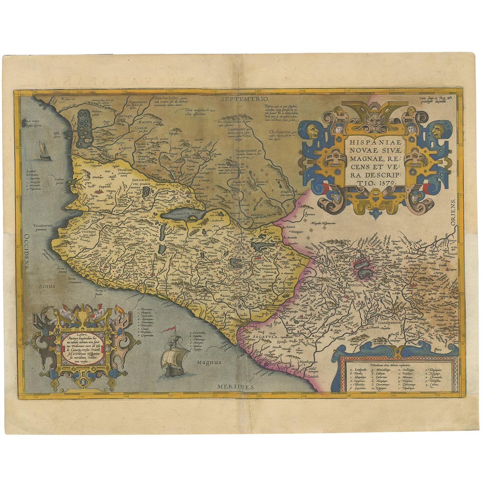
Americae Sive Novi Orbis, Nova Descriptio, 1571
View Similar Items


1 of 1
Americae Sive Novi Orbis, Nova Descriptio, 1571
About the Item
- Creator:Abraham Ortelius (Author)
- Dimensions:Height: 15.5 in (39.37 cm)Width: 20.5 in (52.07 cm)Depth: 0.5 in (1.27 cm)
- Style:Other (Of the Period)
- Place of Origin:
- Period:
- Date of Manufacture:1571
- Condition:
- Seller Location:Houston, TX
- Reference Number:1stDibs: LU129322133852
You May Also Like
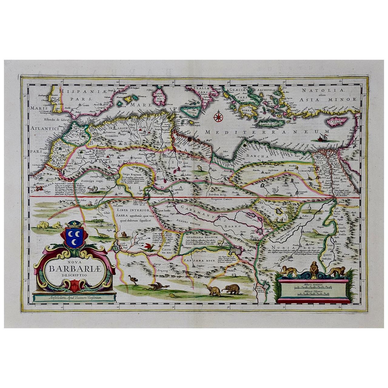
- "Nova Barbariae Descriptio", a 17th Century Hand-Colored Map of North AfricaBy Johannes JanssoniusLocated in Alamo, CAThis original attractive 17th century hand-colored map of North Africa entitled "Nova Barbariae Descriptio" by Johannes Janssonius was published in Paris in 1635. It includes the Med...Category
Antique Mid-17th Century Dutch Maps
MaterialsPaper
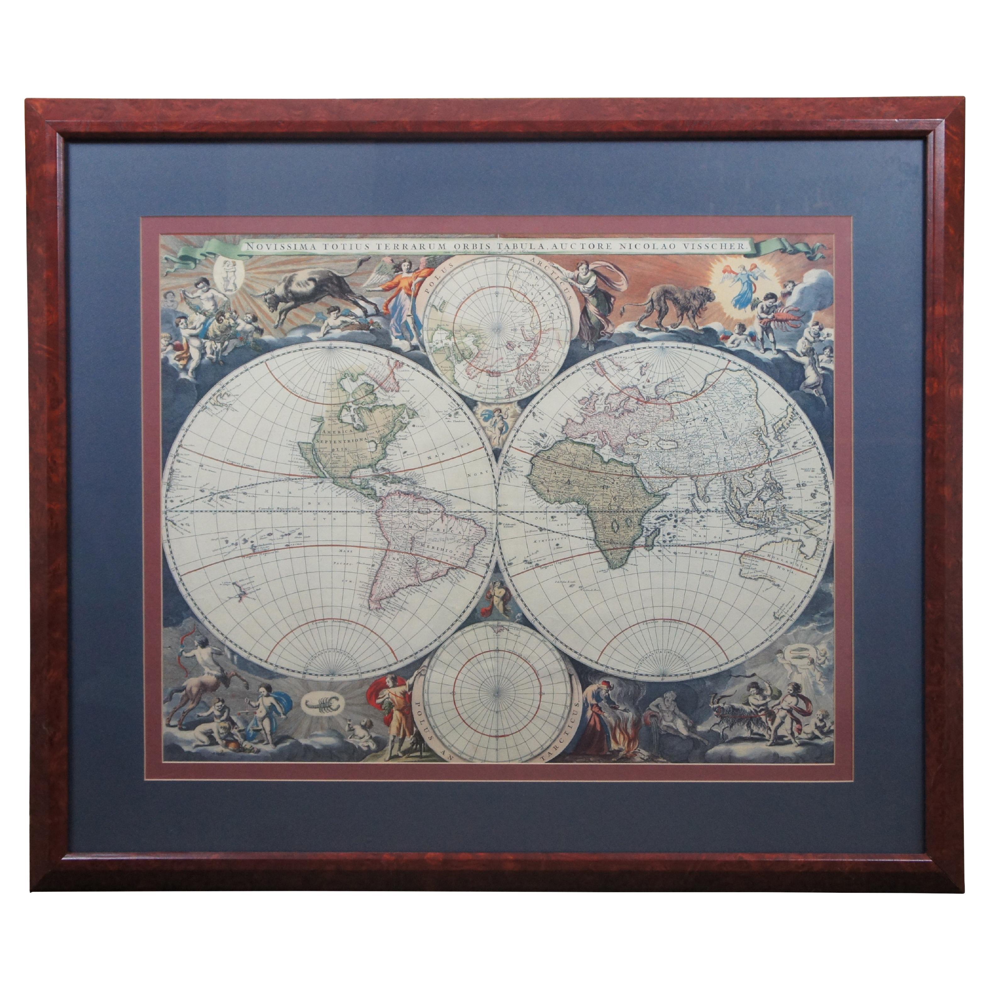
- Novissima Totius Terrarum Orbis Tabula Map After Nicolaes Visscher Burled FrameBy Nicolaes Visscher IILocated in Dayton, OHA stately print after Nicolaes Visscher's Novissima Totius Terrarum Orbis Tabula Map. Neatly framed in burlwood. Dimensions: 39" x 1" x 33" / Sans Frame - 28" x 22" (Width x Dept...Category
Late 20th Century Prints
MaterialsPaper
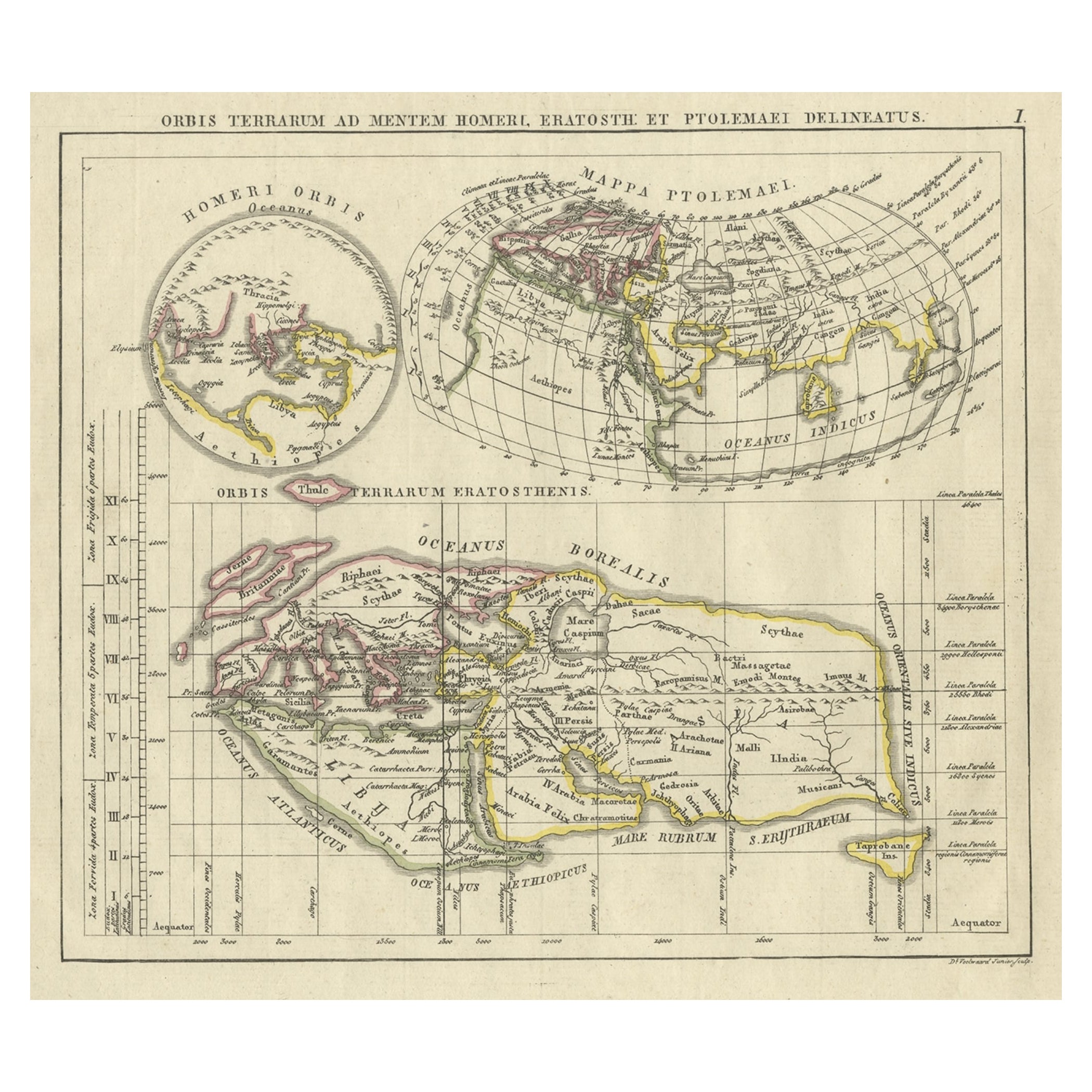
- Antique Map of the Old World Projection, Entitled Orbis Terrarum Ad Mentem, 1825Located in Langweer, NLAntique map titled 'Orbis Terrarum ad Mentem (..)'. Old map of the world originating from 'Atlas der Oude Wereld'. Artists and Engravers: Published by C. Ph. Funke and W. van Boe...Category
Antique 19th Century Maps
MaterialsPaper
- Antique Map of Nova Zembla ‘Russia’ by J.N. Bellin, 1758Located in Langweer, NLAn interesting map of Nova Zembla and surrounding areas. With details on the eastern tip of Nova Zembla of the place where the stranded Dutch sailors under Willem Barentsz spent the ...Category
Antique Mid-18th Century Maps
MaterialsPaper
- Antique Map of Nova Zembla 'Russia' by J.N. Bellin, 1757Located in Langweer, NLDecorative map of Nova Zembla and environs in the Arctic Sea. Includes a large decorative title cartouche. One of the maps produced by Jacques-Nicolas Bellin for Prevost d'Exiles inf...Category
Antique Mid-18th Century Maps
MaterialsPaper
 $217 Sale Price27% Off
 - Antique Map of Southeast Asia by Ortelius '1587'By Abraham OrteliusLocated in Langweer, NLAntique map titled 'Indiae Orientalis Insularumque Adiacientium Typus'. Ortelius includes early European depictions of both Japan and China and is the first to name Formosa (Taiwan). The Philippines and East Indies or Spice Islands are shown based upon Portuguese and Spanish sources, and before their penetration by the Dutch. Japan is shown in kite form, as a large oval island...Category
Antique 16th Century Maps
MaterialsPaper