Articoli simili a Map of Doubs France with Besançon and Swiss Border Landscape, 19th Century


Vuoi altre immagini o video?
Richiedi altre immagini o video al venditore
1 di 10
Map of Doubs France with Besançon and Swiss Border Landscape, 19th Century
120 €IVA inclusa
Spedizione
Recupero del preventivo…La promessa 1stDibs:
Garanzia di autenticità,
Garanzia di rimborso,
Annullamento entro 24 ore
Informazioni sull’articolo
Map of Doubs France with Besançon and Swiss Border Landscape, 19th Century
Description:
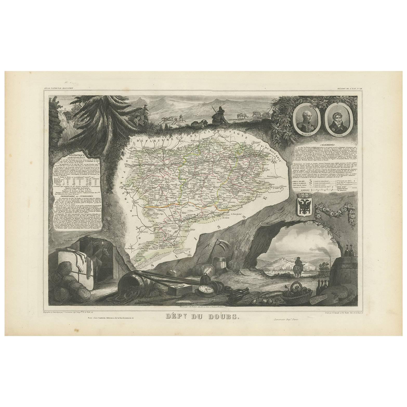
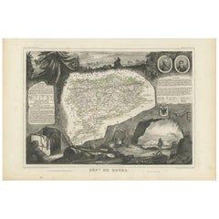
This decorative 19th-century map of the department of Doubs in eastern France was drawn by Alexandre Vuillemin and published in Paris by Migeon as part of the *Nouvel Atlas Illustré*. Situated along the Swiss border, Doubs is a region defined by its mountainous terrain, rich natural beauty, and a long history of scientific and cultural achievement—all reflected in this finely engraved and hand-colored map.
The map shows the department in great detail, with towns, roads, rivers, and mountain ranges clearly engraved and bordered in soft violet watercolor. Besançon, the prefecture and historic heart of the region, is prominently displayed near the center. Other communes such as Montbéliard, Pontarlier, Morteau, and Baume-les-Dames are also clearly labeled.
In the lower left corner is a portrait of Georges Cuvier, the renowned naturalist and paleontologist born in Montbéliard. His scientific legacy is subtly honored in the floral and shell motifs surrounding his likeness. The vignette in the lower right captures the fortified city of Besançon along the Doubs River, nestled among hills and cliffs—an iconic scene that speaks to the city's strategic and cultural importance. The right edge also features the coat of arms of Doubs and a small image of the Saut du Doubs, a picturesque waterfall near the Swiss border.
Doubs is located within the Jura Mountains and forms part of the historic region of Franche-Comté. While not a major wine-producing department like nearby Burgundy, Doubs is known for its production of regional specialties including Comté cheese, smoked sausages, absinthe (especially around Pontarlier), and Jura wines from adjacent departments. Its mountainous terrain supports dairy farming, forestry, and small-scale viticulture along select valleys.
This map is not only a fine piece of decorative cartography, but also a celebration of Doubs’ blend of natural science, alpine beauty, and borderland heritage. It is ideal for collectors with interests in French geography, scientific history, or 19th-century engraving.
Condition summary:
Very good condition with some light foxing and toning in the margins. The engraved lines remain sharp and the original hand coloring is fresh and clean.
Framing tips:
This map suits a dark wood or black frame to emphasize the borderland topography. Pair with a light beige or soft lavender mat to enhance the violet border tones. Use UV-protective glass for long-term preservation.
- Dimensioni:Altezza: 26,1 cm (10,28 in)Larghezza: 32,5 cm (12,8 in)Profondità: 0,2 mm (0,01 in)
- Materiali e tecniche:Carta,Inciso
- Luogo di origine:
- Periodo:
- Data di produzione:circa 1850
- Condizioni:Very good condition with some light foxing and toning in the margins. The engraved lines remain sharp and the original hand coloring is fresh and clean.
- Località del venditore:Langweer, NL
- Numero di riferimento:Venditore: BG-13331-241stDibs: LU3054345363862
Informazioni sul venditore
5,0
Venditore riconosciuto
Questi venditori prestigiosi sono leader del settore e rappresentano il massimo in termini di qualità e design.
Venditore Platino
Venditori Premium con valutazione 4.7+ e tempi di risposta entro 24 ore
Fondazione nel 2009
Venditore 1stDibs dal 2017
2493 vendite su 1stDibs
Tempo di risposta standard: <1 ora
- SpedizioneRecupero del preventivo…Spedizione da: Langweer, Paesi Bassi
- Politica di reso
Alcune parti di questa pagina sono state tradotte automaticamente. 1stDibs non può garantire che le traduzioni siano corrette. L’inglese è la lingua predefinita del sito.
Garanzia di autenticità
Nell’improbabile caso in cui si verifichi un problema con l’autenticità di un articolo, contattaci entro un anno per ottenere un rimborso completo. DettagliGaranzia di rimborso
Se il tuo articolo non corrisponde alla descrizione, è danneggiato durante il trasporto o non arriva, contattaci entro 7 giorni per un rimborso completo. DettagliAnnullamento entro 24 ore
Hai un periodo di tolleranza di 24 ore per annullare il tuo acquisto, senza necessità di fornire spiegazioni.Venditori professionali selezionati
I nostri venditori di livello internazionale devono aderire a rigorosi standard di servizio e qualità, garantendo l’integrità delle inserzioni.Garanzia miglior prezzo
Se scopri che un venditore ha pubblicato altrove lo stesso articolo a un prezzo più basso, applicheremo lo stesso prezzo.Consegna globale affidabile
La nostra rete di vettori leader del settore offre opzioni di spedizione specializzate in tutto il mondo, inclusa la consegna personalizzata.Altro da questo venditore
Mostra tuttoCarta geografica antica di Doubs 'France' di V. Levasseur, 1854
Di Victor Levasseur
Carta geografica antica intitolata 'Dépt. du Doubs'. Mappa del dipartimento francese del Doubs, Francia. Il tutto è circondato da elaborate incisioni decorative pensate per illustrar...
Categoria
Di antiquariato/d’epoca, Metà XIX secolo, Mappe
Materiali
Carta
144 € Prezzo promozionale
20% in meno
Map of Aude France with Carcassonne and Languedoc Vineyards, 19th Century
Map of Aude France with Carcassonne and Languedoc Vineyards, 19th Century
Description:
This elegant 19th-century map of Aude, a department in southern France along the Mediterranean...
Categoria
Di antiquariato/d’epoca, Metà XIX secolo, Francese, Mappe
Materiali
Carta

Map of Aube France with Troyes and Champagne Wine Region, 19th Century
Map of Aube France with Troyes and Champagne Vineyards by Vuillemin, 19th c
Description:
This 19th-century map of the Aube department in the Grand Est region of northeastern France ...
Categoria
Di antiquariato/d’epoca, Metà XIX secolo, Francese, Mappe
Materiali
Carta

Map of Côtes-du-Nord France with Saint-Brieuc and Brittany Coastline, c.1850
Map of Côtes-du-Nord France with Saint-Brieuc and Brittany Coastline, 19th c
Description:
This elegant 19th-century map of Côtes-du-Nord, the historic name for what is now known as ...
Categoria
Di antiquariato/d’epoca, Metà XIX secolo, Francese, Mappe
Materiali
Carta

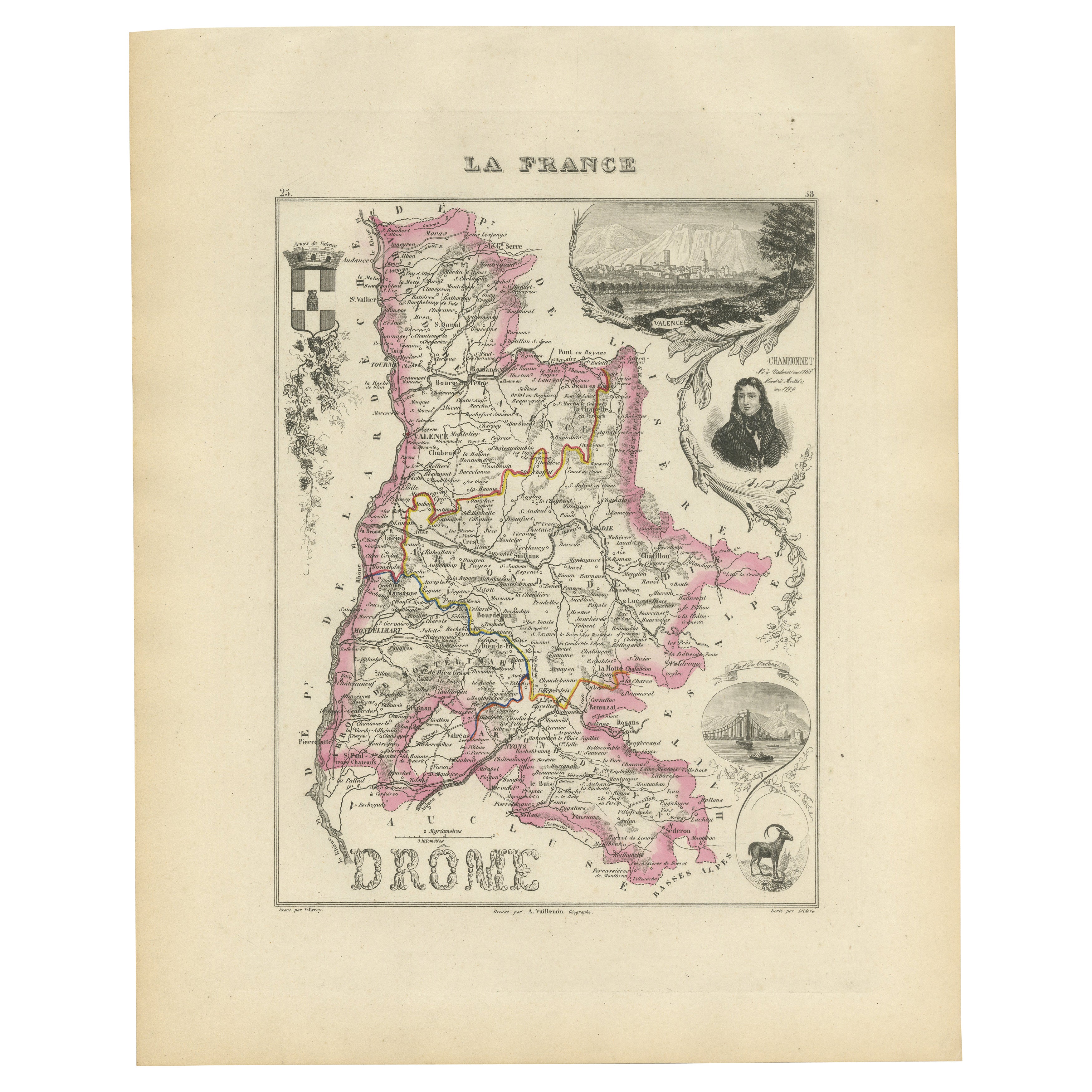
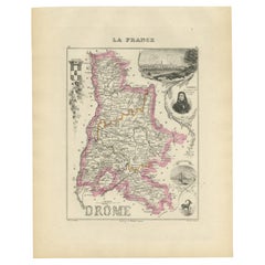
Map of Drôme France with Valence and Rhône Valley Wine Region, 19th Century
Map of Drôme France with Valence and Rhône Valley Wine Region, 19th Century
Description:
This beautifully engraved 19th-century map of the Drôme department in southeastern France wa...
Categoria
Di antiquariato/d’epoca, Metà XIX secolo, Francese, Mappe
Materiali
Carta
Map of Ariège France with Foix and Pyrenees Landscape by Vuillemin, 19th c
Map of Ariège France with Foix and Pyrenees Landscape by Vuillemin, 19th c
Description:
This beautifully detailed 19th-century map of the Ariège department in southwestern France wa...
Categoria
Di antiquariato/d’epoca, Metà XIX secolo, Francese, Mappe
Materiali
Carta

Ti potrebbe interessare anche
Aube, Francia. Mappa antica di un dipartimento francese, 1856
Di Victor Levasseur
'Dept. de L'Aube', incisione in acciaio con colorazione a mano dei contorni originali, 1856, da 'Atlas National Illustre' di Levasseur.
Questa zona della Francia è nota per la prod...
Categoria
XIX secolo, Naturalismo, Stampe (paesaggio)
Materiali
Incisione

Giura, Francia. Mappa antica di un dipartimento francese, 1856
Di Victor Levasseur
Dept. du Jura", incisione in acciaio con colorazione a mano dei contorni originali, 1856, da "Atlas National Illustre" di Levasseur.
I vini del Giura sono molto particolari e insol...
Categoria
XIX secolo, Naturalismo, Stampe (paesaggio)
Materiali
Incisione

Mappa di Deux Sèvres - Incisione originale - XIX secolo
La Mappa di Deux Sèvres è un'incisione antica originale realizzata da un incisore anonimo del XIX secolo.
Stampato in serie "France Pittoresque" in alto al centro.
Lo stato di cons...
Categoria
XIX secolo, Moderno, Stampe figurative
Materiali
Acquaforte

Bas Rhin, Francia. Mappa antica di un dipartimento francese, 1856
Di Victor Levasseur
'Dept. du Bas Rhin', incisione in acciaio con colorazione a mano dei contorni originali, 1856, dall'Atlas National Illustre di Levasseur.
Fa parte della regione vinicola dell'Alsaz...
Categoria
XIX secolo, Naturalismo, Stampe (paesaggio)
Materiali
Incisione

Grande mappa della Francia del XIX secolo
Grande mappa della Francia del XIX secolo.
Condizioni notevoli, con una piacevole patina di usura.
Incorniciato di recente.
Francia, circa 1874.
Categoria
Di antiquariato/d’epoca, Fine XIX secolo, Francese, Mappe
Materiali
Lino, Carta

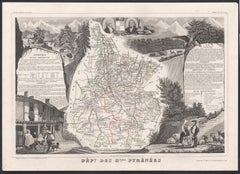
Alti Pirenei, Francia. Mappa antica di un dipartimento francese, 1856
Di Victor Levasseur
'Dept. des Hautes Pyrenees', incisione in acciaio con colorazione a mano dei contorni originali, 1856, dall'Atlas National Illustre di Levasseur.
In quest'area si trova la regione ...
Categoria
XIX secolo, Naturalismo, Stampe (paesaggio)
Materiali
Incisione