Articoli simili a Map of Haute-Garonne France with Toulouse and Garonne River by Vuillemin, c.1850


Vuoi altre immagini o video?
Richiedi altre immagini o video al venditore
1 di 10
Map of Haute-Garonne France with Toulouse and Garonne River by Vuillemin, c.1850
140 €IVA inclusa
Informazioni sull’articolo
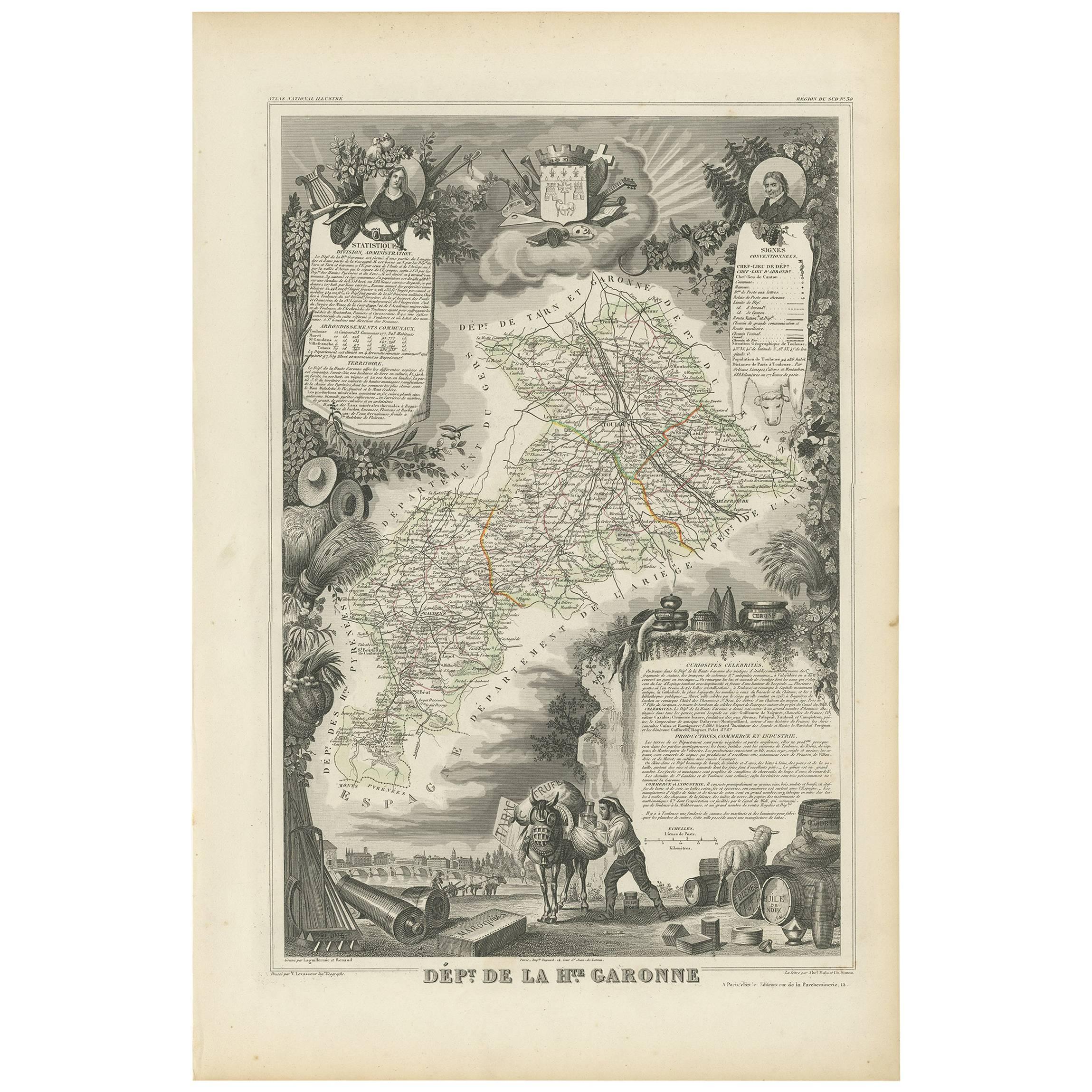
Map of Haute-Garonne France with Toulouse and Garonne River by Vuillemin, 19th c
Description:
This finely engraved 19th-century map of the department of Haute-Garonne, located in southwestern France, is part of Alexandre Vuillemin’s *Nouvel Atlas Illustré*, published in Paris by Migeon. The map presents a detailed view of the region’s topography and settlements, enriched by charming vignettes and portraits that highlight its cultural and historical importance.
Haute-Garonne is situated in the Occitanie region and is named after the Garonne River, which flows through the department’s capital, Toulouse. The map displays the area’s borders in soft hand-applied pink, and meticulously marks rivers, roads, and towns. Toulouse is prominently featured at the center, reflecting its status as the economic and cultural heart of the department.
The map is visually enriched with several artistic details. At the lower right, an attractive vignette shows the city of Toulouse with the Garonne River and a stone bridge—likely the Pont Neuf—connecting the historic parts of the city. At the top right, a portrait of the Abbé Sicard, a notable educator and pioneer in teaching the deaf, pays homage to one of the region’s historical figures. On the left side, a costumed couple with an ox—representing regional dress and agricultural heritage—adds a folkloric touch. The department's coat of arms is also included, further underscoring its civic identity.
Haute-Garonne is part of the greater Sud-Ouest wine region of France. Though better known today for its high-tech industry centered in Toulouse, the department still has a presence in viticulture. Local wines fall under the Comté Tolosan IGP label, and grape varieties such as Merlot, Cabernet Franc, and Tannat are grown in nearby areas. The region’s climate—characterized by warm summers and cool winters—supports a variety of wine styles, from red to white and rosé.
Alexandre Vuillemin was a noted 19th-century French cartographer who brought artistry and clarity to geographical publishing. His maps, engraved with great precision and often accompanied by cultural illustrations, were widely admired and collected. Publisher Migeon specialized in quality illustrated atlases that served both educational and decorative purposes.
Condition summary:
Very good condition with mild age toning and a few faint foxing spots near the edges. The engraved detail is crisp and the hand coloring remains clean and vivid.
Framing tips:
Best displayed in a natural wood or black frame to enhance the contrast of the engraving. A cream or soft rose-tinted mat will pair well with the pink border. Use UV-protective glass to preserve the fine detail and coloring.
- Dimensioni:Altezza: 26,1 cm (10,28 in)Larghezza: 32,5 cm (12,8 in)Profondità: 0,2 mm (0,01 in)
- Materiali e tecniche:Carta,Inciso
- Luogo di origine:
- Periodo:
- Data di produzione:circa 1850
- Condizioni:Very good condition with mild age toning and a few faint foxing spots near the edges. The engraved detail is crisp and the hand coloring remains clean and vivid.
- Località del venditore:Langweer, NL
- Numero di riferimento:Venditore: BG-13331-301stDibs: LU3054345363932
Informazioni sul venditore
5,0
Venditore riconosciuto
Questi venditori prestigiosi sono leader del settore e rappresentano il massimo in termini di qualità e design.
Venditore Platino
Venditori Premium con valutazione 4.7+ e tempi di risposta entro 24 ore
Fondazione nel 2009
Venditore 1stDibs dal 2017
2533 vendite su 1stDibs
Tempo di risposta standard: <1 ora
- SpedizioneRecupero del preventivo…Spedizione da: Langweer, Paesi Bassi
- Politica di reso
Alcune parti di questa pagina sono state tradotte automaticamente. 1stDibs non può garantire che le traduzioni siano corrette. L’inglese è la lingua predefinita del sito.
Garanzia di autenticità
Nell’improbabile caso in cui si verifichi un problema con l’autenticità di un articolo, contattaci entro un anno per ottenere un rimborso completo. DettagliGaranzia di rimborso
Se il tuo articolo non corrisponde alla descrizione, è danneggiato durante il trasporto o non arriva, contattaci entro 7 giorni per un rimborso completo. DettagliAnnullamento entro 24 ore
Hai un periodo di tolleranza di 24 ore per annullare il tuo acquisto, senza necessità di fornire spiegazioni.Venditori professionali selezionati
I nostri venditori di livello internazionale devono aderire a rigorosi standard di servizio e qualità, garantendo l’integrità delle inserzioni.Garanzia miglior prezzo
Se scopri che un venditore ha pubblicato altrove lo stesso articolo a un prezzo più basso, applicheremo lo stesso prezzo.Consegna globale affidabile
La nostra rete di vettori leader del settore offre opzioni di spedizione specializzate in tutto il mondo, inclusa la consegna personalizzata.Altro da questo venditore
Mostra tuttoCarta geografica antica della Haute-Garonne 'France' di V. Levasseur, 1854
Carta geografica antica intitolata "Dépt. de la Hte. Garonna". Mappa del dipartimento francese di Haute-Garonne, Francia. In questa zona della Francia si producono i deliziosi ma men...
Categoria
Di antiquariato/d’epoca, Metà XIX secolo, Mappe
Materiali
Carta
144 € Prezzo promozionale
20% in meno
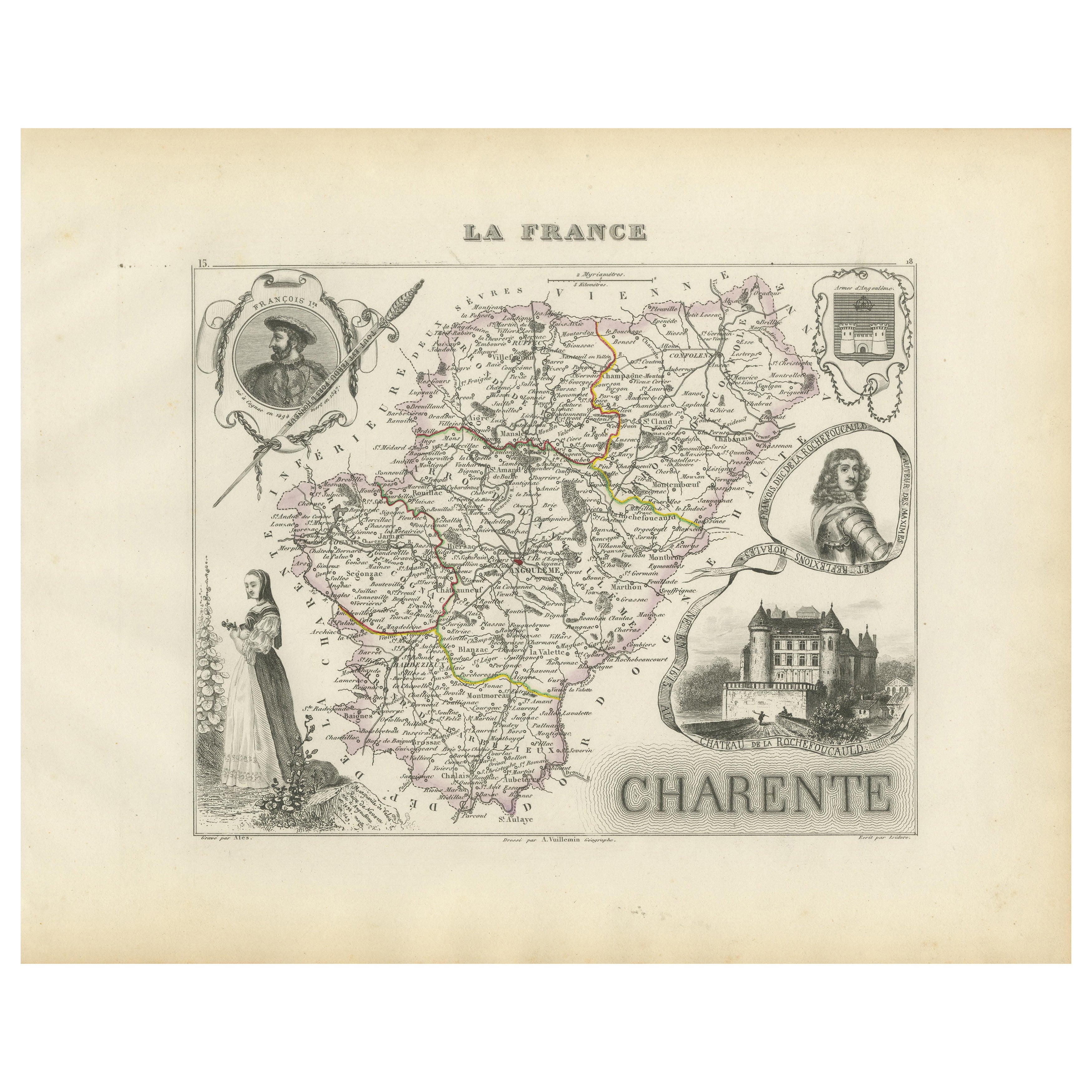
Map of Charente France with Cognac Region and Château de La Rochefoucauld, 1850
Map of Charente France with Cognac Region and Château de La Rochefoucauld, 19th c
Description:
This richly illustrated 19th-century map of the Charente department in southwestern Fr...
Categoria
Di antiquariato/d’epoca, Metà XIX secolo, Francese, Mappe
Materiali
Carta

Map of Ariège France with Foix and Pyrenees Landscape by Vuillemin, 19th c
Map of Ariège France with Foix and Pyrenees Landscape by Vuillemin, 19th c
Description:
This beautifully detailed 19th-century map of the Ariège department in southwestern France wa...
Categoria
Di antiquariato/d’epoca, Metà XIX secolo, Francese, Mappe
Materiali
Carta

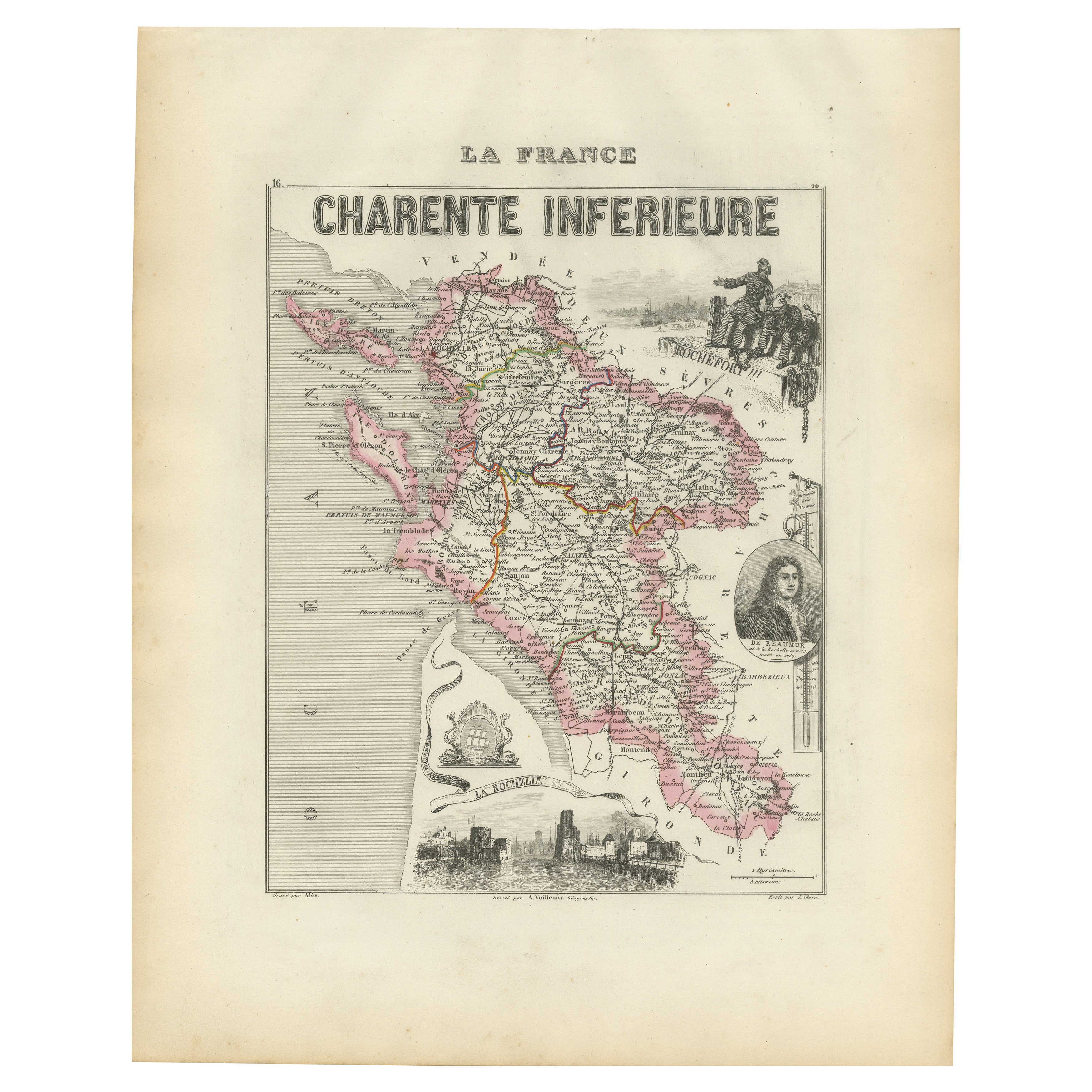
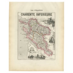
Map of Charente-Inférieure France with La Rochelle and Coastal Vineyards, c.1850
Map of Charente-Inférieure France with La Rochelle and Coastal Vineyards, 19th c
Description:
This decorative 19th-century map of the former department of Charente-Inférieure, now k...
Categoria
Di antiquariato/d’epoca, Metà XIX secolo, Francese, Mappe
Materiali
Carta
Map of Gard France with Pont du Gard and Wine Regions by Vuillemin, 19th c
Title: Map of Gard France with Pont du Gard and Wine Regions by Vuillemin, 19th c
Description:
This finely engraved 19th-century map of the department of Gard in southern France was...
Categoria
Di antiquariato/d’epoca, Metà XIX secolo, Francese, Mappe
Materiali
Carta

Map of Côtes-du-Nord France with Saint-Brieuc and Brittany Coastline, c.1850
Map of Côtes-du-Nord France with Saint-Brieuc and Brittany Coastline, 19th c
Description:
This elegant 19th-century map of Côtes-du-Nord, the historic name for what is now known as ...
Categoria
Di antiquariato/d’epoca, Metà XIX secolo, Francese, Mappe
Materiali
Carta

Ti potrebbe interessare anche
Saone e Loira, Francia. Mappa antica di un dipartimento francese, 1856
Di Victor Levasseur
'Dept. de Saone et Loire', incisione in acciaio con colorazione a mano dei contorni originali, 1856, dall'Atlas National Illustre di Levasseur.
Il dipartimento francese di Saone et...
Categoria
XIX secolo, Naturalismo, Stampe (paesaggio)
Materiali
Incisione

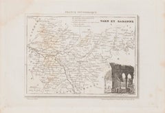
Mappa di Tarn et Garonne - Litografia originale - XIX secolo
La Mappa di Tarn et Garonne è una litografia originale realizzata da un artista anonimo del XIX secolo.
Stampato in serie "France Pittoresque" in alto al centro.
Lo stato di conser...
Categoria
XIX secolo, Moderno, Stampe figurative
Materiali
Carta, Litografia
L'Herault, Francia. Mappa antica di un dipartimento francese, 1856
Di Victor Levasseur
'Dept. de Saone et Loire', incisione in acciaio con colorazione a mano dei contorni originali, 1856, dall'Atlas National Illustre di Levasseur.
Quest'area ospita un'ampia varietà d...
Categoria
XIX secolo, Naturalismo, Stampe (paesaggio)
Materiali
Incisione

L'Isere, Francia. Mappa antica del dipartimento francese, 1856
Di Victor Levasseur
'Dept. de L'Isere', incisione in acciaio con colorazione a mano dei contorni originali, 1856, da 'Atlas National Illustre' di Levasseur.
Questa zona è nota per la produzione del Bl...
Categoria
XIX secolo, Naturalismo, Stampe (paesaggio)
Materiali
Incisione

Aude, Francia. Mappa antica di un dipartimento francese, 1856
Di Victor Levasseur
'Dept. de L' Aude', incisione in acciaio con colorazione a mano dei contorni originali, 1856, da 'Atlas National Illustre' di Levasseur.
Questa zona della Francia è famosa per l'am...
Categoria
XIX secolo, Naturalismo, Stampe (paesaggio)
Materiali
Incisione

Aube, Francia. Mappa antica di un dipartimento francese, 1856
Di Victor Levasseur
'Dept. de L'Aube', incisione in acciaio con colorazione a mano dei contorni originali, 1856, da 'Atlas National Illustre' di Levasseur.
Questa zona della Francia è nota per la prod...
Categoria
XIX secolo, Naturalismo, Stampe (paesaggio)
Materiali
Incisione
