Articoli simili a Map of Switzerland by Justus Danckerts, Hand-Colored Engraving ca. 1690


Vuoi altre immagini o video?
Richiedi altre immagini o video al venditore
1 di 11
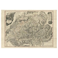
Map of Switzerland by Justus Danckerts, Hand-Colored Engraving ca. 1690
550 €IVA inclusa
Informazioni sull’articolo
Map of Switzerland by Justus Danckerts, Hand-Colored Engraving ca. 1690
This detailed and attractively hand-colored antique map titled *Helvetiae Rhaetiae et Valesiae, nec non partis Sabaudiae Tabula* was engraved and published by Justus Danckerts in Amsterdam around 1690. It depicts the Swiss Confederacy along with neighboring regions, including Rhaetia (modern Graubünden), Valais, and part of Savoy. This is a quintessential example of late 17th-century Dutch cartography—ornate, richly detailed, and both scientifically useful and visually appealing.
The map is a masterful representation of the geography of the Swiss Alps and surrounding territories. It features major cities such as Zurich, Bern, Basel, Lucerne, and Geneva (Genève), along with an exceptional network of rivers, lakes, mountain ranges, and political boundaries. Lake Geneva (Lemanus Lacus) and parts of the Rhône River system are prominently illustrated.
The regional borders are highlighted in original hand-color, a practice common in maps from this period to distinguish various cantons and territories. In the upper left, a decorative cartouche with scrollwork, draped fabric, and two allegorical figures presents the title. This style of embellishment, with its bold putti and theatrical flair, is characteristic of the Danckerts workshop and helps distinguish this map from earlier works by Blaeu or Janssonius.
Justus Danckerts (1635–1701) came from a renowned family of Dutch mapmakers and publishers. He was part of the third generation of the Danckerts firm and was known for producing high-quality wall maps, atlases, and decorative engravings. His maps were prized for their clarity, vivid hand-coloring, and elegant ornamentation.
This map serves as both a collector’s piece and a decorative artifact of late Dutch Golden Age cartography. It captures a richly detailed vision of Switzerland at a time when it was forming its independent identity in the heart of Europe.
Condition report:
Well-preserved, considering age, but with some edge wear, light age toning, but mostly in the borders. The image itself mostly a clean and detailed sharp impression.
Tips for Framng:
Best framed in dark walnut or gold-leaf wood, with an off-white or pale grey mat to enhance the map’s intricate linework and rich period coloring.
- Dimensioni:Altezza: 52 cm (20,48 in)Larghezza: 60 cm (23,63 in)Profondità: 0,02 mm (0 in)
- Materiali e tecniche:Carta,Inciso
- Periodo:Fine XVII secolo
- Data di produzione:circa 1690
- Condizioni:Well-preserved, considering age, but with some edge wear, light age toning, but mostly in the borders. The image itself mostly a clean and detailed sharp impression.
- Località del venditore:Langweer, NL
- Numero di riferimento:Venditore: BG-13669-11stDibs: LU3054345364222
Informazioni sul venditore
5,0
Venditore riconosciuto
Questi venditori prestigiosi sono leader del settore e rappresentano il massimo in termini di qualità e design.
Venditore Platino
Venditori Premium con valutazione 4.7+ e tempi di risposta entro 24 ore
Fondazione nel 2009
Venditore 1stDibs dal 2017
2531 vendite su 1stDibs
Tempo di risposta standard: <1 ora
- SpedizioneRecupero del preventivo…Spedizione da: Langweer, Paesi Bassi
- Politica di reso
Alcune parti di questa pagina sono state tradotte automaticamente. 1stDibs non può garantire che le traduzioni siano corrette. L’inglese è la lingua predefinita del sito.
Garanzia di autenticità
Nell’improbabile caso in cui si verifichi un problema con l’autenticità di un articolo, contattaci entro un anno per ottenere un rimborso completo. DettagliGaranzia di rimborso
Se il tuo articolo non corrisponde alla descrizione, è danneggiato durante il trasporto o non arriva, contattaci entro 7 giorni per un rimborso completo. DettagliAnnullamento entro 24 ore
Hai un periodo di tolleranza di 24 ore per annullare il tuo acquisto, senza necessità di fornire spiegazioni.Venditori professionali selezionati
I nostri venditori di livello internazionale devono aderire a rigorosi standard di servizio e qualità, garantendo l’integrità delle inserzioni.Garanzia miglior prezzo
Se scopri che un venditore ha pubblicato altrove lo stesso articolo a un prezzo più basso, applicheremo lo stesso prezzo.Consegna globale affidabile
La nostra rete di vettori leader del settore offre opzioni di spedizione specializzate in tutto il mondo, inclusa la consegna personalizzata.Altro da questo venditore
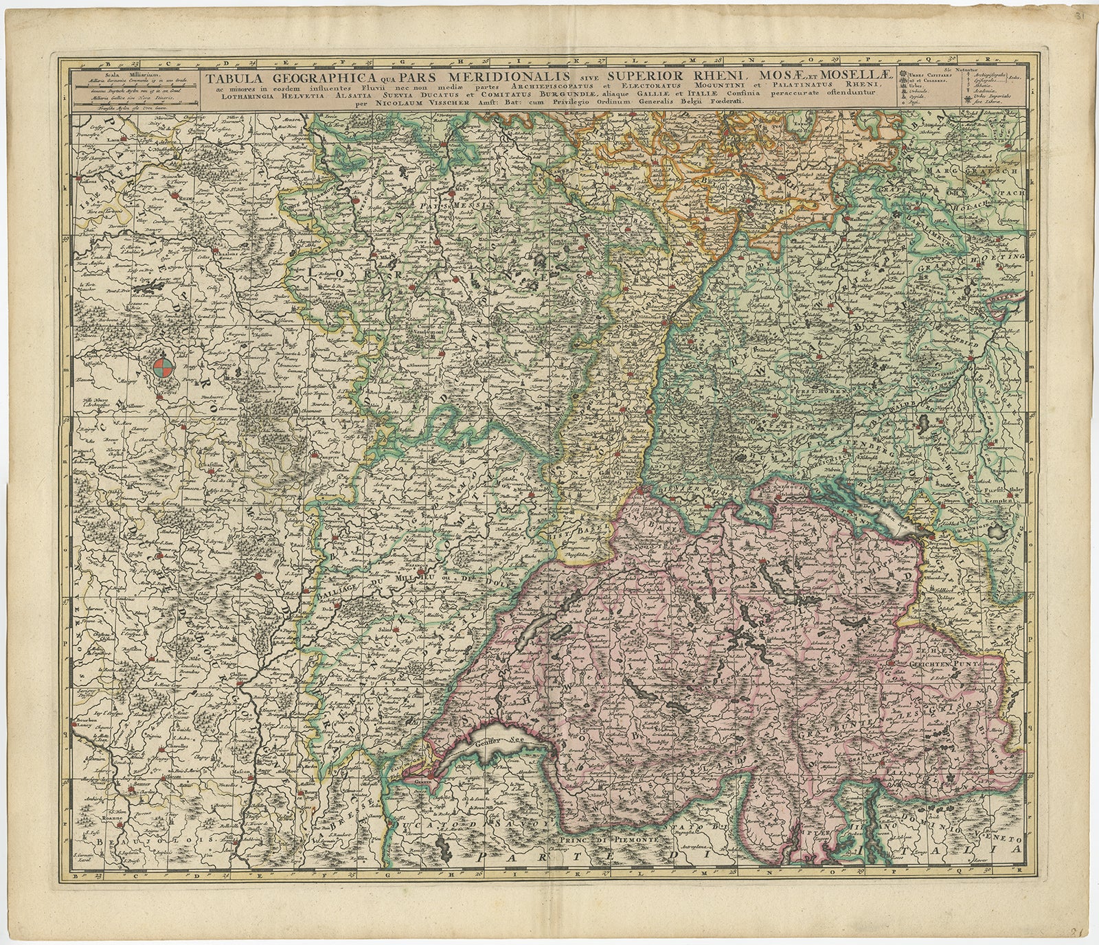
Mostra tuttoCarta geografica antica della Svizzera di N. Visscher, 1690 circa
Carta geografica antica intitolata "Tabula Geogaphica qua Pars Meridionalis sive Superior Rheni, Mosae, et Mosellae (...)". Pubblicato da N. Visscher, Amsterdam, circa 1690. Colorazi...
Categoria
Di antiquariato/d’epoca, Fine XVII secolo, Mappe
Materiali
Carta
532 € Prezzo promozionale
20% in meno
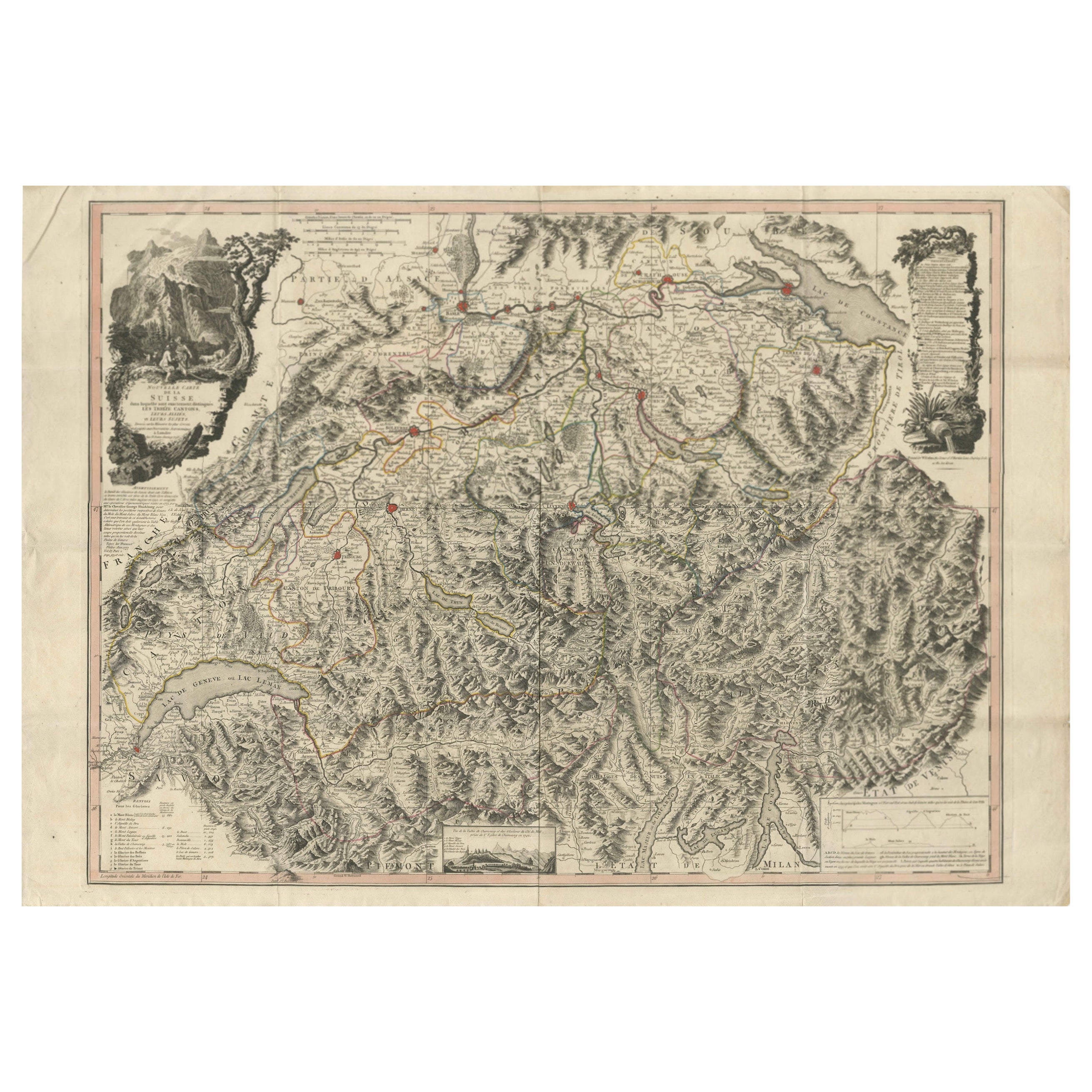
Mappa della Svizzera 1778 - Splendida lastra di rame colorata a mano dei tredici cantoni
Switzerland Map 1778 – Faden’s Hand-Colored Copperplate of the Thirteen Cantons
This striking copperplate engraving, published by William Faden in London in 1778, offers a detailed ...
Categoria
Di antiquariato/d’epoca, Fine XVIII secolo, Europeo, Mappe
Materiali
Carta
Mappa antica della Svizzera di J. B. J. B. Homann, 1751
Di Johann Baptist Homann
Esemplare decorativo della carta della Svizzera di Homann, con cartiglio decorativo e lo stemma di ciascuno dei 13 cantoni.
Categoria
Di antiquariato/d’epoca, Metà XVIII secolo, Mappe
Materiali
Carta

472 € Prezzo promozionale
20% in meno
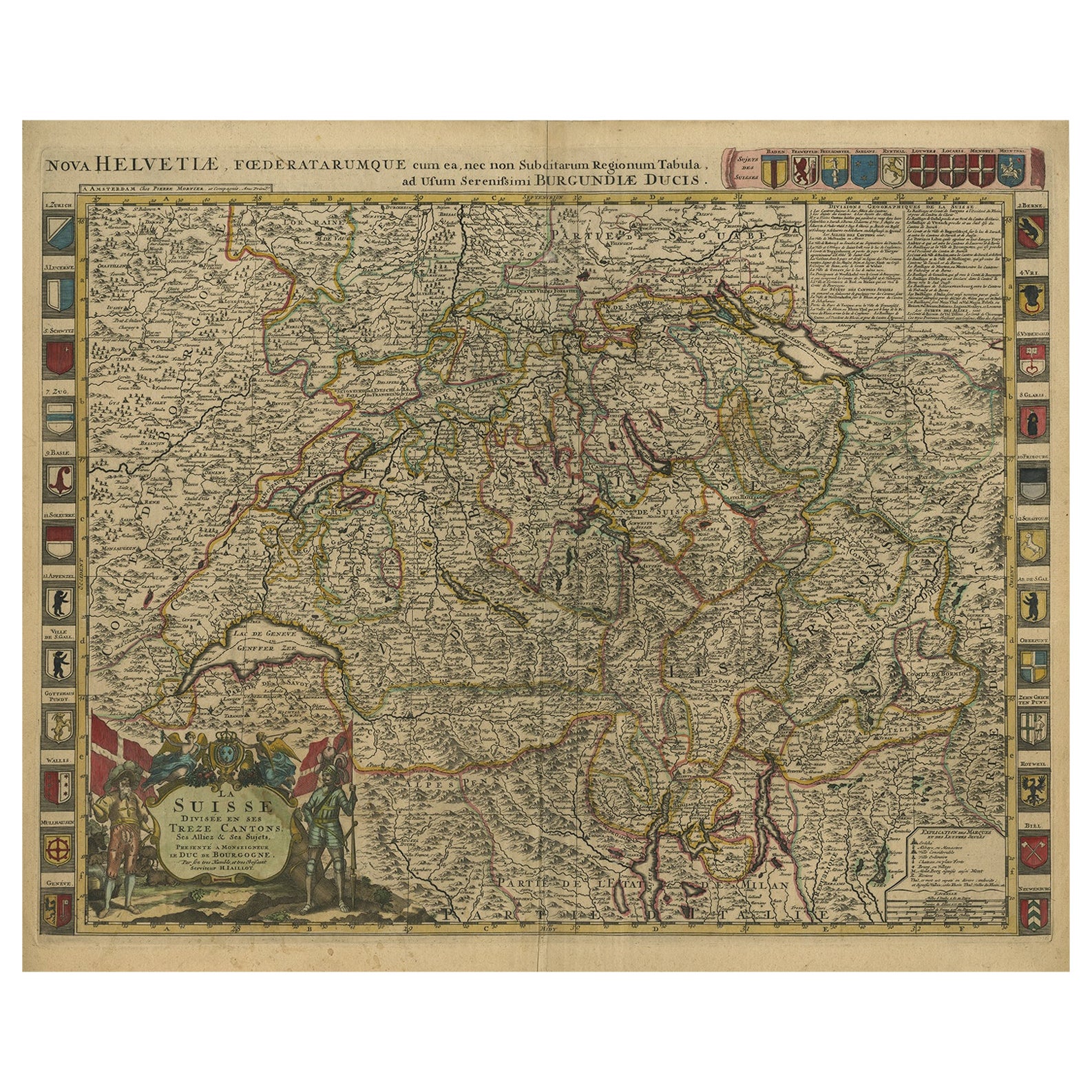
Bellissima mappa antica della Svizzera colorata a mano con 33 stemmi, 1705 ca.
Carta geografica antica della Svizzera intitolata "La Suisse Divisee en ses Treze Cantons, ses Alliez & ses Sujets (...)".
Bellissima mappa della Svizzera con 33 stemmi. La mappa è...
Categoria
Di antiquariato/d’epoca, Inizio Settecento, Mappe
Materiali
Carta
1280 € Prezzo promozionale
20% in meno
Spedizione gratuita
Carta geografica antica della Svizzera di Keizer & de Lat, 1788
Carta geografica antica intitolata "La Suisse (...)". Carta geografica antica e non comune della Svizzera. Questa mappa proviene da "Nieuwe Natuur- Geschied- en Handelkundige Zak- en...
Categoria
Di antiquariato/d’epoca, Fine XVIII secolo, Mappe
Materiali
Carta

280 € Prezzo promozionale
20% in meno
Carta geografica antica della Svizzera di Homann Heirs, 1732 ca.
Carta geografica antica intitolata "Potentissimae Helvetiorum Reipublicae (...)". Bellissima mappa dettagliata della Svizzera, che mostra i 13 cantoni. Il grande cartiglio del titolo...
Categoria
Di antiquariato/d’epoca, XVIII secolo, Mappe
Materiali
Carta

314 € Prezzo promozionale
20% in meno
Ti potrebbe interessare anche
Mappa della Svizzera - Acquaforte - XIX secolo
Questa mappa dei Paesi Bassi è un'incisione realizzata nel XIX secolo.
Lo stato di conservazione delle opere d'arte è eccellente. La firma "F.B." è incisa in basso a destra. Nella p...
Categoria
XIX secolo, Stampe figurative
Materiali
Acquaforte

Mappa antica originale della Svizzera, incisa da Barlow, datata 1807
Ottima mappa della Svizzera
Incisione su rame di Barlow
Pubblicato da Brightly & Kinnersly, Bungay, Suffolk.
Datato 1807
Senza cornice.
Categoria
Di antiquariato/d’epoca, Inizio Ottocento, Inglese, Mappe
Materiali
Carta

Mappa dell'Austria di Homann del XVIII secolo colorata a mano che include Vienna e il Danubio
Di Johann Baptist Homann
"Archiducatus Austriae inferioris" è una mappa dell'Austria colorata a mano creata da Johann Baptist Homann (1663-1724) e pubblicata a Norimberga, in Germania, nel 1728 poco dopo la ...
Categoria
Inizio XVIII secolo, Antichi maestri, Stampe (paesaggio)
Materiali
Incisione

Germania occidentale: Mappa originale del 17° secolo colorata a mano da Johannes Janssonius
Di Johannes Janssonius
Una mappa originale incisa in rame colorata a mano e intitolata in latino "Archiepiscopatus Maghdeburgensis et Anhaltinus Ducatus cum terris adjacentibus", pubblicata ad Amsterdam ne...
Categoria
Metà XVII secolo, Antichi maestri, Altre stampe
Materiali
Incisione

1571-1638 Willem Blaeu mappa intitolata "Ilcadorino", colorata a mano Ric0009
Mappa di Willem Blaeu intitolata,
"Ilcadorino,".
Colorato a mano.
Descrizione: grande, insolita e bella mappa antica incisa su rame dell'Ilcadorino, opera di Willem Blaeu (157...
Categoria
Di antiquariato/d’epoca, XVI secolo, Olandese, Mappe
Materiali
Carta

Mappa della guerra -Vesfaglia e Bassa Sassonia - Acquaforte - XIX secolo
La Mappa della Guerra di Vestaglia e della Bassa Sassonia è un'incisione realizzata nel XIX secolo.
Buone condizioni.
Categoria
Inizio XIX secolo, Moderno, Stampe figurative
Materiali
Acquaforte
