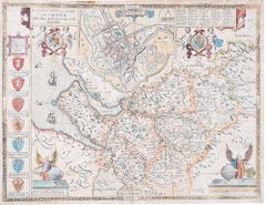
Items Similar to Map of the North of Scotland 17th century hand-coloured map by Gerardus Mercator

Want more images or videos?
Request additional images or videos from the seller
1 of 10
Gerardus MercatorMap of the North of Scotland 17th century hand-coloured map by Gerardus MercatorLate 16th / early 17th century
Late 16th / early 17th century
About the Item
Gerardus Mercator (1512 - 1594)
Map of the North of Scotland (1683)
Engraving with later hand colouring
35 x 45 cm
A fantastically characterful and detailed map engraving of the North of Scotland from 1683. The highly detailed and beautifully coloured map is inscribed to the reverse with a description of the parts of Scotland illustrated, called the 'Troisieme Table d'Escosse'. The map comes from the 1683 French edition of Gerardus Mercator's Atlas Major, which was first published in 1585.
Gerardus Mercator was the Flemish father of mapmaking. He was a skilled geographer, cosmographer and cartographer and is most renowned for creating the 1569 world map based on a new projection which represented sailing courses of constant bearing (rhumb lines) as straight lines - an innovation that is still employed in today's nautical charts.
Mercator was a highly influential pioneer in the history of cartography and is generally considered one of the founders of the Netherlandish school of cartography and geography. He is also widely considered the most notable figure of the school. In his own day, he was a notable maker of globes and scientific instruments. In addition, he had interests in theology, philosophy, history, mathematics and geomagnetism. He was also an accomplished engraver and calligrapher. Unlike other great scholars of the age, he travelled little and his knowledge of geography came from his library of over a thousand books and maps, from his visitors and from his vast correspondence (in six languages) with other scholars, statesmen, travellers, merchants and seamen. Mercator's early maps were in large formats suitable for wall mounting but in the second half of his life, he produced over 100 new regional maps in a smaller format suitable for binding into his Atlas of 1595. This was the first appearance of the word Atlas in reference to a book of maps. However, Mercator used it as a neologism for a treatise (Cosmologia) on the creation, history and description of the universe, not simply a collection of maps. He chose the word as a commemoration of the Titan Atlas, "King of Mauretania", whom he considered to be the first great geographer. Mercator wrote on geography, philosophy, chronology and theology. All of the wall maps were engraved with copious text on the region concerned. As an example, the famous world map of 1569 is inscribed with over five thousand words in fifteen legends.
- Creator:Gerardus Mercator (1512 - 1594, Flemish)
- Creation Year:Late 16th / early 17th century
- Dimensions:Height: 13.78 in (35 cm)Width: 17.72 in (45 cm)
- Medium:
- Period:1680-1689
- Condition:A little gentle spotting, primarily to margins.
- Gallery Location:London, GB
- Reference Number:1stDibs: LU795311533462
About the Seller
4.8
Platinum Seller
These expertly vetted sellers are 1stDibs' most experienced sellers and are rated highest by our customers.
Established in 2014
1stDibs seller since 2017
286 sales on 1stDibs
Typical response time: <1 hour
- ShippingRetrieving quote...Ships From: London, United Kingdom
- Return PolicyA return for this item may be initiated within 14 days of delivery.
More From This SellerView All
- John Speede Map The Countye Palatine of Chester with that most ancient citieBy John SpeedLocated in London, GBTo see our other views and maps of England - including London, Oxford and Cambridge, scroll down to "More from this Seller" and below it click on "See all from this Seller" - or send...Category
17th Century Realist Landscape Prints
MaterialsEngraving
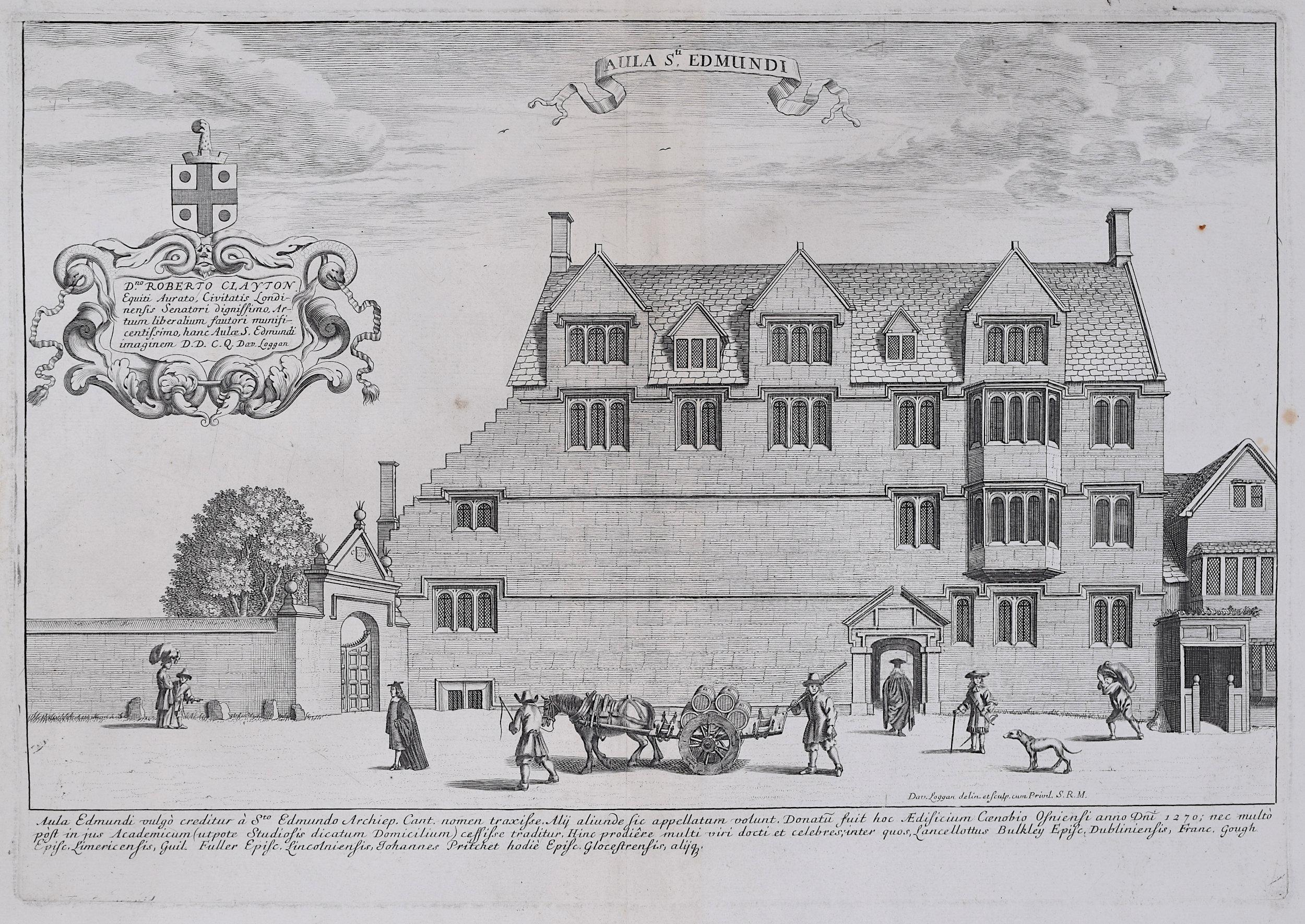
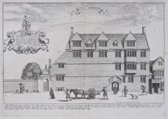
- David Loggan St Edmund Hall Oxford - Aula St Edmundi - 1675 engravingBy David LogganLocated in London, GBTo see our other views of Oxford and Cambridge, scroll down to "More from this Seller" and below it click on "See all from this Seller" - or send us a message if you cannot find the view you want. David Loggan (1634-1692) St Edmund Hall...Category
1670s Realist Prints and Multiples
MaterialsEngraving
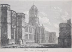
- Christ Church, Oxford 18th century engraving by John Dadley after Edward DayesLocated in London, GBTo see our other views of Oxford and Cambridge, scroll down to "More from this Seller" and below it click on "See all from this Seller" - or send us a message if you cannot find the ...Category
1790s Landscape Prints
MaterialsEngraving
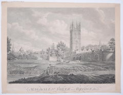
- Magdalen College, Oxford Tower and Bridge 18th century engraving by James BasireLocated in London, GBTo see our other views of Oxford and Cambridge, scroll down to "More from this Seller" and below it click on "See all from this Seller" - or send us a message if you cannot find the ...Category
1790s Landscape Prints
MaterialsEngraving
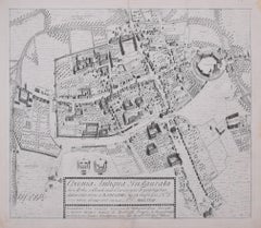
- The First Map of Oxford engraving by William Williams after Ralph AgasLocated in London, GBTo see our other views of Oxford and Cambridge, scroll down to "More from this Seller" and below it click on "See all from this Seller" - or send us a message if you cannot find the view you want. William Williams (active 1724 - 1733) after Ralph Agas (c. 1540 - 1621) The First Map of Oxford (1733) Engraving 47 x 54 cm In 1578, Ralph Agas drew the first ever map of Oxford, studded with the first colleges of the University. In 1733 it was engraved by William Williams for publication in the Oxonia Depicta, a book of illustrations depicting similar views as David Loggan's volume of engravings. Ralph Agas was an English surveyor and cartographer. He was born in Suffolk and lived there throughout his life, although he travelled regularly to London. He began to practise as a surveyor in about 1566, and has been described as "one of the leaders of the emerging body of skilled land surveyors". regular work consisted of drawing up local estate maps...Category
1730s Landscape Prints
MaterialsEngraving
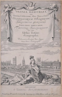
- University of Oxford Oxonia Illustrata 1675 engraving by David LogganBy David LogganLocated in London, GBTo see our other views of Oxford and Cambridge, scroll down to "More from this Seller" and below it click on "See all from this Seller" - or send us a message if you cannot find the ...Category
1670s Old Masters Prints and Multiples
MaterialsEngraving
You May Also Like
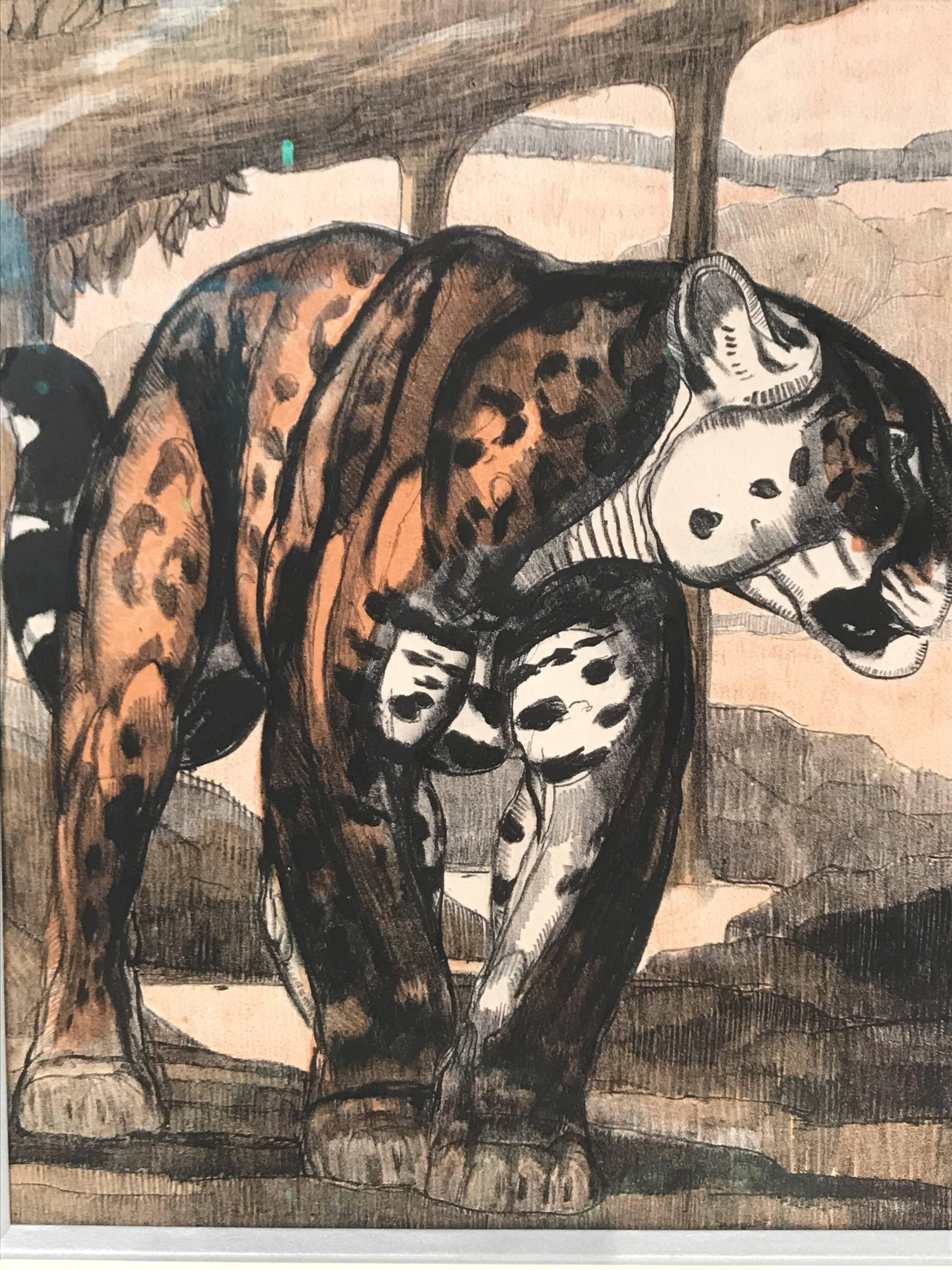
- Gravure Panthere 1By Paul JouveLocated in Saint Ouen, FREngraving after Paul Jouve From the work of Terrasse in 1948 490 copies Size etching: 23 x 18 cm Frame: 45 x 49 cmCategory
2010s Animal Prints
MaterialsEngraving
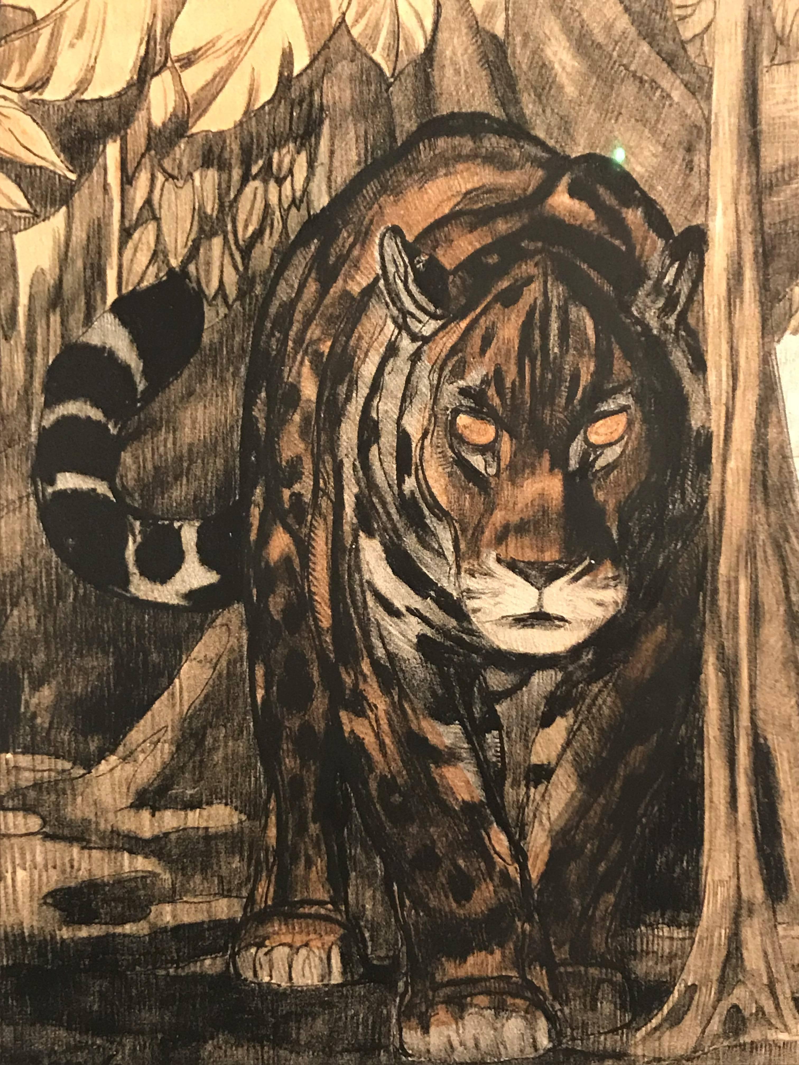
- Gravure Panthere 2By Paul JouveLocated in Saint Ouen, FREngraving after Paul Jouve From the work of Terrasse in 1948 490 copies Size etching: 23 x 18 cm Frame: 45 x 49 cmCategory
2010s Animal Prints
MaterialsEngraving
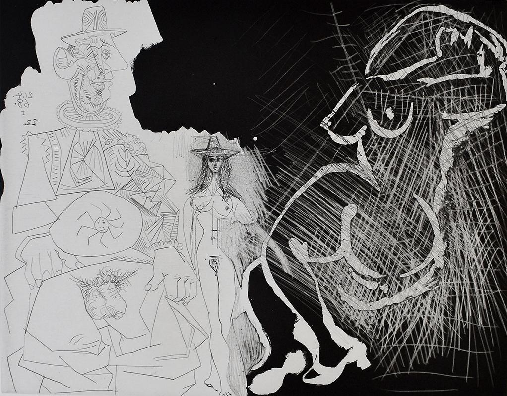
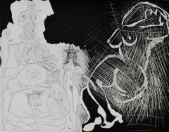
- Caricature of General de Gaulle and Two Women, from: Series 347 - French SeriesBy Pablo PicassoLocated in London, GBPABLO PICASSO 1881-1973 Málaga 1881- 1973 Mougins (Spanish) Title: Caricature of General de Gaulle and Two Women, from: Series 347 Caricature du général de ...Category
1960s Portrait Prints
MaterialsDrypoint
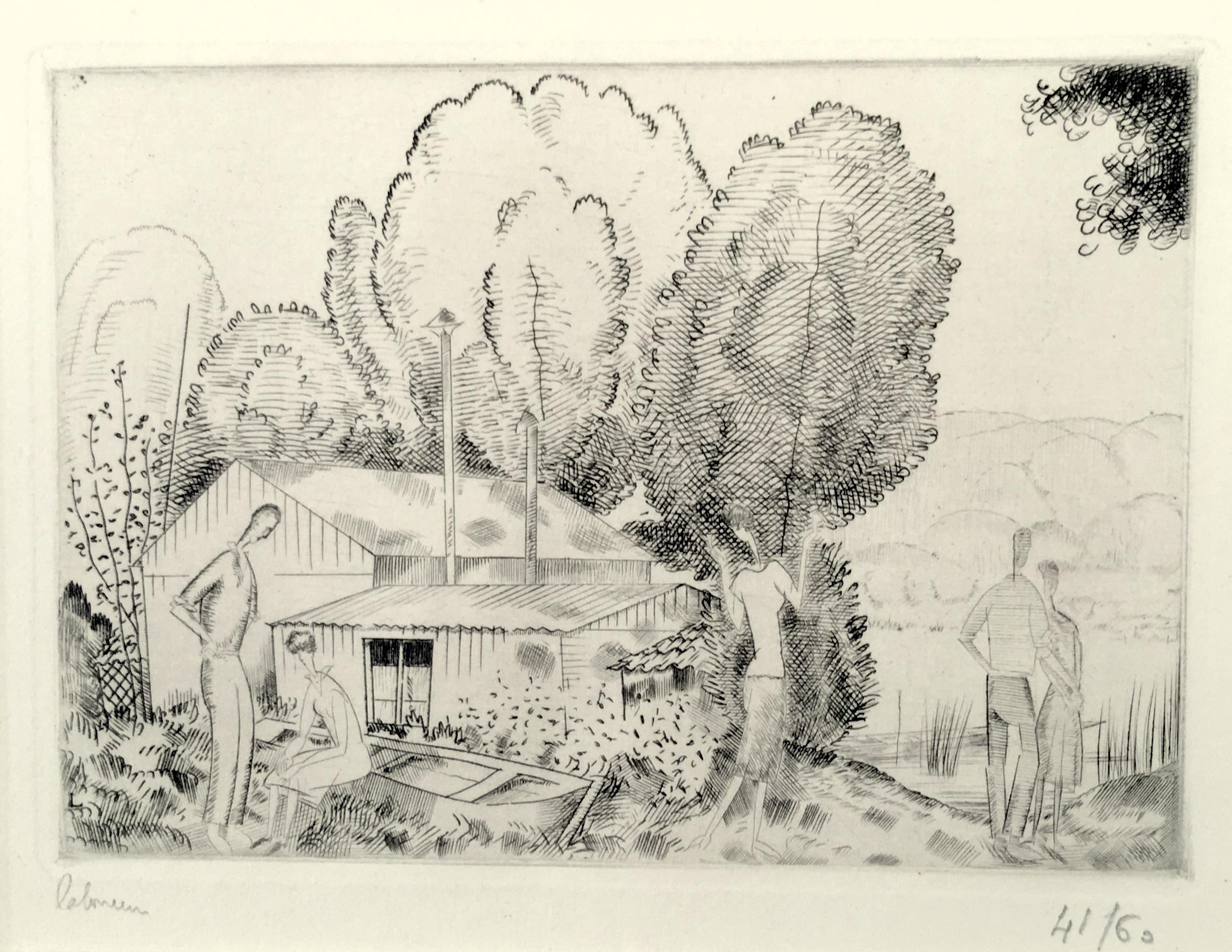
- L’Auberge du Bord de L’Eau (Petite Planche)By Jean-Emile LaboureurLocated in New York, NYJean-Emile Laboureur (1877-1943), L’Auberge du Bord de L’Eau (Petite Planche), engraving, 1924, signed in pencil lower left, numbered lower right ((41/60), and titled in pencil by th...Category
1920s Modern Landscape Prints
MaterialsEngraving
- "Paysage II"By Arthur Luiz PizaLocated in Paris, FREngraving, 1987 Edition : /99 Catalog : [37] 63.00 cm. x 45.00 cm. 24.8 in. x 17.72 in. (paper) 20.00 cm. x 20.00 cm. 7.87 in. x 7.87 in. (image) Handsigned by the artist in pencil...Category
1980s Abstract Abstract Prints
MaterialsEngraving
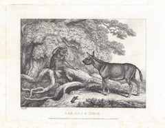
- Ass, Ape & Mole, antique animal fable etching by Samuel HowittBy Samuel HowittLocated in Melbourne, VictoriaOriginal antique etching by Samuel Howitt (1756-1822) . C1810. Published by Edward Orme. An early 19th century etching by Howitt from a series depicting ...Category
Early 19th Century Naturalistic Animal Prints
MaterialsEtching, Engraving


Recently Viewed
View AllMore Ways To Browse
Book Of Knowledge
The Book Of The Thousand
Antique Scottish Prints
16th Century Engraving
Hand Coloured Engravings
Engraving Scotland
Scottish Engraving
Large Coloured Print
17th Century French Engravings
King Of Scotland
Antique Sailing Prints
School World Map
Antique World Map Art
Engraving Flemish
Mercator Map
Mercator Antique
16th Century Scotland
World Map Globe