Items Similar to Louisiana: A Framed 19th Century Map by O.W. Gray

Want more images or videos?
Request additional images or videos from the seller
1 of 10
Ormando Wyllis GrayLouisiana: A Framed 19th Century Map by O.W. Gray1873
1873
About the Item
This framed 19th century map of the Louisiana territory was published in "Gray's Atlas of the United States with General Maps of the World, accompanied by Descriptions Geographical, Historical, Scientific and Statistica" published in 1873 in Philadelphia by O.W. Gray and Son and Stedman, Brown and Lyon. It is a highly detailed map of Louisiana and adjacent portions of Mississippi to the east and Texas to the west, as the borders existed in the late 19th century. It includes portions of the Gulf of Mexico and towns and cities, such as New Orleans, Baton Rouge and Lafayette. Ormando Wyllis (O.W.) Gray (1829-1912) was a Civil and Topographical Engineer who became a cartographer and map atlas publisher.
The map is presented in a light brown distressed bleached wood frame with a cream mat. The frame measures 22.63" wide x 20" high x 0.88" deep. The map is somewhat toned, although the appearance appears in part to be related to its tinting. It is otherwise in very good condition.
There are two other mid-19th century maps of North America in identical style frames and maps that are listed on 1stdibs. They would make for an attractive and interesting display grouping. There is a discount available for multiple purchases. These additional maps may be viewed by entering their reference numbers in the search field: LU5206221574212 or LU5206221506302.
- Creator:Ormando Wyllis Gray (1829 - 1912, American)
- Creation Year:1873
- Dimensions:Height: 20 in (50.8 cm)Width: 22.63 in (57.49 cm)Depth: 0.88 in (2.24 cm)
- Medium:
- Period:
- Condition:
- Gallery Location:Alamo, CA
- Reference Number:
About the Seller
5.0
Vetted Seller
These experienced sellers undergo a comprehensive evaluation by our team of in-house experts.
Established in 2011
1stDibs seller since 2019
242 sales on 1stDibs
Typical response time: 1 hour
- ShippingRetrieving quote...Ships From: Alamo, CA
- Return PolicyA return for this item may be initiated within 7 days of delivery.
More From This SellerView All
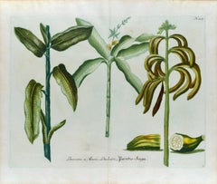
- Banana Plants: An 18th Century Hand-colored Botanical Engraving by J. WeinmannBy Johann Wilhelm WeinmannLocated in Alamo, CAThis is a striking original antique colored botanical mezzotint and line double page engraving of banana plants, which is finished with hand-coloring. It is entitled "Banana 1. Musa,...Category
Mid-18th Century Naturalistic Still-life Prints
MaterialsEngraving, Mezzotint
- Asia Declineatio: A 17th Century Hand-colored Map of Asia by Justus DanckertsLocated in Alamo, CAThis is a scarce 17th century beautifully hand-colored copperplate engraved map of Asia entitled “Exactissima Asiae Delineatio in Praecipuas Regiones Caerterasque Partes divisa et de...Category
Late 17th Century Old Masters Landscape Prints
MaterialsEngraving
- Peacock Butterfly & Moth: A 1st Ed. Hand-colored 18th C. Engraving by M. HarrisBy Moses HarrisLocated in Alamo, CAThis is a rare, original first edition hand-colored engraving of Water Betony Moths and Peacock Butterflies, which is plate 8 from Moses Harris's publication "The Aurelian: or Natura...Category
Mid-18th Century Landscape Prints
MaterialsEngraving
- California: 18th Century Hand-colored Map by de VaugondyBy Didier Robert de VaugondyLocated in Alamo, CAThis is an 18th century hand-colored map of the western portions of North America entitled "Carte de la Californie et des Pays Nord-Ouest separés de l'Asie par le détroit d'Anian, ex...Category
1770s Landscape Prints
MaterialsEngraving
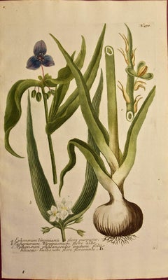
- Spider Lily: An Original 18th C. Hand-colored Botanical Engraving by J. WeinmannBy Johann Wilhelm WeinmannLocated in Alamo, CAThis colored botanical mezzotint and line engraving finished with hand coloring by Johann Wilhelm Weinmann (1683-1741) is entitled "A. Ephemerum Virginianu flore Purpureo, B. Ephemer...Category
Mid-18th Century Naturalistic Still-life Prints
MaterialsMezzotint, Engraving
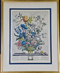
- "February Bouquet" from 'The Twelve Months of Flowers' series by Robert FurberBy Robert FurberLocated in Alamo, CAThis framed hand-colored engraving entitled "February Bouquet" is from 'The Twelve Months of Flowers' by Henry Furber, published in London in 1730 by Robert Sayer and John King. Each of the twelve hand-colored engravings in the book were produced from paintings by Pieter Casteels (1684-1749) and engraved by Henry Fletcher (1710-1753). The book featured twelve detailed engravings of seasonal plants in bloom in the form of a bouquet. More than 400 different species of flowering plants were included with each plant numbered and accompanied by a list of the corresponding species names. Thirty-five species of flowers are depicted in this engraving in a bouquet sitting in an ornate attractive bowl. A few of the flowers lie loose on a table. The flower species are listed in a table in the lower portion of the plate, along with the month that these flowers are in bloom. This colorful print is presented in a gold-colored wood frame with a cream-colored double mat with a heather green inner mat. The frame measures 23.5" High, 19" wide and 1.63" deep. There are a few small frame abrasions, but the print is in very good condition. Robert Furber...Category
Mid-18th Century Naturalistic Still-life Prints
MaterialsEngraving


You May Also Like
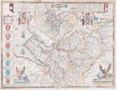
- John Speede Map The Countye Palatine of Chester with that most ancient citieBy John SpeedLocated in London, GBTo see our other views and maps of England - including London, Oxford and Cambridge, scroll down to "More from this Seller" and below it click on "See all from this Seller" - or send...Category
17th Century Realist Landscape Prints
MaterialsEngraving
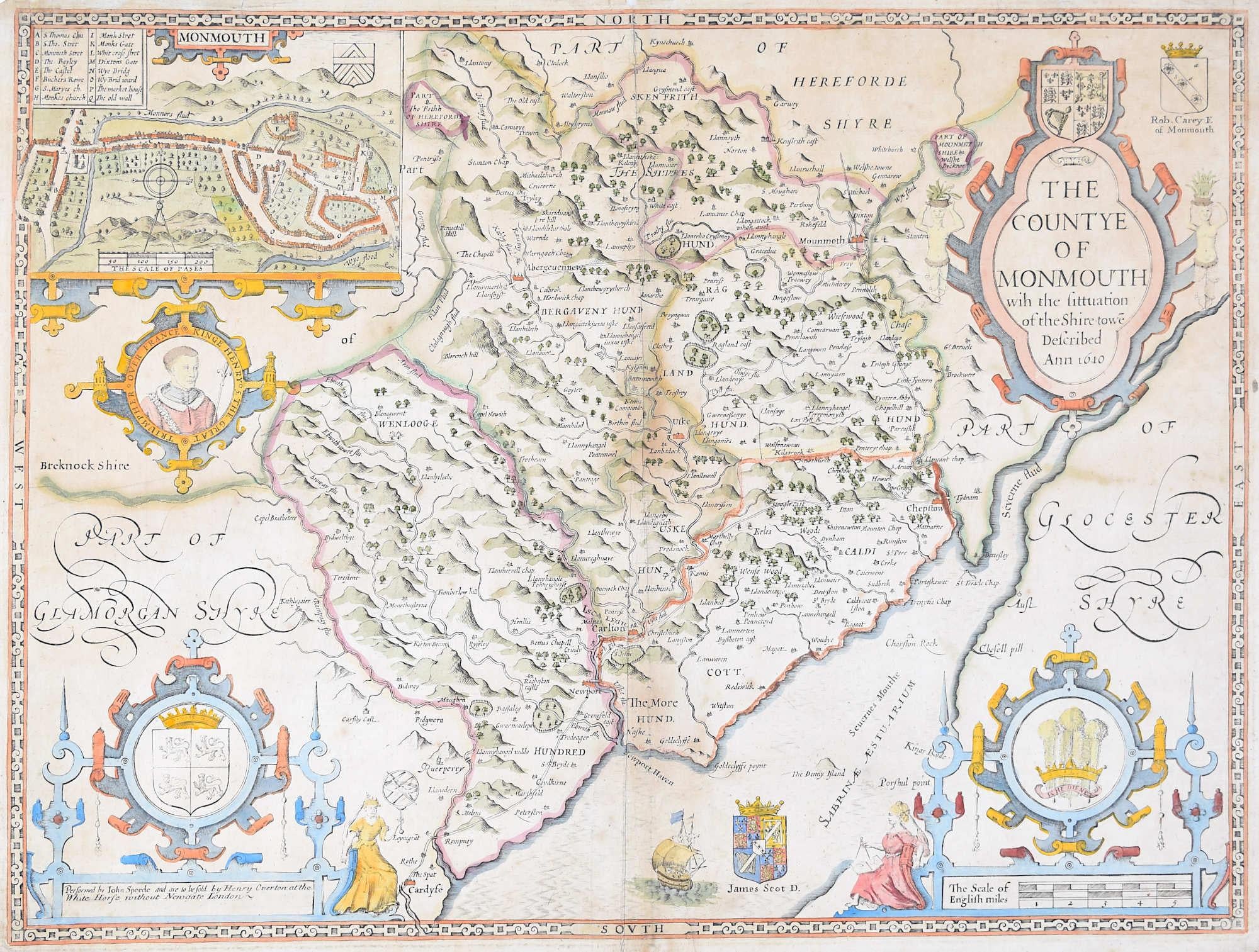
- John Speede Map The Countye of MonmouthBy John SpeedLocated in London, GBTo see our other views and maps of England - including London, Oxford and Cambridge, scroll down to "More from this Seller" and below it click on "See all from this Seller" - or send...Category
17th Century Realist Landscape Prints
MaterialsEngraving
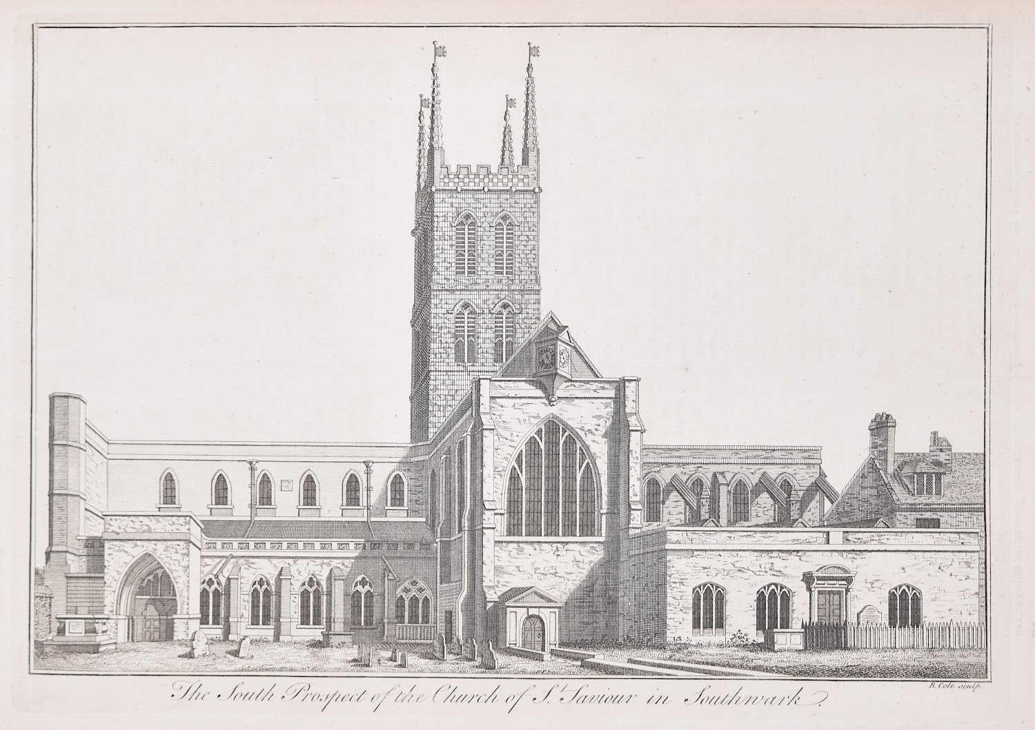
- Southwark Cathedral engraving c. 1753 for Stow's Survey of LondonLocated in London, GBTo see our other views and maps of England - including London, Oxford and Cambridge, scroll down to "More from this Seller" and below it click on "See all from this Seller" - or send...Category
1750s Realist Landscape Prints
MaterialsEngraving
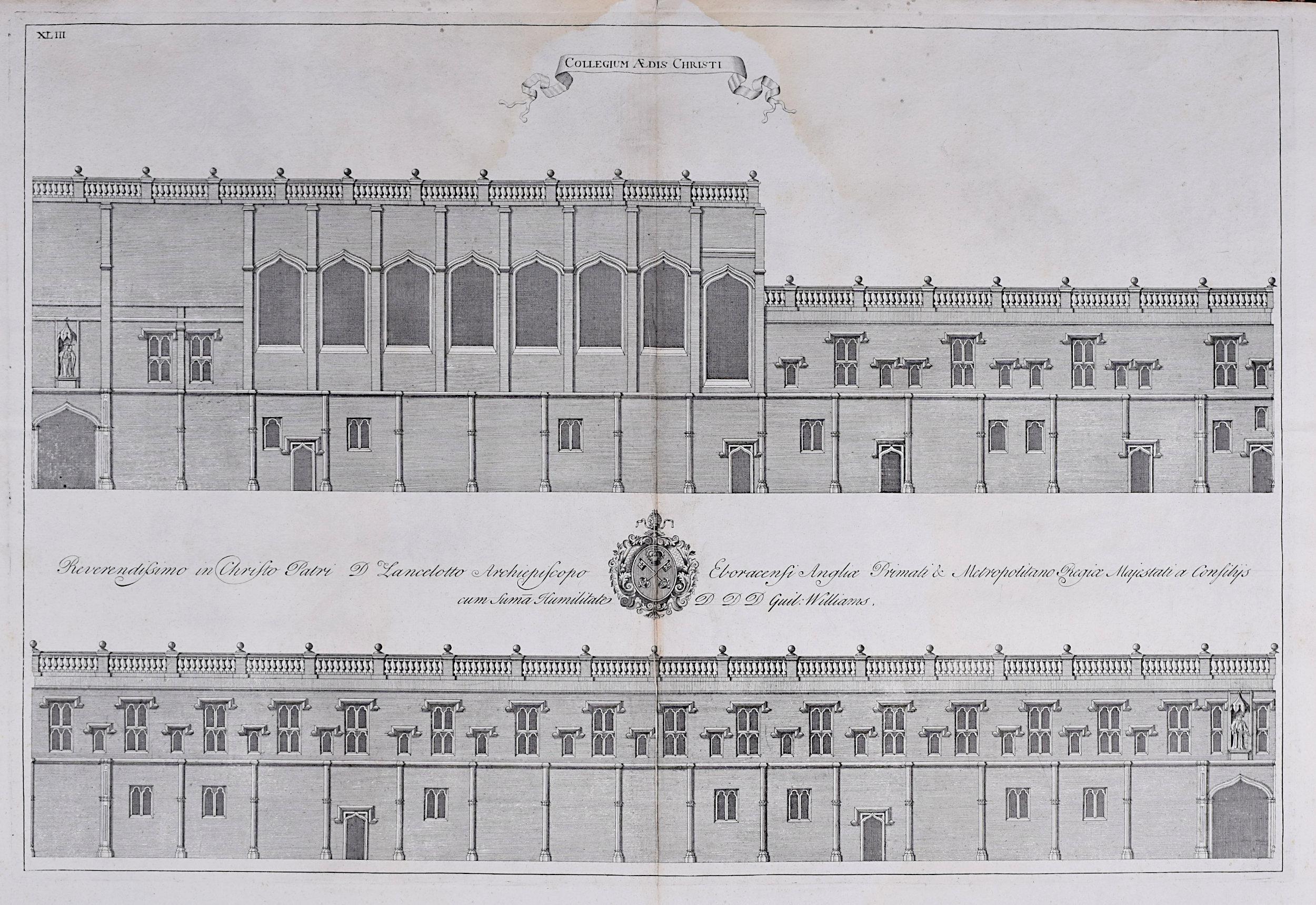
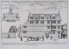
- William Williams engraving of Christ Church - College at Oxford c.1732By William Williams (painter)Located in London, GBTo see our other views of Oxford and Cambridge, scroll down to "More from this Seller" and below it click on "See all from this Seller" - or send us a message if you cannot find the view you want. William Williams...Category
Early 18th Century Realist Landscape Prints
MaterialsEngraving
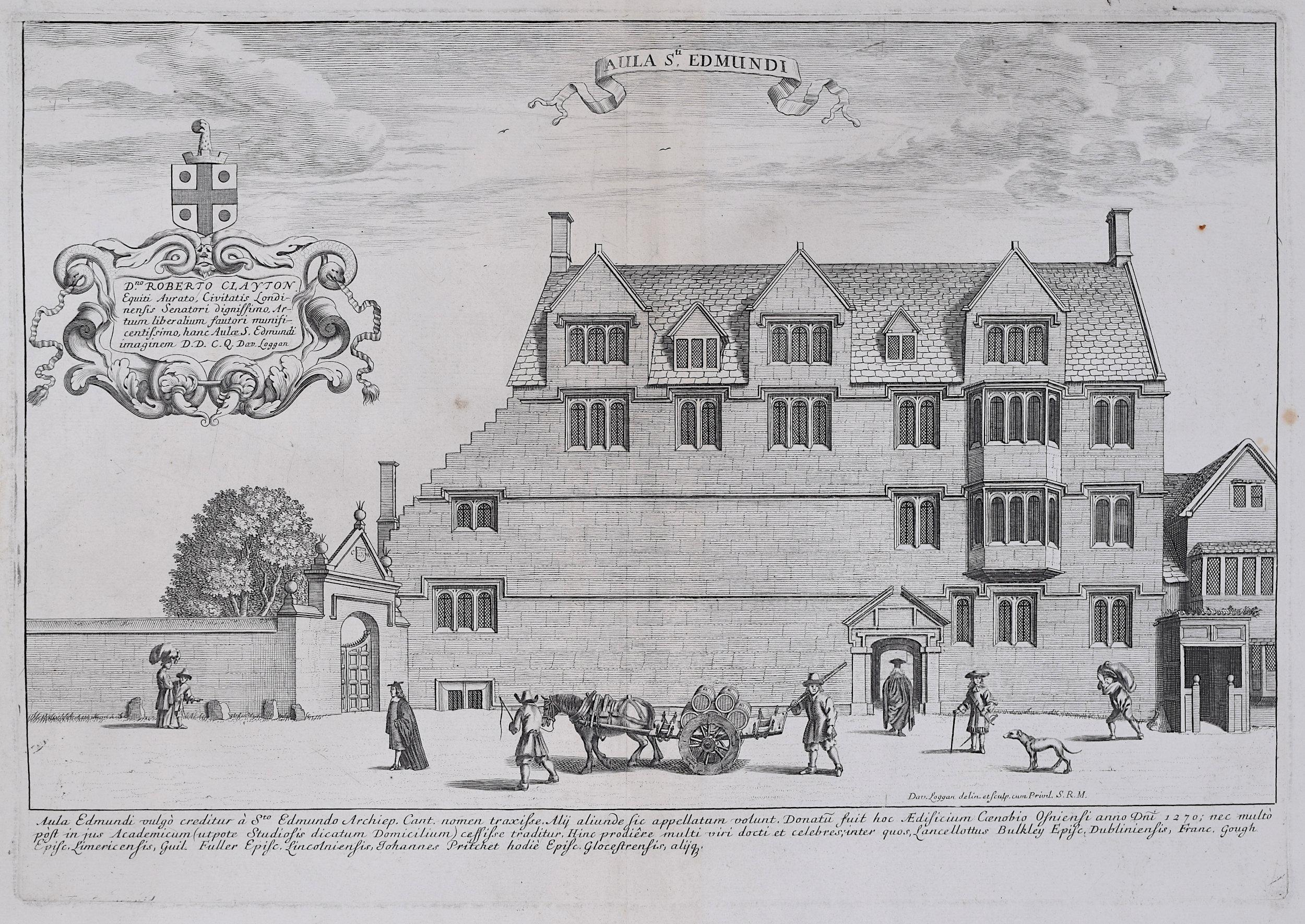
- David Loggan St Edmund Hall Oxford - Aula St Edmundi - 1675 engravingBy David LogganLocated in London, GBTo see our other views of Oxford and Cambridge, scroll down to "More from this Seller" and below it click on "See all from this Seller" - or send us a message if you cannot find the view you want. David Loggan (1634-1692) St Edmund Hall...Category
1670s Realist Prints and Multiples
MaterialsEngraving
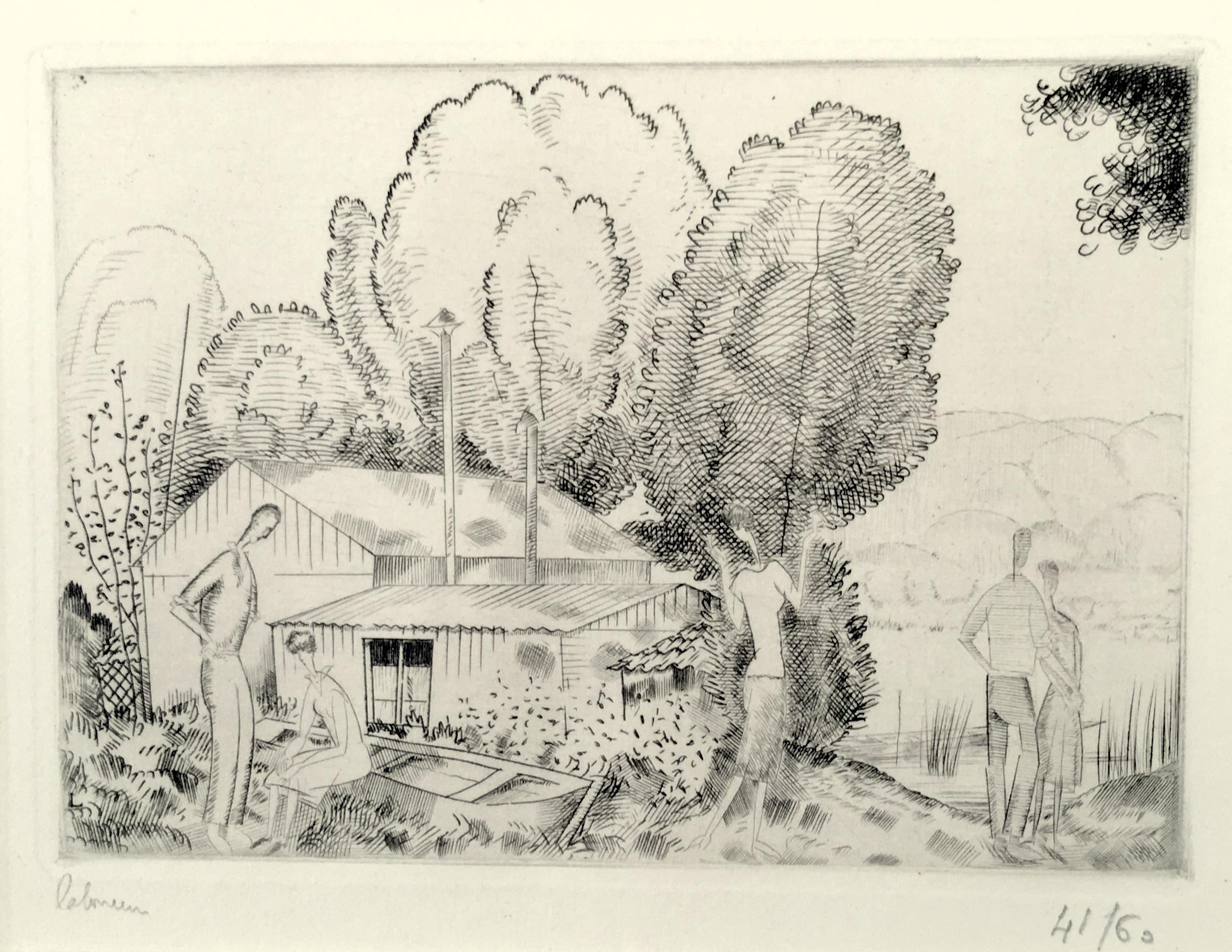
- L’Auberge du Bord de L’Eau (Petite Planche)By Jean-Emile LaboureurLocated in New York, NYJean-Emile Laboureur (1877-1943), L’Auberge du Bord de L’Eau (Petite Planche), engraving, 1924, signed in pencil lower left, numbered lower right ((41/60), and titled in pencil by th...Category
1920s Modern Landscape Prints
MaterialsEngraving


Recently Viewed
View AllMore Ways To Browse
A Frame
Gray Wood
Framed 19th Century Prints
19th Century Engraving Framed
19th Century Texas
Framed Map United States
Lafayette Antique
Baton Brown
Lyons Antique Prints
Gulf Of Mexico
Texas Maps
Map Of Texas
Mississippi Antique
Antique Map Mexico
Antique Maps Mexico
Antique Map Of Mexico
Antique Maps Of Mexico
Map Louisiana