17th Century More Prints
to
2
45
2
7
14
39
8
9
12
11
15
Overall Height
to
Overall Width
to
9
1
1
1
1
1
1
1
240
604
6,267
3,666
81
156
286
554
560
761
988
1,019
629
436
165
13
4
2
2
2
42
3
3
1
1
Period: 17th Century
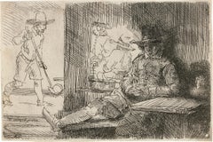
The Ringball Player By Rembrandt Van Rijn
Located in New Orleans, LA
Rembrandt van Rijn
1606-1669 Dutch
The Ringball Player
Etching on paper
New Hollstein’s first state of two
Signed and dated lower left: Rembrandt F. 1654
Among the foremost figur...
Category
Old Masters 17th Century More Prints
Materials
Paper, Etching
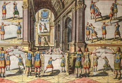
Academie de l’Espee Tabula XXI by Girard Thibault 17thc fencing engraving
Located in Paonia, CO
Hand colored original engraving from the Academie de l’Espee ( full title can be translated as Academy of the Sword: wherein is demonstrated by mathematical rules on the foundation of a mysterious circle the theory and practice of the true and heretofore unknown secrets of handling arms on foot and horseback ) by Girard Thibault...
Category
Other Art Style 17th Century More Prints
Materials
Engraving
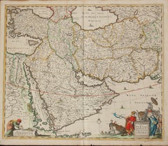
Persiae, Armeniae, Natoliae et Arabiae Descriptio per Frederick deWit 1666 map
Located in Paonia, CO
Map of Persiae, Armeniae, Natoliae et Arabiae Descriptio per F de Wit 1688 engraving from: Atlas Contractus Orbis Terrarum Praecipuas ac Novissimas Complectens Tabulas. Amsterdam, N. Visscher, 1656-77. (Koeman III, Vis5-8) This highly decorative map of the Middle East is by the Dutch engraver, publisher, and map seller...
Category
Realist 17th Century More Prints
Materials
Engraving
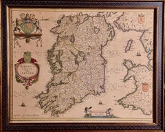
Ireland: A Framed 17th Century Hand-colored Map by Jan Jannson
Located in Alamo, CA
This is a 17th century hand-colored map entitled "Hibernia Regnum Vulgo Ireland" by Johannes Janssonius's (Jan Jansson), published in Amsterdam in 1640. This highly detailed map depicts the Emerald Isle with an extensive display of towns, roads, mountains, rivers, lakes and county borders, etc. It includes two decorative cartouches on the left. The title cartouche includes the Irish harp and the second, in the upper left, includes a lion wearing a crown on the left, a unicorn on the right and a coat-of-arms in the middle, which includes another Irish harp. A distance scale is seen in the lower right, augmented with two putti. The map is embellished with three sailing ships and a sea monster. Western portions of Scotland and England...
Category
Old Masters 17th Century More Prints
Materials
Engraving
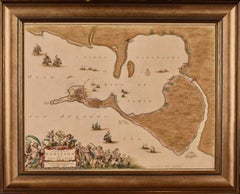
Cadiz Island: A Framed 17th Century Hand-colored Map from Blaeu's Atlas Major
Located in Alamo, CA
This is a 17th century hand-colored map entitled "Insula Gaditana Isla de Cadiz" from Johannes (Joan) Blaeu's Atlas Maior, published in Amsterdam in 1662.
The map provides an excellent plan of Cadiz Island on the southwest coast of Spain, with its harbor, fortifications, agricultural fields and several surrounding salt processing areas. Numerous sailing ships of various sizes are included in and around the harbor and bay, including five large sailing ships, as well as twenty-four smaller ships. There is a small compass rose overlying the bay. The bridge to the mainland from the island is shown on the right. There is an extremely ornate and colorful title cartouche in the lower left, with its mythological figures reminiscent of Raphael’s Galatea fresco at the Villa Farnesina in Rome. The vibrant colors are vividly preserved. The master colorist tried to emulate a painting by using various tones to create a three-dimensional effect.
Blaeu's name is present in the plate in the lower right. Blaeu stated in his description of Cadiz: “The main wealth of the islanders consists of salt, which they harvest, and
the tuna fisheries.”
This 17th century hand-colored map is framed in an ornate, partially textured bronze-colored wood frame and glazed with UV protected conservation glass. There is a vertical center fold, as issued. There is a faint crease in the lower right and faint color offset on the left from the right side of the map, resulting from having been in an atlas for hundreds of years. Small foci of paint are present in the upper portion of the left margin and in the left corner margin. The map is otherwise in very good condition.
Due in large part to their powerful trade empire, the Dutch became known for cartography in the seventeenth century. This period is considered the Golden Age of Dutch cartography. Their publishing houses produced the highest quality work in Europe, particularly those maps and charts of foreign lands, and Dutch map-making set the bar for cartographic accuracy and artistry into the early-eighteenth century. Some of the most well-known cartographers worked in Amsterdam during this period. Perhaps the most famous of these was the Blaeu family. Willem Janszoon Blaeu, set up shop in Amsterdam. His son, Johannes (Joan), succeeded him upon his death in 1638, continuing in his father’s position as Hydrographer to the Dutch East India Company and selling maps to the public. The Blaeu map presses, located near Amsterdam’s Dam Square...
Category
Old Masters 17th Century More Prints
Materials
Engraving
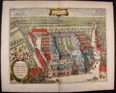
Cartusia Bruxellensis Monastery in Brussels: A 17th C. Hand-colored Engraving
Located in Alamo, CA
This is a 17th century hand-colored copperplate engraving entitled "Cartusia Bruxellensis" by Lucas Vorsterman, the Younger, after a drawing by Jacob van Werden or Jacques van Weerden, published in 1659 in Antonius Sanderus' book 'Chorographia sacra Brabantiae sive celebrium aliquot in ea provincia ecclesiarum et coenobiorum descriptio . . . Brussel' (A sacred chorography of Brabant, or a description of several famous churches and convents in that province). It also appeared in other publications by Sanderus. In the 17th century, Brussels was within the Duchy of Brabant.
This engraving depicts a bird's-eye view of the Scheut Carthusian Monastery in Brussels. Scheut is a district of Anderlecht, a municipality of Brussels, Belgium. The monastery housed monks, who took a vow of silence, in 20 rooms. There is a central courtyard with trees and shrubs. Monks are depicted strolling along its pathways. The cells for the friars are in the middle the cloister. There are people along the streets in the foreground and to the right of the large, imposing monastery. Some are on horseback, others are walking. In the lower right, what appears to be a dog pulls a small cart containing barrels, possibly of beer or wine. Districts and neighborhoods are labelled in the background, including Scheut, Anderlecht and Ransfort. A very ornate cartouche in the lower left contains Latin and the artist's attribution. Another decorative cartouche in the upper central area contains the title.
This beautifully hand-colored and detailed engraving is printed on laid, chain-linked paper with wide, full margins. The sheet measures 17.25" high and 21.25" wide. It has Latin text on the verso. It has a central vertical fold, as issued, which is reinforced on the verso. Two small spots in the lower margin may actually represent drops of watercolor paint used to color the engraving. It is otherwise in very good condition.
Antonius Sanderus (1586-1664) was a Flemish Catholic cleric and historian. He was born "Antoon Sanders", but Latinized his name like many writers and scholars of his time. He was the author of several books, including 'Chorographia Sacra Brabantiae', which was illustrated with this engraving.
Lucas Vorsterman the Younger (1624-between 1666 & 1676) was a Flemish Baroque engraver and draughtsman. He produced engravings after the work of contemporary painters and for books by Antwerp publishers.
Jacob van Werden or Jacques van Weerden (active 1643-1669), was a Flemish draughtsman, cartographer, military engineer and archer who was active in the Habsburg Netherlands. His drawings were used as designs for prints executed by various printmakers. He worked on maps, topographical views, historical scenes, portraits and book illustrations. He had a career as a military engineer and a member of the guard of the Spanish King. He advised on various military engineering projects and was an engineer of the Spanish army...
Category
Old Masters 17th Century More Prints
Materials
Engraving
Rugen Island, Germany: An Early 17th Century Map by Mercator and Hondius
Located in Alamo, CA
This is an early 17th century map entitled "Nova Famigerabilis Insulae Ac Ducatus Rugiae Desciptio" (Map of Rugen Island, Germany) by Gerard Mercator and Henricus and Joducus Hondiu...
Category
Old Masters 17th Century More Prints
Materials
Engraving
Prospetto della nobil Piazza Navona
Located in New York, NY
A very good, richly-inked impression of this etching with strong contrasts and no sign of wear. Anchor or fleur-de-lys in a double circle watermark. From "Prospectus locorum urbis Ro...
Category
Italian School 17th Century More Prints
Materials
Etching
Persia, Armenia & Adjacent Regions: A Hand-colored 17th Century Map by De Wit
Located in Alamo, CA
This colorful and detailed 17th century copperplate map by Frederick De Wit was published in Amsterdam between 1666 and 1690. It depicts the Caspian Se...
Category
Old Masters 17th Century More Prints
Materials
Engraving
Solis Circa Orbem Terrarum Spiralis Revolution
Located in Mount Vernon, NY
Engraving after celestial map from Dutch-German mathematician and cosmographer Andreas Cellarius’ (1596-1665) “Harmonia Macrocosmica,” 1660, illustrating...
Category
17th Century More Prints
Materials
Engraving
"Africa Vetus": A 17th Century Hand-colored Map By Sanson
Located in Alamo, CA
This original hand-colored copperplate engraved map of Africa entitled "Africa Vetus, Nicolai Sanson Christianiss Galliar Regis Geographi" was originally created by Nicholas Sanson d...
Category
17th Century More Prints
Materials
Engraving
Naples and S. Italy: A Large 17th C. Hand-colored Map by Sanson and Jaillot
Located in Alamo, CA
This large hand-colored map entitled "Le Royaume de Naples Divisé en Douze Provinces. sur les Memoires les plus Nouveaux. Par le Sr. Sanson Presenté" was originally created by Nicholas Sanson d'Abbeville and published by Hubert Jaillot in "Atlas Nouveau" in Paris in 1692. It depicts central and southern Italy, as well as Corfu, Albania, Mediterranean Sea and the Adriatic Sea. Naples, Sorrento, the Isle of Capri, Rome in the upper left corner of the map, as well as many other landmarks.
This striking original hand-colored map of Italy is printed on antique hand-made laid, chain-linked paper with wide margins. The sheet measures 20" high and 24.88" wide. There is one spot on the left, it is otherwise in very good to excellent condition.
Nicholas Sanson d'Abbeville (1600-1667) was one of the greatest French cartographather of French cartography. Sanson opened his first printing business in Paris in 1638. The king recognized his skill and knowledge and made him the official geographer to the court. He eventually served two kings in this capacity. Sanson was succeeded by his sons and son...
Category
17th Century More Prints
Materials
Engraving
L'Isle de France map
By Cornelis Danckerts II
Located in Wilton Manors, FL
Gouvernement general de l'Isle de France : ou sont la France, le Valois, Soissonnois, le Beauvaisis, Laonnois, la Brie, Francoise, l'Hurepoix noyonnois et les comtes de Senlis et de ...
Category
17th Century More Prints
Materials
Laid Paper, Engraving
Southeastern England: A 17th Century Hand-Colored Map by Mercator and Hondius
Located in Alamo, CA
A 17th century copperplate hand-colored map entitled "The Sixt Table of England" by Gerard Mercator and Jodocus Hondius, published in Amsterdam in 1635 in 'Cosmographicall Descriptio...
Category
17th Century More Prints
Materials
Engraving
Belgium and the Netherlands: A Hand-colored 17th Century Map by Visscher
Located in Alamo, CA
This is an original hand-colored 17th century map of Belgium by Nicolaus (Nicolas) Visscher II entitled "Belgium Foederatum emendate auctum et novissime editum", published in Amsterdam in 1678. The map shows the seven provinces comprising the Belgium federation or the Republic of the Seven United Netherlands or the Dutch Republic as it was also known. The republic was formed when an alliance of seven Dutch provinces in the Spanish Netherlands revolted against rule by Spain in 1579 (the Union of Utrecht) and declared their independence in 1581 (the Act of Abjuration). The seven provinces were Groningen, Frisia, Overijssel, Guelders, Utrecht, Holland and Zeeland. This was a predecessor state to the Netherlands and the first fully independent Dutch nation state. Amsterdam, Delft, Rouen, Utrecht, Brugge, Ghent, and Antwerp are all included on the map. A small inset map in the lower right depicts the course of the Maas River from Maastricht to Wessem. There is a decorative cartouche in the upper left corner and a distance scale cartouche in the lower right corner.
The map is presented in an attractive antiqued medium brown-colored wood frame with gold-colored inner and outer trim and a light tan-colored fabric mat. The frame measures 26.63" high by 30" wide by 0.75" deep. There is some darkening of the red areas in the map, presumably related to oxidation of the original iron containing pigment over time. There are also a few scattered spots. The map is otherwise in very good condition.
The Visscher family were one of the great cartographic families of the 17th century. Begun by Claes Jansz Visscher...
Category
Other Art Style 17th Century More Prints
Materials
Engraving
Southern Greece: A Large 17th Century Hand-colored Map By Sanson and Jaillot
Located in Alamo, CA
This large original hand-colored copperplate engraved map of southern Greece and the Pelopponese Peninsula entitled "La Moree Et Les Isles De Zante, Cefalonie, Ste. Marie, Cerigo & C...
Category
17th Century More Prints
Materials
Engraving
West Africa: A 17th Century Hand-Colored Map by Mercator/Hondius
Located in Alamo, CA
A 17th century hand-colored map entitled "Guineae Nova Descriptio" by Gerard Mercator and Jodocus Hondius, published in their 'Atlas Minor' in Amsterdam in 1635. It is focused on the...
Category
17th Century More Prints
Materials
Engraving
The Normandy Region of France: A 17th C. Hand-colored Map by Sanson and Jaillot
Located in Alamo, CA
This large hand-colored map entitled "Le Duché et Gouvernement de Normandie divisée en Haute et Basse Normandie en divers Pays; et par evêchez, avec le Gouvernement General du Havre ...
Category
17th Century More Prints
Materials
Engraving
North & South America: A 17th Century Hand-colored Map by Jansson & Goos
Located in Alamo, CA
A 17th century hand-colored map of North & South America entitled "Americae Descriptio" by the cartographer Johannes Jansson, published in Jansson's Atlas Minor in Amsterdam in 1628....
Category
17th Century More Prints
Materials
Engraving
Utrecht, Netherlands: A Large 17th Century Hand-colored Map by Sanson & Jaillot
Located in Alamo, CA
This large hand-colored map entitled "La Seigneurie d'Utrecht. Dressé sur les memoires les plus nouveaux par le Sr. Sanson" was originally created by Nicholas Sanson d'Abbeville. Thi...
Category
17th Century More Prints
Materials
Engraving
Hungary & Eastern Europe: A Large 17th C. Hand-colored Map by Sanson & Jaillot
Located in Alamo, CA
This large hand-colored map entitled "Le Royaume De Hongrie et les Estats qui en ont este sujets et qui font presentement La Partie Septentrionale de la Turquie en Europe" was origin...
Category
17th Century More Prints
Materials
Engraving
Southeastern Ireland: A 17th Century Hand Colored Map by Mercator and Hondius
Located in Alamo, CA
A 17th century copperplate hand-colored map entitled "The Second Table of Ireland, Udrone" by Gerard Mercator and Jodocus Hondius, published in Amsterdam in 1635 in 'Cosmographicall ...
Category
17th Century More Prints
Materials
Engraving
Southern & Eastern Europe: A Large 17th C. Hand-colored Map by Sanson & Jaillot
Located in Alamo, CA
This large hand-colored map entitled "Estats de L'Empire des Turqs en Europe, ou sont les Beglerbeglicz our Gouvernements" was originally created by Nicholas Sanson d'Abbeville and this version was published by Hubert Jaillot in "Atlas Nouveau" in Paris in 1692. It depicts the territories of the Ottoman Empire in Europe, predominantly Eastern Europe. Highlights include, the Mediterranean Sea, the Adriatic Sea, the Black Sea, the Dalmation Coast including present day Croatia, Bosnia and Herzegovina, Montenegro, Serbia, Slovenia, Italy, Greece, North Macedonia, Turkey, Romania, Hungary, Albania, Kosovo, Bulgaria, Transylvania, Moldova and southern portions of France, Switzerland, Germany, and Poland..
The map consists of two sheets joined as one along a vertical joint. The map has original hand-coloring. It is printed on antique hand-made laid, chain-linked paper with wide margins. The sheet measures 24.88" high and 38" wide. There is a central vertical joint, as issued. The map is in very good condition.
Nicholas Sanson d'Abbeville (1600-1667) was one of the greatest French cartographather of French cartography. Sanson opened his first printing business in Paris in 1638. The king recognized his skill and knowledge and made him the official geographer to the court. He eventually served two kings in this capacity. Sanson was succeeded by his sons and son...
Category
17th Century More Prints
Materials
Engraving
Africa: A Large 17th Century Hand-colored Map By Sanson and Jaillot
Located in Alamo, CA
This large original hand-colored copperplate engraved map of Africa entitled "L'Afrique divisee suivant l'estendue de ses principales parties ou sont distingues les uns des autres, L...
Category
17th Century More Prints
Materials
Engraving
Spain and Portugal: A Hand-colored 17th/18th Century Map by Visscher
Located in Alamo, CA
This is an early 18th century map of Spain and Portugal, with attractive original hand-coloring, entitled "Hispaniae et Portugalliae Regna per Nicolaum Visscher cum Privilegio Ordinum Hollandiae et Westfrisiae" first published by Nicolaes Visscher II (1649-1702) in 1688, and later re-published from Visscher's original copper plate by Peter Schenk, Junior in Amsterdam in 1725. The cartouche in the right lower corner depicts a coat of arms representing one combined kingdom of Spain and Portugal before their break-up. Putti hold up the coat-of-arms of Phillip II on the right and a queen reaches for it on the left. There is a scale cartouche in the lower left corner surmounted by two putti and a wheel. This is an outstanding depiction of the Iberian peninsula, showing Spain and Portugal and Balearic Islands. The map includes portions of North Africa and the Strait of Gibralter.
This copperplate engraved map is presented in a cream-colored mat. It is printed on fine chain-linked, laid paper. The mat measures 26.5" high by 30" wide and the sheet measures 21.75" high by 26.375" wide. There is a central fold, as issued. The lower portion of the fold is reinforced on the verso. There is a small paper defect at the lower edge of the fold and another at the edge of the right corner, as well as a few small tears along the lower edge; none affecting the map and all covered by the mat. There are a few small faint spots in the upper margin and on the left. The map is otherwise in very good condition.
The Visscher family were one of the great art and cartographic printing families of the 17th century. Begun by Claes Jansz Visscher...
Category
Other Art Style 17th Century More Prints
Materials
Engraving
Vienna, Austria: A Large 17th Century Hand-colored Map by Sanson and Jaillot
Located in Alamo, CA
This large 17th century hand-colored map of Vienna, Austria and the surrounding countryside and villages entitled "Plan de la Ville de Vienne en Austrich...
Category
17th Century More Prints
Materials
Engraving
North Holland, Netherlands: A Large 17th C. Hand-colored Map by Sanson & Jaillot
Located in Alamo, CA
This large hand-colored map entitled "Le Comte De Hollande Dressee sur les Memoires les plus Nouveaux" was originally created by Nicholas Sanson d'Abbeville. This version was publish...
Category
17th Century More Prints
Materials
Engraving
"Allegory of Justice": A 17th Century Old Master Engraving by van Swanenburg
By Willem van Swanenburg
Located in Alamo, CA
This old master engraving entitled "Allegorie op de Rechtspraak" is by Willem van Swaanenburg after a painting by Joachim Wtewael, published by Ch...
Category
Old Masters 17th Century More Prints
Materials
Engraving
Portugal: A Large 17th Century Hand-colored Map by Sanson and Jaillot
Located in Alamo, CA
This large hand-colored map entitled "Le Royaume de Portugal et des Algarves Divisee en see Archeveches, Eveches et Territoires Par le Sr Sanson" was originally created by Nicholas S...
Category
17th Century More Prints
Materials
Engraving
Great Britain, N. France: A Large 17th C. Hand-colored Map by Sanson and Jaillot
Located in Alamo, CA
This large hand-colored 17th century copperplate engraved map entitled "Le Royaume D Angleterre, distingué en ses Provinces. Par le Sr. Sanson. Geographe du Roy. Presenté A Monseigne...
Category
17th Century More Prints
Materials
Engraving
The Loire Valley of France: A 17th C. Hand-colored Map by Sanson and Jaillot
Located in Alamo, CA
This large 17th century copper plate hand-colored engraved map entitled "Gouvernement D'Orleans et la Generalite divisee en ses Elections Par...
Category
17th Century More Prints
Materials
Engraving
The Card Game: An Early 17th Century Engraving by A. Voet after Cornelis de Vos
By Alexander Voet
Located in Alamo, CA
A 17th century engraving entitled "The Card Game" by old master artist Alexander de Voet after a painting by Cornelis de Vos, created in 1632. The pain...
Category
Old Masters 17th Century More Prints
Materials
Engraving
Take Away the Pricks of Pleasure
By CLAUDE PARADIN (c1510-1573)
Located in Florham Park, NJ
CLAUDE PARADIN (c1510-1573)
Devises Heroiques et Emblemes
Woodcut.
Paris, 1614.
The emblem has played an important role throughout history. Found on ...
Category
Academic 17th Century More Prints
Materials
Engraving
Edinburgh, Scotland: An Original 17th C. Hand-Colored Engraved Sea Chart
By Captain Greenvile Collins
Located in Alamo, CA
This hand-colored sea chart is entitled "Edinburgh Firth" from "Great Britain's Coasting Pilot. Being a New and Exact Survey of the Sea-Coast of England" by Captain Greenville Collin...
Category
17th Century More Prints
Materials
Engraving
Nova Totius Terrarum Orbis Geographica Ac Hydrographica Tabula
Located in New York, NY
Copper-plate engraving, hand-colored, 1608 - c.1630 and published by Joannes Jansonius, Amsterdam. Image size 15.75 x 21.19 inches (40 x 53.9 cm).
A classic example of a world ma...
Category
Other Art Style 17th Century More Prints
Materials
Engraving
Planisphaerivm Brahevm, Sive Structura Mvndi Totivs
Located in Mount Vernon, NY
Engraving after celestial map from Dutch-German mathematician and cosmographer Andreas Cellarius’ (1596-1665) “Harmonia Macrocosmica,” 1660, illustrating the structure of the universe following the hypothesis of Tycho Brahe...
Category
17th Century More Prints
Materials
Engraving
AYX Map of Aix en Provence, France by J. Blaeu 17th c.
Located in Paonia, CO
Detailed plan of Aix en Provence, in France. This print is a hand -colored double sheet engraving by the famous cartographer Joan (Johannes) Blaeu ( 1596 - 1673 ). The left side ...
Category
Other Art Style 17th Century More Prints
Materials
Engraving
Map of Methoni - Etching by George Braun - Late 16th Century
Located in Roma, IT
This Map of Methoni is an etching realized by George Braun (1541 – 1622)
The state of preservation of the artwork is good but aged and the trace of foxing that doesn't affect the i...
Category
17th Century More Prints
Materials
Etching
West Germany: Original Hand Colored 17th Century Map by Johannes Janssonius
Located in Alamo, CA
An original hand colored copperplate engraved map entitled in Latin "Archiepiscopatus Maghdeburgensis et Anhaltinus Ducatus cum terris adjacentibus", published in Amsterdam in 1640 i...
Category
Old Masters 17th Century More Prints
Materials
Engraving
Michael Drayton 1622 Cambridgeshire Map for Poly-Olbion original antique vintage
By Michael Drayton
Located in London, GB
Visit our other items to see a large selection of views of Oxford and Cambridge.
Michael Drayton (1563-1631)
Map of Cambridge and the Isle of Ely (1...
Category
Surrealist 17th Century More Prints
Materials
Engraving
Carte Particuliere Des Coste De Bretagne qui Comprend Morlaix
Located in Paonia, CO
Carte Particuliere Des Costes De Bretagne qui Comprend Morlaix, Saint Paul de Leon, les Sept Isles, et L’Isle. Faite par ordre Exprez Du Roy de France is from the collection of ch...
Category
17th Century More Prints
Materials
Engraving
Carte Particular Des Costes De Bretagne Depuis le Cap de Frehel, Jusques a Perros
Located in Paonia, CO
Carte Particulaire Des Costes De Bretagne Depuis Le Cap de Frehel, Jusques a Perros, & L’Isle Tome. This large sea scale chart shows part of the northwestern co...
Category
17th Century More Prints
Materials
Engraving
Three Varieties of Leucoium , Hortus Eystettensis, ( after ) Besler
By (After) Basilius Besler
Located in Paonia, CO
Three Varieties of Leucoium (I. Leucoium purpureum variegatum flore pleno. II Leucoium pleno flor album purpureis maculis signatum. III. Leucoium pleno flor album sanguine maculis signatum), from B. Besler, Hortus Eystettensis possibly (after) Basil Besler...
Category
17th Century More Prints
Materials
Engraving
The Temptation of Christ by the Devil (2nd State)
Located in Chicago, IL
Woodcut after Peter Paul Rubens (Siegen 1577-1640 Antwerp)
Reference:
Le Blanc 6
Hollstein 6 II/III
Notes:
1. A very fine impression of the 2nd state (of three) of this majo...
Category
Baroque 17th Century More Prints
Materials
Woodcut
Map of Denmark, 1724
Located in Houston, TX
Extraordinary copper engraved map of Denmark by cartographer Christoph Weigel from 1724. Shows counties, rivers and towns. Ornate title cartouche. Original hand-color. Over 250 years old.
Original antique map displayed...
Category
Other Art Style 17th Century More Prints
Materials
Paper, Ink, Watercolor
Tabula Magellanica, qua Tierra del fuego, cum celeberrimis fretis a F. Magellano
Located in New York, NY
This mid 17th-century map was published by Guiljelmum Blaeu in Amsterdam. The engraved map is 16 1/8 x 21" (41 x 53.1 cm) with beautiful original hand color. Tabula Magellanica is a highly decorative map of the southern tip of South America, including Tierra del Fuego...
Category
Other Art Style 17th Century More Prints
Materials
Engraving
Défaite de la cavalerie Turque (1st State)
Located in Chicago, IL
Defeat of the Turkish Cavalry (1st State)
From: The Life of Ferdinando de'Medici
Engraving
224 x 300 mm.; 8 7/8 x 11 7/8 inches
Reference:
Lieure No. 154
Meaume No. 541
Ru...
Category
Baroque 17th Century More Prints
Materials
Engraving
Recently Viewed
View AllMore Ways To Browse
Day Tripper
Andalusia Poster
Locomotive Lithograph
Metropolitan Museum Of Art Tiffany Stained Glass
Vintage Ski Posters Savoie
Bermuda Travel Poster
Ancient Hebrew Texts
André Masson On Sale
Retro Travel Poster Edinburgh
Malaya Vintage Poster
Malaya Poster
Le Mont St Michel
Rolling Stones Tattoo You
Travel Poster Bermuda
Vintage Rallye Posters
Ww2 Propaganda Posters
Vintage Ww2 Propaganda Posters
Philippines Vintage Poster
