Cambridgeshire Antique Map
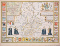
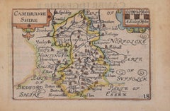
Cambridgeshire map 17th century engraving by John Speed
By John Speed
Located in London, GB
."
John Speed (1551 or 1552 - 1629)
Map of Cambridgeshire
Engraving with later hand colouring
39 x 53 cm
Category
1610s Cambridgeshire Antique Map
Materials
Engraving
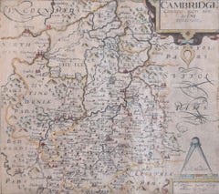
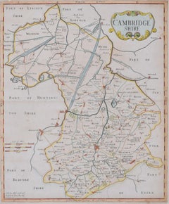
Cambridgeshire map 17th century engraving by Kip after Saxton
Located in London, GB
."
William Kip (active 1598 - 1610) after Christopher Saxton (1540 - 1610).
Map of Cambridgeshire (1637
Category
1630s Cambridgeshire Antique Map
Materials
Engraving
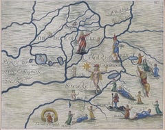
Michael Drayton 1622 Cambridgeshire Map for Poly-Olbion original antique vintage
By Michael Drayton
Located in London, GB
(1563-1631)
Map of Cambridge and the Isle of Ely (1622) engraved by William Hole for Drayton’s Poly
Category
1620s Surrealist Cambridgeshire Antique Map
Materials
Engraving
H 9.45 in W 12.21 in D 0.04 in
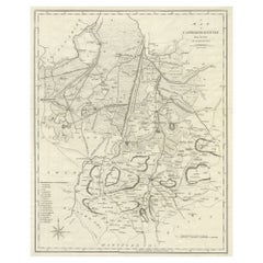
Large Antique County Map of Cambridgeshire, England
Located in Langweer, NL
Antique map titled 'A Map of Cambridgeshire from the best Authorities'. Original old county map of
Category
Early 19th Century Cambridgeshire Antique Map
Materials
Paper
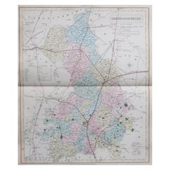
Original Antique English County Map, Cambridgeshire, J & C Walker, 1851
Located in St Annes, Lancashire
Great map of Cambridgeshire
Original colour
By J & C Walker
Published by Longman, Rees
Category
1850s English Other Cambridgeshire Antique Map
Materials
Paper
No Reserve
H 13.75 in W 17.25 in D 0.07 in
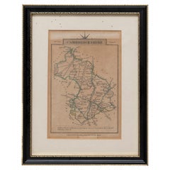
Cambridgeshire J Cary
By John Cary
Located in BUNGAY, SUFFOLK
Cambridgeshire published may 1 1814 engraver no 181 strand
Maker John Cary c. 1754 – 1835.
Category
19th Century English Georgian Cambridgeshire Antique Map
Materials
Paper
Cambridge map 17th century engraving after John Speed
By John Speed
Located in London, GB
."
Pieter van den Keere (1571 - circa 1646) after John Speed (1551 or 1552 - 1629)
Map of Cambridgeshire
Category
1620s Cambridgeshire Antique Map
Materials
Engraving
Map of Cambridge 18th century engraving by Sutton Nichols
Located in London, GB
."
Sutton Nichols (1668 - 1729)
Map of Cambridgeshire
Engraving
43 x 36 cm
Signed in plate lower left.
A
Category
18th Century Cambridgeshire Antique Map
Materials
Engraving
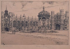
Mabel Oliver Rae, Trinity College Cambridge Great Court Etching (c.1920)
Located in London, GB
To see our other views and maps of England - including London, Oxford and Cambridge, scroll down to
Category
1920s Modern Cambridgeshire Antique Map
Materials
Etching
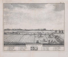
Pieter van der Aa: Cambridge from the East, after David Loggan
By Pieter Van Der Aa
Located in London, GB
and Cambridge. A wide Cambridgeshire sky opens out over the harvest scene; in the background, the
Category
Early 18th Century Cambridgeshire Antique Map
Materials
Engraving
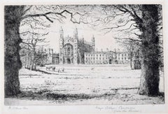
Mabel Oliver Rae, Etching of Kings College Cambridge from the Meadow (c.1920)
Located in London, GB
To see our other views and maps of England - including London, Oxford and Cambridge, scroll down to
Category
Early 20th Century Modern Cambridgeshire Antique Map
Materials
Etching
People Also Browsed
Antique Religious Print "No.26" the Institution of the Eucharist, circa 1840
Located in Langweer, NL
Antique print titled ‘Histoire Sainte, Nouveau Testament, Institution de L'Eucharistie.’ This plate shows a scene from the New Testament; The Institution of the Eucharist at the Last...
Category
Mid-19th Century Cambridgeshire Antique Map
Materials
Paper
H 15.44 in W 19.34 in D 0.02 in
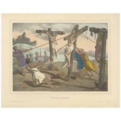
Antique Religious Print "No. 35" the Crucifixion of Jesus, circa 1840
Located in Langweer, NL
Antique print titled ‘Histoire Sainte, Nouveau Testament, Crucifiement.’ This plate shows a scene from the New Testament; The Crucifixion of Jesus.’
This print originates from a r...
Category
Mid-19th Century Cambridgeshire Antique Map
Materials
Paper
H 15.36 in W 19.22 in D 0.02 in
Pair of Prints Depicting Antique World Maps Framed in Burl Wood
Located in Dallas, TX
A pair of prints depicting antique world maps framed in burl wood. One picture contains a depiction of Africa, Europe, and Oceania. The other picture is of North and South America. T...
Category
20th Century American Cambridgeshire Antique Map
Materials
Paper
17th Century John Speed Map of Denbighshire, c.1610
By John Speed
Located in Royal Tunbridge Wells, Kent
Antique early 17th century British very rare and original John Speed, hand coloured map of Denbighshire, dated 1610, by John Sunbury and George Humble. John Speed (1550s – 1629) was ...
Category
17th Century British Cambridgeshire Antique Map
Materials
Wood, Paper
Antique Religious Print "No. 34" Jesus Carrying the Cross, circa 1840
Located in Langweer, NL
Antique print titled ‘Histoire Sainte, Nouveau Testament, Jésus portant sa Croix, console les filles de Jérusalem.’ This plate shows a scene from the New Testament; Jesus carrying th...
Category
Mid-19th Century Cambridgeshire Antique Map
Materials
Paper
H 15.44 in W 19.22 in D 0.02 in
Antique Religious Print "No. 22" the Resurrection of Lazarus, circa 1840
Located in Langweer, NL
Antique print titled ‘Histoire Sainte, Nouveau Testament, Lazare Ressuscité.’ This plate shows a scene from the New Testament; The Resurrection of Lazarus.
This print originates ...
Category
Mid-19th Century Cambridgeshire Antique Map
Materials
Paper
H 15.36 in W 19.06 in D 0.02 in
Christopher Dresser Elkington & Co. Silver-Plate Cruet
By Christopher Dresser
Located in Sharon, CT
Rare Classic original. Has engraved monogram FEA. Fully signed.
Category
Late 19th Century English Aesthetic Movement Cambridgeshire Antique Map
Materials
Silver Plate
Antique Bird Print of the Whydahbird and Others by A. Nuyens, 1886
Located in Langweer, NL
Plate VI: 30. 'De staalvink, zwarte musch of combassou - Vidua nitens (Ultramarine finch or Glossy finch.); 31a+b. De Zwartbonte of Dominikaner Wida -Vidua principalis (Dominican wid...
Category
Late 19th Century Cambridgeshire Antique Map
Materials
Paper
Antique Religious Print 'No. 20' Jesus Heals a Man Born Blind, circa 1840
Located in Langweer, NL
Antique print titled ‘Histoire Sainte, Nouveau Testament, Aveugle-Né.’ This plate shows a scene from the new testament; Jesus heals a man born blind.
This print originates from a ...
Category
Mid-19th Century Cambridgeshire Antique Map
Materials
Paper
H 15.36 in W 19.22 in D 0.02 in
Christopher Dresser Aesthetic Movement Claret, Hukin and Heath, 1880s
By Christopher Dresser
Located in Sharon, CT
A rare silver plate and glass claret from the English Aesthetic Movement designed by Christopher Dresser for Hukin and Heath. Signed, bears engraving as an athletic award.
Category
1880s English Aesthetic Movement Cambridgeshire Antique Map
Materials
Silver Plate
Antique Religious Print 'No. 42' Election of Saint Matthias, circa 1840
Located in Langweer, NL
Antique print titled ‘Histoire Sainte, Nouveau Testament, Élection de Saint Mathias.' This plate shows a scene from the New Testament; The election of Saint Matthias.’
This print ...
Category
Mid-19th Century Cambridgeshire Antique Map
Materials
Paper
H 15.36 in W 19.22 in D 0.02 in
Road Map John Ogilby London St David's Britannia No 15 Abingdon Monmouth Framed
By John Ogilby
Located in BUNGAY, SUFFOLK
John Ogilby (British 1600-1676) Cosmographer and Geographick Printer to Charles II. A road map from Britannia, 1675/6. No 15.
The continuation of the road from London to St David...
Category
1670s English Baroque Cambridgeshire Antique Map
Materials
Paper
H 20.48 in W 24.41 in D 0.6 in
Antique Religious Print 'No. 39' the Appearance to Mary Magdalene, circa 1840
Located in Langweer, NL
Antique print titled ‘Histoire Sainte, Nouveau Testament, Apparition à la Madeleine.’ This plate shows a scene from the New Testament; The Appearance to Mary Magdelene.’
This prin...
Category
Mid-19th Century Cambridgeshire Antique Map
Materials
Paper
H 15.4 in W 19.18 in D 0.02 in
Antique Religious Print 'No. 33' Pilate Washing His Hands, circa 1840
Located in Langweer, NL
Antique print titled ‘Histoire Sainte, Nouveau Testament, Pilate lave ses Mains.’ This plate shows a scene from the New Testament; Pilate washing his Hands.’
This print originates...
Category
Mid-19th Century Cambridgeshire Antique Map
Materials
Paper
H 15.44 in W 19.02 in D 0.02 in
17th Century Map of Cumberland County in Northwest England Printed by John Speed
By John Speed
Located in Middleburg, VA
Rare extremely early map of the county of Cumberland in the Northwest of England. Printed by John Speed, hand colored. Excellent condition.
English. Dated 1610.
Measures: 23” H 27...
Category
Early 17th Century English Cambridgeshire Antique Map
Materials
Paper
H 23 in W 27 in D 1 in
Antique Map of Northamptonshire by Speed, 1676
Located in Langweer, NL
Antique map titled 'Norhamtonshire'. Map of Norhamptonshire, England. Includes inset town plans of Peterborough and Northampton. This map originates from 'Theatre of Great Britaine' ...
Category
17th Century Cambridgeshire Antique Map
Materials
Paper
Recent Sales
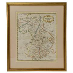
18th Century Map of Cambridgeshire
Located in Austin, TX
A handsome 18th century English map of Cambridgeshire, mounted and framed under glass.
Printed in
Category
18th Century English Cambridgeshire Antique Map
Materials
Glass, Wood, Paper
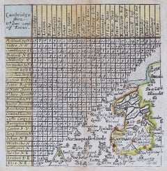
Jacob van Langeren Cambridgeshire map 1643-1673 distance table engraving
Located in London, GB
van Langeren
Cambridgeshire
10.5 x 10.5cm
Engraving
1643-1673
A scarce seventeenth-century map of
Category
17th Century Realist Cambridgeshire Antique Map
Materials
Engraving
Get Updated with New Arrivals
Save "Cambridgeshire Antique Map", and we’ll notify you when there are new listings in this category.
Cambridgeshire Antique Map For Sale on 1stDibs
You are likely to find exactly the cambridgeshire antique map you’re looking for on 1stDibs, as there is a broad range for sale. You can easily find an example made in the Surrealist style, while we also have 1 Surrealist versions to choose from as well. Making the right choice when shopping for a cambridgeshire antique map may mean carefully reviewing examples of this item dating from different eras — you can find an early iteration of this piece from the 18th Century and a newer version made as recently as the 20th Century. On 1stDibs, the right cambridgeshire antique map is waiting for you and the choices span a range of colors that includes gray. A cambridgeshire antique map from Michael Drayton and Pieter Van Der Aa — each of whom created distinctive versions of this kind of work — is worth considering. Frequently made by artists working in engraving, etching and paper, these artworks are unique and have attracted attention over the years.
How Much is a Cambridgeshire Antique Map?
The price for an artwork of this kind can differ depending upon size, time period and other attributes — a cambridgeshire antique map in our inventory may begin at $50 and can go as high as $2,039, while the average can fetch as much as $605.
More Ways To Browse
Antique Map New
Antique Map Of England
Antique Maps Of England
Antique Map New England
Antique Maps Wales
Antique Maps Of Wales
Irish 17th Century
Antique Ireland Maps
Antique Map Of Ireland
Antique Bedford
Nurse Antique
Antique Nurses
Antique Compass Art
Antique Compass London
King George Vi
William Bull
Antique English Bible
British Isles Antique Map
