Ptolemy Map
3
to
6
64
18
74
46
27
22
16
9
5
4
4
3
2
2
2
2
1
1
1
1
1
1
1
1
1
1
1
1
1
1
1
24
3
3
2
1
Sort By
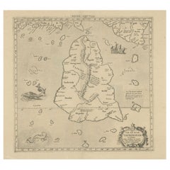
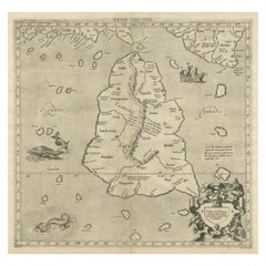
Rare Original Antique Ptolemy Map of Ceylon, Present Day Sri Lanka
Located in Langweer, NL
this map in his 1578 edition of Ptolemy's great Geography; this is from the last edition and two cracks
Category
Antique Late 17th Century Maps
Materials
Paper
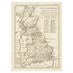
Antique Map of Britain in Roman Times
Located in Langweer, NL
Antique map titled 'Britannia Romana collected from Ptolemy (..)'. Map of Britain in Roman times
Category
Antique Early 19th Century Maps
Materials
Paper
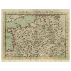
Antique Map of France, based on the work of Ptolemy
Located in Langweer, NL
Antique map titled 'Gallia Nova Tabula'. Ruscelli's map of France. This map originates from
Category
Antique 16th Century Maps
Materials
Paper
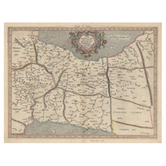
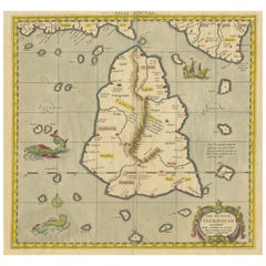
Antique Map of Ceylon or Sri Lanka by Ptolemy/Mercator, circa 1695
Located in Langweer, NL
Antique map titled 'Tab XII Asiae Taprobanam'. Ptolemaic map of Taprobana (Sri Lanka). Ptolemy drew
Category
Antique Late 17th Century Maps
Materials
Paper
Exploring Ancient Persia: Ptolemaic Map of Iran and Iraq by Ptolemy and Mercator
Located in Langweer, NL
Claudius Ptolemy was a mathematician, astronomer and geographer who worked in Alexandria, then a
Category
Antique 1610s Maps
Materials
Paper
H 13.71 in W 18.39 in D 0 in
Original Antique Woodcut Map of Persia
Located in Langweer, NL
.
This map originates from 'Claudii Ptolemaei Geograhicae' by Claudius Ptolemy (Latin: Ptolemaeus).
Category
Antique 16th Century Maps
Materials
Paper
Mercator's Ptolemaic map of Taprobana, (Ceylon) Sri Lanka
Located in Langweer, NL
Antique map titled 'Asiae XII Tab'. Mercator's Ptolemaic map of Taprobana. The map shows Ptolemy
Category
Antique 16th Century Maps
Materials
Paper
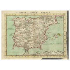
Antique Map of Spain including the Balearic Islands
Located in Langweer, NL
Antique map titled 'Hispania Nova Tabula'. Ruscelli's map of Spain, including the Balearic Islands
Category
Antique 16th Century Maps
Materials
Paper
Antique Ptolemaic Map of Ceylon or nowadays Sri Lanka
Located in Langweer, NL
Antique map titled 'Tab XII. Asiae Taprobanam'. Ptolemaic map of Sri Lanka. Ptolemy drew on the
Category
Antique Mid-18th Century Maps
Materials
Paper
Antique Map of the Balkans with Coat of Arms
Located in Langweer, NL
Antique map titled 'Tavola Nuova di Schiavonia'. Ruscelli's map of the Balkans, with a coat of arms
Category
Antique 16th Century Maps
Materials
Paper
Antique Map of Mauritania 'Africa' by G. Ruscelli, 1574
Located in Langweer, NL
A very rare mid-16th century black and white map of North and West Africa called Mauritania by the
Category
Antique 16th Century Maps
Materials
Paper
1633 Map Entitled "Beauvaisis Comitatus Belova Cium, Ric.0002
Located in Norton, MA
County maps for William Smith (\\\\\\\\\\\\\\\'anonymous maps\\\\\\\\\\\\\\\') * 1605 Ptolemy
Category
Antique 17th Century Dutch Maps
Materials
Paper
Old Map of the Bourbonnais Region of France, ca.1630
Located in Langweer, NL
Antique map titled 'Bourbonois - Borbonium Ducatus'.
Old map of the Bourbonnais region of
Category
Antique 1630s Maps
Materials
Paper
Antique Map of the French Province of Quercy, ca.1625
Located in Langweer, NL
Antique map titled 'Quercy Cadurcium'. Old map of the region of Quercy, France. Quercy is a former
Category
Antique 17th Century Maps
Materials
Paper
"Africa Vetus": a 17th Century Hand-Colored Map by Sanson
By Nicolas Sanson
Located in Alamo, CA
This original hand-colored copperplate engraved map of Africa entitled "Africa Vetus, Nicolai
Category
Antique Late 17th Century French Maps
Materials
Paper
1616 Bertius Map of Sumatra, Singapore and the Straits of Malacca
Located in Langweer, NL
Title: "1616 Bertius Map of Sumatra and the Straits of Malacca"
Description: This is an exquisite
Category
Antique Early 17th Century Maps
Materials
Paper
Decorative Original Antique Map of Valencia in Southern Spain, circa 1601
Located in Langweer, NL
This is an original antique map titled 'Valentiae Regni olim Contestanorum Si Ptolemaeo
Category
Antique Early 17th Century Maps
Materials
Paper
No Reserve
H 17.52 in W 22.45 in D 0.02 in
Original Antique Ptolemaic Map of the Region of Thailand and Malaysia
Located in Langweer, NL
Antique map titled 'Tabula Asiae XI'. Based on the interpretations of Solinus and Munster, this
Category
Antique 16th Century Maps
Materials
Paper
Original Antique Map of Brasil, Published in the 16th Century, 1561
Located in Langweer, NL
This important Ruscelli map of Brazil, from his work La Geografia di Claudio Tolomeo Alessandrino
Category
Antique 1660s Maps
Materials
Paper
Free Shipping
H 8.67 in W 11.82 in D 0 in
Antique Map of The Dutch Provinces of Gelderland and Overijssel, 1623
Located in Langweer, NL
publish a new edition of Ptolemy's Geographia. Followed by his major work, a 3 volume collection of maps
Category
Antique 17th Century Maps
Materials
Paper
Antique Map of the Southern Lorraine Region by Mercator, c.1625
By Gerard Mercator
Located in Langweer, NL
Antique map titled 'Lotharingiae Ducatus'. Old map of the southern portion of the Lorraine region
Category
Antique 17th Century Maps
Materials
Paper
Original Antique Map the Imperial States of the Habsburg Netherlands, 1609
Located in Langweer, NL
Antique map titled 'Belgii inferioris descriptio (..)'.
Old map of the Seventeen Provinces, the
Category
Antique Early 1600s Maps
Materials
Paper
H 20.08 in W 25.2 in D 0 in
Early Antique Map of Gelderland and Overijssel in the Netherlands, c.1625
Located in Langweer, NL
publish a new edition of Ptolemy's Geographia. Followed by his major work, a 3 volume collection of maps
Category
Antique 17th Century Maps
Materials
Paper
H 15.75 in W 21.46 in D 0 in
1625 Mercator Map of the Provenience of Quercy, "Quercy Cadvrcivm Ric.0013
Located in Norton, MA
edition of Ptolemy's Geographia. Followed by his major work, a 3 volume collection of maps to which the
Category
Antique 17th Century French Maps
Materials
Paper
H 18.9 in W 22.45 in D 0.4 in
Early Antique Map of the Dutch Provinces of Friesland and Groningen, 1604
Located in Langweer, NL
Ptolemy's Geographia. Followed by his major work, a 3 volume collection of maps to which the word "Atlas
Category
Antique Early 1600s Maps
Materials
Paper
H 16.93 in W 21.07 in D 0 in
16th Century Map of Saudi Arabia, the Persian Gulf and Red Sea, ca. 1574
Located in Langweer, NL
”
The subject of this antique map is Arabia, crafted by Ptolemy and further published by Ruscelli in the
Category
Antique 16th Century Maps
Materials
Paper
No Reserve
H 7.1 in W 9.8 in D 0.002 in
Old Ptolemaic Map of the Region Between the Persian Gulf and Caspian Sea, 1598
Located in Langweer, NL
, and maps of the Old World were revised. Ptolemy's Geographia continued to be revised and published by
Category
Antique 16th Century Maps
Materials
Paper
H 7.09 in W 9.81 in D 0 in
One of the Earliest Maps of Gelderland and Overijssel in the Netherlands, 1623
Located in Langweer, NL
publish a new edition of Ptolemy's Geographia. Followed by his major work, a 3 volume collection of maps
Category
Antique 1620s Maps
Materials
Paper
H 18.31 in W 22.05 in D 0 in
Old Map of the Dutch Provinces of Friesland and Groningen, The Netherlands, 1604
Located in Langweer, NL
Antique print, titled: 'Frisiae Occidentalis.'
Handsome map of the Dutch Provinces of Friesland
Category
Antique Early 1600s Maps
Materials
Paper
H 17.05 in W 21.15 in D 0 in
Ancient Cartography of Britannia and Hibernia, Published in 1880
Located in Langweer, NL
This map depicts the geographical area of Great Britain and Ireland, labeled "BRITANNIA et HIBERNIA
Category
Antique 1880s Maps
Materials
Paper
Free Shipping
H 18.51 in W 15.56 in D 0 in
Late 16th Century Sheet with Copper Engravings of India, Pakistan, etc, 1598
Located in Langweer, NL
One sheet with two engraved maps, one on each site, and text in Italian. Late 16th century copper
Category
Antique 16th Century Maps
Materials
Paper
H 11.82 in W 8.08 in D 0 in
Antique Roman Battle Print of Ptolemy's Camp by Duncan, c.1753
Located in Langweer, NL
Antique battle map showing Ptolemy's Camp. With detailed legend explaining the various elements of
Category
Antique 18th Century Prints
Materials
Paper
Temple of Ptolemy - Architectural Drawing: Acrylic and Gilding Ink on Canvas
By Marco Araldi
Located in London, GB
, applying traditional techniques such as multiple Cartesian coordinates and polar system coordinates to maps
Category
2010s Contemporary Still-life Paintings
Materials
Ink, Canvas, Acrylic
H 30.12 in W 18.9 in D 1.19 in
16th c. woodcut map - Tabula Asiae Vlll
By Sebastian Münster
Located in Santa Monica, CA
Geographia Universalis, Basel, Henri Petri. 1545 edition of Ptolemy. Shows ancient Scythia Extra, India
Category
16th Century Old Masters Landscape Prints
Materials
Woodcut
Map Tabula Asiae IX Pakistan Afghanistan Iran Indian Ocean
Located in Florham Park, NJ
well known for his exacting revision of Ptolemy's Geographia. He was influenced by the 1548 Gastaldi
Category
16th Century Realist Prints and Multiples
Materials
Copper
H 16.75 in W 19 in D 2 in
"Africa Vetus": A 17th Century Hand-colored Map By Sanson
By Nicholas Sanson d'Abbeville
Located in Alamo, CA
This original hand-colored copperplate engraved map of Africa entitled "Africa Vetus, Nicolai
Category
1690s Landscape Prints
Materials
Engraving
Rugen Island, Germany: An Early 17th Century Map by Mercator and Hondius
By Gerard Mercator
Located in Alamo, CA
This is an early 17th century map entitled "Nova Famigerabilis Insulae Ac Ducatus Rugiae Desciptio
Category
Early 17th Century Old Masters Landscape Prints
Materials
Engraving
A huge pair of 21 inches Cruchley Library Globes
By G.F. Cruchley
Located in ZWIJNDRECHT, NL
, published by G.F. Cruchley, map-seller & globe maker, 81 Fleet street.
Signed: CRUCHLEY in London England
Category
Antique 1850s British Victorian Globes
Materials
Other
A beautiful Celestial Table Globe produced by Gerard & Leonard Valk
By Gerard and Leonard Valk
Located in ZWIJNDRECHT, NL
Gerard began his publishing firm producing maps and atlases in co-operation with Petrus Schenk about 1680
Category
Antique Early 18th Century Dutch Dutch Colonial Globes
Materials
Other
The 1564 Medici Danti Map of California
By Fra Egnazio Danti
Located in New York, NY
ceiling. The commission for the maps, inspired by Ptolemy’s Geographia, was given to the celebrated
Category
17th Century Old Masters Drawings and Watercolor Paintings
Materials
Canvas, Pen, Gouache, Watercolor, Ink, Paper
Ptolemaic map of Italy by Mercator - Engraving - 17th c.
By Gerard Mercator
Located in Zeeland, Noord-Brabant
Ptolemaic map of Italy.
Description: From the 1698 ed. of Mercator's Ptolemy Atlas: 'Claudii Ptolemaei
Category
1690s Old Masters More Prints
Materials
Engraving
c. 1750 Double-Hemisphere World Map showing California as an Island
Located in New York, NY
c. 1750 beautifully hand-colored engraved double hemisphere world map, showing California as an
Category
1750s Realist Landscape Prints
Materials
Engraving
Ptolemaic map - Balkan Peninsula, Greece, Crete by Mercator - Engraving - 17th c
By Gerard Mercator
Located in Zeeland, Noord-Brabant
publish a new edition of Ptolemy's Geographia. Followed by his major work, a 3 volume collection of maps
Category
1690s Old Masters More Prints
Materials
Engraving
Ptolemaic map of Bulgaria, Rumania, Bosporus by Mercator - Engraving - 17th c
By Gerard Mercator
Located in Zeeland, Noord-Brabant
partem (…).' - A beautiful Ptolemaic map covering covers the northern Balkans (Bulgaria, Rumania) with
Category
1690s Old Masters More Prints
Materials
Engraving
Ptolemaic map of ancient Spain and Portugal by Mercator - Engraving - 17th c.
By Gerard Mercator
Located in Zeeland, Noord-Brabant
Ptolemaic map covering ancient Spain and Portugal. Wit sean monsters and a gallion ship.
Description: From
Category
1690s Old Masters More Prints
Materials
Engraving
Ptolemaic map of ancient Tunesia, Malta, Lybia by Mercator - Engraving - 17th c.
By Gerard Mercator
Located in Zeeland, Noord-Brabant
a new edition of Ptolemy's Geographia. Followed by his major work, a 3 volume collection of maps to
Category
1690s Old Masters More Prints
Materials
Engraving
Ptolemaic map of Balkan coast extending north by Mercator - Engraving - 17th c.
By Gerard Mercator
Located in Zeeland, Noord-Brabant
, Dalmatia, cum Italiae parte. (…).' - A beautiful Ptolemaic map of the Balkan coast and northern Italy along
Category
1690s Old Masters More Prints
Materials
Engraving
Ptolemaic map of India and Himalayan mountains by Mercator - Engraving - 17th c.
By Gerard Mercator
Located in Zeeland, Noord-Brabant
edition of Ptolemy's Geographia. Followed by his major work, a 3 volume collection of maps to which the
Category
1690s Old Masters More Prints
Materials
Engraving
Map of ancient Great Britain, Scotland, Ireland by Mercator - Engraving - 17th c
By Gerard Mercator
Located in Zeeland, Noord-Brabant
(…).' - A beautiful Ptolemaic map covering ancient Great Britain, England, Scotland and Ireland. This rare
Category
1690s Old Masters More Prints
Materials
Engraving
Map of Syria, Libanon, Palestine, Iraq, Israel by Mercator - Engraving - 17th c.
By Gerard Mercator
Located in Zeeland, Noord-Brabant
a new edition of Ptolemy's Geographia. Followed by his major work, a 3 volume collection of maps to
Category
1690s Old Masters More Prints
Materials
Engraving
Old map of Georgia, Armenia and Azerbaijan by Mercator - Engraving - 17th c.
By Gerard Mercator
Located in Zeeland, Noord-Brabant
edition of Ptolemy's Geographia. Followed by his major work, a 3 volume collection of maps to which the
Category
1690s Old Masters More Prints
Materials
Engraving
Ptolemaic map of North Africa, Libya, Egypt by Mercator - Engraving - 17th c
By Gerard Mercator
Located in Zeeland, Noord-Brabant
(…).' - A beautiful Ptolemaic map covering ancient North Africa, specifically Libya and part of Ethiopia but
Category
1690s Old Masters More Prints
Materials
Engraving
Ancient map of South Russia and Black Sea by Mercator - Engraving - 17th c
By Gerard Mercator
Located in Zeeland, Noord-Brabant
beautiful Ptolemaic map of the region north of the Black and Caspian Seas as far as the Hyperborie Montes
Category
1690s Old Masters More Prints
Materials
Engraving
Ptolemaic map - Persian Gulf to the Caspian Sea by Mercator - Engraving - 17th c
By Gerard Mercator
Located in Zeeland, Noord-Brabant
publish a new edition of Ptolemy's Geographia. Followed by his major work, a 3 volume collection of maps
Category
1690s Old Masters More Prints
Materials
Engraving
Old map of Himalayas, N. India and Afghanistan by Mercator - Engraving - 17th c.
By Gerard Mercator
Located in Zeeland, Noord-Brabant
publish a new edition of Ptolemy's Geographia. Followed by his major work, a 3 volume collection of maps
Category
1690s Old Masters More Prints
Materials
Engraving
Map of Sardinia, Sicily and part of Corsica by Mercator - Engraving - 17th c.
By Gerard Mercator
Located in Zeeland, Noord-Brabant
Ptolemy's Geographia. Followed by his major work, a 3 volume collection of maps to which the word "Atlas
Category
1690s Old Masters More Prints
Materials
Engraving
Ptolemaic map of NW Africa, Morocco and Algeria by Mercator - Engraving - 17th c
By Gerard Mercator
Located in Zeeland, Noord-Brabant
map covering ancient northwestern Africa, including present day Morocco and Algeria. The interior
Category
1690s Old Masters More Prints
Materials
Engraving
Ptolemaic map of Turkey and Cyprus - Tab I - by Mercator - Engraving - 17th c.
By Gerard Mercator
Located in Zeeland, Noord-Brabant
Ptolemy's Geographia. Followed by his major work, a 3 volume collection of maps to which the word "Atlas
Category
1690s Old Masters More Prints
Materials
Engraving
Very decorative world map of the ancient world by Mercator - Engraving - 17th c.
By Gerard Mercator
Located in Zeeland, Noord-Brabant
a new edition of Ptolemy's Geographia. Followed by his major work, a 3 volume collection of maps to
Category
1690s Old Masters More Prints
Materials
Engraving
Ptolemaic map of Asia east of the river Ganges by Mercator - Engraving - 17th c.
By Gerard Mercator
Located in Zeeland, Noord-Brabant
beautiful Ptolemaic map of Asia east of the Ganges. The map is embellished with a decorative cartouche
Category
1690s Old Masters More Prints
Materials
Engraving
- 1
Get Updated with New Arrivals
Save "Ptolemy Map", and we’ll notify you when there are new listings in this category.
Ptolemy Map For Sale on 1stDibs
Find many varieties of an authentic ptolemy map available at 1stDibs. Each ptolemy map for sale was constructed with extraordinary care, often using paper, canvas and fabric. There are many kinds of the ptolemy map you’re looking for, from those produced as long ago as the 18th Century to those made as recently as the 20th Century. Andreas Cellarius, Johann Bayer and Gerard Mercator each produced at least one beautiful ptolemy map that is worth considering.
How Much is a Ptolemy Map?
A ptolemy map can differ in price owing to various characteristics — the average selling price 1stDibs is $776, while the lowest priced sells for $213 and the highest can go for as much as $247,122.
