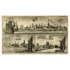
Items Similar to Antique Engraving of Dutch and German North Sea Coast of Friesland, ca.1680


Want more images or videos?
Request additional images or videos from the seller
1 of 6
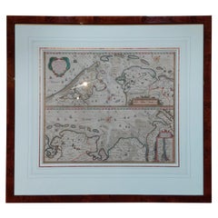
Antique Engraving of Dutch and German North Sea Coast of Friesland, ca.1680
About the Item
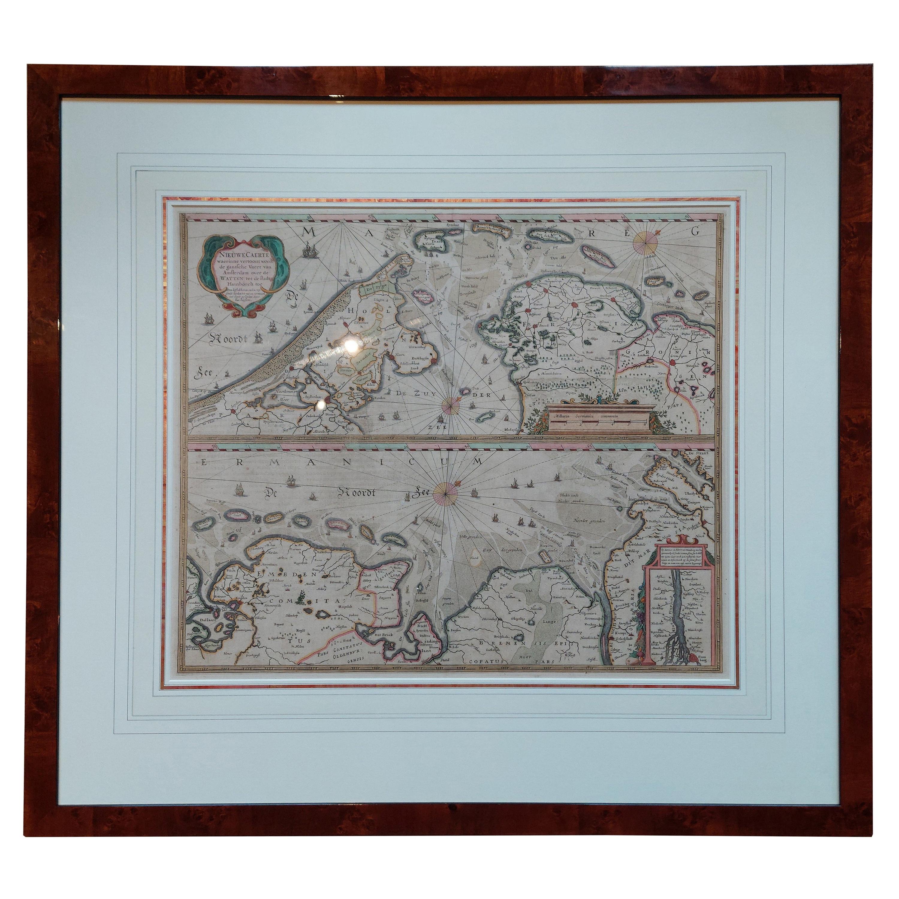
Antique map titled 'Tabula Nova In qua accuratè demonstratur tota Navigatio ab Amstelodami Statione per Vada vulgo de Watten Hamburgum usq.' -
Two maps with the Dutch and German North Sea coast of Friesland, with West Frisian Islands and below East Frisian Islands with inset map of the Elbe around Hamburg. With title and a scale cartouche. Map by Henricus Hondius, first published by J. Janssonius (1634) ´NIEUWE CAERTE waerinne vertoont wordt de gantsche Vaert van Amsterdam over de WATTEN tot de stadt Hamborch toe´, here with the name and address changed from ´The English Atlas´ published by Moses Pitt, Steven Swart and Johannes Janssonius van Waesberghen, Oxford/Amsterdam 1683.
Artists and Engravers: Publisher: Henricus Hondius
Condition: Good, given age. Edges with a few small tears. Paper separation lower middle fold; backed and not affecting image. A few minor crinkles and small creases. One tiny hole in middle fold image. Original middle fold as issued. Very wide margins. General age-related toning and/or occasional minor defects from handling. Please study scan carefully.
- Dimensions:Height: 23.43 in (59.5 cm)Width: 27.96 in (71 cm)Depth: 0 in (0.02 mm)
- Materials and Techniques:
- Period:1680-1689
- Date of Manufacture:circa 1680
- Condition:Wear consistent with age and use. Condition: Good, given age. Edges with a few small tears. Paper separation lower middle fold; backed and not affecting image. A few minor crinkles and small creases. One tiny hole in middle fold image. Original middle fold as issued.
- Seller Location:Langweer, NL
- Reference Number:
About the Seller
5.0
Platinum Seller
These expertly vetted sellers are 1stDibs' most experienced sellers and are rated highest by our customers.
Established in 2009
1stDibs seller since 2017
1,976 sales on 1stDibs
Typical response time: <1 hour
- ShippingRetrieving quote...Ships From: Langweer, Netherlands
- Return PolicyA return for this item may be initiated within 14 days of delivery.
More From This SellerView All
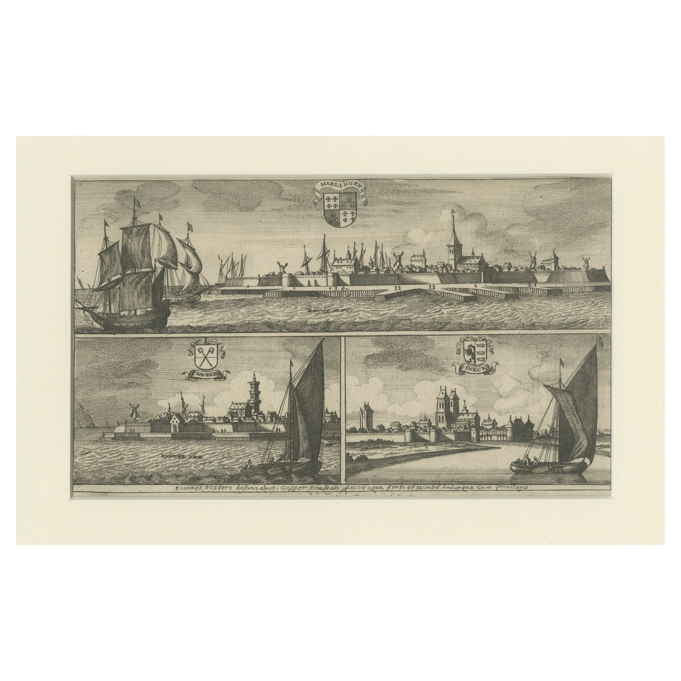
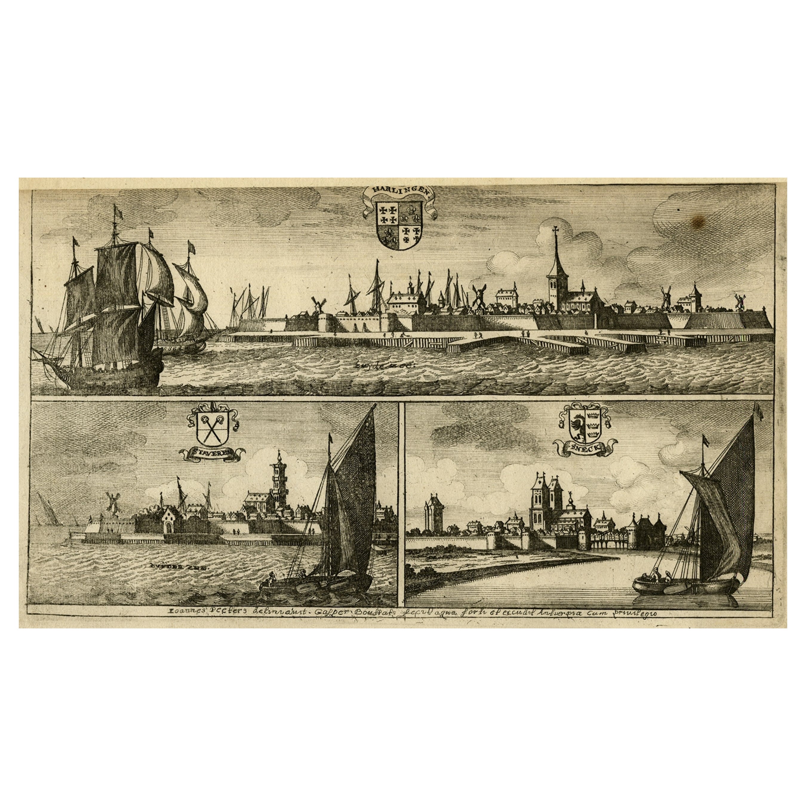
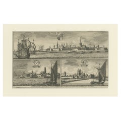
- Engravings of Harlingen, Stavoren and Sneek in Friesland, the Netherlands, 1680Located in Langweer, NLAntique print titled 'Harlingen, Staveren, Sneck'. Views of the cities of Harlingen, Stavoren and Sneek, Friesland, the Netherlands. This print originates from 'Thooneel der Steden e...Category
Antique 17th Century Prints
MaterialsPaper
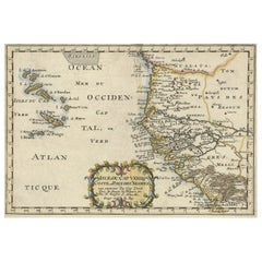
- Antique Map of the Coast of Africa and the Cape Verde Islands, ca.1680Located in Langweer, NLAntique map Africa titled 'Isles du Cap Verd Coste et Pays des Negres'. Antique map of the coast of Africa and the Cape Verde islands. Artis...Category
Antique 1680s Maps
MaterialsPaper
- Antique Print of Harlingen, Stavoren and Sneek in Friesland, 1680Located in Langweer, NLAntique print titled 'Harlingen, Staveren, Sneck'. Views of the cities of Harlingen, Stavoren and Sneek, Friesland, the Netherlands. This print originates from 'Thooneel der Steden e...Category
Antique 17th Century Prints
MaterialsPaper
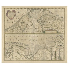
- Two Original Antique Engravings with the Dutch and German North Sea Coast, c1650Located in Langweer, NLAntique map titled 'Nieuwe Caerte waerinne vertoont wordt de gantsche Vaert van Amsterdam over de Watten tot de stadt Hamborch toe'. Two maps with the Dutch and German North Sea ...Category
Antique 1650s Maps
MaterialsPaper
- Antique Map of the Coast of Holland and Germany by Janssonius 'c.1650'Located in Langweer, NLAntique map titled 'Nieuwe Caerte waerinne vertoont wordt de gantsche Vaert van Amsterdam over de Watten tot de stadt Hamborch toe'. Two maps with the Dutch and German North Sea coas...Category
Antique Mid-17th Century Maps
MaterialsPaper
- Antique Map of the West Coast of North America & North East Coast of Asia '1772'Located in Langweer, NLAntique map titled 'Carte des nouvelles decouvertes/ Extrait d'une Carte Japonoise de l'Universe'. Map of the West Coast of North America and North-East Coast of Asia, based upon Buache's report of the various Russian Discoveries between 1731 and 1742 including the various explorers routes and notes. The lower map is based upon a Japanese map...Category
Antique Late 18th Century Maps
MaterialsPaper

You May Also Like
- Dutch Kolf Print, Winter, Golf EngravingLocated in Oxfordshire, GBDutch golf engraving by J. Boydell, Winter. Rare 18th century Dutch golf engraving by J. Boydell depicting Dutchman playing the early form of golf on the ice, titled 'Winter'. The s...Category
Antique 18th Century Dutch Prints
MaterialsPaper
- Large Antique 1859 Map of North AmericaLocated in Sag Harbor, NYThis Map was made by Augustus Mitchell in 1859 It is in amazing condition for being 163 years old. This price is for the rolled up easy to ship version of this piece. I will be Frami...Category
Antique Mid-19th Century American Maps
MaterialsCanvas, Paper

- Italy, Sicily, Sardinia, Corsica and Dalmatian Coast: A 17th Century Dutch MapBy Theodorus DanckertsLocated in Alamo, CAThis hand colored 17th century Dutch map entitled "Novissima et Accuratissima totius Italiae Corsicae et Sardiniae Descriptio" by Theodore Danckerts depicts the Italian Peninsula in ...Category
Antique Late 17th Century Dutch Maps
MaterialsPaper
- “A Football Match, Scotland v. England” Antique Engraving, Proof Edition of 100By Overend and SmytheLocated in Colorado Springs, COThis is the 1889 William H. Overend (1851-1898) and Lionel Smythe (1839-1918) first edition, photogravure of the Calcutta Cup – a Rugby match between Scotland and England, that has been played over 100 times, the first match...Category
Antique 19th Century English Prints
MaterialsPaper
- Antique Golf Print, Royal North Devon Golf Club, Photogravure of Westward HoLocated in Oxfordshire, GBRoyal North Devon Golf Club 1893 by Mayall & Co. Ltd. A great image of the members of the 'Royal North Devon Golf Club, Westward Ho!' from 1893. The figures are all photographs superimposed onto a painted background of the course. In the margin is printed 'Permanent Autotype, Produced by Mayall & Co. Ltd. 73 Piccadilly'. The image appears very much photographic but is more of a photomechanical print rather than a photograph. John Jabez Edwin Paisley Mayall (1813-1901) was an English photographer who in 1860 took the first carte-de-visite photographs of Queen Victoria. Taken from Royal North Devon:- Royal North Devon at Westward Ho! Can rightly claim to be the cradle of English Golf. Founded in 1864, it is the oldest golf course in the country and is regarded as the St Andrews of the South. The golf course is as tough as any of the UK's more famous links layouts and has recently been placed in Golf World 's 'Top 100 Courses in the World' that a golfer 'must play'. Not only is Royal North Devon a great course, it is also a place of huge historical importance. Inside the warmly welcoming clubhouse, the golf museum, honours boards and the clubs top competition trophies are worth a visit on their own and help to tell the story of the game and this remarkable club's unique place in it. Above all, this is great, natural golf that is largely unchanged from 100 years ago when Harold Hilton et al pronounced Westward Ho! As England's No 1 competition golf course. RND is pure, raw exhilaration and ultimately the experience of playing a fast running links in a stiff breeze still tests the very best in the game. Many of the great players of the last 100 years were regular competitors at RND but the greatest of them all is without doubt John Henry Taylor...Category
Antique 1890s British Sporting Art Sports Equipment and Memorabilia
MaterialsPaper
- Original Antique English County Map, North Yorkshire, J & C Walker, 1851Located in St Annes, LancashireGreat map of North Yorkshire Original colour By J & C Walker Published by Longman, Rees, Orme, Brown & Co. 1851 Unframed.Category
Antique 1850s English Other Maps
MaterialsPaper


Recently Viewed
View AllMore Ways To Browse
German Furniture Hamburg
Antique German Scales
Johannes Engravings
Map Of Oxford
Map Of The Middle East
Antique Maps Oxford
Map Of Middle East
Middle East Maps
Middle East Antique Map
Henricus Hondius
Steven Minor
Antique Map Of New England
Antique Maps New England
Ireland Map
Map Of Ireland
Caribbean Antique Furniture
Old Italian Map
18th Century Maps America